


Nature reserve Xalapa, Veracruz Municipality of Xalapa Xalapa and the coffee hills
A wooded extinct volcano in the middle of Xalapa, now an ecological park with spiral paths, a lookout tower and a small fauna museum.
From Teziutlán: 1 h 25 min by car (87 km by road) How to get there ↓
Near here
See everything nearby ↓


Plan your visit to Cerro de Macuiltépetl
Where to stay near Cerro de Macuiltépetl
Compare hotels, posadas and guest houses in Cerro de Macuiltépetl.
Tours to Cerro de Macuiltépetl
Day trips and guided outings from Coatepec often include Cerro de Macuiltépetl; with a local guide you can get there without a car.
 Tours from Veracruz
Private Sunrise Taj Mahal Tour from Delhi By Car -All inclusive
★ 5.0 (549) · From US$14
How to get to Cerro de Macuiltépetl
- From Teziutlán: about 1 h 25 min by road (~87 km)
- Nearest airport: Veracruz (VER), 1 h 37 min by car to Coatepec
Links open a partner site. We may earn a commission if you book, at no cost to you.
Tours from Veracruz, near Cerro de Macuiltépetl


Tours, prices and ratings from Viator, checked weekly. We may earn a commission if you book.
About Cerro de Macuiltépetl
Cerro de Macuiltépetl, also spelled Macuiltépec, is a small extinct volcano in the north of Xalapa and the highest point in the city, at about 1,500 to 1,600 metres above sea level. Its slopes form the Parque Ecológico Macuiltépetl, a protected area of about 31 hectares surrounded by city streets, about 2.5 km north of the centre. The name is usually translated from Nahuatl as "fifth hill", though a study backed by the park's trust argues it means "mountain of the five peaks", since 19th-century maps show five summits, of which only two are now visible.
The hill is a monogenetic cone with steep slopes, formed in the late Pleistocene, up to about 30,000 years ago, and covered in andesitic or basaltic scoria. Accounts of Xalapa's origins say the Totonacs first settled around it. In 1922 William K. Boone, then head of the local chamber of commerce, designed a road for cars that spiralled to the summit, and wrote about it for Popular Mechanics in 1923. In the 1940s a pyramid-shaped mausoleum was built at the top for agrarian leaders including Úrsulo Galván.
Today the old spiral roads are footpaths that wind up through a mix of native cloud-forest trees such as sweetgum, cedar and ash, alongside planted ornamentals and fruit trees. Researchers have recorded about 180 bird species here, more than 40 percent of them migrants, and from the lookout tower counts of more than 51,000 migrating raptors have been made. The park has a small Museo de la Fauna, a colony of stingless melipona bees by the museum steps, children's play areas and the summit mausoleum, and the lookout gives one of the widest views over Xalapa. The entrance is in Colonia Aguacatal, beside the state cancer centre.
How to get to Cerro de Macuiltépetl
Drive from Teziutlán: 1 h 25 min, 87 km
The park is about 2.5 km north of Xalapa's centre, roughly 10 minutes by car or taxi. The entrance is in Colonia Aguacatal, next to the Centro Estatal de Cancerología.
Directions to Cerro de Macuiltépetl on Google Maps
Distances are in a straight line; the road is usually longer.
Links open a partner site. We may earn a commission if you book, at no cost to you.
From the nearest cities to Cerro de Macuiltépetl
- Teziutlán · 87 km by road, 1 h 25 min
- Córdoba · about 95 km by road, ~1 h 25 min
- Veracruz · 104 km by road, 1 h 30 min
Drive times by road from OpenStreetMap, without traffic or stops. Times marked ~ are estimated from the straight-line distance.
Before you go to Cerro de Macuiltépetl: hours, prices and tips
- Hours
- Open every day of the year, 6 am to 6 pm. Wikipedia (park regulations) · checked Oct 2026
- Entry
- Entry to the park is free; the fauna museum charges a small separate fee. Zona Turística · checked Oct 2026
Hours and prices change, especially around holidays. Each fact links to where we checked it.
Visiting Cerro de Macuiltépetl: what to see and do
Walk the spiral paths up the old volcano through cloud-forest trees.
Climb the lookout tower for a wide view over Xalapa.
Visit the small Museo de la Fauna.
See the 1940s pyramid mausoleum at the summit.
Watch for birds, including migrating hawks in season.
Plan your trip
Places to stay in Cerro de Macuiltépetl
Compare hotels, posadas, and rentals in and around Cerro de Macuiltépetl.
Tours & activities
Day trips and guided outings from Coatepec often include Cerro de Macuiltépetl; with a local guide you can get there without a car.
Rental cars
Pick up a car at VER (Veracruz): about 1 h 37 min by road to Coatepec, then 11 km more to Cerro de Macuiltépetl, on your own schedule.
Flights
The nearest airport with scheduled flights is Veracruz (VER), about 1 h 37 min by road from Coatepec, the base for Cerro de Macuiltépetl.
Travel insurance
If you plan on hiking at Cerro de Macuiltépetl, check that your policy covers it: some plans leave adventure activities out.
Mobile data
Signal can drop away from Coatepec: download a map of the way to Cerro de Macuiltépetl before you set out, or carry an eSIM with data.
Links open a partner site. We may earn a commission if you book, at no cost to you.
Photos
When to go to Cerro de Macuiltépetl mild
Cerro de Macuiltépetl shares the climate of Coatepec, 11 km away. The best months to visit are February, March, April, and May.
See the month-by-month climate of Coatepec
Weather in Cerro de Macuiltépetl now and the next 7 days
Live forecast from Open-Meteo. Chance of rain is the day's highest.
The closest Pueblo Mágico: Coatepec

Coatepec is the Pueblo Mágico closest to Cerro de Macuiltépetl, with places to stay, food, and more to see.
Also close to
- Naolinco · Veracruz · 13 km away
- Xico · Veracruz · 17 km away
- Coscomatepec · Veracruz · 54 km away
- Teziutlán · Puebla · 57 km away
- Tlatlauquitepec · Puebla · 69 km away
Closest to Cerro de Macuiltépetl
-
Museo de Antropología de Xalapa · Landmark · 1 km away
-
Xalapa · City · 1 km away
-
Barrio de Xallitic · Landmark · 2 km away
-
Catedral de Xalapa · Landmark · 2 km away
-
Parque Ecológico Los Tecajetes · Nature reserve · 2 km away
-
Parque Juárez · Landmark · 2 km away
-
Jardín Botánico Clavijero · Nature reserve · 4 km away
-
El Castillo · Village · 6 km away


Near Cerro de Macuiltépetl


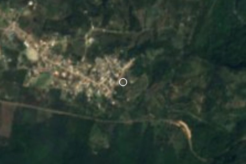


Drive times by road from OpenStreetMap, without traffic. Times marked ~ are estimated from the straight-line distance.
Lists with Cerro de Macuiltépetl
Nature Parks in Veracruz · 6 Nature Parks near Xalapa · 5 Nature Parks near Xico · 4 Nature Parks near Coscomatepec · 4 Nature Parks near Martínez de la Torre · 4Location from OpenStreetMap. Written by Puebloteca.