Town Landero y Coss, Veracruz Xalapa and the coffee hills
Seat of Veracruz's least populated municipality, 2,000 m up in the Sierra de Chiconquiaco, 10 km from Naolinco; San Isidro feast in May.
From Xalapa: 55 min by car (45 km by road) How to get there ↓
Near here


Plan your visit to Landero y Coss
Where to stay near Landero y Coss
Compare hotels, posadas and guest houses in Landero y Coss.
Tours to Landero y Coss
Day trips around Naolinco sometimes stop in Landero y Coss; a tour is the easy way to see it without a car.
 Tours from Veracruz
Private Sunrise Taj Mahal Tour from Delhi By Car -All inclusive
★ 5.0 (549) · From US$14
How to get to Landero y Coss
- From Xalapa: about 55 min by road (~45 km)
- Nearest airport: Veracruz (VER), 1 h 55 min by car to Naolinco
Links open a partner site. We may earn a commission if you book, at no cost to you.
Tours from Veracruz, near Landero y Coss


Tours, prices and ratings from Viator, checked weekly. We may earn a commission if you book.
About Landero y Coss
Landero y Coss is a mountain village of just over a thousand people (1,117 in the 2020 census) and the seat of Veracruz's least populated municipality: the whole municipality counted 1,543 residents in only three localities, the seat itself, Buena Vista a kilometre away, and the tiny hamlet of Raicero. It sits at about 2,000 metres in the foothills of the Sierra de Chiconquiaco, north of Xalapa and a short drive from Naolinco.
The name is fairly new. The village used to be San Juan Miahuatlán, founded in the mid-16th century when the people of the old town of Cexuchitlan, hit by epidemics, split up and one group settled here. In 1899 it was merged with neighbouring San José Miahuatlán, which kept the seat; San Juan became a municipality again in 1922, and in 1932 it was renamed after Francisco de Landero y Coss (1828-1900), a Veracruz-born governor of the state from 1872 to 1875 who also served as minister of finance.
The climate is temperate and damp, averaging around 16 °C with more than 2,000 mm of rain a year, a damp mountain climate; neighbouring Chiconquiaco sees fog on about 120 days a year. The volcanic soil feeds streams running to the Actopan River, and the slopes carry oak, jonote and chancarro woodland. Three quarters of the land is farmed, mainly maize, beans, coffee and green chiles.
The big celebration is for San Isidro Labrador, 14 to 16 May, with a dance and a fair; San Juan Bautista, the saint of the village's old name, is honoured on 24 June. For All Saints on 1 and 2 November families build home altars laid with the dishes their dead loved best. Mole is the festive dish.
How to get to Landero y Coss
Drive from Xalapa: 55 min, 45 km
From Xalapa it is about 44 km and some 55 minutes: leave on Avenida Lázaro Cárdenas and the Xalapa–Banderilla boulevard (Federal 140), take State Highway 65 (Xalapa–Misantla) at Banderilla, and about 28 km on leave it at Buena Vista for a road of about 3 km that climbs into the centre along Calle Vicente Guerrero. From Naolinco, the nearest Pueblo Mágico, it is about 10.5 km and 20 minutes north on local roads. By bus, everything goes through Xalapa's Central de Autobuses (CAXA), reached by ADO and AU from Mexico City's TAPO in about four hours, almost hourly. Second-class buses run from Xalapa to Naolinco in about an hour and a half; we found no published schedule for a service on to Landero y Coss, so a taxi from Naolinco is the sure option. Fog is frequent in these hills, so drive with headlights on.
Directions to Landero y Coss on Google Maps
Distances are in a straight line; the road is usually longer.
Links open a partner site. We may earn a commission if you book, at no cost to you.
From the nearest cities to Landero y Coss
- Xalapa · 45 km by road, 55 min
- Martínez de la Torre · 75 km by road, 1 h 30 min
- Papantla · about 120 km by road, ~1 h 45 min
Drive times by road from OpenStreetMap, without traffic or stops. Times marked ~ are estimated from the straight-line distance.
Map of Landero y Coss
Neighbourhoods and villages of Landero y Coss
Part of Landero y Coss or just outside it, closest first.
-
Acatlán · Town · 4 km from the centre
A small hillside town just north of Naolinco, with the parish of San Andrés Apóstol and a big fiesta every November 30. -
Chiconquiaco · Town · 4 km from the centre
A misty mountain town in the cloud forests of the Sierra de Chiconquiaco, on the winding scenic road north toward Misantla. -
Miahuatlán · Town · 4 km from the centre
Highland municipal seat at nearly 1,800 m, 7 km from Naolinco: San José church, farm cheeses, a waterfall and a patron fiesta in March.
Day trips and tours from Landero y Coss
The closest Pueblos Mágicos and places to visit, with the drive from Landero y Coss and tours that leave from it.


Times marked ~ are estimated from the distance. Links open a partner site. We may earn a commission if you book, at no cost to you.
Before you go: getting to and around Landero y Coss
- The nearest airport is Veracruz (VER).
- The best months to go are February, March, April, and December.
- 3 of the places on this page are more than 3 km from the centre: take a taxi, a ride-hailing app or a local bus.
- For day trips a rental car gives the most freedom; the tours above leave from Landero y Coss.
Visiting Landero y Coss: what to see and do
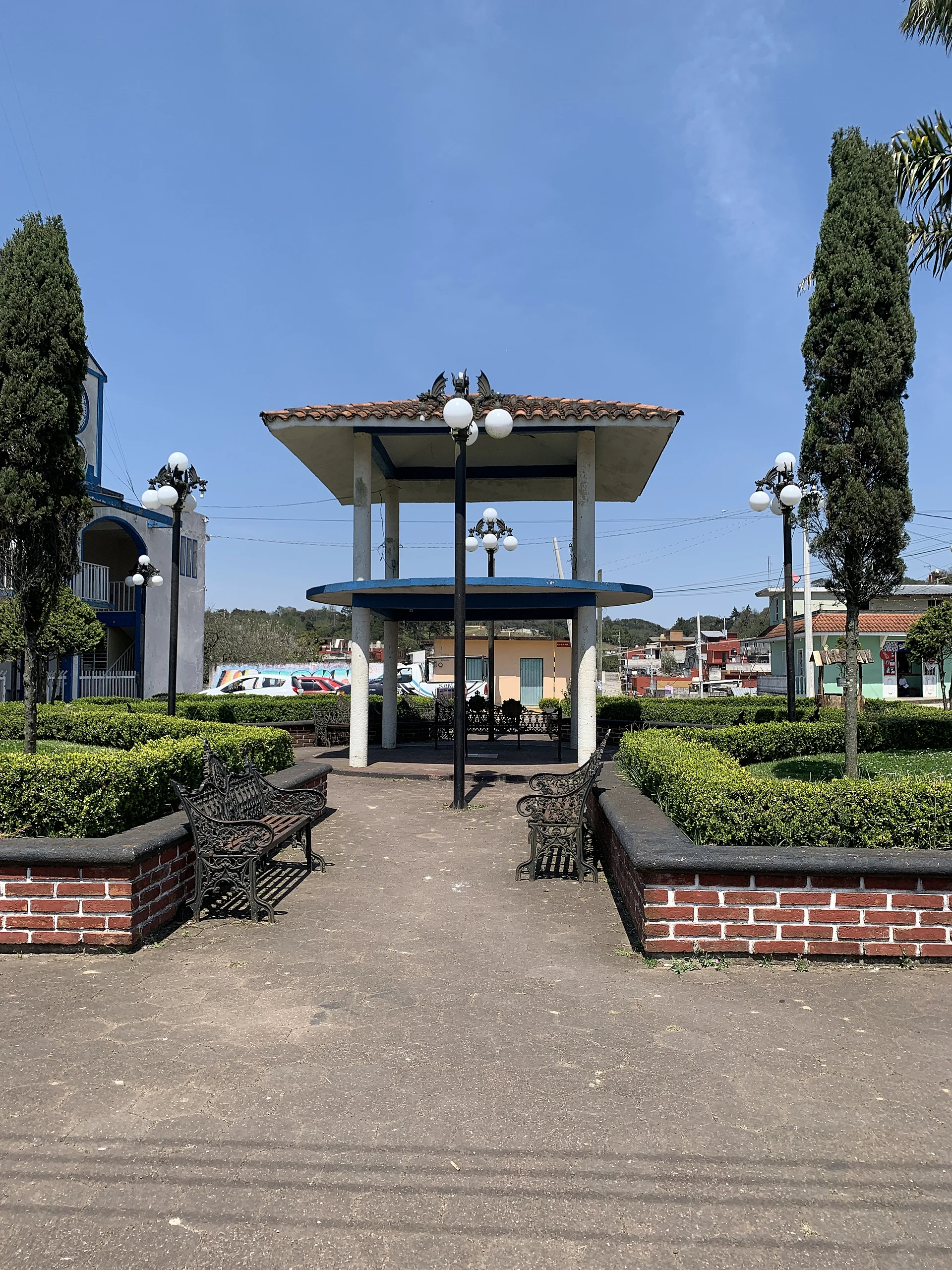
The village church and the central park.
The bandstand in the central park.
The San Isidro Labrador feast, 14 to 16 May, with a dance and fair.
The feast of San Juan Bautista, 24 June.
All Saints home altars, 1 and 2 November.
Naolinco, 10 km away, for a combined trip.
Plan your trip
Places to stay in Landero y Coss
Compare hotels, posadas, and rentals in and around Landero y Coss.
Tours & activities
Day trips around Naolinco sometimes stop in Landero y Coss; a tour is the easy way to see it without a car.
Rental cars
Pick up a car at VER (Veracruz): about 1 h 55 min by road to Naolinco, then 9 km more to Landero y Coss, on your own schedule.
Flights
The nearest airport with scheduled flights is Veracruz (VER), about 1 h 55 min by road from Naolinco, the base for Landero y Coss.
Mobile data
Signal can drop away from Naolinco: download a map of the way to Landero y Coss before you set out, or carry an eSIM with data.
Links open a partner site. We may earn a commission if you book, at no cost to you.
When to go to Landero y Coss mild
Landero y Coss shares the climate of Naolinco, 9 km away. The best months to visit are February, March, April, and December.
See the month-by-month climate of Naolinco
Weather in Landero y Coss now and the next 7 days
Live forecast from Open-Meteo. Chance of rain is the day's highest.
The closest Pueblo Mágico: Naolinco

Naolinco is the Pueblo Mágico closest to Landero y Coss, with places to stay, food, and more to see.
Also close to
- Coatepec · Veracruz · 33 km away
- Xico · Veracruz · 39 km away
- Teziutlán · Puebla · 55 km away
- Tlatlauquitepec · Puebla · 69 km away
- Coscomatepec · Veracruz · 76 km away
Near Landero y Coss


Drive times by road from OpenStreetMap, without traffic. Times marked ~ are estimated from the straight-line distance.
Location from OpenStreetMap. Written by Puebloteca.