Village Amatepec, Estado de México Southern Estado de México
A former silver-mining town in the State of Mexico's Tierra Caliente, with San Gaspar church, high-altitude coffee and a 6 January feast.
From Cuernavaca: about 2 h by road (~135 km) How to get there ↓
Near here
See everything nearby ↓


Plan your visit to Amatepec
Where to stay near Amatepec
Compare hotels, posadas and guest houses in Amatepec.
Tours to Amatepec
Day trips and guided outings from Ixcateopan often include Amatepec; with a local guide you can get there without a car.
 Tours from Taxco
Taxco and Cuernavaca Tour from CDMX
★ 4.5 (11) · From US$61
How to get to Amatepec
- From Cuernavaca: about 2 h by road (~135 km)
- Nearest airport: Toluca (TLC), 2 h 40 min by car to Ixcateopan
Links open a partner site. We may earn a commission if you book, at no cost to you.
Tours from Taxco, near Amatepec


Tours, prices and ratings from Viator, checked weekly. We may earn a commission if you book.
About Amatepec
In the far southwest of the State of Mexico, with Guerrero close by, Amatepec is the capital of a municipality of 25,244 people (2020) that borders Tejupilco to the north, Tlatlaya to the south and Sultepec to the east, and its terrain runs from 500 to 2,400 m, averaging 843. The seat itself is small: 1,911 people in 2020, fewer than Palmar Chico, the municipality's largest locality at 3,022. The Nahuatl name means "place on the hill of the amate trees".
Evangelisation began in 1526, and between 1527 and 1534 Juan de Saucedo, the first encomendero, founded more than ten mining camps; silver mining at Amatepec began in 1531. Together with Sultepec the district became known as the Provincia de la Plata. In 1819 Vicente Guerrero took refuge at La Goleta while royalist troops pursued him, and in 1912 Zapatista forces took the seat and burned the municipal archive. The municipality was created by decree on 20 May 1833.
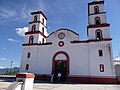
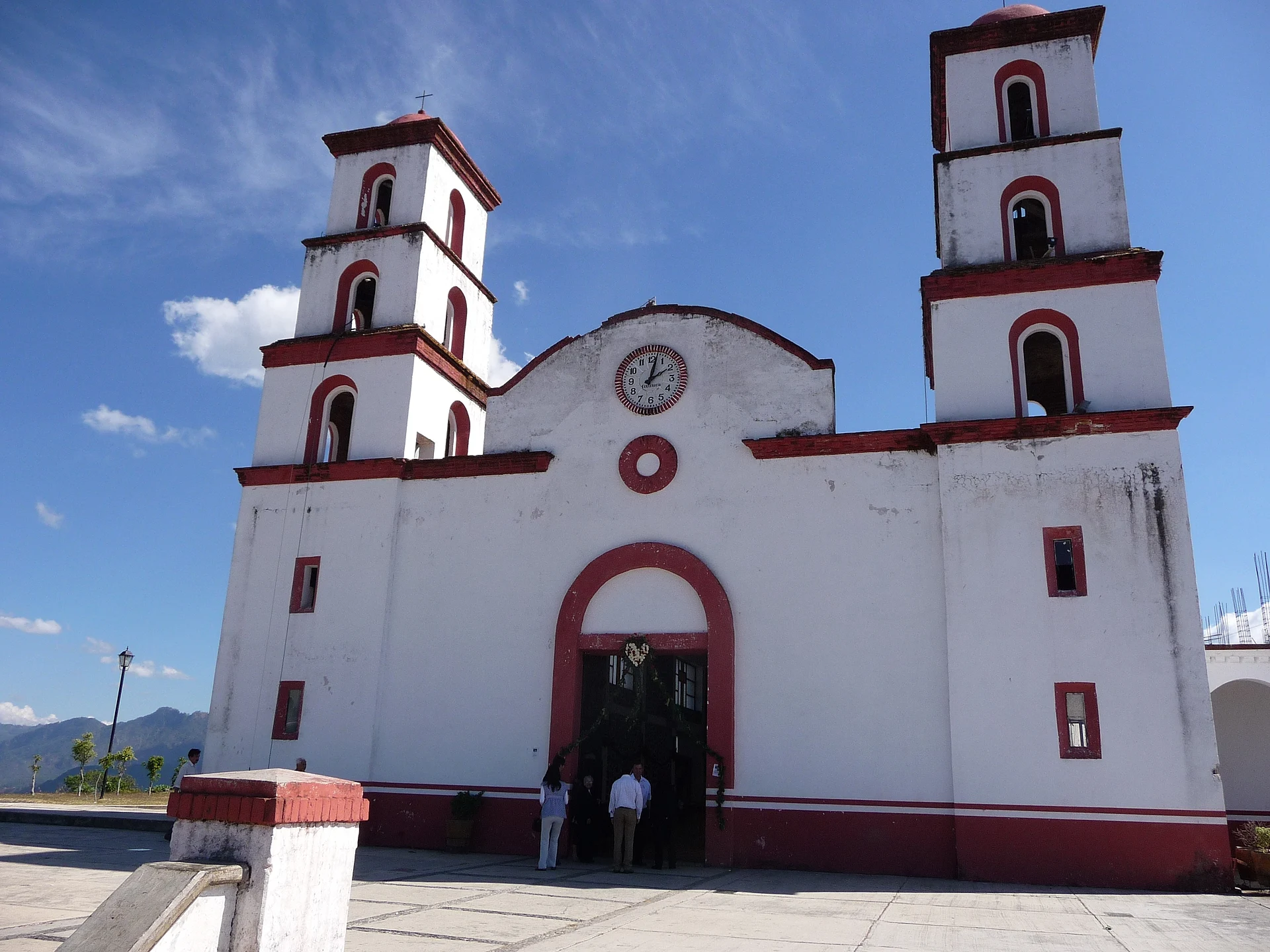
The main church is San Gaspar; the patron saint is celebrated on 6 January, with a wind band and fireworks. The municipality recognises archaeological sites such as the Trincheras de Pedro Ascencio, the Peña que Responde, La Calavera and San Gaspar. Coffee is one of the main activities: mostly small growers farm it between 1,202 and 2,100 m, at an average of 1,598, which qualifies it as strictly high-altitude coffee (Típica, Caturra, Bourbon and Garnica varieties).
How to get to Amatepec
Amatepec is far out: about 135 km from Toluca by road and two and a half hours or more (approx.; Rome2Rio gives 2 hours 22 minutes by car), in the Tierra Caliente region. Tejupilco, the district seat the municipality belongs to, is the nearest regional centre; state road EM 2 continues towards the Guerrero border. From the Guerrero side, Iguala is about 78 km away in a straight line, though much more by road (we found no reliable time).
Without a car, Rome2Rio lists no direct bus: it suggests a Zina bus from Toluca to Los Colorines (about 2 hours, twice a day, approx.) and then a taxi of an hour and a half to Amatepec. It is a long trip on mountain roads; leave early and confirm timetables at the Toluca terminal. Ixcateopan lies some 46 km off in a straight line, on the Guerrero side.
Directions to Amatepec on Google Maps
Distances are in a straight line; the road is usually longer.
Links open a partner site. We may earn a commission if you book, at no cost to you.
From the nearest cities to Amatepec
- Cuernavaca · about 135 km by road, ~2 h
- Toluca · 135 km by road, 2 h 40 min
- Zitácuaro · 169 km by road, 2 h 50 min
Drive times by road from OpenStreetMap, without traffic or stops. Times marked ~ are estimated from the straight-line distance.
Before you go to Amatepec: hours, prices and tips
- Best season
- The patron-saint feast of San Gaspar is on 6 January in the seat, with a wind band and fireworks. H. Ayuntamiento de Amatepec · checked Oct 2026
Hours and prices change, especially around holidays. Each fact links to where we checked it.
Visiting Amatepec: what to see and do
The church of San Gaspar, the seat's main church.
Archaeological sites in the municipality: Trincheras de Pedro Ascencio, Peña que Responde, La Calavera.
High-altitude coffee farms between 1,202 and 2,100 m, run by small growers.
The feast of San Gaspar, on 6 January.
Plan your trip
Places to stay in Amatepec
Compare hotels, posadas, and rentals in and around Amatepec.
Tours & activities
Day trips and guided outings from Ixcateopan often include Amatepec; with a local guide you can get there without a car.
Rental cars
Pick up a car at TLC (Toluca): about 2 h 40 min by road to Ixcateopan, then 46 km more to Amatepec, on your own schedule.
Flights
The nearest airport with scheduled flights is Toluca (TLC), about 2 h 40 min by road from Ixcateopan, the base for Amatepec.
Mobile data
Signal can drop away from Ixcateopan: download a map of the way to Amatepec before you set out, or carry an eSIM with data.
Links open a partner site. We may earn a commission if you book, at no cost to you.
When to go to Amatepec mild
Amatepec shares the climate of Ixcateopan, 46 km away. The best months to visit are January, February, March, and December.
See the month-by-month climate of Ixcateopan
Weather in Amatepec now and the next 7 days
Live forecast from Open-Meteo. Chance of rain is the day's highest.
The closest Pueblo Mágico: Ixcateopan

Ixcateopan is the Pueblo Mágico closest to Amatepec, with places to stay, food, and more to see.
Also close to
- Tonatico · Estado de México · 56 km away
- Ixtapan de la Sal · Estado de México · 57 km away
- Valle de Bravo · Estado de México · 57 km away
- Taxco · Guerrero · 63 km away
- Malinalco · Estado de México · 78 km away
Closest to Amatepec
-
Tlatlaya · Town · 8 km away
-
Sierra de Nanchititla · Nature reserve · 30 km away
-
Almoloya de Alquisiras · Village · 37 km away
-
Texcaltitlán · Town · 38 km away
-
Temascaltepec · Town · 43 km away
-
Zacualpan · Town · 43 km away
-
Real de Arriba · Town · 44 km away
-
Zacazonapan · Town · 44 km away


Near Amatepec


Drive times by road from OpenStreetMap, without traffic. Times marked ~ are estimated from the straight-line distance.
Location from OpenStreetMap. Written by Puebloteca.