Town Chiautla, Estado de México Valley of Mexico Teotihuacan Valley
San Andrés Chiautla, just north of Texcoco: a late 16th-century Franciscan church, a scorpion-handed Christ and a hill lit up every 12 May.
From Mexico City: 40 min by car (36 km by road) How to get there ↓
Near here


Plan your visit to Chiautla
Where to stay near Chiautla
Compare hotels, posadas and guest houses in Chiautla.
Tours to Chiautla
Day trips around Teotihuacán sometimes stop in Chiautla; a tour is the easy way to see it without a car.
 Tours from Zacatlan
Zacatlán Guided Tour walking through the Center
★ 5.0 (2) · From US$8
How to get to Chiautla
- From Mexico City: about 40 min by road (~36 km)
- Nearest airport: Mexico City (Felipe Ángeles) (NLU), 35 min by car to Teotihuacán
Links open a partner site. We may earn a commission if you book, at no cost to you.
Tours from Zacatlan, near Chiautla
Tours, prices and ratings from Viator, checked weekly. We may earn a commission if you book.
About Chiautla
Almost everyone calls the town San Andrés Chiautla, after the apostle its parish church is dedicated to, though officially both town and municipality are simply Chiautla. It is the seat of a small municipality of about 20 km² on the northern edge of Texcoco, in the old lakebed zone of the valley, at about 2,260 m. It had 10,810 residents in 2020. The state's book of Indigenous place names reads the name as "where aphids abound".
The federal municipal encyclopedia says Toltec-Chichimec groups founded the town in the 12th century and that it was a lordship under Texcoco before the conquest; it appears on five of the ten sheets of the Codex Xolotl. Afterwards Cortés granted it in encomienda to Alonso de Grado, one of his trusted men, and it later passed to Jerónimo López. Chiautla had its own town council from 15 July 1820, under the Cádiz Constitution, and has been a municipality since 2 March 1824. In 1914, the same source says, Emiliano Zapata set up a base in the Ixquitlán quarter.
The parish church of San Andrés has had a rough history. A study published by INAH explains that in 1569 Chiautla was a dependency of the Franciscan convent in Texcoco, and that late in the 16th century the friars founded a small adobe convent here, with an orchard and even a library. By 1737 the church was close to collapse and the convent had fallen down; when it passed to the secular clergy in 1753 the vaults were closed but it had no doors and no carved entrance. Today it has a white façade with a single tower and a stained-glass window of the apostle framed in carved stone.
In the village of Tlaltecahuacan, within the municipality, a 17th-century church holds the Señor de la Ascensión, a Christ with scorpions in his hands in place of wounds, among gilded Baroque altarpieces. On the night of 12 May, people from San Antonio Tepetitlán climb the Cerro de las Promesas and light cans of fuel around letters painted in lime to honour the Virgin of Fátima; the glow can be seen for kilometres, and locals say the custom is more than a hundred years old.
How to get to Chiautla
Drive from Mexico City: 40 min, 36 km
From central Mexico City it is about 43 km, roughly 45 minutes in light traffic: the Circuito Interior and Avenida Río Consulado lead to the México–Texcoco toll road (136D); after about 17 km of toll road continue on the San Bernardino–Tepexpan road (142) and Federal Highway 136 to the northern exit of Texcoco, then take Avenida del Trabajo for the last 4 km or so into Chiautla.
By public transport, buses leave the TAPO (Metro San Lázaro) for Texcoco every 30 to 60 minutes and take about 40 minutes; in Texcoco, local buses run to San Andrés Chiautla about every 15 minutes, a 10-minute ride, or take a short taxi. Teotihuacán, the nearest of our pueblos, is about 26 km away on the Pirámides–Texcoco toll road (132D), roughly 25 minutes.
Directions to Chiautla on Google Maps
Distances are in a straight line; the road is usually longer.
Links open a partner site. We may earn a commission if you book, at no cost to you.
From the nearest cities to Chiautla
- Mexico City · 36 km by road, 40 min
- San Martín Texmelucan · 83 km by road, 1 h 5 min
- Pachuca · 83 km by road, 1 h 10 min
Drive times by road from OpenStreetMap, without traffic or stops. Times marked ~ are estimated from the straight-line distance.
Map of Chiautla
Neighbourhoods and villages of Chiautla
Part of Chiautla or just outside it, closest first.
-
Chiconcuac · Town · 1 km from the centre
A small town turned giant clothing market, famous for its wool sweaters, blankets and bargain-hunting crowds. -
Papalotla · Village · 3 km from the centre
Seat of the State of Mexico's smallest municipality: a Pueblo con Encanto with an 18th-century church, lamb barbacoa and a butterfly house. -
San Salvador Atenco · Town · 3 km from the centre
A town on the old shore of Lake Texcoco: a Franciscan chapel from 1571, cypress groves from Nezahualcóyotl's time and the 'two Mondays' feast.
Day trips and tours from Chiautla
The closest Pueblos Mágicos and places to visit, with the drive from Chiautla and tours that leave from it.


Times marked ~ are estimated from the distance. Links open a partner site. We may earn a commission if you book, at no cost to you.
Before you go: getting to and around Chiautla
- The nearest airport is Mexico City (Felipe Ángeles) (NLU).
- The best months to go are January, February, March, and December.
- Everything on this page is in or close to the centre: walk, or take a short taxi ride.
- For day trips a rental car gives the most freedom; the tours above leave from Chiautla.
Before you go to Chiautla: hours, prices and tips
- Best season
- On the night of 12 May, people from San Antonio Tepetitlán light up the Cerro de las Promesas in honour of the Virgin of Fátima; it can be seen for several kilometres. Wikipedia · checked Oct 2026
Hours and prices change, especially around holidays. Each fact links to where we checked it.
Visiting Chiautla: what to see and do
The parish church of San Andrés Apóstol, founded by the Franciscans, with its white façade, tower and stained-glass saint.
The 17th-century church at Tlaltecahuacan and its Señor de la Ascensión with scorpions in his hands.
The gilded Baroque altarpieces in the same Tlaltecahuacan church.
The Cerro de las Promesas lit up on the night of 12 May, seen from San Antonio Tepetitlán.
The church of Santiago Chimalpa, with stained glass, altarpieces and images nearly two centuries old.
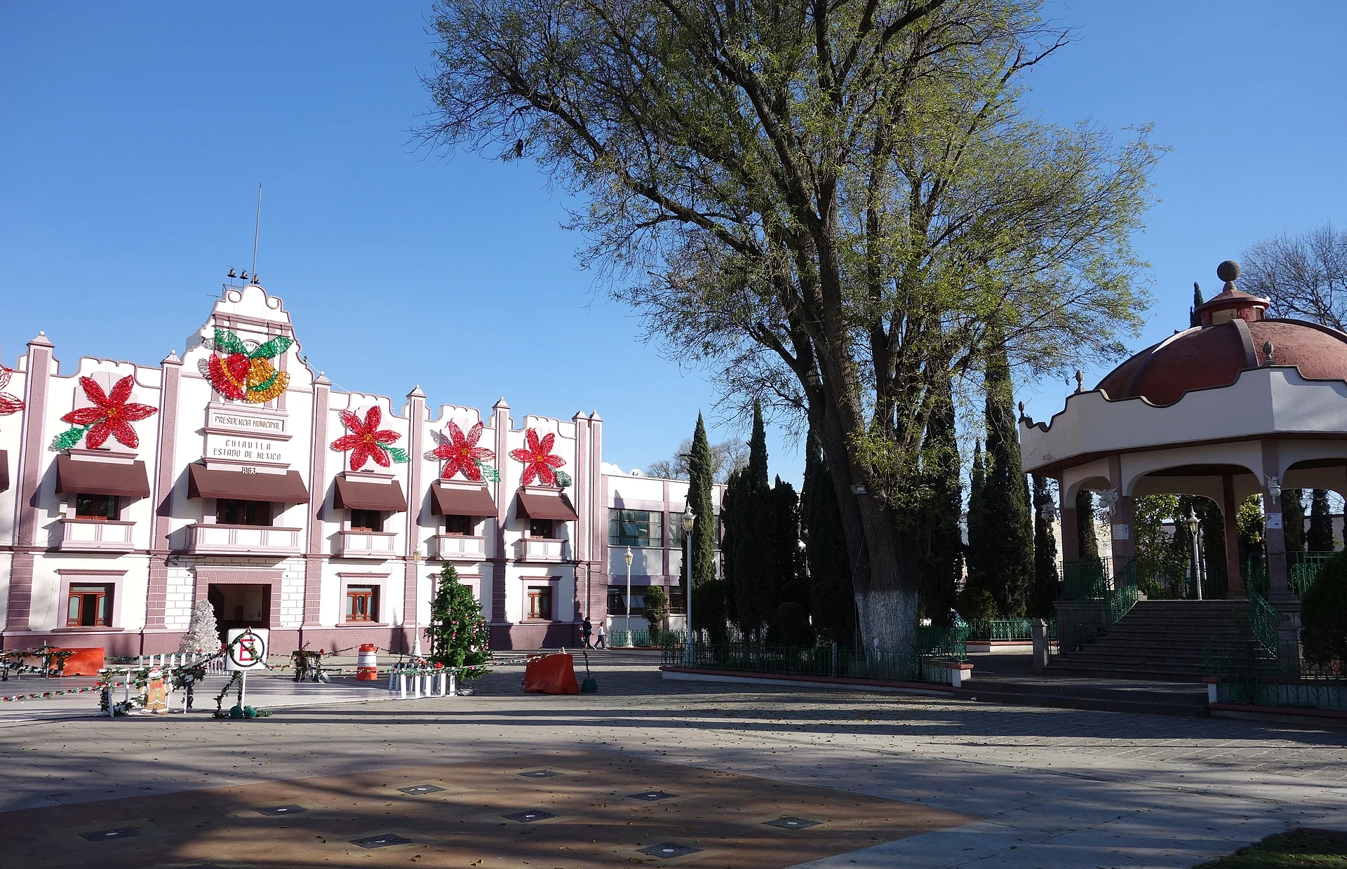
The town hall, built between 1934 and 1941.
Plan your trip
Places to stay in Chiautla
Compare hotels, posadas, and rentals in and around Chiautla.
Tours & activities
Day trips around Teotihuacán sometimes stop in Chiautla; a tour is the easy way to see it without a car.
Rental cars
Pick up a car at NLU (Mexico City (Felipe Ángeles)): about 35 min by road to Teotihuacán, then 16 km more to Chiautla, on your own schedule.
Flights
The nearest airport with scheduled flights is Mexico City (Felipe Ángeles) (NLU), about 35 min by road from Teotihuacán, the base for Chiautla.
Mobile data
Signal can drop away from Teotihuacán: download a map of the way to Chiautla before you set out, or carry an eSIM with data.
Links open a partner site. We may earn a commission if you book, at no cost to you.
When to go to Chiautla mild
Chiautla shares the climate of Teotihuacán, 16 km away. The best months to visit are January, February, March, and December.
See the month-by-month climate of Teotihuacán
Weather in Chiautla now and the next 7 days
Live forecast from Open-Meteo. Chance of rain is the day's highest.
The closest Pueblo Mágico: Teotihuacán

Teotihuacán is the Pueblo Mágico closest to Chiautla, with places to stay, food, and more to see.
Also close to
- Otumba · Estado de México · 21 km away
- Tepotzotlán · Estado de México · 40 km away
- Zempoala · Hidalgo · 46 km away
- Villa del Carbón · Estado de México · 64 km away
- Huejotzingo · Puebla · 66 km away
Near Chiautla


Drive times by road from OpenStreetMap, without traffic. Times marked ~ are estimated from the straight-line distance.
Location from OpenStreetMap. Written by Puebloteca.