Village Papalotla, Estado de México Valley of Mexico Teotihuacan Valley
Seat of the State of Mexico's smallest municipality: a Pueblo con Encanto with an 18th-century church, lamb barbacoa and a butterfly house.
From Mexico City: 45 min by car (37 km by road) How to get there ↓
Near here
See everything nearby ↓


Plan your visit to Papalotla
Where to stay near Papalotla
Compare hotels, posadas and guest houses in Papalotla.
Tours to Papalotla
Day trips and guided outings from Teotihuacán often include Papalotla; with a local guide you can get there without a car.
 Tours from Zacatlan
Zacatlán Guided Tour walking through the Center
★ 5.0 (2) · From US$8
How to get to Papalotla
- From Mexico City: about 45 min by road (~37 km)
- Nearest airport: Mexico City (Felipe Ángeles) (NLU), 35 min by car to Teotihuacán
Links open a partner site. We may earn a commission if you book, at no cost to you.
Tours from Zacatlan, near Papalotla
Tours, prices and ratings from Viator, checked weekly. We may earn a commission if you book.
About Papalotla
Papalotla means "place of many butterflies" in Nahuatl, and it is the seat of the smallest municipality in the State of Mexico: about 3 sq km just north of Texcoco, with 4,862 residents in the 2020 census (4,784 in the town itself). In Acolhua times it answered to the lordship of Texcoco, and its glyph, two butterflies, appears in a codex as a sign of loyalty to Nezahualcóyotl. The state government named it a Pueblo con Encanto in August 2011.
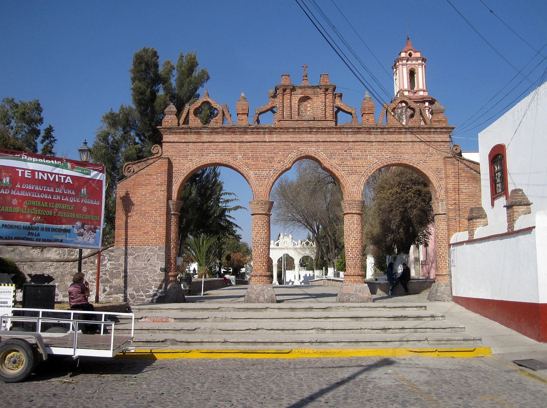
What you come for is in the old centre, with its cobbled and paved streets. The parish church of Santo Toribio, Bishop of Astorga, went up in five stages between 1747 and 1776; its Texcoco-baroque arcades frame a churchyard that still has centuries-old olive trees, and inside are six baroque, rococo and churrigueresque altarpieces. Next door stands the Casa de Piedra, one of the oldest buildings in town. A few blocks away the Parque Didáctico El Árbol (opened in 1970) has grills, palapas and a lively squirrel population, with a butterfly house beside it.
The local table is lamb barbacoa, fried pork, mole and chuales, tamales of corn and alverjón (a pea-like legume) sweetened with piloncillo; the Corredor Gastronómico Los Arcos, beside the town hall, has six food stalls. Workshops make leatherwork (bags, belts, saddles), wrought iron and carved wood. The big feast is Santo Toribio in April, with the Vaqueros, Santiagueros and Sembradores dances; in June there is a taco fair at the Alameda.
How to get to Papalotla
Drive from Mexico City: 45 min, 37 km
By car from Mexico City, head for Texcoco; once there, take the Camino a San Simón north until you reach Papalotla, per México Desconocido. In a straight line it is about 32 km from the centre of the capital and about 14 km from Teotihuacán; with eastern-city traffic allow roughly 1 hour from CDMX rather than the 35 minutes a straight-line estimate suggests.
By public transport, take a bus from the TAPO terminal (Metro San Lázaro) to Texcoco, or start from Texcoco's own bus terminal, then a taxi or local transport to Papalotla; Wikivoyage notes the municipality has buses and taxis. Once in town, everything of interest is a walk around the plaza and the parish church.
Directions to Papalotla on Google Maps
Distances are in a straight line; the road is usually longer.
Links open a partner site. We may earn a commission if you book, at no cost to you.
From the nearest cities to Papalotla
- Mexico City · 37 km by road, 45 min
- San Martín Texmelucan · 77 km by road, 1 h
- Pachuca · 83 km by road, 1 h 10 min
Drive times by road from OpenStreetMap, without traffic or stops. Times marked ~ are estimated from the straight-line distance.
Before you go to Papalotla: hours, prices and tips
- Entry
- Entry to the Parque Didáctico El Árbol is free. Wikiviajes: Papalotla · checked Oct 2026
- Best time of day
- April, when the feast of Santo Toribio brings music and traditional dances. Wikiviajes: Papalotla · checked Oct 2026
Hours and prices change, especially around holidays. Each fact links to where we checked it.
Visiting Papalotla: what to see and do
Parish church of Santo Toribio, Bishop of Astorga (1747-1776), with its arcades and centuries-old olive trees in the atrium
Casa de Piedra, next to the church
Parque Didáctico El Árbol, with grills, palapas and squirrels
Butterfly house (mariposario) on Avenida Insurgentes
Corredor Gastronómico Los Arcos: lamb barbacoa, fried pork and chuales
Workshops for leather, wrought iron and carved wood
Plan your trip
Places to stay in Papalotla
Compare hotels, posadas, and rentals in and around Papalotla.
Tours & activities
Day trips and guided outings from Teotihuacán often include Papalotla; with a local guide you can get there without a car.
Rental cars
Pick up a car at NLU (Mexico City (Felipe Ángeles)): about 35 min by road to Teotihuacán, then 14 km more to Papalotla, on your own schedule.
Flights
The nearest airport with scheduled flights is Mexico City (Felipe Ángeles) (NLU), about 35 min by road from Teotihuacán, the base for Papalotla.
Mobile data
Signal can drop away from Teotihuacán: download a map of the way to Papalotla before you set out, or carry an eSIM with data.
Links open a partner site. We may earn a commission if you book, at no cost to you.
When to go to Papalotla mild
Papalotla shares the climate of Teotihuacán, 14 km away. The best months to visit are January, February, March, and December.
See the month-by-month climate of Teotihuacán
Weather in Papalotla now and the next 7 days
Live forecast from Open-Meteo. Chance of rain is the day's highest.
The closest Pueblo Mágico: Teotihuacán

Teotihuacán is the Pueblo Mágico closest to Papalotla, with places to stay, food, and more to see.
Also close to
- Otumba · Estado de México · 18 km away
- Tepotzotlán · Estado de México · 42 km away
- Zempoala · Hidalgo · 44 km away
- Huejotzingo · Puebla · 65 km away
- Villa del Carbón · Estado de México · 66 km away
Closest to Papalotla
-
Chiautla · Town · 3 km away
-
Chiconcuac · Town · 4 km away
-
Tepetlaoxtoc · Town · 4 km away
-
Ocopulco · Village · 5 km away
-
La Purificación Tepetitla · Village · 6 km away
-
Parque Nacional Molino de Flores · Nature reserve · 6 km away
-
San Salvador Atenco · Town · 6 km away
-
Baños de Nezahualcóyotl · Archaeological site · 8 km away


Near Papalotla


Drive times by road from OpenStreetMap, without traffic. Times marked ~ are estimated from the straight-line distance.
Location from OpenStreetMap. Written by Puebloteca.