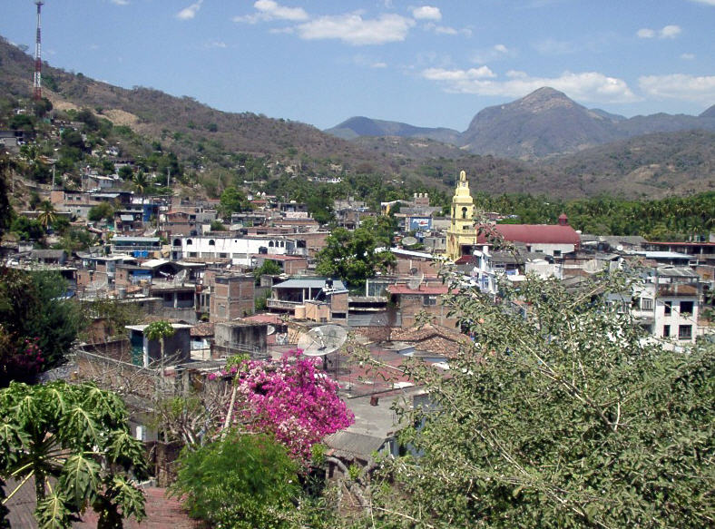
Town Juan R. Escudero, Guerrero Central Guerrero
Seat of Juan R. Escudero between Chilpancingo and Acapulco: the Papagayo and Omitlán rivers, La Pinta pool and a December Guadalupe fair.
From Chilpancingo: about 50 min by road (~55 km) How to get there ↓
Near here
See everything nearby ↓


Plan your visit to Tierra Colorada
Where to stay near Tierra Colorada
Compare hotels, posadas and guest houses in Tierra Colorada.
Tours to Tierra Colorada
Day trips around Guerrero sometimes stop in Tierra Colorada; a tour is the easy way to see it without a car.
 Tours from Acapulco
Paddle Boarding At Acapulco´s Bay
★ 5.0 (247) · From US$24
How to get to Tierra Colorada
- From Chilpancingo: about 50 min by road (~55 km)
Links open a partner site. We may earn a commission if you book, at no cost to you.
Tours from Acapulco, near Tierra Colorada


Tours, prices and ratings from Viator, checked weekly. We may earn a commission if you book.
About Tierra Colorada
Tierra Colorada is the seat of Juan R. Escudero municipality, in the foothills of the Sierra Madre del Sur halfway between Chilpancingo and Acapulco on federal highway 95, which earns it the nickname "gateway to the two coasts". It lies around 290 metres up and had 12,262 residents in 2020, almost half the municipality's 26,000. The name means red earth, after the colour of the soil.
Around 1848-49 this was a hacienda owned by General Juan N. Álvarez, who in 1854 handed out land to his workers, and the town grew from that. It was recognised as a pueblo under Chilpancingo in 1923, and in December 1951 the municipality was created, named after Juan Ranulfo Escudero, a labour leader born in Acapulco. Revolutionary forces fought here in 1913, and in 1927 President Calles had a boulder blown up that blocked the Mexico City-Acapulco road near Garrapatas; the road was finished in 1931.
This is river country. The Omitlán and the Papagayo meet in the La Venta canyon, between reddish limestone walls, where the General Ambrosio Figueroa hydroelectric dam stands. On the Hueyapan stream is La Pinta, a pool with a waterfall and the town's favourite outing, and there are more falls at Tepehuaje, El Zapotal and Apanlázaro. People kayak the rivers and rappel the cliffs.
Local food includes green pipián mole, charcoal-grilled chicken and quail Plan de Lima style, langostino broth and enchiladas de la parada. The Feria Regional Guadalupana runs from 1 to 12 December with processions, bullfights, horse races and fireworks, and festivities bring out the Mojigangas and the Red Devils (charracachinchis) dancers to chile frito brass bands.
How to get to Tierra Colorada
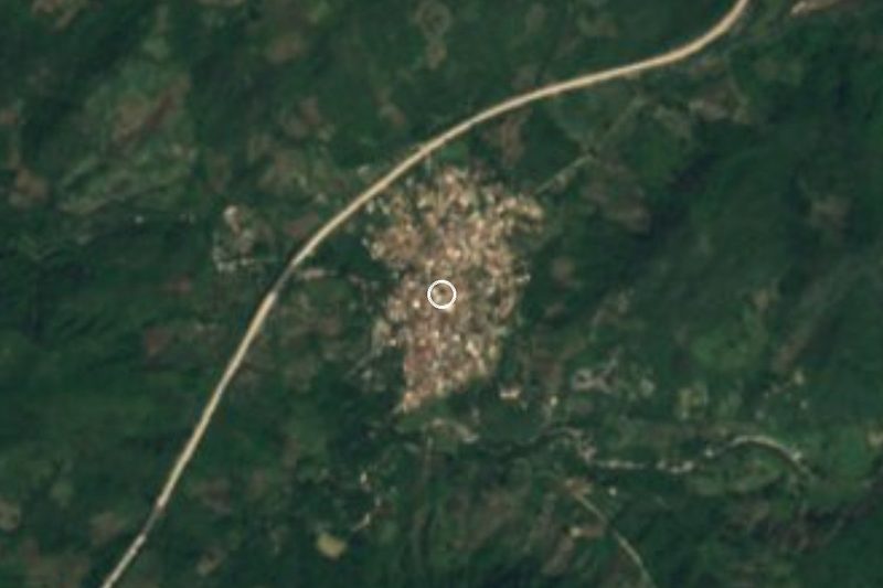
Tierra Colorada sits on federal highway 95, the old Mexico City-Acapulco road that runs through town, and has its own exit off the Autopista del Sol (95D). It is 35 minutes and 52 km by road from Chilpancingo, with Acapulco further south on the same route. By bus, Los Galgos has run from Acapulco's Costera terminal every half hour, taking about 1 h 20 min, but the line has announced it will stop running, so check times before you go. Buses reach both Chilpancingo and Acapulco from Mexico City's Terminal del Sur (Taxqueña). Guerrero carries the US State Department's top "Do Not Travel" level; drive in daylight and check road conditions locally before setting out.
Directions to Tierra Colorada on Google Maps
Distances are in a straight line; the road is usually longer.
Links open a partner site. We may earn a commission if you book, at no cost to you.
From the nearest cities to Tierra Colorada
- Chilpancingo · about 55 km by road, ~50 min
- Acapulco · about 65 km by road, ~1 h
- Tlapa · about 140 km by road, ~2 h 5 min
Drive times by road from OpenStreetMap, without traffic or stops. Times marked ~ are estimated from the straight-line distance.
Before you go to Tierra Colorada: hours, prices and tips
- Best time of day
- Warm and semi-humid, averaging 32 °C; most of the roughly 1,400 mm of yearly rain falls in summer. Wikipedia · checked Oct 2026
- Best season
- Feria Regional Guadalupana from 1 to 12 December, with processions, bullfights, horse races and fireworks. Wikipedia · checked Oct 2026
Hours and prices change, especially around holidays. Each fact links to where we checked it.
Visiting Tierra Colorada: what to see and do
La Pinta pool and waterfall on the Hueyapan stream.
The La Venta canyon, where the Omitlán and Papagayo rivers meet.
The General Ambrosio Figueroa dam.
The Tepehuaje, El Zapotal and Apanlázaro waterfalls.
Green pipián mole or enchiladas de la parada.
The Feria Regional Guadalupana, 1 to 12 December.
Plan your trip
Places to stay in Tierra Colorada
Compare hotels, posadas, and rentals in and around Tierra Colorada.
Tours & activities
Day trips around Guerrero sometimes stop in Tierra Colorada; a tour is the easy way to see it without a car.
Mobile data
Signal can drop away from Guerrero: download a map of the way to Tierra Colorada before you set out, or carry an eSIM with data.
Links open a partner site. We may earn a commission if you book, at no cost to you.
Closest to Tierra Colorada
-
Tehuacalco · Archaeological site · 4 km away
-
Dos Arroyos · Village · 21 km away
-
La Avispa Museo Interactivo · Landmark · 41 km away
-
Catedral de Santa María de la Asunción de Chilpancingo · Landmark · 43 km away
-
Chilpancingo · City · 43 km away
-
Museo Regional de Guerrero · Landmark · 43 km away
-
Zona arqueológica "Pezuapan" · Archaeological site · 43 km away
-
San Marcos · Town · 44 km away


Near Tierra Colorada


Drive times by road from OpenStreetMap, without traffic. Times marked ~ are estimated from the straight-line distance.
Location from OpenStreetMap. Written by Puebloteca.