
Town Tepeapulco, Hidalgo Municipality of Tepeapulco
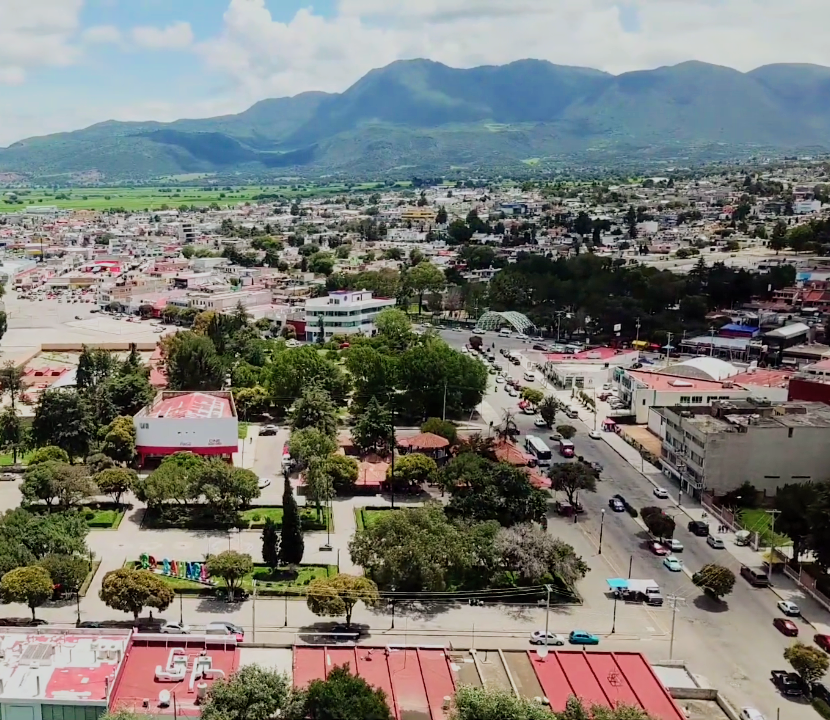
Industrial new town planned in the 1950s on the Llanos de Apan for DINA, Concarril and Sidena; now the largest town in Tepeapulco municipality.
From Pachuca: 45 min by car (47 km by road) How to get there ↓
Near here
See everything nearby ↓



Plan your visit to Ciudad Sahagún
Where to stay near Ciudad Sahagún
Compare hotels, posadas and guest houses in Ciudad Sahagún.
Tours to Ciudad Sahagún
Day trips around Zempoala sometimes stop in Ciudad Sahagún; a tour is the easy way to see it without a car.
How to get to Ciudad Sahagún
- From Pachuca: about 45 min by road (~47 km)
- Nearest airport: Mexico City (Felipe Ángeles) (NLU), 58 min by car to Zempoala
Links open a partner site. We may earn a commission if you book, at no cost to you.
About Ciudad Sahagún
Ciudad Sahagún, officially named Fray Bernardino de Sahagún, grew around three factories rather than a church. In the early 1950s President Miguel Alemán chose land in Tepeapulco, 95 km north of Mexico City, for a model industrial hub meant to lift the Llanos de Apan out of poverty. Diesel Nacional (DINA) was set up on 28 July 1951 under licence from Italy's Fiat; work on Concarril's first railway-car plant began in 1952, and in 1954 came the Toyoda de México textile-machinery works, later Siderúrgica Nacional (Sidena).
The workers' town was laid out alongside: 1,317 houses and 46 flats with a market, sports fields, schools and clinics, plus 515 more homes built by the IMSS in 1961. Sahagún joined Tepeapulco municipality in 1971, and Renault arrived in 1979. That plant's closure in 1986 cost seven thousand jobs; Concarril went to Bombardier, Sidena went bankrupt and DINA shut its last truck factory. From some 40,000 jobs the town was down to about 12,000 by 2008, and firms such as Gerdau, SCA and Greenbrier have since moved in. With 31,737 residents in 2020, it is the most populous place in Hidalgo that is not a municipal seat.
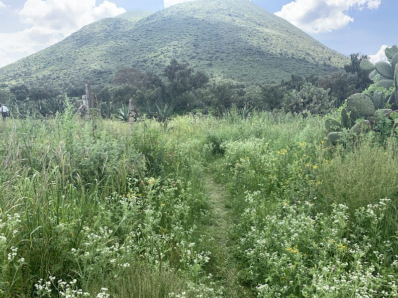
The town lies at 2,448 metres on the pulque-growing plateau, in a dry temperate climate, with Cerro Xihuingo in the Chichicuautla range on the skyline. Its heart is Plaza Rodrigo Gómez, remodelled in 2010, with the main church facing it. The festivities gather there: the founding anniversary fills the second week of October with cultural and sports events; on 12 December more than 400 floats carry images of the Virgin of Guadalupe along Avenida México to the church; and on the second weekend of December paper hot-air balloons go up at a festival that began in 2008. A national huapango contest is also held during the fair.
How to get to Ciudad Sahagún
Drive from Pachuca: 45 min, 47 km
From Pachuca it is about 46 km by road, roughly 45 minutes by car; from Mexico City about 81 km and around 1 h 15 min.
By bus, Autobuses Teotihuacan runs an hourly direct service from Mexico City's Terminal Norte (about 2 h 40 min); you can also go to San Juan Teotihuacan, with departures every 20 minutes, and change there for the hourly bus to Sahagún. From Pachuca's Central de Autobuses, Autotransportes Hidalgo takes about 40 minutes. Zempoala, the nearest Pueblo Mágico, is about 19 km away as the crow flies, and Tulancingo about 41 km.
Directions to Ciudad Sahagún on Google Maps
Distances are in a straight line; the road is usually longer.
Links open a partner site. We may earn a commission if you book, at no cost to you.
From the nearest cities to Ciudad Sahagún
- Pachuca · 47 km by road, 45 min
- Tulancingo · 52 km by road, 50 min
- San Martín Texmelucan · 69 km by road, 55 min
Drive times by road from OpenStreetMap, without traffic or stops. Times marked ~ are estimated from the straight-line distance.
Before you go to Ciudad Sahagún: hours, prices and tips
- Best season
- Town anniversary in the second week of October; 12 December procession; Paper Balloon Festival on the second weekend of December. Wikipedia: Ciudad Sahagún · checked Oct 2026
Hours and prices change, especially around holidays. Each fact links to where we checked it.
Visiting Ciudad Sahagún: what to see and do
Plaza Rodrigo Gómez, the town centre, with the main church facing it
The 1950s workers' neighbourhoods laid out beside the factories
Views of Cerro Xihuingo in the Chichicuautla range
The 12 December float procession along Avenida México
The Paper Balloon Festival, second weekend of December
Plan your trip
Places to stay in Ciudad Sahagún
Compare hotels, posadas, and rentals in and around Ciudad Sahagún.
Tours & activities
Day trips around Zempoala sometimes stop in Ciudad Sahagún; a tour is the easy way to see it without a car.
Rental cars
Pick up a car at NLU (Mexico City (Felipe Ángeles)): about 58 min by road to Zempoala, then 19 km more to Ciudad Sahagún, on your own schedule.
Flights
The nearest airport with scheduled flights is Mexico City (Felipe Ángeles) (NLU), about 58 min by road from Zempoala, the base for Ciudad Sahagún.
Mobile data
Signal can drop away from Zempoala: download a map of the way to Ciudad Sahagún before you set out, or carry an eSIM with data.
Links open a partner site. We may earn a commission if you book, at no cost to you.
When to go to Ciudad Sahagún cool
Ciudad Sahagún shares the climate of Zempoala, 19 km away. The best months to visit are January, February, November, and December.
See the month-by-month climate of Zempoala
Weather in Ciudad Sahagún now and the next 7 days
Live forecast from Open-Meteo. Chance of rain is the day's highest.
The closest Pueblo Mágico: Zempoala

Zempoala is the Pueblo Mágico closest to Ciudad Sahagún, with places to stay, food, and more to see.
Also close to
- Otumba · Estado de México · 20 km away
- Teotihuacán · Estado de México · 29 km away
- Real del Monte · Hidalgo · 42 km away
- Huasca de Ocampo · Hidalgo · 48 km away
- Tlaxco · Tlaxcala · 51 km away
Closest to Ciudad Sahagún
-
Tepeapulco · Town · 3 km away
-
Zona Arqueológica de Xihuingo · Archaeological site · 5 km away
-
Acueducto del Padre Tembleque · Landmark · 11 km away
-
Los Voladores · Village · 13 km away
-
San Felipe Teotitlán · Village · 13 km away
-
Chimalpa Tlalayote · Village · 14 km away
-
Nopaltepec · Town · 14 km away
-
Apan · Town · 15 km away


Near Ciudad Sahagún




Drive times by road from OpenStreetMap, without traffic. Times marked ~ are estimated from the straight-line distance.
Location from OpenStreetMap. Written by Puebloteca.