

Village Calpulalpan, Tlaxcala Teotihuacan Valley
Calpulalpan village on highway 136 with a 16th-century Franciscan chapel, a carnival for the Señor de la Bondad and the Tecoaque site.
From San Martín Texmelucan: 40 min by car (49 km by road) How to get there ↓
Near here
See everything nearby ↓


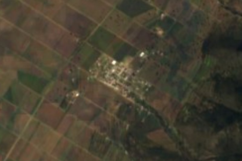
Plan your visit to San Felipe Sultepec
Where to stay near San Felipe Sultepec
Compare hotels, posadas and guest houses in San Felipe Sultepec.
Tours to San Felipe Sultepec
Day trips and guided outings from Otumba often include San Felipe Sultepec; with a local guide you can get there without a car.
 Tours from Zacatlan
Zacatlán Guided Tour walking through the Center
★ 5.0 (2) · From US$8
How to get to San Felipe Sultepec
- From San Martín Texmelucan: about 40 min by road (~49 km)
- Nearest airport: Mexico City (Felipe Ángeles) (NLU), 43 min by car to Otumba
Links open a partner site. We may earn a commission if you book, at no cost to you.
Tours from Zacatlan, near San Felipe Sultepec
Tours, prices and ratings from Viator, checked weekly. We may earn a commission if you book.
About San Felipe Sultepec
San Felipe Sultepec lies at about 2,600 metres in the municipality of Calpulalpan, beside federal highway 136 between Texcoco and Calpulalpan. The 2020 census counted 1,251 residents. Its name pairs the patron, Philip the Apostle, with Nahuatl Sultepec, read as 'at the hill of the quails'.
The church of San Felipe is catalogued as a federal historic building from the 16th century, of the Franciscan order: a single-nave chapel with adobe and stone walls, now roofed in concrete slab and beams. The plain Renaissance portal has a round arch on pilasters with plateresque carving, and above the choir window a relief of San Felipe sits in a niche under a triangular pediment.
The village has two big dates. In February a carnival honours the Señor de la Bondad and has run for over a century: in 2015 the groups set out from the church with the camada Los Negros de San Felipe, dances, satire and rhymed 'herencias' verses, and closed with the 'ahorcados'. The patron's fair for San Felipe Apóstol, which a local report also calls a century-old tradition, brings a convite of bread and salt, first communions, a jaripeo, horse races and a dance.
On lands of the San Marcos Guaquilpan ejido, within the locality, lies the Tecoaque (Zultépec) archaeological zone with its site museum, just off the highway at kilometre 33.
How to get to San Felipe Sultepec
Drive from San Martín Texmelucan: 40 min, 49 km
San Felipe Sultepec is on federal highway 136 (Texcoco–Calpulalpan, the free Mexico–Veracruz road); the access to Tecoaque leaves at kilometre 33 and the turn-off to the San Marcos Guaquilpan ejido at kilometre 35. From Mexico City it is about 65 km. By bus, the second-class lines Autobuses Verdes and Autobuses Texcoco run Texcoco–Calpulalpan and connect with TAPO; from Tlaxcala city, Autotransportes de Hidalgo runs direct to Calpulalpan in an hour (about 100 pesos, paid on board), then continue by taxi. The Tlaxcala bus station is on Tepehitec boulevard. Tlaxcala is about 71 km away and Puebla about 92 km (approx.); Otumba, the nearest pueblo, is about 19 km (about 20 min).
Directions to San Felipe Sultepec on Google Maps
Distances are in a straight line; the road is usually longer.
Links open a partner site. We may earn a commission if you book, at no cost to you.
From the nearest cities to San Felipe Sultepec
- San Martín Texmelucan · 49 km by road, 40 min
- Chiautempan · 68 km by road, 55 min
- Mexico City · 62 km by road, 1 h
Drive times by road from OpenStreetMap, without traffic or stops. Times marked ~ are estimated from the straight-line distance.
Before you go to San Felipe Sultepec: hours, prices and tips
- Entry
- Tecoaque has free admission (professional cameras cost extra). INAH Lugares · checked Oct 2026
- Best season
- Carnival of the Señor de la Bondad in February (in 2015 it began on 2 February); fair of San Felipe Apóstol in early May. Gentetlx · checked Oct 2026
Hours and prices change, especially around holidays. Each fact links to where we checked it.
Visiting San Felipe Sultepec: what to see and do
The church of San Felipe, a 16th-century Franciscan chapel with a plateresque portal
The Tecoaque (Zultépec) archaeological zone and museum at kilometre 33 of highway 136
The carnival of the Señor de la Bondad, in February
The fair of San Felipe Apóstol, with jaripeo, horse races and a dance
Calpulalpan's fair for San Antonio de Padua (13 June), in the municipal seat
Plan your trip
Places to stay in San Felipe Sultepec
Compare hotels, posadas, and rentals in and around San Felipe Sultepec.
Tours & activities
Day trips and guided outings from Otumba often include San Felipe Sultepec; with a local guide you can get there without a car.
Rental cars
Pick up a car at NLU (Mexico City (Felipe Ángeles)): about 43 min by road to Otumba, then 19 km more to San Felipe Sultepec, on your own schedule.
Flights
The nearest airport with scheduled flights is Mexico City (Felipe Ángeles) (NLU), about 43 min by road from Otumba, the base for San Felipe Sultepec.
Mobile data
Signal can drop away from Otumba: download a map of the way to San Felipe Sultepec before you set out, or carry an eSIM with data.
Links open a partner site. We may earn a commission if you book, at no cost to you.
When to go to San Felipe Sultepec cool
San Felipe Sultepec shares the climate of Otumba, 19 km away. The best months to visit are January, February, November, and December.
See the month-by-month climate of Otumba
Weather in San Felipe Sultepec now and the next 7 days
Live forecast from Open-Meteo. Chance of rain is the day's highest.
The closest Pueblo Mágico: Otumba

Otumba is the Pueblo Mágico closest to San Felipe Sultepec, with places to stay, food, and more to see.
Also close to
- Teotihuacán · Estado de México · 26 km away
- Zempoala · Hidalgo · 37 km away
- Tlaxco · Tlaxcala · 52 km away
- Huejotzingo · Puebla · 53 km away
- Real del Monte · Hidalgo · 61 km away
Closest to San Felipe Sultepec
-
Zona Arqueológica de Tecoaque · Archaeological site · 1 km away
-
Calpulalpan · Town · 5 km away
-
Chimalpa Tlalayote · Village · 13 km away
-
Nanacamilpa · Town · 15 km away
-
San Felipe Hidalgo · Village · 15 km away
-
Los Voladores · Village · 16 km away
-
Domingo Arenas · Village · 17 km away
-
Laguna de San Antonio de Atocha · Lagoon · 18 km away

Near San Felipe Sultepec


Drive times by road from OpenStreetMap, without traffic. Times marked ~ are estimated from the straight-line distance.
Location from OpenStreetMap. Written by Puebloteca.