Town Benito Juárez, Tlaxcala
Railway and pulque country in northern Tlaxcala, minutes from Apan, with a hacienda, a station and paper balloons.
From San Martín Texmelucan: 40 min by car (48 km by road) How to get there ↓
Near here
See everything nearby ↓


Plan your visit to Benito Juárez
Where to stay near Benito Juárez
Compare hotels, posadas and guest houses in Benito Juárez.
Tours to Benito Juárez
Day trips around Tlaxco sometimes stop in Benito Juárez; a tour is the easy way to see it without a car.
 Private Transportation from Benito Juarez Airport CDMX to Puebla
★ 5.0 (1) · From US$175
How to get to Benito Juárez
- From San Martín Texmelucan: about 40 min by road (~48 km)
- Nearest airport: Puebla (PBC), 1 h 6 min by car to Tlaxco
Links open a partner site. We may earn a commission if you book, at no cost to you.
Popular tours to Benito Juárez


Tours, prices and ratings from Viator, checked weekly. We may earn a commission if you book.
About Benito Juárez
Benito Juárez is the seat of the municipality of the same name, at the far north of Tlaxcala, at about 2,535 metres and very close to Apan, Hidalgo. At the 2020 census the locality had 6,185 inhabitants, according to Wikipedia and INEGI data. The municipality is one of the state's youngest: a decree of the state Congress on 9 October 1995 split it from Sanctórum de Lázaro Cárdenas. Besides the seat it has only Álvaro Obregón, with 864 people, and a two-person ranch.
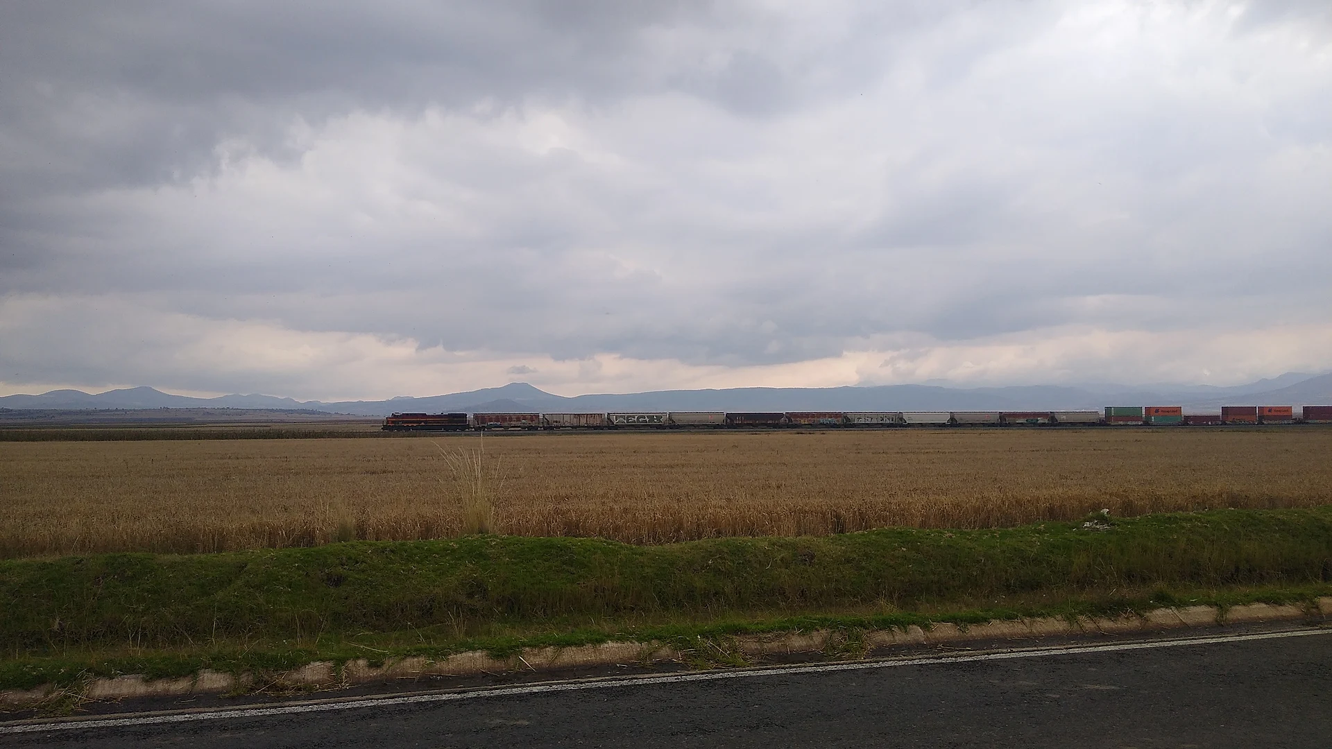
Its history is tied to the haciendas of the high plateau. San Nicolás El Grande, a kilometre from town, keeps its granary, pulque-making hall, chapel and the owner's house, and it was devoted to farming, livestock and pulque. In October 1914 there was fighting at that hacienda and at Zoquiapan during the Revolution. At the entrance to the municipality stands Iturbide station, a 19th-century red-stone building, and the railway line crosses the territory.
The economy was agricultural, with barley for breweries, and the municipality is known for fireworks, balloons and tissue-paper kites. Carnival starts a week before Ash Wednesday and closes with a dance in the square. San Benito is celebrated on 21 March, though his day is 17 January, and on 31 May the Sacred Heart is honoured with fireworks, morning serenades, barbacoa and black mole. The table also offers mixiote, maguey worms and capulin and tejocote preserves.
How to get to Benito Juárez
Drive from San Martín Texmelucan: 40 min, 48 km
Benito Juárez is at the far north of Tlaxcala, about 1.5 km from Apan, Hidalgo, and about 32 km from Tlaxco (approx.). From Tlaxcala city it is roughly 50 minutes to a little over an hour by car, depending on the route. There is no direct bus from the capital: Autotransportes de Hidalgo runs two daily buses from Tlaxcala to Calpulalpan (about an hour), and from there a taxi to Benito Juárez takes about 33 minutes. Another option is to reach Apan: buses leave Apizaco about every 30 minutes (around an hour), and from Mexico City the Calpulalpan terminal has Texcoco-line buses to TAPO. Schedules change, so confirm them first. Ask for Iturbide station, which is at the entrance.
Directions to Benito Juárez on Google Maps
Distances are in a straight line; the road is usually longer.
Links open a partner site. We may earn a commission if you book, at no cost to you.
From the nearest cities to Benito Juárez
- San Martín Texmelucan · 48 km by road, 40 min
- Chiautempan · 54 km by road, 50 min
- Huamantla · 76 km by road, 1 h 5 min
Drive times by road from OpenStreetMap, without traffic or stops. Times marked ~ are estimated from the straight-line distance.
Before you go to Benito Juárez: hours, prices and tips
- Best season
- Carnival from a week before Ash Wednesday; San Benito on 21 March; Sacred Heart festival on 31 May. Guía Turística México · checked Oct 2026
Hours and prices change, especially around holidays. Each fact links to where we checked it.
Visiting Benito Juárez: what to see and do
Visit the San Nicolás El Grande hacienda, with its granary, pulque hall and chapel.
See Iturbide station, in red stone, at the entrance to the municipality.
Watch where the railway line crosses the territory.
Look for the tissue-paper balloons and kites and the fireworks made here.
Come at carnival or on 31 May and try the barbacoa and black mole.
Plan your trip
Places to stay in Benito Juárez
Compare hotels, posadas, and rentals in and around Benito Juárez.
Tours & activities
Day trips around Tlaxco sometimes stop in Benito Juárez; a tour is the easy way to see it without a car.
Rental cars
Pick up a car at PBC (Puebla): about 1 h 6 min by road to Tlaxco, then 32 km more to Benito Juárez, on your own schedule.
Flights
The nearest airport with scheduled flights is Puebla (PBC), about 1 h 6 min by road from Tlaxco, the base for Benito Juárez.
Mobile data
Signal can drop away from Tlaxco: download a map of the way to Benito Juárez before you set out, or carry an eSIM with data.
Links open a partner site. We may earn a commission if you book, at no cost to you.
When to go to Benito Juárez cool
Benito Juárez shares the climate of Tlaxco, 32 km away. The best months to visit are January, February, November, and December.
See the month-by-month climate of Tlaxco
Weather in Benito Juárez now and the next 7 days
Live forecast from Open-Meteo. Chance of rain is the day's highest.
The closest Pueblo Mágico: Tlaxco

Tlaxco is the Pueblo Mágico closest to Benito Juárez, with places to stay, food, and more to see.
Also close to
- Otumba · Estado de México · 37 km away
- Teotihuacán · Estado de México · 45 km away
- Zempoala · Hidalgo · 45 km away
- Huejotzingo · Puebla · 47 km away
- Chignahuapan · Puebla · 50 km away
Closest to Benito Juárez
-
Ignacio Zaragoza · Village · 5 km away
-
Laguna de San Antonio de Atocha · Lagoon · 5 km away
-
Domingo Arenas · Village · 9 km away
-
Sanctórum · Town · 11 km away
-
La Magdalena Soltepec · Village · 12 km away
-
Ocotepec · Village · 12 km away
-
San Diego Recoba · Village · 12 km away
-
San Lorenzo Soltepec · Village · 12 km away


Near Benito Juárez


Drive times by road from OpenStreetMap, without traffic. Times marked ~ are estimated from the straight-line distance.
Location from OpenStreetMap. Written by Puebloteca.