

Village Tlaxco, Tlaxcala Municipality of Tlaxco Northern Tlaxcala
Hamlet of 182 people and home to the ex pulque hacienda of Concepción Mazaquiáhuac (1549), now a motorised cavalry base.
From Chiautempan: 50 min by car (48 km by road) How to get there ↓
Near here
See everything nearby ↓


Plan your visit to Mazaquiáhuac
Where to stay near Mazaquiáhuac
Compare hotels, posadas and guest houses in Mazaquiáhuac.
Tours to Mazaquiáhuac
Day trips and guided outings from Tlaxco often include Mazaquiáhuac; with a local guide you can get there without a car.
 Tours from Zacatlan
Zacatlán Guided Tour walking through the Center
★ 5.0 (2) · From US$8
How to get to Mazaquiáhuac
- From Chiautempan: about 50 min by road (~48 km)
- Nearest airport: Puebla (PBC), 1 h 6 min by car to Tlaxco
Links open a partner site. We may earn a commission if you book, at no cost to you.
Tours from Zacatlan, near Mazaquiáhuac
Tours, prices and ratings from Viator, checked weekly. We may earn a commission if you book.
About Mazaquiáhuac
Mazaquiáhuac is a locality of 182 people (2020 census) at 2,556 metres, about 19 km in a straight line west of Tlaxco. Its reason for being is the hacienda of Concepción Mazaquiáhuac, which goes back to 1549, when Viceroy Antonio de Mendoza granted a Spaniard, Pierrez Gómez, a land grant for smaller livestock in the province of Tlaxcala. Over the centuries the estate changed hands; by about 1800 it belonged to Felipe Santiago Sanz, and his family kept it until agrarian reform. The chapel, dedicated to the Virgin of the Conception, stood inside the main house itself.
Joined to the neighbouring hacienda of El Rosario it formed a single complex of 9,389 hectares, the fifth largest in the state of Tlaxcala, and specialised in pulque once the railway arrived to carry it to Mexico City. In 1911 the complex sold 3,337,025 litres to the Compañía Expendedora de Pulques. From 1939 agrarian reform split its lands into eight ejidos, among them Lagunillas, Maguey Cenizo and Matamoros, and only the main house remained, which its owner left unused. The state government later bought it and donated it to the federal government; after repairs that restored its original look it is occupied by the 5th Motorised Cavalry Regiment and the Military Shooting School of the Sedena.
The population fell from 303 in 2010 to 182 in 2020. Around it are ranches of one or two residents and, 1.5 km away, the community of Mariano Matamoros, with 924 residents.
How to get to Mazaquiáhuac
Drive from Chiautempan: 50 min, 48 km
Mazaquiáhuac is about 19 km in a straight line west of Tlaxco, the municipal seat and Pueblo Mágico; a travel article puts it at about 20 km from Tlaxco. A direct bus from TAPO (Mexico City) reaches Tlaxco with Autotransportes Tlaxcala, Apizaco, Huamantla (ATAH), about 2 h 30 min according to Rome2rio, and from Apizaco the Autobuses Teotihuacan service leaves every hour and takes about 25 minutes. From Tlaxco to the ex-hacienda you follow roads in the western part of the municipality; there are no published schedules for public transport straight there, so most people drive or take a taxi. Because the ex-hacienda is now a Secretaría de la Defensa Nacional installation, visits go through the Sedena: it has opened Sunday family days, and you can write to [email protected] before going.
Directions to Mazaquiáhuac on Google Maps
Distances are in a straight line; the road is usually longer.
Links open a partner site. We may earn a commission if you book, at no cost to you.
From the nearest cities to Mazaquiáhuac
- Chiautempan · 48 km by road, 50 min
- Huamantla · 68 km by road, 1 h
- San Martín Texmelucan · 57 km by road, 1 h 5 min
Drive times by road from OpenStreetMap, without traffic or stops. Times marked ~ are estimated from the straight-line distance.
Before you go to Mazaquiáhuac: hours, prices and tips
- Hours
- No opening hours are published. The Sedena has opened the ex-hacienda for Sunday family outings under a national programme; to confirm dates, write to [email protected]. SNDigital / Sedena · checked Oct 2026
- Time needed
- The guided tour lasts about 2 hours. El Souvenir · checked Oct 2026
- Guide or tour
- Soldiers of the regiment narrate the tour, which covers the historic areas and the military facilities. El Souvenir · checked Oct 2026
Hours and prices change, especially around holidays. Each fact links to where we checked it.
Visiting Mazaquiáhuac: what to see and do
The ex-hacienda of Concepción Mazaquiáhuac, founded in 1549, seen from the fields around it.
The restored main house: offices, stables and historic meeting rooms, beside the regiment's facilities.
The guided tour of about 2 hours narrated by the soldiers themselves, when visit days are held.
The soldiers' legend of a hacendado's daughter and her swing under a tree.
Mariano Matamoros and Maguey Cenizo, ejidos born from the hacienda's breakup, 1.5 and 2.5 km away.
Plan your trip
Places to stay in Mazaquiáhuac
Compare hotels, posadas, and rentals in and around Mazaquiáhuac.
Tours & activities
Day trips and guided outings from Tlaxco often include Mazaquiáhuac; with a local guide you can get there without a car.
Rental cars
Pick up a car at PBC (Puebla): about 1 h 6 min by road to Tlaxco, then 19 km more to Mazaquiáhuac, on your own schedule.
Flights
The nearest airport with scheduled flights is Puebla (PBC), about 1 h 6 min by road from Tlaxco, the base for Mazaquiáhuac.
Mobile data
Signal can drop away from Tlaxco: download a map of the way to Mazaquiáhuac before you set out, or carry an eSIM with data.
Links open a partner site. We may earn a commission if you book, at no cost to you.
When to go to Mazaquiáhuac cool
Mazaquiáhuac shares the climate of Tlaxco, 19 km away. The best months to visit are January, February, November, and December.
See the month-by-month climate of Tlaxco
Weather in Mazaquiáhuac now and the next 7 days
Live forecast from Open-Meteo. Chance of rain is the day's highest.
The closest Pueblo Mágico: Tlaxco

Tlaxco is the Pueblo Mágico closest to Mazaquiáhuac, with places to stay, food, and more to see.
Also close to
- Chignahuapan · Puebla · 34 km away
- Zacatlán · Puebla · 47 km away
- Otumba · Estado de México · 49 km away
- Zempoala · Hidalgo · 49 km away
- Tetela de Ocampo · Puebla · 54 km away
Closest to Mazaquiáhuac
-
Lagunilla · Village · 2 km away
-
Maguey Cenizo · Village · 2 km away
-
Mariano Matamoros · Village · 2 km away
-
San Lorenzo Soltepec · Village · 5 km away
-
Tierra y Libertad · Town · 5 km away
-
San José Tepeyahualco · Village · 6 km away
-
El Rosario · Town · 7 km away
-
Presa El Muerto · Lake · 7 km away


Near Mazaquiáhuac


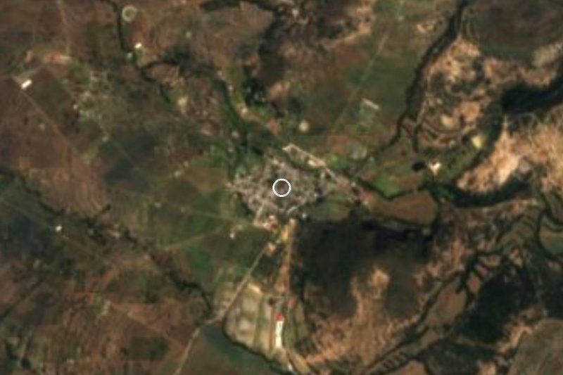


Drive times by road from OpenStreetMap, without traffic. Times marked ~ are estimated from the straight-line distance.
Location from OpenStreetMap. Written by Puebloteca.