
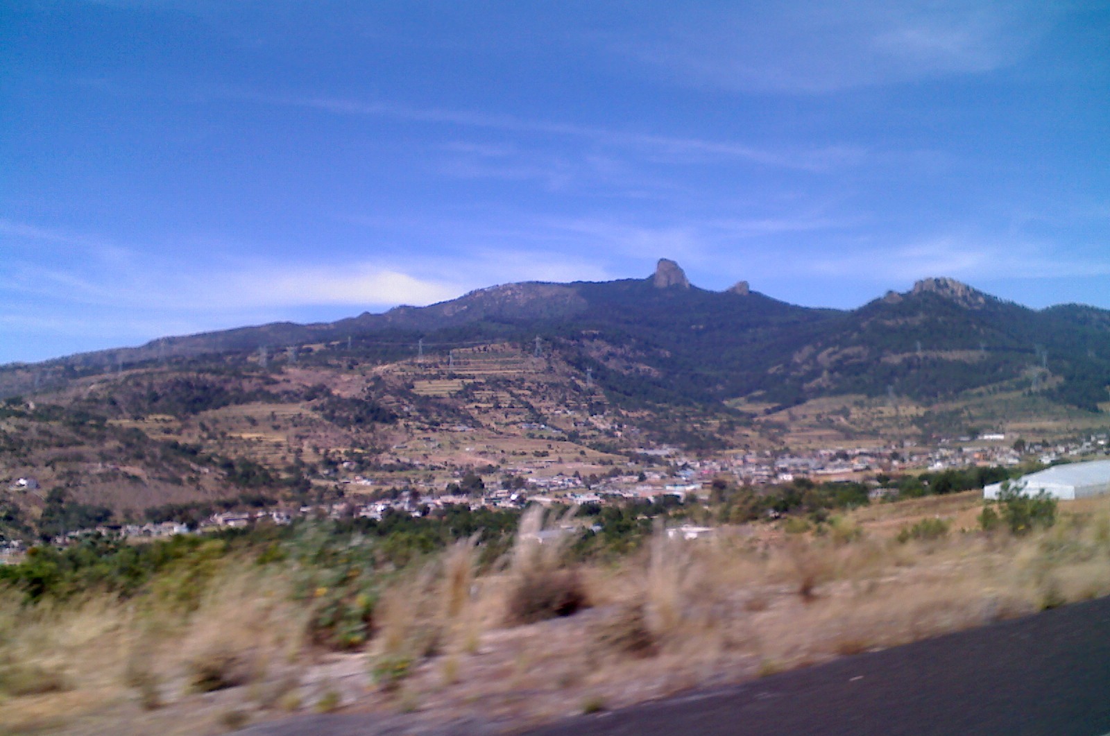
Village Tlaxco, Tlaxcala Municipality of Tlaxco Northern Tlaxcala
Village in Tlaxco about 7 km from the town, at the foot of the Peñón del Rosario, a 3,400 m-plus rock summit for hiking and climbing.
From Chiautempan: 45 min by car (46 km by road) How to get there ↓
Near here
See everything nearby ↓



Plan your visit to Acopinalco del Peñón
Where to stay near Acopinalco del Peñón
Compare hotels, posadas and guest houses in Acopinalco del Peñón.
Tours to Acopinalco del Peñón
Day trips and guided outings from Tlaxco often include Acopinalco del Peñón; with a local guide you can get there without a car.
 Tours from Puebla City
Africam Safari Zoo Admission with Transportation
★ 4.8 (87) · From US$35
How to get to Acopinalco del Peñón
- From Chiautempan: about 45 min by road (~46 km)
- Nearest airport: Puebla (PBC), 1 h 6 min by car to Tlaxco
Links open a partner site. We may earn a commission if you book, at no cost to you.
Tours from Puebla City, near Acopinalco del Peñón


Tours, prices and ratings from Viator, checked weekly. We may earn a commission if you book.
About Acopinalco del Peñón
Acopinalco del Peñón is a village in the municipality of Tlaxco, in northern Tlaxcala, at about 2,642 metres above sea level. At the 2020 census it had 2,502 residents, up from 2,382 in 2010, and its founding is dated to 19 May 1920. The name is Nahuatl and is read as "on the other side of the water", from atl (water), copona (to draw out), nalli (the other side) and the locative suffix co.
What gives it the second half of its name is the rock: the Peñón del Rosario, also called cerro El Rosario, a massif of volcanic tuff crowned by a rock outcrop that can be seen from the village and from the road. It is the second-highest point of the Sierra de Tlaxco after the Huilacapitzo (about 3,500 m) and reaches roughly 3,440 metres by most accounts (another figure is 3,404). Its north, south and east faces are almost vertical, and the north slope is covered in dense pine, juniper and oyamel forest.
On the west side the approach is gentler: a logging track leaves from Acopinalco and El Rosario, and a staircase eases the last stretch to the top. The climate is temperate and subhumid, with an average of about 14 °C a year and 600 to 700 mm of rain, almost all of it from June to October. The summit sits right on the state line and INEGI places it on the Puebla side (Chignahuapan), so the village and the southern slope are in Tlaxcala.
How to get to Acopinalco del Peñón
Drive from Chiautempan: 45 min, 46 km
Acopinalco del Peñón is about 7 km from Tlaxco (approx.), on a local road. Tlaxco is reached from Apizaco on the Apizaco-Tlaxco-Chignahuapan road (federal 119D), about 25 km; from Tlaxcala city it is about 44 km, from Puebla about 74 and from Mexico City about 160. According to Rome2Rio, Autobuses Teotihuacan runs an hourly bus from Tlaxco to Apizaco in about 25 minutes. There are no published schedules for transport from Tlaxco to Acopinalco; the village is the gateway to the forestry track that climbs the Peñón del Rosario from the west.
Directions to Acopinalco del Peñón on Google Maps
Distances are in a straight line; the road is usually longer.
Links open a partner site. We may earn a commission if you book, at no cost to you.
From the nearest cities to Acopinalco del Peñón
- Chiautempan · 46 km by road, 45 min
- Huamantla · 59 km by road, 55 min
- San Martín Texmelucan · 70 km by road, 1 h
Drive times by road from OpenStreetMap, without traffic or stops. Times marked ~ are estimated from the straight-line distance.
Visiting Acopinalco del Peñón: what to see and do
The Peñón del Rosario (cerro El Rosario), the 3,400 m-plus rock that dominates the village.
The logging track and staircase that climb to the summit from the west.
The near-vertical rock faces, used for rock climbing.
The pine, juniper and oyamel forest of the north slope.
Tlaxco, a Pueblo Mágico about 7 km away, with its centre of old houses and its churches.
Plan your trip
Places to stay in Acopinalco del Peñón
Compare hotels, posadas, and rentals in and around Acopinalco del Peñón.
Tours & activities
Day trips and guided outings from Tlaxco often include Acopinalco del Peñón; with a local guide you can get there without a car.
Rental cars
Pick up a car at PBC (Puebla): about 1 h 6 min by road to Tlaxco, then 7 km more to Acopinalco del Peñón, on your own schedule.
Flights
The nearest airport with scheduled flights is Puebla (PBC), about 1 h 6 min by road from Tlaxco, the base for Acopinalco del Peñón.
Mobile data
Signal can drop away from Tlaxco: download a map of the way to Acopinalco del Peñón before you set out, or carry an eSIM with data.
Links open a partner site. We may earn a commission if you book, at no cost to you.
When to go to Acopinalco del Peñón cool
Acopinalco del Peñón shares the climate of Tlaxco, 7 km away. The best months to visit are January, February, November, and December.
See the month-by-month climate of Tlaxco
Weather in Acopinalco del Peñón now and the next 7 days
Live forecast from Open-Meteo. Chance of rain is the day's highest.
The closest Pueblo Mágico: Tlaxco

Tlaxco is the Pueblo Mágico closest to Acopinalco del Peñón, with places to stay, food, and more to see.
Also close to
- Chignahuapan · Puebla · 24 km away
- Zacatlán · Puebla · 37 km away
- Tetela de Ocampo · Puebla · 41 km away
- Huamantla · Tlaxcala · 46 km away
- Ixtenco · Tlaxcala · 51 km away
Closest to Acopinalco del Peñón
-
Hacienda Xochuca · Landmark · 5 km away
-
Peñón del Rosario · Mountain · 5 km away
-
El Rosario · Town · 7 km away
-
Rinconada · Village · 7 km away
-
Hacienda Santa María Xalostoc · Landmark · 10 km away
-
Laguna de Atlangatepec · Lake · 11 km away
-
Lagunilla · Village · 12 km away
-
Mariano Matamoros · Village · 12 km away


Near Acopinalco del Peñón




Drive times by road from OpenStreetMap, without traffic. Times marked ~ are estimated from the straight-line distance.
Location from OpenStreetMap. Written by Puebloteca.