Village Tlaxco, Tlaxcala Municipality of Tlaxco Northern Tlaxcala
Northern Tlaxcala village at the foot of Cerro de Villalta, with an 18th-19th century pulque hacienda and a San José fiesta on 19 March.
From Chiautempan: 40 min by car (41 km by road) How to get there ↓
Near here
See everything nearby ↓


Plan your visit to San José Tepeyahualco
Where to stay near San José Tepeyahualco
Compare hotels, posadas and guest houses in San José Tepeyahualco.
Tours to San José Tepeyahualco
Day trips and guided outings from Tlaxco often include San José Tepeyahualco; with a local guide you can get there without a car.
 Tours from Puebla City
Africam Safari Zoo Admission with Transportation
★ 4.8 (87) · From US$35
How to get to San José Tepeyahualco
- From Chiautempan: about 40 min by road (~41 km)
- Nearest airport: Puebla (PBC), 1 h 6 min by car to Tlaxco
Links open a partner site. We may earn a commission if you book, at no cost to you.
Tours from Puebla City, near San José Tepeyahualco


Tours, prices and ratings from Viator, checked weekly. We may earn a commission if you book.
About San José Tepeyahualco
San José Tepeyahualco is a locality in the municipality of Tlaxco, in northern Tlaxcala, at about 2,560 m at the foot of Cerro de Villalta. The 2020 census counted 1,218 people. Its neighbours are Santiago Villalta to the north, San Lorenzo Soltepec to the south, Lagunilla to the west and José María Morelos Buenavista to the east. The Nahuatl name is glossed as "place surrounded by hills"; locally it is shortened to "Tepe", and residents are called tepeyahualqueños.
What sets it apart is the ex-Hacienda San José Tepeyahualco, built between the 18th and 19th centuries and now privately owned. The Enciclopedia de los Municipios and the Wikipedia entry list its spaces: granary, tinacal for pulque, machero, stable, corrals, chapel, calpanerías and the owner's house. It lived off pulque, farming and livestock, like other haciendas in Tlaxco, which in 1932 was the state's second-largest pulque producer. Farming and cattle are still the main activities.
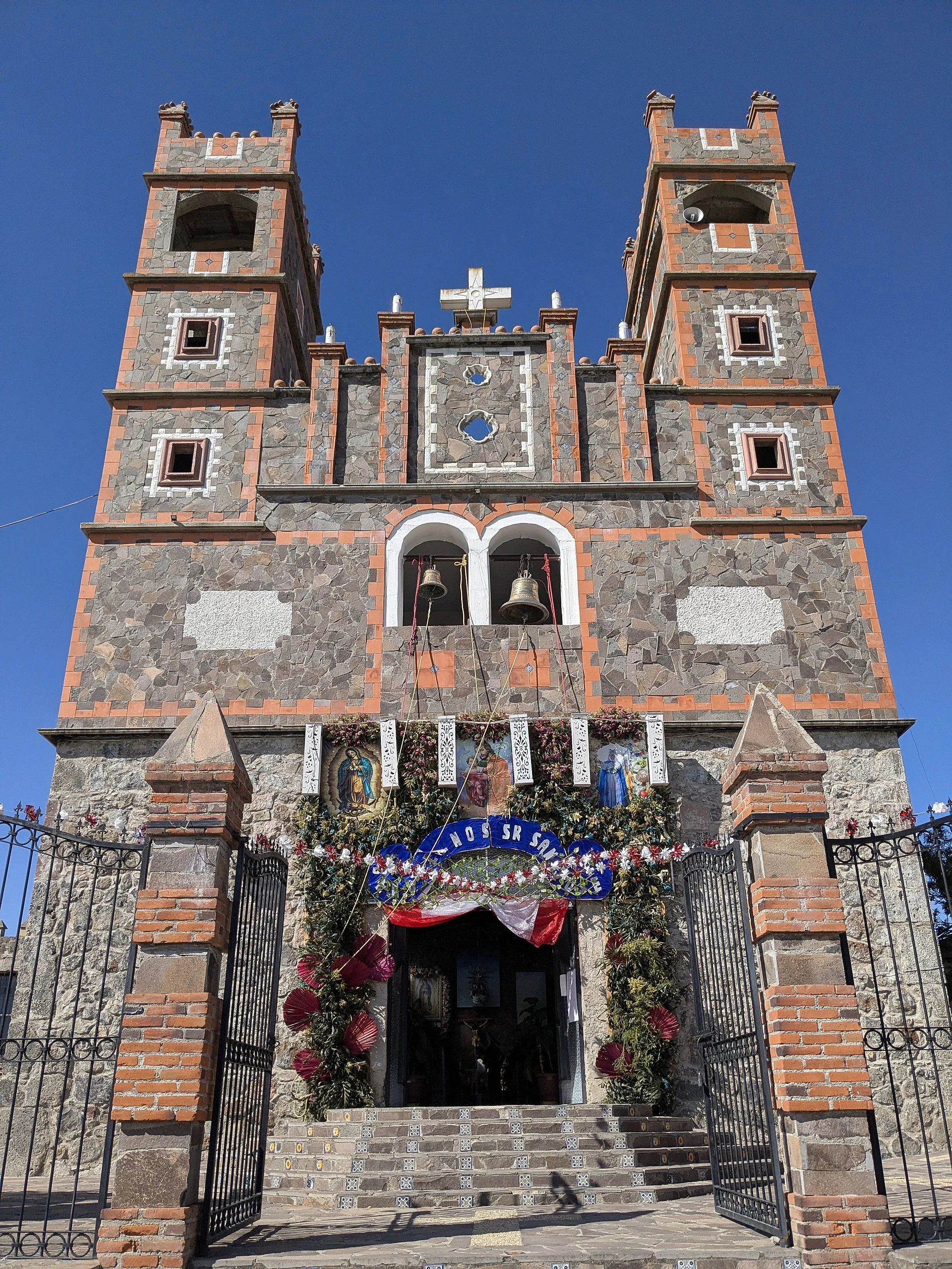
The patron fiesta, for San José, is on 19 March. There is no museum or tourist service: you come for the hill landscape, the hacienda's facade from the road and the life of a highland Tlaxcala ranch village. This is the Tepeyahualco in Tlaxco, not the one of the same name in Puebla.
How to get to San José Tepeyahualco
Drive from Chiautempan: 40 min, 41 km
San José Tepeyahualco is about 16 km west of Tlaxco (a Pueblo Mágico), roughly 20 minutes by car, in the high country of northern Tlaxcala. You reach Tlaxco from Tlaxcala city, 41 km away, by highway 117 Tlaxcala-Apizaco and 119 Apizaco-Tlaxco, per the Enciclopedia de los Municipios; from Mexico City, ATAH buses run from TAPO to Tlaxco. From Tlaxco to the village you take local roads toward Lagunilla and Villalta:. Bring cash and fuel and do not expect services in the village. The nearest big city, Tulancingo (Hidalgo), is about 55 km away.
Directions to San José Tepeyahualco on Google Maps
Distances are in a straight line; the road is usually longer.
Links open a partner site. We may earn a commission if you book, at no cost to you.
From the nearest cities to San José Tepeyahualco
- Chiautempan · 41 km by road, 40 min
- San Martín Texmelucan · 50 km by road, 55 min
- Huamantla · 63 km by road, 55 min
Drive times by road from OpenStreetMap, without traffic or stops. Times marked ~ are estimated from the straight-line distance.
Before you go to San José Tepeyahualco: hours, prices and tips
- Best season
- Patron fiesta of San José on 19 March. Wikipedia (es) · checked Oct 2026
- Rules
- The ex-hacienda is private property; view it from outside. Wikipedia (es) · checked Oct 2026
Hours and prices change, especially around holidays. Each fact links to where we checked it.
Visiting San José Tepeyahualco: what to see and do
Ex-Hacienda San José Tepeyahualco (private), with granary, pulque tinacal and chapel, seen from the road
The hacienda chapel, seen from outside
Cerro de Villalta and the hills around the village
The San José fiesta on 19 March
Nearby Tlaxco, a Pueblo Mágico, for food and shopping
Plan your trip
Places to stay in San José Tepeyahualco
Compare hotels, posadas, and rentals in and around San José Tepeyahualco.
Tours & activities
Day trips and guided outings from Tlaxco often include San José Tepeyahualco; with a local guide you can get there without a car.
Rental cars
Pick up a car at PBC (Puebla): about 1 h 6 min by road to Tlaxco, then 16 km more to San José Tepeyahualco, on your own schedule.
Flights
The nearest airport with scheduled flights is Puebla (PBC), about 1 h 6 min by road from Tlaxco, the base for San José Tepeyahualco.
Mobile data
Signal can drop away from Tlaxco: download a map of the way to San José Tepeyahualco before you set out, or carry an eSIM with data.
Links open a partner site. We may earn a commission if you book, at no cost to you.
When to go to San José Tepeyahualco cool
San José Tepeyahualco shares the climate of Tlaxco, 16 km away. The best months to visit are January, February, November, and December.
See the month-by-month climate of Tlaxco
Weather in San José Tepeyahualco now and the next 7 days
Live forecast from Open-Meteo. Chance of rain is the day's highest.
The closest Pueblo Mágico: Tlaxco

Tlaxco is the Pueblo Mágico closest to San José Tepeyahualco, with places to stay, food, and more to see.
Also close to
- Chignahuapan · Puebla · 36 km away
- Huamantla · Tlaxcala · 48 km away
- Zacatlán · Puebla · 49 km away
- Huejotzingo · Puebla · 51 km away
- Otumba · Estado de México · 52 km away
Closest to San José Tepeyahualco
-
José María Morelos Buenavista · Village · 3 km away
-
Presa El Muerto · Lake · 3 km away
-
Lagunilla · Village · 4 km away
-
La Magdalena Soltepec · Village · 5 km away
-
San Lorenzo Soltepec · Village · 5 km away
-
Mariano Matamoros · Village · 6 km away
-
Mazaquiáhuac · Village · 6 km away
-
El Rosario · Town · 8 km away


Near San José Tepeyahualco


Drive times by road from OpenStreetMap, without traffic. Times marked ~ are estimated from the straight-line distance.
Location from OpenStreetMap. Written by Puebloteca.