Town Tetla de la Solidaridad, Tlaxcala Municipality of Tetla de la Solidaridad Northern Tlaxcala
Locality in Tetla de la Solidaridad that grew from 3,215 to 6,779 people between 2000 and 2020; patron fiesta of St Bartholomew on 24 August.
From Chiautempan: 20 min by car (19 km by road) How to get there ↓
Near here


Plan your visit to San Bartolomé Matlalohcan
Where to stay near San Bartolomé Matlalohcan
Compare hotels, posadas and guest houses in San Bartolomé Matlalohcan.
Tours to San Bartolomé Matlalohcan
Day trips around Tlaxco sometimes stop in San Bartolomé Matlalohcan; a tour is the easy way to see it without a car.
 Tours from Puebla City
Africam Safari Zoo Admission with Transportation
★ 4.8 (87) · From US$35
How to get to San Bartolomé Matlalohcan
- From Chiautempan: about 20 min by road (~19 km)
- Nearest airport: Puebla (PBC), 1 h 6 min by car to Tlaxco
Links open a partner site. We may earn a commission if you book, at no cost to you.
Tours from Puebla City, near San Bartolomé Matlalohcan


Tours, prices and ratings from Viator, checked weekly. We may earn a commission if you book.
About San Bartolomé Matlalohcan
San Bartolomé Matlalohcan is a locality in Tetla de la Solidaridad, in northern Tlaxcala, at about 2,496 metres above sea level. At the 2020 census it had 6,779 inhabitants, making it one of the largest in the municipality: it had 2,193 in 1990, 3,215 in 2000 and 4,881 in 2010. Two decades ago the Enciclopedia de los Municipios described it as a village whose main activity was farming and livestock.
The name joins a saint to Nahuatl. San Bartolomé is the apostle Bartholomew, the village's patron; Matlalohcan comes from matlatl (net) and the locative -can, meaning "where nets are kept". Its fiesta is on 24 August, which the Tetla town hall lists in its calendar of community fairs (Santiago Apóstol, patron of the seat, is on 25 July). A parish directory describes the church as a 16th-century building with a sober façade and a bell tower, notes that its bells sound softer than those of many churches, and mentions a celebration of the Virgen de la Asunción and a wheelchair-accessible entrance. Those details come from visitor reviews, not an official register.
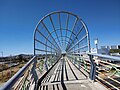
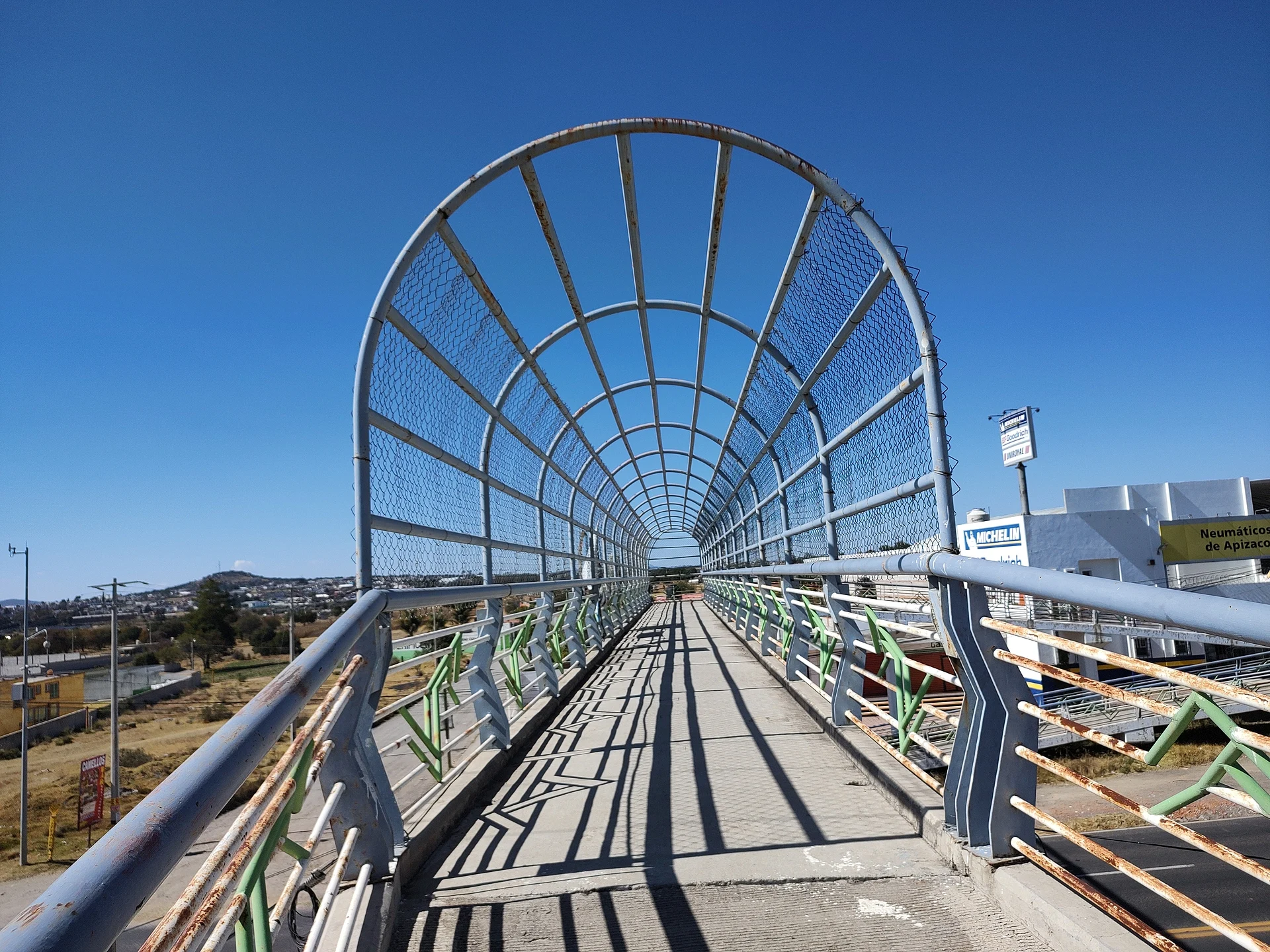
In the village, over the highway, a long metal-caged pedestrian bridge appears in several Wikimedia Commons photographs, with an Apizaco tyre shop sign in the background. The municipality it belongs to is known for stone carving (molcajetes, metates, troughs) and for camada carnivals, with dancers in frock coats, top hats and carved wooden masks.
How to get to San Bartolomé Matlalohcan
Drive from Chiautempan: 20 min, 19 km
San Bartolomé Matlalohcan is in northern Tlaxcala, in the municipality of Tetla de la Solidaridad. The seat, Tetla, is 21 km from Tlaxcala city and 22 km from Tlaxco by the federal highway, according to the Enciclopedia de los Municipios; Matlalohcan is a few kilometres from that seat. From the capital, head north toward Apizaco and Tlaxco, take the turn-off to Tetla and continue to the village. From Puebla it is about 46 km, around 55 minutes by car; the nearest Pueblo Mágico, Tlaxco, is about 19 km away, roughly 20 minutes. There are no published schedules for direct public transport; the usual way is to reach Tlaxcala's bus terminal or Apizaco and continue on local transport toward Tetla.
Directions to San Bartolomé Matlalohcan on Google Maps
Distances are in a straight line; the road is usually longer.
Links open a partner site. We may earn a commission if you book, at no cost to you.
From the nearest cities to San Bartolomé Matlalohcan
- Chiautempan · 19 km by road, 20 min
- Huamantla · 32 km by road, 25 min
- San Martín Texmelucan · 43 km by road, 35 min
Drive times by road from OpenStreetMap, without traffic or stops. Times marked ~ are estimated from the straight-line distance.
What to see in San Bartolomé Matlalohcan 1
Sights with their own page, closest to the centre first.
-
Basílica de Nuestra Señora de la Misericordia (Apizaco) · Landmark · 4 km from the centre
Grey-stone neo-Gothic basilica in central Apizaco, finished in 1961; its two 50 m towers make it the tallest church in Tlaxcala.
Map of San Bartolomé Matlalohcan
Neighbourhoods and villages of San Bartolomé Matlalohcan
Part of San Bartolomé Matlalohcan or just outside it, closest first.
-
Tetla de la Solidaridad · Town · 2 km from the centre
Santiago Tetla, north of Apizaco: a pink-stone church, a lava field with a dwarf forest, metate and molcajete carvers and the Piedras Negras bull ranch. -
Apizaco · Town · 3 km from the centre
Railway city in central Tlaxcala that grew from a Ferrocarril Mexicano work camp; its emblem is locomotive 212, La Maquinita. -
San Francisco Atexcatzinco · Town · 3 km from the centre
North Tlaxcala town at 2,509 m whose Nahuatl name means "in the little mirror of water"; it has its own carnival camada and a 17th-century chapel. -
San Luis Apizaquito · Town · 3 km from the centre
The original San Luis Apizaco, 2 km from Apizaco: the railway city took its name from here. Fiesta 25 August and El Ojito dam. -
San José Tetel · Town · 4 km from the centre
Second-largest locality in Yauhquemehcan (7,826 people in 2020), right beside Apizaco at 2,475 m, with its own carnival dance groups.
Day trips and tours from San Bartolomé Matlalohcan
The closest Pueblos Mágicos and places to visit, with the drive from San Bartolomé Matlalohcan and tours that leave from it.


Times marked ~ are estimated from the distance. Links open a partner site. We may earn a commission if you book, at no cost to you.
Before you go: getting to and around San Bartolomé Matlalohcan
- The nearest airport is Puebla (PBC).
- The best months to go are January, February, November, and December.
- 2 of the places on this page are more than 3 km from the centre: take a taxi, a ride-hailing app or a local bus.
- For day trips a rental car gives the most freedom; the tours above leave from San Bartolomé Matlalohcan.
Before you go to San Bartolomé Matlalohcan: hours, prices and tips
- Best season
- Patron fiesta of San Bartolomé on 24 August. Ayuntamiento de Tetla de la Solidaridad, Ferias · checked Oct 2026
Hours and prices change, especially around holidays. Each fact links to where we checked it.
Visiting San Bartolomé Matlalohcan: what to see and do
The church of San Bartolomé, reported to date from the 16th century, with its bell tower.
The Feria de San Bartolomé on 24 August.
The long caged pedestrian bridge over the highway, often photographed.
Tetla, the seat, with its church of Santiago and its camada carnival.
The municipality's stone-carving workshops (molcajetes, metates).
Plan your trip
Places to stay in San Bartolomé Matlalohcan
Compare hotels, posadas, and rentals in and around San Bartolomé Matlalohcan.
Tours & activities
Day trips around Tlaxco sometimes stop in San Bartolomé Matlalohcan; a tour is the easy way to see it without a car.
Rental cars
Pick up a car at PBC (Puebla): about 1 h 6 min by road to Tlaxco, then 19 km more to San Bartolomé Matlalohcan, on your own schedule.
Flights
The nearest airport with scheduled flights is Puebla (PBC), about 1 h 6 min by road from Tlaxco, the base for San Bartolomé Matlalohcan.
Mobile data
Signal can drop away from Tlaxco: download a map of the way to San Bartolomé Matlalohcan before you set out, or carry an eSIM with data.
Links open a partner site. We may earn a commission if you book, at no cost to you.
When to go to San Bartolomé Matlalohcan cool
San Bartolomé Matlalohcan shares the climate of Tlaxco, 19 km away. The best months to visit are January, February, November, and December.
See the month-by-month climate of Tlaxco
Weather in San Bartolomé Matlalohcan now and the next 7 days
Live forecast from Open-Meteo. Chance of rain is the day's highest.
The closest Pueblo Mágico: Tlaxco

Tlaxco is the Pueblo Mágico closest to San Bartolomé Matlalohcan, with places to stay, food, and more to see.
Also close to
- Huamantla · Tlaxcala · 26 km away
- Ixtenco · Tlaxcala · 30 km away
- Chignahuapan · Puebla · 44 km away
- Huejotzingo · Puebla · 44 km away
- Cholula · Puebla · 47 km away
Near San Bartolomé Matlalohcan




Drive times by road from OpenStreetMap, without traffic. Times marked ~ are estimated from the straight-line distance.
Location from OpenStreetMap. Written by Puebloteca.