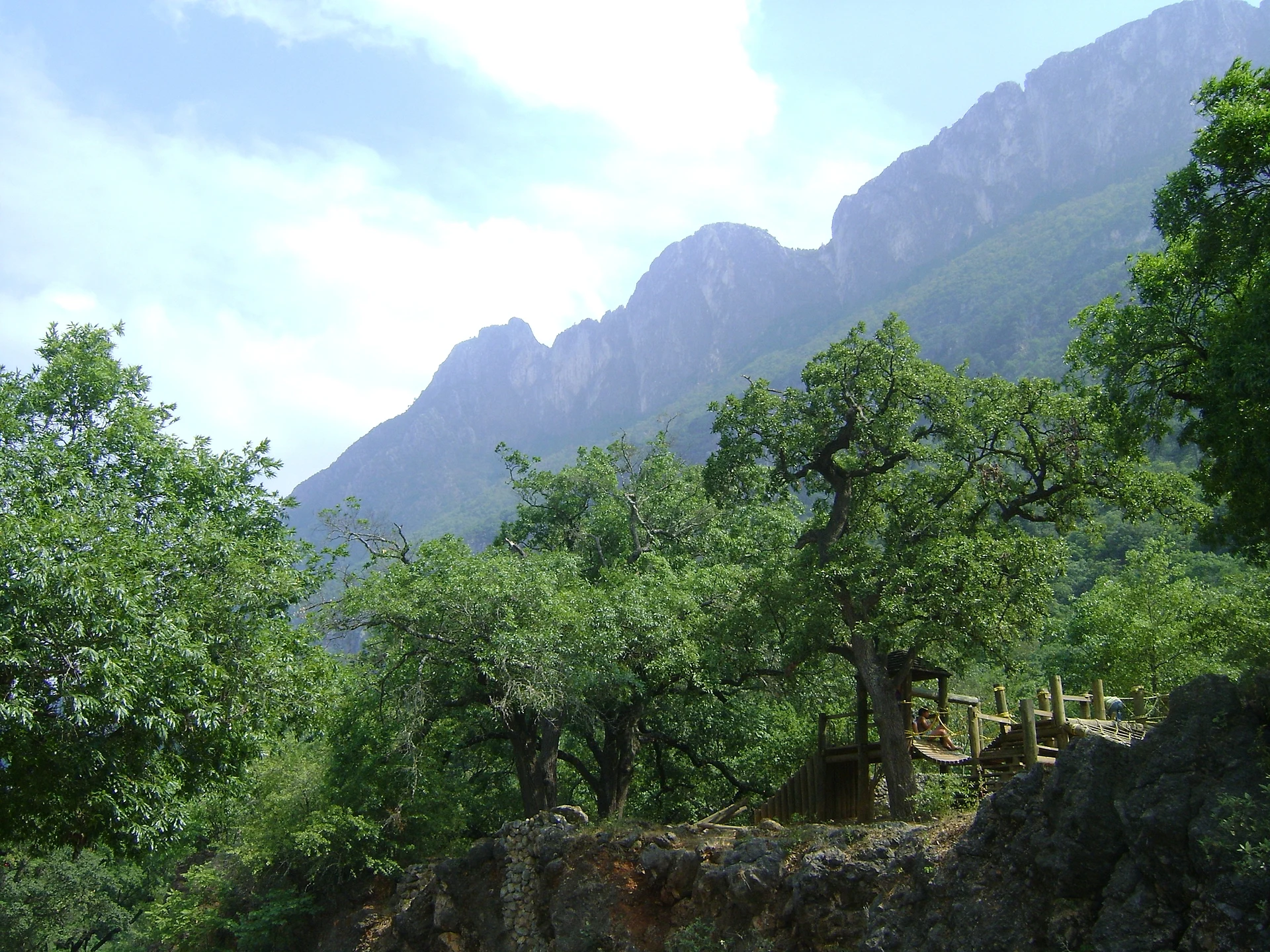


Nature reserve San Pedro Garza García, Nuevo León Monterrey and its mountains
A 1,791-hectare forest reserve on the mountain above San Pedro and Monterrey, with 37 trails, a 1930s general's house and guided climbs to La M.
From Monterrey: 15 min by car (12 km by road) How to get there ↓
Near here
See everything nearby ↓


Plan your visit to Parque Ecológico Chipinque
Where to stay near Parque Ecológico Chipinque
Compare hotels, posadas and guest houses in Parque Ecológico Chipinque.
Tours to Parque Ecológico Chipinque
Day trips and guided outings from Santiago often include Parque Ecológico Chipinque; with a local guide you can get there without a car.
 Tours from Monterrey
Matacanes : Canyoning + Hiking + Water Jumps + Rappel + Caves
★ 4.9 (1,783) · From US$157
How to get to Parque Ecológico Chipinque
- From Monterrey: about 15 min by road (~12 km)
- Nearest airport: Monterrey (MTY), 44 min by car to Santiago
Links open a partner site. We may earn a commission if you book, at no cost to you.
Tours from Monterrey, near Parque Ecológico Chipinque


Tours, prices and ratings from Viator, checked weekly. We may earn a commission if you book.
About Parque Ecológico Chipinque
Chipinque, officially the Reserva Natural or Parque Ecológico Chipinque, is a forest reserve of 1,791 hectares on the Cerro de Chipinque, the wall of the Sierra Madre Oriental that rises directly behind San Pedro Garza García and southern Monterrey. It lies within the Parque Nacional Cumbres de Monterrey, a national park decreed by President Lázaro Cárdenas in 1939, and it has been run as a reserve since 1992. A road climbs from the city's edge through the forest to the Meseta de Chipinque, where there is a hotel, and the reserve is where many regiomontanos go to walk, run and ride on weekends.
The reserve maps 37 trails, from short, easy paths to steep summit routes. The Ardilla trail (1.3 km) links the visitor center with the wide Brecha del Chile (2.3 km); the Abrazo del Oso loop (2.5 km) is shared by hikers and mountain bikers; and the forested Empalme (3.6 km) connects many of the others. The two classic climbs are the Copete de las Águilas, 3.2 km with about 980 meters of ascent, and the Vereda a la M, 3.7 km with about 850 meters of ascent to the summit known as La M; access to the summits is controlled and was suspended in October 2026 because of the risk of rain. Other stops include the abandoned Mina de San Francisco, reached by a popular moderate trail with wide views, and the house built in the 1930s as a mountain retreat for the revolutionary general and politician Juan Andreu Almazán; there is also an astronomical observatory.
The wider Cumbres de Monterrey national park, which Chipinque belongs to, was the largest in Mexico when created and still covers about 177,000 hectares after its boundaries were redrawn in 2000, and it also takes in the Cola de Caballo waterfall and the canyon of La Huasteca. Its forests shelter black bear, white-tailed deer, collared peccary and puma. Chipinque is the most accessible slice of it, and it is managed with rules to match: the reserve opens very early, at 5:30, which suits Monterrey's hot climate, entry tickets are sold online only and are required even at the gate, parking is paid separately and limited, and guided summit climbs have to be booked at least a day in advance. Plan your visit around these rules and buy your ticket before you drive up.
How to get to Parque Ecológico Chipinque
Drive from Monterrey: 15 min, 12 km
Chipinque is in San Pedro Garza García, on the southern edge of the Monterrey metropolitan area. From Avenida Gómez Morín, follow the Camino a Chipinque uphill to the gate and on through the forest to the parking areas. Taxis and ride-hail cars can only drop you at the entrance. Monterrey's airport in Apodaca is about 28 km north-east of downtown Monterrey.
Directions to Parque Ecológico Chipinque on Google Maps
Distances are in a straight line; the road is usually longer.
Links open a partner site. We may earn a commission if you book, at no cost to you.
From the nearest cities to Parque Ecológico Chipinque
- Monterrey · 12 km by road, 15 min
- Montemorelos · 86 km by road, 1 h 15 min
- Saltillo · 90 km by road, 1 h 15 min
Drive times by road from OpenStreetMap, without traffic or stops. Times marked ~ are estimated from the straight-line distance.
Before you go to Parque Ecológico Chipinque: hours, prices and tips
- Hours
- Daily 5:30–21:00; last car in at 19:00, last pedestrian at 20:00. Holidays may vary. Chipinque (official site) · checked Oct 2026
- Entry
- MX$88 per adult, MX$48 children 7–12, MX$58 INAPAM seniors; under-6s and people with disabilities free. Parking MX$50 extra. Tickets online only. adn40 (October 2026), Chipinque store · checked Oct 2026
- Rules
- Summit climbs (La M, Copete de las Águilas) have restricted access and must be booked ahead; in October 2026 they were suspended because of rain risk. Chipinque (official site); adn40 · checked Oct 2026
Hours and prices change, especially around holidays. Each fact links to where we checked it.
Visiting Parque Ecológico Chipinque: what to see and do
Walk the easy Ardilla trail from the visitor center to the Brecha del Chile.
Hike to the old Mina de San Francisco for views over the valley.
Visit the 1930s house of General Juan Andreu Almazán.
Climb the Copete de las Águilas or La M with prior booking, when summit access is open.
Ride the Abrazo del Oso loop on a mountain bike.
Plan your trip
Places to stay in Parque Ecológico Chipinque
Compare hotels, posadas, and rentals in and around Parque Ecológico Chipinque.
Tours & activities
Day trips and guided outings from Santiago often include Parque Ecológico Chipinque; with a local guide you can get there without a car.
Rental cars
Pick up a car at MTY (Monterrey): about 44 min by road to Santiago, then 31 km more to Parque Ecológico Chipinque, on your own schedule.
Flights
The nearest airport with scheduled flights is Monterrey (MTY), about 44 min by road from Santiago, the base for Parque Ecológico Chipinque.
Travel insurance
If you plan on hiking at Parque Ecológico Chipinque, check that your policy covers it: some plans leave adventure activities out.
Mobile data
Signal can drop away from Santiago: download a map of the way to Parque Ecológico Chipinque before you set out, or carry an eSIM with data.
Links open a partner site. We may earn a commission if you book, at no cost to you.
Photos
When to go to Parque Ecológico Chipinque mild
Parque Ecológico Chipinque shares the climate of Santiago, 31 km away. The best months to visit are January, February, March, and December.
See the month-by-month climate of Santiago
Weather in Parque Ecológico Chipinque now and the next 7 days
Live forecast from Open-Meteo. Chance of rain is the day's highest.
The closest Pueblo Mágico: Santiago

Santiago is the Pueblo Mágico closest to Parque Ecológico Chipinque, with places to stay, food, and more to see.
Also close to
- Arteaga · Coahuila · 52 km away
- General Terán · Nuevo León · 80 km away
Closest to Parque Ecológico Chipinque
-
El Obispado · Landmark · 6 km away
-
Cerro del Chupón · Mountain · 7 km away
-
Barrio Antiguo · Landmark · 8 km away
-
Macroplaza · Landmark · 8 km away
-
Monterrey · City · 8 km away
-
Paseo Santa Lucía · Landmark · 9 km away
-
Parque Fundidora · Landmark · 10 km away
-
Parque La Huasteca · Nature reserve · 10 km away


Near Parque Ecológico Chipinque


Drive times by road from OpenStreetMap, without traffic. Times marked ~ are estimated from the straight-line distance.
Lists with Parque Ecológico Chipinque
Nature Parks in Nuevo León · 9 Nature Parks near Monterrey · 6 Nature Parks near Santiago · 7 Nature Parks near Arteaga · 4Location from OpenStreetMap. Written by Puebloteca.