
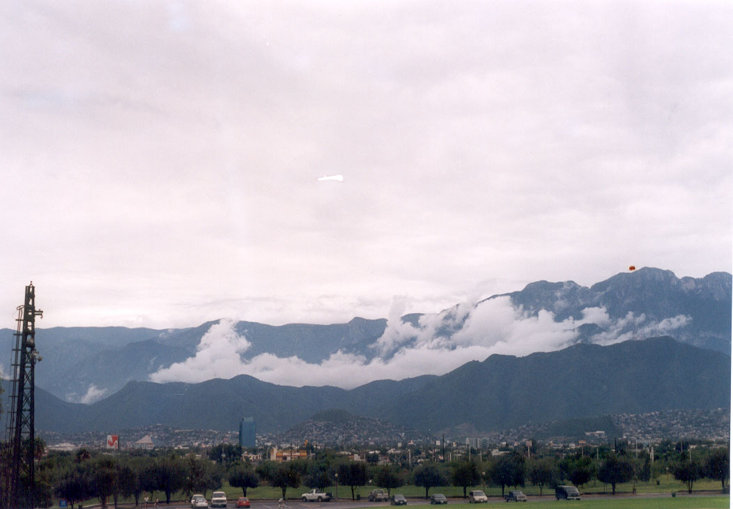
Mountain Monterrey, Nuevo León Municipality of Monterrey Monterrey and its mountains
A pacifier-shaped peak on Monterrey's southern edge: a steep half-day hike from Colonia Villa Sol to a 360° view of the city and the Sierra Madre.
From Monterrey: 15 min by car (12 km by road) How to get there ↓
Near here
See everything nearby ↓


Plan your visit to Cerro del Chupón
Where to stay near Cerro del Chupón
Compare hotels, posadas and guest houses in Cerro del Chupón.
Tours to Cerro del Chupón
Day trips and guided outings from Santiago often include Cerro del Chupón; with a local guide you can get there without a car.
 Monterrey Hiking Tour : Panoramic Route in the Cerro del Supacón
★ 4.5 (10) · From US$94
How to get to Cerro del Chupón
- From Monterrey: about 15 min by road (~12 km)
- Nearest airport: Monterrey (MTY), 44 min by car to Santiago
Links open a partner site. We may earn a commission if you book, at no cost to you.
Popular tours to Cerro del Chupón
Tours, prices and ratings from Viator, checked weekly. We may earn a commission if you book.
About Cerro del Chupón
Cerro del Chupón is a small, sharp peak of about 995 meters on the southern edge of Monterrey, at the foot of the Sierra Madre Oriental. It takes its name from its outline, which looks like a baby's pacifier, a chupón. Because the trailhead is inside the city, about 20 minutes from downtown, the climb fits easily into a morning or an evening, and local guides run sunset hikes to the top.
The usual route starts at a small community park on Calle Francisco Cárdenas in Colonia Villa Sol, reached by heading south from downtown on Avenida Lázaro Cárdenas and turning onto Paseo de la Reforma. From there the path climbs through low woodland, reaches a ridge with the first open views of the city, and then gets steeper and rockier near the top. Reports put the round trip at roughly 4 to 6 kilometers with about 400 to 600 meters of climbing; most people take around two and a half hours, though fit hikers move much faster. Signage is basic and there are many side paths, so a GPS track helps.
The reward is a panorama in every direction. The Monterrey metropolitan area spreads out below, with the Cerro de la Silla and the Cerro de las Mitras easy to pick out, and behind you rise the ridges of the Sierra Madre. Dawn and dusk give the best light, and staying for the sunset means walking down past the city lights. The slopes are home to birds such as cardinals and parrots, and to small mammals including badgers and the occasional coyote.
How to get to Cerro del Chupón
Drive from Monterrey: 15 min, 12 km
The trailhead is in southern Monterrey, about 20 minutes from downtown. Drive south on Avenida Lázaro Cárdenas, turn onto Paseo de la Reforma and follow it into Colonia Villa Sol to the community park on Calle Francisco Cárdenas. Park in the spaces near the park without blocking driveways. Guided tours meet at Walmart Las Torres and include pickup.
Directions to Cerro del Chupón on Google Maps
Distances are in a straight line; the road is usually longer.
Links open a partner site. We may earn a commission if you book, at no cost to you.
From the nearest cities to Cerro del Chupón
- Monterrey · 12 km by road, 15 min
- Montemorelos · 75 km by road, 1 h
- Saltillo · 94 km by road, 1 h 15 min
Drive times by road from OpenStreetMap, without traffic or stops. Times marked ~ are estimated from the straight-line distance.
Before you go to Cerro del Chupón: hours, prices and tips
- Time needed
- About 2.5 hours for the roughly 6 km round trip, with a climb of around 425 to 600 meters. POSTA · checked Oct 2026
- Best time of day
- Dawn or dusk, for the best light over the city and the Sierra Madre. POSTA · checked Oct 2026
- Guide or tour
- The trail can be done on your own with a GPS track, since signage is basic. Guided sunset hikes run about 4 hours with pickup and cost from about 1,970 pesos per person. Tours: Viator GetYourGuide Airbnb Experiences · checked Oct 2026
- What to bring
- Proper hiking shoes and, if you have them, trekking poles for the steep sections; at least 2 liters of water and some snacks. POSTA / Airbnb Experiences · checked Oct 2026
Hours and prices change, especially around holidays. Each fact links to where we checked it.
Visiting Cerro del Chupón: what to see and do
Climb from Colonia Villa Sol to the pacifier-shaped summit.
Pick out the Cerro de la Silla and the Cerro de las Mitras from the top.
Time the hike for sunrise or sunset, the best light of the day.
Look for cardinals and parrots in the woods on the way up.
Join a guided sunset hike if you'd rather not go alone.
Plan your trip
Places to stay in Cerro del Chupón
Compare hotels, posadas, and rentals in and around Cerro del Chupón.
Tours & activities
Day trips and guided outings from Santiago often include Cerro del Chupón; with a local guide you can get there without a car.
Rental cars
Pick up a car at MTY (Monterrey): about 44 min by road to Santiago, then 25 km more to Cerro del Chupón, on your own schedule.
Flights
The nearest airport with scheduled flights is Monterrey (MTY), about 44 min by road from Santiago, the base for Cerro del Chupón.
Travel insurance
If you plan on hiking at altitude at Cerro del Chupón, check that your policy covers it: some plans leave adventure activities out.
Mobile data
Signal can drop away from Santiago: download a map of the way to Cerro del Chupón before you set out, or carry an eSIM with data.
Links open a partner site. We may earn a commission if you book, at no cost to you.
When to go to Cerro del Chupón mild
Cerro del Chupón shares the climate of Santiago, 25 km away. The best months to visit are January, February, March, and December.
For the clearest views from Cerro del Chupón, go in the driest months (January, February, August, and December); in the rains, clouds tend to build up by midday.
See the month-by-month climate of Santiago
Weather in Cerro del Chupón now and the next 7 days
Live forecast from Open-Meteo. Chance of rain is the day's highest.
The closest Pueblo Mágico: Santiago

Santiago is the Pueblo Mágico closest to Cerro del Chupón, with places to stay, food, and more to see.
Also close to
- Arteaga · Coahuila · 58 km away
- General Terán · Nuevo León · 74 km away
Closest to Cerro del Chupón
-
Barrio Antiguo · Landmark · 6 km away
-
Cerro de la Silla · Mountain · 6 km away
-
Macroplaza · Landmark · 7 km away
-
Monterrey · City · 7 km away
-
Parque Ecológico Chipinque · Nature reserve · 7 km away
-
Parque Natural La Estanzuela · Nature reserve · 7 km away
-
Paseo Santa Lucía · Landmark · 7 km away
-
El Obispado · Landmark · 8 km away


Near Cerro del Chupón


Drive times by road from OpenStreetMap, without traffic. Times marked ~ are estimated from the straight-line distance.
Lists with Cerro del Chupón
Mountains in Nuevo León · 4 Mountains near Monterrey · 5 Mountains near Arteaga · 3Location from OpenStreetMap. Written by Puebloteca.