

Mountain Guadalupe, Nuevo León Monterrey and its mountains
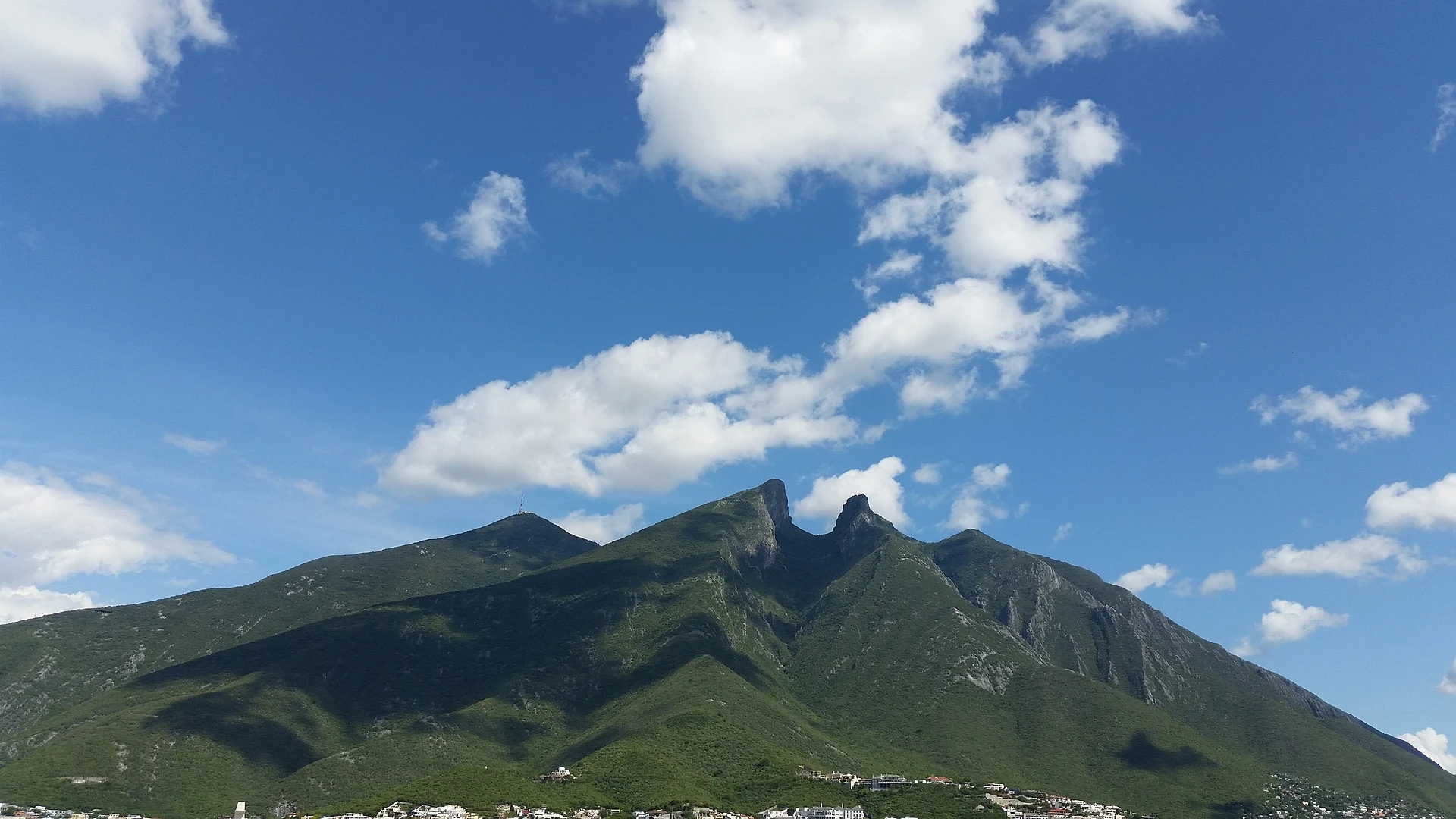
Monterrey's saddle-shaped emblem, a 1,820-meter natural monument with trails past an abandoned 1961 cable car to Pico Norte and the antenna peak.
From Monterrey: 15 min by car (11 km by road) How to get there ↓
Near here
See everything nearby ↓


Plan your visit to Cerro de la Silla
Where to stay near Cerro de la Silla
Compare hotels, posadas and guest houses in Cerro de la Silla.
Tours to Cerro de la Silla
Day trips and guided outings from Santiago often include Cerro de la Silla; with a local guide you can get there without a car.
 Cerro de la Silla Teleférico Morning/Afternoon Hike (Active)
★ 5.0 (16) · From US$110
How to get to Cerro de la Silla
- From Monterrey: about 15 min by road (~11 km)
- Nearest airport: Monterrey (MTY), 44 min by car to Santiago
Links open a partner site. We may earn a commission if you book, at no cost to you.
Popular tours to Cerro de la Silla
Tours, prices and ratings from Viator, checked weekly. We may earn a commission if you book.
About Cerro de la Silla
The Cerro de la Silla, the saddle hill, is the mountain on Monterrey's eastern skyline whose two rounded humps you see from almost everywhere in the city, and it is the symbol of the city and its people. It is part of the Sierra Madre Oriental and its slopes are shared by the municipalities of Guadalupe, Monterrey and Juárez. The highest point, Pico Norte, reaches about 1,820 meters, with a prominence of about 1,210 meters, and it is topped by a lightning rod; the neighboring Pico Antena carries a Televisa transmitter, and Pico Sur and the lower Loma de la Virgen complete the ridge. The rock is folded Cretaceous limestone and shale.
In April 1991 a presidential decree made the mountain a Monumento Natural, the first protected area in Mexico in that category, covering about 6,039 hectares. The area receives roughly 1,000 to 1,100 mm of rain a year. The mountain also has a sad footnote in the city's history. In the late 1950s and early 1960s a cable car was built to carry visitors up the hill, but on its inaugural trip on June 2, 1961, a car fell and several people died, among them its designer, the engineer Jesús Fernández. The project was abandoned, and its concrete platform still stands on the climb as a lookout.
Hiking the Cerro de la Silla is a Monterrey tradition. Four main routes lead toward the summits: Camino a la Antena, Paso de los Elefantes, Ruta MG and San Ángel. The most popular starts at the foot of the mountain by the Bosques de la Pastora neighborhood in Guadalupe; the old cable car structure is 2.6 km up, and the climb to the antenna is about 6 km each way, with a further stretch from Puerto del Oso to Pico Norte of around 30 minutes. A shorter walk reaches the La Virgen lookout in about 25 minutes. The trails are steep and exposed, the city's summers are very hot, so start early and carry plenty of water.
How to get to Cerro de la Silla
Drive from Monterrey: 15 min, 11 km
The mountain rises on the south-east edge of the Monterrey metropolitan area. The main trailhead is at the foot of the hill by the Bosques de la Pastora neighborhood in Guadalupe, reached by car or taxi from downtown Monterrey. Monterrey's airport in Apodaca is about 28 km north-east of downtown.
Directions to Cerro de la Silla on Google Maps
Distances are in a straight line; the road is usually longer.
Links open a partner site. We may earn a commission if you book, at no cost to you.
From the nearest cities to Cerro de la Silla
- Monterrey · 11 km by road, 15 min
- Montemorelos · 73 km by road, 1 h
- Saltillo · 96 km by road, 1 h 15 min
Drive times by road from OpenStreetMap, without traffic or stops. Times marked ~ are estimated from the straight-line distance.
Before you go to Cerro de la Silla: hours, prices and tips
- Time needed
- About 2.6 km to the old cable car platform; about 6 km each way to the antenna, plus around 30 minutes more to Pico Norte. Plan a full morning for the summit. Wikipedia (Cerro de la Silla) · checked Oct 2026
Hours and prices change, especially around holidays. Each fact links to where we checked it.
Visiting Cerro de la Silla: what to see and do
Hike from the Bosques de la Pastora trailhead to the ruins of the 1961 cable car (2.6 km).
Continue to the Pico Antena and on to Pico Norte, the summit at about 1,820 m.
Take the short walk to the La Virgen lookout if you want just a taste.
Watch the mountain turn colors at sunset from Parque Fundidora or the Paseo Santa Lucía.
Plan your trip
Places to stay in Cerro de la Silla
Compare hotels, posadas, and rentals in and around Cerro de la Silla.
Tours & activities
Day trips and guided outings from Santiago often include Cerro de la Silla; with a local guide you can get there without a car.
Rental cars
Pick up a car at MTY (Monterrey): about 44 min by road to Santiago, then 24 km more to Cerro de la Silla, on your own schedule.
Flights
The nearest airport with scheduled flights is Monterrey (MTY), about 44 min by road from Santiago, the base for Cerro de la Silla.
Travel insurance
If you plan on hiking at altitude at Cerro de la Silla, check that your policy covers it: some plans leave adventure activities out.
Mobile data
Signal can drop away from Santiago: download a map of the way to Cerro de la Silla before you set out, or carry an eSIM with data.
Links open a partner site. We may earn a commission if you book, at no cost to you.
Photos
When to go to Cerro de la Silla mild
Cerro de la Silla shares the climate of Santiago, 24 km away. The best months to visit are January, February, March, and December.
For the clearest views from Cerro de la Silla, go in the driest months (January, February, August, and December); in the rains, clouds tend to build up by midday.
See the month-by-month climate of Santiago
Weather in Cerro de la Silla now and the next 7 days
Live forecast from Open-Meteo. Chance of rain is the day's highest.
The closest Pueblo Mágico: Santiago

Santiago is the Pueblo Mágico closest to Cerro de la Silla, with places to stay, food, and more to see.
Also close to
- Arteaga · Coahuila · 64 km away
- General Terán · Nuevo León · 70 km away
Closest to Cerro de la Silla
-
Cerro del Chupón · Mountain · 6 km away
-
Parque Fundidora · Landmark · 7 km away
-
Barrio Antiguo · Landmark · 8 km away
-
Macroplaza · Landmark · 8 km away
-
Monterrey · City · 8 km away
-
Paseo Santa Lucía · Landmark · 8 km away
-
Parque Natural La Estanzuela · Nature reserve · 9 km away
-
El Obispado · Landmark · 11 km away


Near Cerro de la Silla


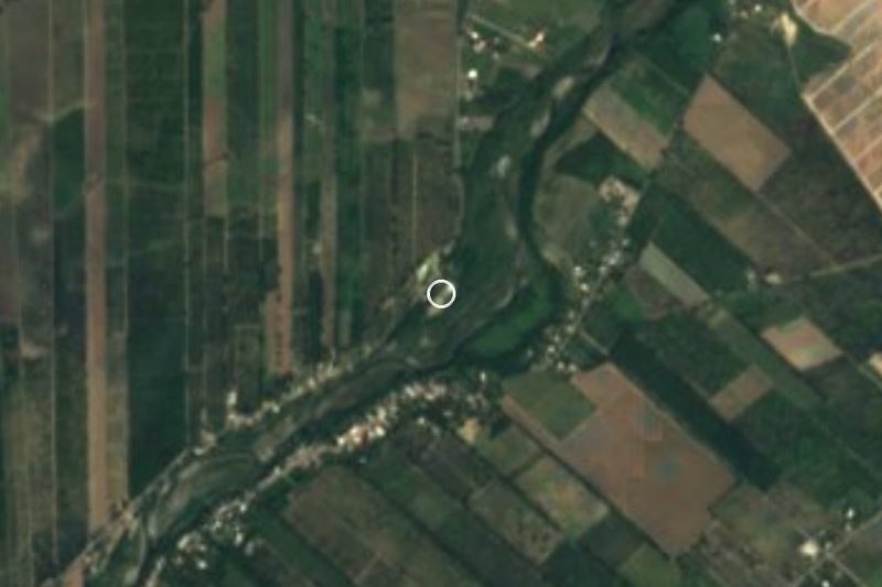

Drive times by road from OpenStreetMap, without traffic. Times marked ~ are estimated from the straight-line distance.
Lists with Cerro de la Silla
Mountains in Nuevo León · 4 Mountains near Monterrey · 5Location from OpenStreetMap. Written by Puebloteca.