Mountain Juárez, Nuevo León Monterrey and its mountains
A mountain with a great hole in its flank, south of Monterrey: a mostly level river hike with wading and small waterfalls.
From Monterrey: 25 min by car (26 km by road) How to get there ↓
Near here
See everything nearby ↓


Plan your visit to Cerro Agujerado
Where to stay near Cerro Agujerado
Compare hotels, posadas and guest houses in Cerro Agujerado.
Tours to Cerro Agujerado
Day trips and guided outings from Santiago often include Cerro Agujerado; with a local guide you can get there without a car.
 Tours from Monterrey
Matacanes : Canyoning + Hiking + Water Jumps + Rappel + Caves
★ 4.9 (1,783) · From US$157
How to get to Cerro Agujerado
- From Monterrey: about 25 min by road (~26 km)
- Nearest airport: Monterrey (MTY), 44 min by car to Santiago
Links open a partner site. We may earn a commission if you book, at no cost to you.
Tours from Monterrey, near Cerro Agujerado


Tours, prices and ratings from Viator, checked weekly. We may earn a commission if you book.
About Cerro Agujerado
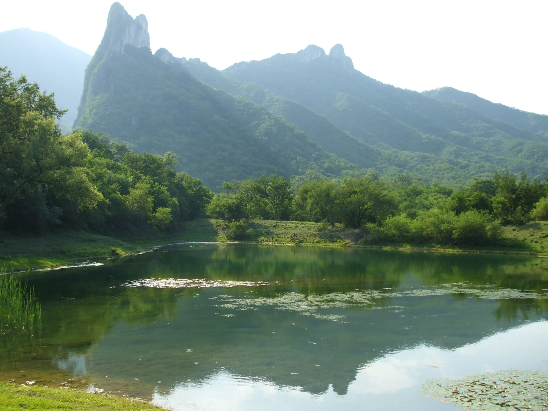
Cerro Agujerado, the "holed hill," is a mountain in the Sierra Madre Oriental in the municipality of Juárez, Nuevo León, close to Monterrey. It is named for a huge cavity in one of its slopes, a hole in the mountainside that is the goal of most hikers. Because the walk starts on the edge of the metropolitan area, near the Bosques de la Silla neighborhood and the road to San Mateo, it has become one of the favorite first hikes for people from Monterrey who are new to the mountains.
The route follows a canyon and its stream for most of the way. Guides describe the trail as easy and almost flat until the last 500 meters, which climb more steeply to the hole. The catch is the water: you cross the stream several times, pass small waterfalls, and at one point wade through a channel where the water can reach your shoulders; bring clothes that dry fast. The full outing is about 10 to 12 kilometers round trip and takes around four hours, so it suits beginners with reasonable fitness rather than complete novices.
Along the way you pass rivers, small waterfalls and a mix of vegetation, with butterflies, raccoons and endemic plants, and the route opens to wide views over the Sierra Madre. There is no entry fee, though a parking charge of about 50 pesos keeps your car secure near the trailhead. Insect repellent is useful near the water, a flashlight helps if the walk runs late, and in the rainy season the trails turn slippery, so plan the outing for a dry spell.
How to get to Cerro Agujerado
Drive from Monterrey: 25 min, 26 km
The trailhead is on the southern edge of the Monterrey metro area, in Juárez municipality near Colonia Bosques de la Silla. Drive the road to San Mateo in Juárez and follow the signs for "Cerro Agujerado" to the parking area, where a fee of about 50 pesos is charged. From there the hike is roughly 12 kilometers round trip, about four hours in all.
Directions to Cerro Agujerado on Google Maps
Distances are in a straight line; the road is usually longer.
Links open a partner site. We may earn a commission if you book, at no cost to you.
From the nearest cities to Cerro Agujerado
- Monterrey · 26 km by road, 25 min
- Montemorelos · 60 km by road, 50 min
- Saltillo · 111 km by road, 1 h 30 min
Drive times by road from OpenStreetMap, without traffic or stops. Times marked ~ are estimated from the straight-line distance.
Before you go to Cerro Agujerado: hours, prices and tips
- Entry
- No entry fee; parking costs about 50 pesos. POSTA · checked Oct 2026
- Time needed
- About four hours for the roughly 12 km round trip. POSTA · checked Oct 2026
- What to bring
- Quick-dry clothes, a waterproof backpack and a change of clothes for the wading; plenty of water, snacks, a cap, insect repellent and a flashlight in case the hike runs late. Food & Pleasure / POSTA · checked Oct 2026
Hours and prices change, especially around holidays. Each fact links to where we checked it.
Visiting Cerro Agujerado: what to see and do
Hike the mostly level canyon trail beside the stream.
Wade the deep channel, with water up to your shoulders in places.
Stop at the small waterfalls along the way.
Climb the last steep 500 meters to the great hole that names the mountain.
Take in the views over the Sierra Madre from the upper trail.
Plan your trip
Places to stay in Cerro Agujerado
Compare hotels, posadas, and rentals in and around Cerro Agujerado.
Tours & activities
Day trips and guided outings from Santiago often include Cerro Agujerado; with a local guide you can get there without a car.
Rental cars
Pick up a car at MTY (Monterrey): about 44 min by road to Santiago, then 11 km more to Cerro Agujerado, on your own schedule.
Flights
The nearest airport with scheduled flights is Monterrey (MTY), about 44 min by road from Santiago, the base for Cerro Agujerado.
Travel insurance
If you plan on hiking at altitude at Cerro Agujerado, check that your policy covers it: some plans leave adventure activities out.
Mobile data
Signal can drop away from Santiago: download a map of the way to Cerro Agujerado before you set out, or carry an eSIM with data.
Links open a partner site. We may earn a commission if you book, at no cost to you.
When to go to Cerro Agujerado mild
Cerro Agujerado shares the climate of Santiago, 11 km away. The best months to visit are January, February, March, and December.
For the clearest views from Cerro Agujerado, go in the driest months (January, February, August, and December); in the rains, clouds tend to build up by midday.
See the month-by-month climate of Santiago
Weather in Cerro Agujerado now and the next 7 days
Live forecast from Open-Meteo. Chance of rain is the day's highest.
The closest Pueblo Mágico: Santiago

Santiago is the Pueblo Mágico closest to Cerro Agujerado, with places to stay, food, and more to see.
Also close to
- General Terán · Nuevo León · 57 km away
- Arteaga · Coahuila · 69 km away
Closest to Cerro Agujerado
-
Parque Natural La Estanzuela · Nature reserve · 11 km away
-
Presa La Boca · Lake · 12 km away
-
Cerro de la Silla · Mountain · 14 km away
-
Cerro del Chupón · Mountain · 16 km away
-
Cola de Caballo · Waterfall · 18 km away
-
Barrio Antiguo · Landmark · 21 km away
-
Parque Fundidora · Landmark · 21 km away
-
Paseo Santa Lucía · Landmark · 21 km away


Near Cerro Agujerado


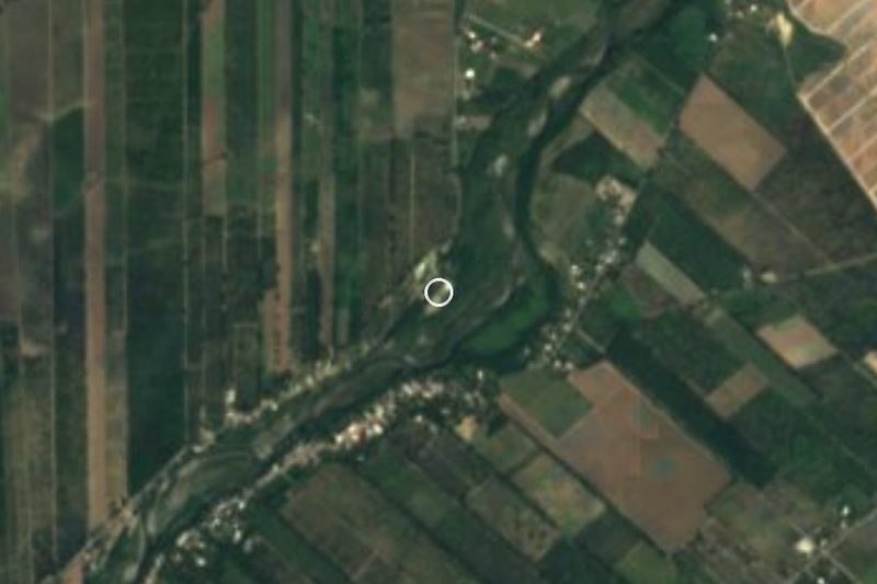

Drive times by road from OpenStreetMap, without traffic. Times marked ~ are estimated from the straight-line distance.
Lists with Cerro Agujerado
Mountains in Nuevo León · 4 Mountains near Monterrey · 5Location from OpenStreetMap. Written by Puebloteca.