Town Acatlán de Pérez Figueroa, Oaxaca La Cañada (Oaxaca)
Sugar-cane town in northern Oaxaca's Papaloapan region, at about 130 m, with the La Margarita mill and the Miguel Alemán reservoir nearby.
From Córdoba: 1 h 10 min by car (66 km by road) How to get there ↓
Near here
See everything nearby ↓



Plan your visit to Acatlán de Pérez Figueroa
Where to stay near Acatlán de Pérez Figueroa
Compare hotels, posadas and guest houses in Acatlán de Pérez Figueroa.
Tours to Acatlán de Pérez Figueroa
Day trips around Huautla sometimes stop in Acatlán de Pérez Figueroa; a tour is the easy way to see it without a car.
How to get to Acatlán de Pérez Figueroa
- From Córdoba: about 1 h 10 min by road (~66 km)
- Nearest airport: Oaxaca (OAX), 3 h 34 min by car to Huautla
Links open a partner site. We may earn a commission if you book, at no cost to you.
About Acatlán de Pérez Figueroa
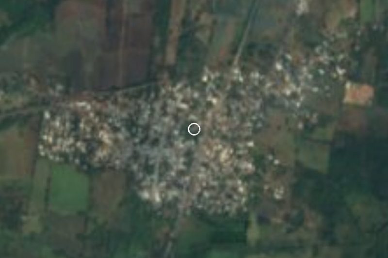
Acatlán de Pérez Figueroa lies in the far north of Oaxaca, in the Papaloapan region, already on the Gulf coastal plain at about 130 m above sea level. The name comes from Nahuatl and is read as "place of canes" or "among the reeds"; the second part honours General Pérez Figueroa, who fought in the Second French Intervention. According to the municipal history, the first settlers belonged to the Remojadas culture around 2000 BCE, and the free municipality was declared on 24 October 1904. In 1921 a railway with oil-fired locomotives began running here.
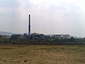
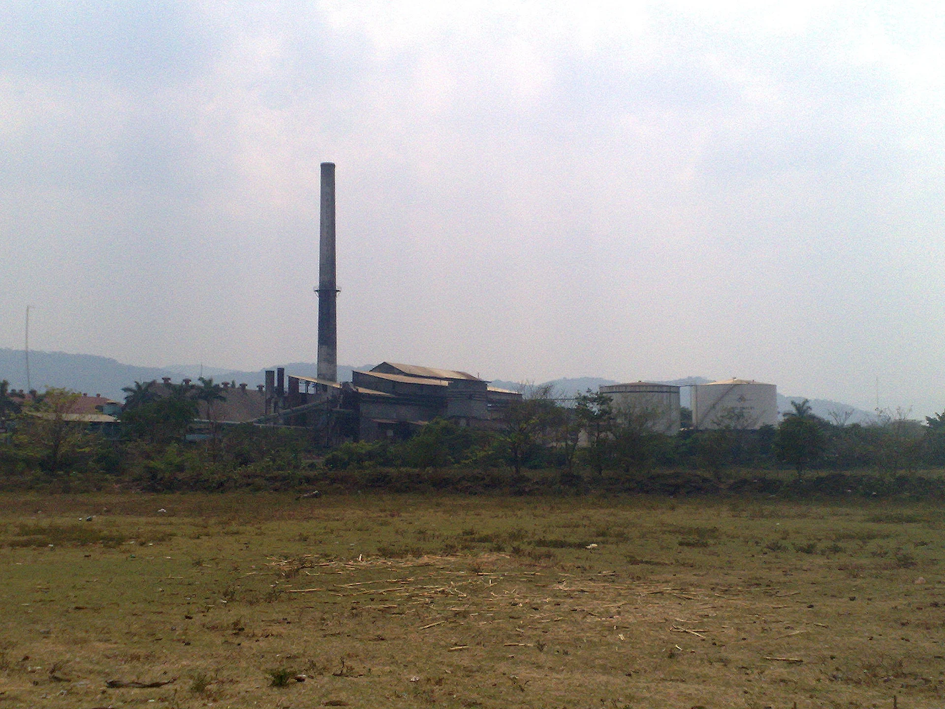
The climate is warm, averaging close to 25 °C, and the land lives from it: maize, rice, coffee, fruit trees and above all sugar cane. The Pablo Machado mill, known as La Margarita, is the big local industry; in the 2004-2005 harvest it processed 104,279 tonnes. Its chimney dominates the skyline of a town that had about 6,000 inhabitants at the 2010 census. There is also pig and cattle farming, and cedar and rubber timber.
For a visitor there are few monuments but plenty of water and countryside. In the centre are the Centenario park and a monument to General Pérez Figueroa. About 25 minutes from the centre is Cerro Mojarra (La Capilla), a fishing and leisure area with lodging on the Miguel Alemán (Temazcal) reservoir, and in the rainy season a waterfall forms in the Cañada San Antonio. Near Tetela stand two stone pyramids called El Fortín, abandoned and needing the residents' permission to visit. Trade here points toward Córdoba, Tierra Blanca and Veracruz.
How to get to Acatlán de Pérez Figueroa
Drive from Córdoba: 1 h 10 min, 66 km
Acatlán sits on the Veracruz border, so it is easiest to approach from the Veracruz side. From Córdoba or Orizaba take the 150D toll road toward Veracruz, exit near the Entronque Boticaria / Mata Tenatito junction (federal highway 150) and take the Cosolapa–Acatlán de Pérez Figueroa road. A route planner gives about 94 km and roughly 1 h 35 min from Orizaba; from Córdoba allow about an hour (the straight-line distance is about 52 km). Cosolapa, already in Oaxaca, lies just north of the municipality. From Oaxaca city it is a long trip that nearly always goes through Tuxtepec or Córdoba. By public transport the usual way is to reach Córdoba or Tuxtepec and look for a bus or colectivo to Acatlán from there; we found no published schedule for a direct line, so confirm at the terminal. Cerro Mojarra is about 25 minutes more from the centre.
Directions to Acatlán de Pérez Figueroa on Google Maps
Distances are in a straight line; the road is usually longer.
Links open a partner site. We may earn a commission if you book, at no cost to you.
From the nearest cities to Acatlán de Pérez Figueroa
- Córdoba · 66 km by road, 1 h 10 min
- Orizaba · 88 km by road, 1 h 25 min
- Tuxtepec · 95 km by road, 1 h 40 min
Drive times by road from OpenStreetMap, without traffic or stops. Times marked ~ are estimated from the straight-line distance.
Visiting Acatlán de Pérez Figueroa: what to see and do
Look at the La Margarita sugar mill and its chimney from the edge of town.
Walk the Centenario park and the monument to General Pérez Figueroa.
Go to Cerro Mojarra (La Capilla), about 25 minutes away, to fish or eat by the reservoir.
Look for the Cañada San Antonio waterfall in the rainy season.
Ask about the El Fortín pyramids near Tetela: you need the residents' permission.
Plan your trip
Places to stay in Acatlán de Pérez Figueroa
Compare hotels, posadas, and rentals in and around Acatlán de Pérez Figueroa.
Tours & activities
Day trips around Huautla sometimes stop in Acatlán de Pérez Figueroa; a tour is the easy way to see it without a car.
Rental cars
Pick up a car at OAX (Oaxaca): about 3 h 34 min by road to Huautla, then 52 km more to Acatlán de Pérez Figueroa, on your own schedule.
Flights
The nearest airport with scheduled flights is Oaxaca (OAX), about 3 h 34 min by road from Huautla, the base for Acatlán de Pérez Figueroa.
Mobile data
Signal can drop away from Huautla: download a map of the way to Acatlán de Pérez Figueroa before you set out, or carry an eSIM with data.
Links open a partner site. We may earn a commission if you book, at no cost to you.
When to go to Acatlán de Pérez Figueroa mild
Acatlán de Pérez Figueroa shares the climate of Huautla, 52 km away. The best months to visit are February, March, April, and May.
See the month-by-month climate of Huautla
Weather in Acatlán de Pérez Figueroa now and the next 7 days
Live forecast from Open-Meteo. Chance of rain is the day's highest.
The closest Pueblo Mágico: Huautla

Huautla is the Pueblo Mágico closest to Acatlán de Pérez Figueroa, with places to stay, food, and more to see.
Also close to
- Córdoba · Veracruz · 52 km away
- Orizaba · Veracruz · 63 km away
- Coscomatepec · Veracruz · 75 km away
Closest to Acatlán de Pérez Figueroa
-
Huixcolotla · Village · 18 km away
-
Motzorongo · Village · 18 km away
-
Tierra Blanca · Town · 28 km away
-
La Tinaja · Village · 29 km away
-
Tlacotepec de Porfirio Díaz · Village · 30 km away
-
Ameyalco · Village · 35 km away
-
Yanga · Town · 38 km away
-
Joachín · Village · 41 km away

Near Acatlán de Pérez Figueroa


Drive times by road from OpenStreetMap, without traffic. Times marked ~ are estimated from the straight-line distance.
Location from OpenStreetMap. Written by Puebloteca.