

Town Santa Catarina Lachatao, Oaxaca Sierra Norte of Oaxaca
The nearest of the Pueblos Mancomunados: a cobbled mountain village with a colonial church, a small museum and hikes to Cerro del Jaguar.
From Oaxaca: 1 h 20 min by car (66 km by road) How to get there ↓
Near here
See everything nearby ↓



Plan your visit to Lachatao
Tours to Lachatao
Day trips around Capulálpam de Méndez sometimes stop in Lachatao; a tour is the easy way to see it without a car.
 Hike el Camino Real, Latuvi – Lachatao
★ 5.0 (14) · From US$259
How to get to Lachatao
- From Oaxaca: about 1 h 20 min by road (~66 km)
- 4 km southwest of Capulálpam de Méndez
- Nearest airport: Oaxaca (OAX), 1 h 27 min by car to Capulálpam de Méndez
Links open a partner site. We may earn a commission if you book, at no cost to you.
Popular tours to Lachatao
Tours, prices and ratings from Viator, checked weekly. We may earn a commission if you book.
About Lachatao
Santa Catarina Lachatao is the closest of the Pueblos Mancomunados to Capulálpam, a small Zapotec village of cobbled lanes in the mountains just to the south. It was settled long before the Spanish arrived and was an important ceremonial center for the Zapotecs, as well as a stop on the trade route between the northern mountains and the central valleys.
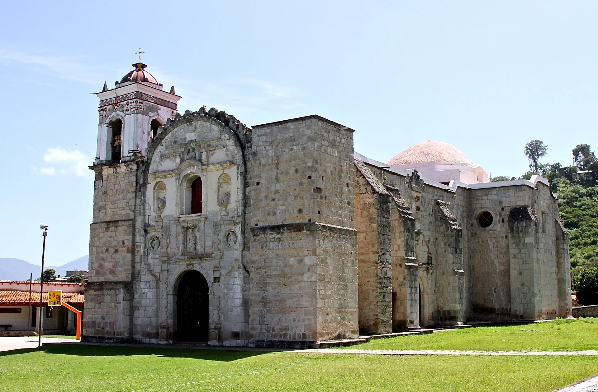
The parish church of Santa Catarina, built of greenish stone between the late 16th and early 17th centuries, stands over a narrow plaza. Nearby, the community museum shows archaeological finds, copies of old maps, colonial paintings and uniforms, photographs and weapons from the Mexican Revolution, collected and cared for by the village itself.
Above the village rises the Cerro del Jaguar, a hill with ancient remains that the community considers sacred. It was brought back to attention in 2009, and today people gather there for the equinoxes. The walk up gives wide views over the Sierra Juárez. Lachatao has simple community cabins and is a good base for hikes into the rest of the Mancomunados.
How to get to Lachatao
Drive from Oaxaca: 1 h 20 min, 66 km
Lachatao is a short drive south of Capulálpam on a mountain road, usually less than half an hour; ask locally about road conditions in the rainy season. There is little public transport, so a taxi from Capulálpam or Ixtlán is the easiest way. Guides for the Cerro del Jaguar and the trails are arranged at the village tourism office.
4 km southwest of Capulálpam de Méndez
Directions from Capulálpam de Méndez on Google Maps
Distances are in a straight line; the road is usually longer.
Links open a partner site. We may earn a commission if you book, at no cost to you.
From the nearest cities to Lachatao
- Oaxaca · 66 km by road, 1 h 20 min
- Tuxtepec · 172 km by road, 2 h 55 min
- Tehuacán · about 215 km by road, ~3 h 10 min
Drive times by road from OpenStreetMap, without traffic or stops. Times marked ~ are estimated from the straight-line distance.
Before you go to Lachatao: hours, prices and tips
- Best time of day
- Come for an equinox if you can: ceremonies are held on Cerro del Jaguar as the sun draws a serpent of light along the ridge. México Desconocido · checked Oct 2026
- Guide or tour
- Community guides lead the forest trails; the ecotourism office also tells you which routes you may take and where you can camp or light a fire. Tours: Viator GetYourGuide México Desconocido · checked Oct 2026
Hours and prices change, especially around holidays. Each fact links to where we checked it.
Visiting Lachatao: what to see and do
See the green-stone church of Santa Catarina on the village plaza.
Visit the community museum, with finds from pre-Hispanic times to the Revolution.
Hike up the Cerro del Jaguar with a local guide for the views and the ancient remains.
Stay in a community cabin and set out on the trails of the Pueblos Mancomunados.
Plan your trip
Places to stay in Lachatao
Cabañas Hotel · 60 m from the center Find on Expedia Cabañas Amatlán Hotel · 1.1 km from the center Find on Expedia Hotel Chorromonte Hotel · 5.0 km from the center Find on Expedia Posada Don Juanito Hotel · 5.0 km from the center Find on Expedia Los Sabinos Hotel · 5.1 km from the center Find on Expedia El Portillo Cabañas Guest house · 4.9 km from the center Find on ExpediaTours & activities
Day trips around Capulálpam de Méndez sometimes stop in Lachatao; a tour is the easy way to see it without a car.
Rental cars
Pick up a car at OAX (Oaxaca): about 1 h 27 min by road to Capulálpam de Méndez, then 4 km more to Lachatao, on your own schedule.
Flights
The nearest airport with scheduled flights is Oaxaca (OAX), about 1 h 27 min by road from Capulálpam de Méndez, the base for Lachatao.
Mobile data
Signal can drop away from Capulálpam de Méndez: download a map of the way to Lachatao before you set out, or carry an eSIM with data.
Links open a partner site. We may earn a commission if you book, at no cost to you. Hotel names from OpenStreetMap.
Photos
When to go to Lachatao cool
Lachatao shares the climate of Capulálpam de Méndez, 4 km away. The best months to visit are January, February, March, and December.
See the month-by-month climate of Capulálpam de Méndez
Weather in Lachatao now and the next 7 days
Live forecast from Open-Meteo. Chance of rain is the day's highest.
Make Capulálpam de Méndez your base

Lachatao is an easy trip from Capulálpam de Méndez, a Pueblo Mágico with places to stay, food, and more to see.
Also close to
- Mitla · Oaxaca · 40 km away
Closest to Lachatao
-
Guelatao de Juárez · Town · 6 km away
-
Ixtlán de Juárez · Town · 7 km away
-
Santa Catarina Ixtepeji · Town · 9 km away · Oaxaca
-
Santa María Jaltianguis · Town · 12 km away · Oaxaca
-
Llano Grande · Village · 15 km away · Oaxaca
-
Pueblos Mancomunados · Nature reserve · 17 km away
-
San Antonio Cuajimoloyas · Village · 17 km away · Oaxaca
-
San Juan Evangelista Analco · Village · 17 km away · Oaxaca


Near Lachatao


Drive times by road from OpenStreetMap, without traffic. Times marked ~ are estimated from the straight-line distance.
Something wrong or missing on this page? Suggest a fix or addition
Location from OpenStreetMap. Written by Puebloteca.