Village San Pablo Macuiltianguis, Oaxaca Sierra Norte of Oaxaca
Zapotec town in the Sierra Juárez at 2,100 m, with five barrios, a lookout and a yearly carnival of petate bulls.
From Oaxaca: 1 h 50 min by car (109 km by road) How to get there ↓
Near here
See everything nearby ↓


Plan your visit to San Pablo Macuiltianguis
Where to stay near San Pablo Macuiltianguis
Compare hotels, posadas and guest houses in San Pablo Macuiltianguis.
Tours to San Pablo Macuiltianguis
Day trips and guided outings from Capulálpam de Méndez often include San Pablo Macuiltianguis; with a local guide you can get there without a car.
How to get to San Pablo Macuiltianguis
- From Oaxaca: about 1 h 50 min by road (~109 km)
- Nearest airport: Oaxaca (OAX), 1 h 27 min by car to Capulálpam de Méndez
Links open a partner site. We may earn a commission if you book, at no cost to you.
About San Pablo Macuiltianguis
Macuiltianguis means something like five plazas or five markets in Nahuatl, and the town, at about 2,100 metres in the Sierra Norte, is still divided into five barrios with Zapotec names: Latzi, Raa, Ruilla, Ree and Yoo. Elders say it was founded around 1500 by Zapotecs from Teococuilco (today Marcos Pérez). Rock paintings, tombs and pre-Hispanic clay pieces have turned up in the area; in 1526 the town was granted in encomienda to Cristóbal de Salas.
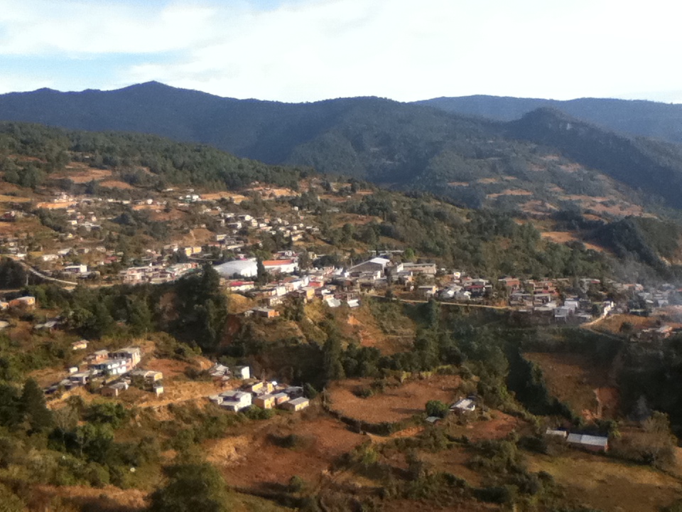
434 people lived here in 2020, and more than half speak Macuiltianguis Zapotec, a variety of Sierra Juárez Zapotec that linguists have studied. Houses are mostly adobe with two-pitch sheet-metal roofs, and there is a library, water and electricity. The climate is cool and very wet: a mean of 14.5 °C, around 2,300 mm of rain and rainy days nearly all year; January is the coldest month and sub-zero lows have been recorded. The hills around have pine, oak, copal and cedar, and the rivers Comal, Ceniza, Culebra and Grande run down from them.
The festival calendar is what is most worth planning around. On 25 January the town celebrates San Pablo Apóstol, with a calenda floral, wind bands, a fireworks castle, sports and a jaripeo. Carnival, before Lent, is the biggest fiesta: in 2019 it ran from 2 to 5 March, with costumes, floats, the petate bulls and a burning castle. The Assumption on 15 August is also kept, and so is All Saints (late October and early November), with altars, flowers, and tamales and atole shared around. The town's own dance is the Torito Serrano.
The closest neighbours are San Juan Luvina (about 3 km east), Santiago Comaltepec and San Pedro Yólox. From the town lookout you see the houses on the slope and the ranges of the sierra.
How to get to San Pablo Macuiltianguis
Drive from Oaxaca: 1 h 50 min, 109 km
San Pablo Macuiltianguis is in the Ixtlán district of the Sierra Juárez and borders Ixtlán de Juárez on the east, which is the gateway. From the city of Oaxaca, the Cuenca line (ADO group) runs from Oaxaca's first-class terminal on Calzada Niños Héroes de Chapultepec to Ixtlán de Juárez: about 10 departures a day, aprox. 90 minutes and around 100 pesos according to Wikivoyage. Ixtlán is on federal highway 175 Oaxaca-Tuxtepec. From there to Macuiltianguis it is about 40 to 55 km depending on the source (aprox. an hour by car).
We found no timetable for pickups or colectivos from Ixtlán to Macuiltianguis, nor confirmation that the whole road is paved: ask in central Ixtlán about local transport or hire a taxi, and check the road if you go in the rainy season (rain nearly all year). To arrive for carnival or 25 January, start early: those are the busiest dates. Around 60% of homes have a mobile phone, but signal is patchy; download the map first.
Directions to San Pablo Macuiltianguis on Google Maps
Distances are in a straight line; the road is usually longer.
Links open a partner site. We may earn a commission if you book, at no cost to you.
From the nearest cities to San Pablo Macuiltianguis
- Oaxaca · 109 km by road, 1 h 50 min
- Tuxtepec · 127 km by road, 2 h
- Tehuacán · about 175 km by road, ~2 h 35 min
Drive times by road from OpenStreetMap, without traffic or stops. Times marked ~ are estimated from the straight-line distance.
Before you go to San Pablo Macuiltianguis: hours, prices and tips
- Best season
- Carnival before Lent (in 2019, 2 to 5 March); San Pablo Apóstol on 25 January; Assumption on 15 August; All Saints at the end of October. Secretaría de Turismo de Oaxaca y ECURED · checked Oct 2026
- What to bring
- A warm layer and a rain jacket: rain nearly all year, mean 14.5 °C. Pueblos de América (datos INEGI y clima) · checked Oct 2026
Hours and prices change, especially around holidays. Each fact links to where we checked it.
Visiting San Pablo Macuiltianguis: what to see and do
Climb to the town lookout and see the houses on the slope with the hills behind.
Walk through the five barrios: Latzi, Raa, Ruilla, Ree and Yoo.
Come for carnival (before Lent) to see the petate bulls and the castle burning.
Arrive on 25 January for San Pablo: calenda floral, brass band and jaripeo.
Walk to San Juan Luvina, about 3 km east, or to Santiago Comaltepec, about 3 km west.
Visit the cemetery at All Saints to see altars of flowers, fruit and tamales.
Plan your trip
Places to stay in San Pablo Macuiltianguis
Compare hotels, posadas, and rentals in and around San Pablo Macuiltianguis.
Tours & activities
Day trips and guided outings from Capulálpam de Méndez often include San Pablo Macuiltianguis; with a local guide you can get there without a car.
Rental cars
Pick up a car at OAX (Oaxaca): about 1 h 27 min by road to Capulálpam de Méndez, then 28 km more to San Pablo Macuiltianguis, on your own schedule.
Flights
The nearest airport with scheduled flights is Oaxaca (OAX), about 1 h 27 min by road from Capulálpam de Méndez, the base for San Pablo Macuiltianguis.
Mobile data
Signal can drop away from Capulálpam de Méndez: download a map of the way to San Pablo Macuiltianguis before you set out, or carry an eSIM with data.
Links open a partner site. We may earn a commission if you book, at no cost to you.
When to go to San Pablo Macuiltianguis cool
San Pablo Macuiltianguis shares the climate of Capulálpam de Méndez, 28 km away. The best months to visit are January, February, March, and December.
See the month-by-month climate of Capulálpam de Méndez
Weather in San Pablo Macuiltianguis now and the next 7 days
Live forecast from Open-Meteo. Chance of rain is the day's highest.
The closest Pueblo Mágico: Capulálpam de Méndez

Capulálpam de Méndez is the Pueblo Mágico closest to San Pablo Macuiltianguis, with places to stay, food, and more to see.
Also close to
Closest to San Pablo Macuiltianguis
-
Santiago Comaltepec · Town · 3 km away
-
San Pedro Yólox · Village · 6 km away
-
San Juan Evangelista Analco · Village · 14 km away
-
Santa María Jaltianguis · Town · 19 km away
-
Ixtlán de Juárez · Town · 24 km away
-
Guelatao de Juárez · Town · 25 km away
-
San Miguel Yotao · Village · 29 km away
-
Santa Catarina Ixtepeji · Town · 30 km away


Near San Pablo Macuiltianguis


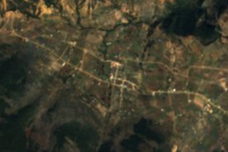


Drive times by road from OpenStreetMap, without traffic. Times marked ~ are estimated from the straight-line distance.
Location from OpenStreetMap. Written by Puebloteca.