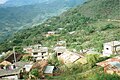

Town Chiquihuitlán de Benito Juárez, Oaxaca La Cañada (Oaxaca)
Mazatec town in the Cañada at 1,205 m, with a two-headed bird legend, sugar cane, panela and wool gabanes; about 30 km from Huautla.
From Córdoba: about 1 h 55 min by road (~135 km) How to get there ↓
Near here
See everything nearby ↓



Plan your visit to Chiquihuitlán de Benito Juárez
Where to stay near Chiquihuitlán de Benito Juárez
Compare hotels, posadas and guest houses in Chiquihuitlán de Benito Juárez.
Tours to Chiquihuitlán de Benito Juárez
Day trips around Huautla sometimes stop in Chiquihuitlán de Benito Juárez; a tour is the easy way to see it without a car.
How to get to Chiquihuitlán de Benito Juárez
- From Córdoba: about 1 h 55 min by road (~135 km)
- Nearest airport: Oaxaca (OAX), 3 h 34 min by car to Huautla
Links open a partner site. We may earn a commission if you book, at no cost to you.
About Chiquihuitlán de Benito Juárez
Chiquihuitlán de Benito Juárez sits at 1,205 m in the north of the Cañada, in the Cuicatlán district, about 198 km from Oaxaca city. The 2020 census recorded 1,462 people in the town, nearly all indigenous, and the language heard is Mazatec. The whole 38.3 km² municipality has 2,179 people in 12 localities; the next largest are La Concepción (206), Agua Tendida (143) and Agua Espina (106). It borders San Pedro Teutila to the east and Santa Ana Cuauhtémoc to the west.
The name comes from Nahuatl and is explained as "place protected by baskets". Local legend tells of an eagle-like bird with two heads that seized people; to drive it off, the villagers drained the lagoon where it hunted, at a spot called La Cruz or Terminal. That is why the municipal coat of arms shows a two-headed eagle with a reed basket. In 1950, comuneros from Santa Ana Cuauhtémoc occupied a large part of the territory, called El Cabildo, and later gained legal title to it.
The economy is agricultural: maize, beans, coffee, sugar cane, squash and tomato, plus fruit trees such as mango, avocado and mamey, which the municipality names as its main natural resource. Cane becomes panela, tepache and aguardiente. Families also make rope bags and sheep-wool gabanes. Elevation runs from about 200 to 1,800 m, and deer, raccoons and iguanas live in the woods.
How to get to Chiquihuitlán de Benito Juárez
Chiquihuitlán de Benito Juárez is about 198 km by road from Oaxaca city, in the northwest of the state, and about 30 km from Huautla de Jiménez (roughly 40 minutes, approximate, per a non-official localities site). One practical way is to reach Huautla first and continue from there to Chiquihuitlán. Tuxtepec is about 67 km away in a straight line. We found no named buses or colectivos published for the town, nor the road's condition, so ask in Huautla or Teotitlán for transport towards Chiquihuitlán and leave early.
Directions to Chiquihuitlán de Benito Juárez on Google Maps
Distances are in a straight line; the road is usually longer.
Links open a partner site. We may earn a commission if you book, at no cost to you.
From the nearest cities to Chiquihuitlán de Benito Juárez
- Orizaba · about 135 km by road, ~1 h 55 min
- Córdoba · about 135 km by road, ~1 h 55 min
- Tuxtepec · 118 km by road, 2 h 25 min
Drive times by road from OpenStreetMap, without traffic or stops. Times marked ~ are estimated from the straight-line distance.
Visiting Chiquihuitlán de Benito Juárez: what to see and do
Walk the Cañada town at 1,205 m.
Ask about the two-headed bird legend and the municipal coat of arms.
Look for panela, tepache or cane aguardiente.
Buy rope bags or a wool gabán if offered.
See the mango, avocado and mamey orchards on the hillsides.
Hear Mazatec in the streets.
Plan your trip
Places to stay in Chiquihuitlán de Benito Juárez
Compare hotels, posadas, and rentals in and around Chiquihuitlán de Benito Juárez.
Tours & activities
Day trips around Huautla sometimes stop in Chiquihuitlán de Benito Juárez; a tour is the easy way to see it without a car.
Rental cars
Pick up a car at OAX (Oaxaca): about 3 h 34 min by road to Huautla, then 19 km more to Chiquihuitlán de Benito Juárez, on your own schedule.
Flights
The nearest airport with scheduled flights is Oaxaca (OAX), about 3 h 34 min by road from Huautla, the base for Chiquihuitlán de Benito Juárez.
Mobile data
Signal can drop away from Huautla: download a map of the way to Chiquihuitlán de Benito Juárez before you set out, or carry an eSIM with data.
Links open a partner site. We may earn a commission if you book, at no cost to you.
When to go to Chiquihuitlán de Benito Juárez mild
Chiquihuitlán de Benito Juárez shares the climate of Huautla, 19 km away. The best months to visit are February, March, April, and May.
See the month-by-month climate of Huautla
Weather in Chiquihuitlán de Benito Juárez now and the next 7 days
Live forecast from Open-Meteo. Chance of rain is the day's highest.
The closest Pueblo Mágico: Huautla

Huautla is the Pueblo Mágico closest to Chiquihuitlán de Benito Juárez, with places to stay, food, and more to see.
Closest to Chiquihuitlán de Benito Juárez
-
Santa María la Asunción · Town · 15 km away
-
Cerro de la Adoración · Viewpoint · 16 km away
-
San José Tenango · Town · 18 km away
-
Cascada de Puente de Fierro · Waterfall · 22 km away
-
San Felipe Jalapa de Díaz · Town · 24 km away
-
Santa María Pápalo · Town · 24 km away
-
Santos Reyes Pápalo · Town · 24 km away
-
Eloxochitlán de Flores Magón · Town · 25 km away


Near Chiquihuitlán de Benito Juárez
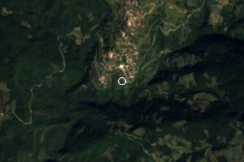


Drive times by road from OpenStreetMap, without traffic. Times marked ~ are estimated from the straight-line distance.
Location from OpenStreetMap. Written by Puebloteca.