Town Santa María Jaltianguis, Oaxaca Sierra Norte of Oaxaca
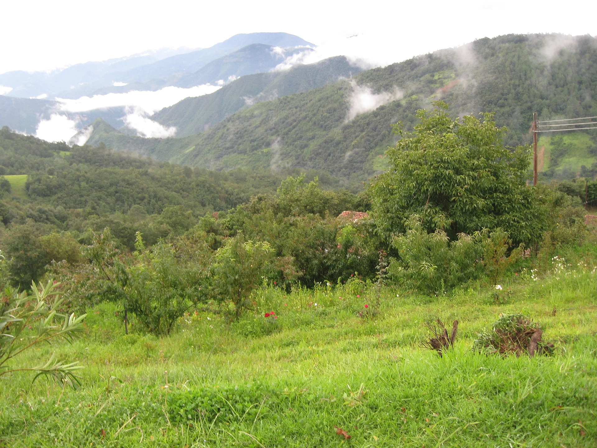
Sierra Juárez town at 2,039 m beside Ixtlán: cloud forest, a certified community sawmill and cabins.
From Oaxaca: 1 h 15 min by car (73 km by road) How to get there ↓
Near here
See everything nearby ↓


Plan your visit to Santa María Jaltianguis
Where to stay near Santa María Jaltianguis
Compare hotels, posadas and guest houses in Santa María Jaltianguis.
Tours to Santa María Jaltianguis
Day trips around Capulálpam de Méndez sometimes stop in Santa María Jaltianguis; a tour is the easy way to see it without a car.
 Tours from Oaxaca City
Hierve el Agua 2.5 hours, Mitla, Tule, Rugs and Mezcal for a Day
★ 4.9 (1,558) · From US$70
How to get to Santa María Jaltianguis
- From Oaxaca: about 1 h 15 min by road (~73 km)
- Nearest airport: Oaxaca (OAX), 1 h 27 min by car to Capulálpam de Méndez
Links open a partner site. We may earn a commission if you book, at no cost to you.
Tours from Oaxaca City, near Santa María Jaltianguis


Tours, prices and ratings from Viator, checked weekly. We may earn a commission if you book.
About Santa María Jaltianguis
Jaltianguis means "sand plaza": it comes from Nahuatl xalli, sand, and tianquiztli, market. It sits at 2,039 m in the Sierra Juárez, in the Ixtlán district, and had 583 residents in 2020, almost the same as in 2010 but far from the 1,137 it counted in 1970. Most of the municipality is forest: it has 127 localities, nearly all of a handful of people, such as Betzitiaá with six or Shia Yaa Bec Cuú with three.
The climate is one of the wettest in the state. Close to 1,900 mm falls a year, on about 300 days, the average hovers around 16 °C and mist is part of the landscape. Almost half the people speak an indigenous language, and every home in town has piped water, with mobile signal reaching a good share of them.
The community lives from the forest. It runs a certified sawmill that aims to use timber without wearing the woods down, and the same forest suits ecotourism, with cabins and outdoor activities. Around it rise Cerro Baratillo at 2,569 m and Naguetzi Too at 3,081 m, a little over 5 km to the northeast. There are comedores in Betzitiaá and a restaurant at the El Vivero site.
The town sits right on the route of the sierra villages: Ixtlán de Juárez is a little under 6 km away, Guelatao de Juárez, Benito Juárez's birthplace, about 6 km, and San Juan Atepec 7 km. Bring a rain jacket: though you can visit all year, the damp is felt even in May, the warmest month.
How to get to Santa María Jaltianguis
Drive from Oaxaca: 1 h 15 min, 73 km
Jaltianguis is on the Sierra Juárez route. From the city of Oaxaca take federal highway 175 east toward Tuxtepec; Ixtlán de Juárez is about 62 km along, and a one-day itinerary counts 1 h 45 from central Oaxaca to Guelatao, which is right beside Ixtlán. From Ixtlán the town is under 6 km by mountain road.
Capulálpam de Méndez, the neighbouring Pueblo Mágico, is about 17 km by road, around 19 minutes by car, and Guelatao about 6 km. We could not find the name of a bus line or a colectivo with a fixed schedule to Jaltianguis; in the Sierra Juárez, transport between villages is usually by pickup and taxi from Ixtlán, so go there and ask. Some excursions from Oaxaca also include round-trip transport.
No lodging is registered in the seat itself. To sleep, use the community cabins or the lodgings in Ixtlán de Juárez and Capulálpam. Mobile signal works in about half of the homes, and internet reaches about 44 percent.
Directions to Santa María Jaltianguis on Google Maps
Distances are in a straight line; the road is usually longer.
Links open a partner site. We may earn a commission if you book, at no cost to you.
From the nearest cities to Santa María Jaltianguis
- Oaxaca · 73 km by road, 1 h 15 min
- Tuxtepec · 150 km by road, 2 h 20 min
- Tehuacán · about 200 km by road, ~2 h 55 min
Drive times by road from OpenStreetMap, without traffic or stops. Times marked ~ are estimated from the straight-line distance.
Before you go to Santa María Jaltianguis: hours, prices and tips
- Best season
- Very wet: about 1,900 mm of rain a year, June the wettest month. May is the warmest (about 18 °C on average). PueblosAmerica (climate 1970-2025) · checked Oct 2026
- What to bring
- A rain jacket and warm layers; the town is at 2,039 m and is damp most of the year. PueblosAmerica (climate 1970-2025) · checked Oct 2026
Hours and prices change, especially around holidays. Each fact links to where we checked it.
Visiting Santa María Jaltianguis: what to see and do
Walk the centre and the church of Santa María Jaltianguis.
Head into the community forest and ask about the cabins and trails.
Ask about the certified community sawmill and how the forest is managed.
Watch mist climb Cerro Baratillo from a clearing.
Eat at the comedores in Betzitiaá or at El Vivero.
Continue to Ixtlán de Juárez and Guelatao, under 7 km away.
Plan your trip
Places to stay in Santa María Jaltianguis
Compare hotels, posadas, and rentals in and around Santa María Jaltianguis.
Tours & activities
Day trips around Capulálpam de Méndez sometimes stop in Santa María Jaltianguis; a tour is the easy way to see it without a car.
Rental cars
Pick up a car at OAX (Oaxaca): about 1 h 27 min by road to Capulálpam de Méndez, then 11 km more to Santa María Jaltianguis, on your own schedule.
Flights
The nearest airport with scheduled flights is Oaxaca (OAX), about 1 h 27 min by road from Capulálpam de Méndez, the base for Santa María Jaltianguis.
Mobile data
Signal can drop away from Capulálpam de Méndez: download a map of the way to Santa María Jaltianguis before you set out, or carry an eSIM with data.
Links open a partner site. We may earn a commission if you book, at no cost to you.
When to go to Santa María Jaltianguis cool
Santa María Jaltianguis shares the climate of Capulálpam de Méndez, 11 km away. The best months to visit are January, February, March, and December.
See the month-by-month climate of Capulálpam de Méndez
Weather in Santa María Jaltianguis now and the next 7 days
Live forecast from Open-Meteo. Chance of rain is the day's highest.
The closest Pueblo Mágico: Capulálpam de Méndez

Capulálpam de Méndez is the Pueblo Mágico closest to Santa María Jaltianguis, with places to stay, food, and more to see.
Also close to
- Mitla · Oaxaca · 52 km away
Closest to Santa María Jaltianguis
-
Ixtlán de Juárez · Town · 5 km away
-
San Juan Evangelista Analco · Village · 5 km away
-
Guelatao de Juárez · Town · 6 km away
-
Santa Catarina Ixtepeji · Town · 11 km away
-
Lachatao · Town · 12 km away
-
San Pablo Macuiltianguis · Village · 19 km away
-
San Miguel Yotao · Village · 20 km away
-
Santiago Comaltepec · Town · 23 km away


Near Santa María Jaltianguis
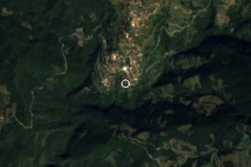


Drive times by road from OpenStreetMap, without traffic. Times marked ~ are estimated from the straight-line distance.
Location from OpenStreetMap. Written by Puebloteca.