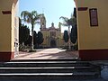

Town Chiautempan, Tlaxcala Municipality of Chiautempan La Malinche
Chiautempan locality on the slopes of La Malinche, once called Melendeztla, with two churches and a Nahuatl wedding dance.
From Chiautempan: 10 min by car (5 km by road) How to get there ↓
Near here


Plan your visit to San Pedro Tlalcuapan
Where to stay near San Pedro Tlalcuapan
Compare hotels, posadas and guest houses in San Pedro Tlalcuapan.
Tours to San Pedro Tlalcuapan
Day trips around Ixtenco sometimes stop in San Pedro Tlalcuapan; a tour is the easy way to see it without a car.
 Tours from Puebla City
Africam Safari Zoo Admission with Transportation
★ 4.8 (87) · From US$35
How to get to San Pedro Tlalcuapan
- From Chiautempan: about 10 min by road (~5 km)
- Nearest airport: Puebla (PBC), 1 h 16 min by car to Ixtenco
Links open a partner site. We may earn a commission if you book, at no cost to you.
Tours from Puebla City, near San Pedro Tlalcuapan


Tours, prices and ratings from Viator, checked weekly. We may earn a commission if you book.
About San Pedro Tlalcuapan
San Pedro Tlalcuapan is a locality in the municipality of Chiautempan, on the slopes of La Malinche volcano, with 4,143 inhabitants at the 2020 census; it is the municipality's third most populous place, after Santa Ana Chiautempan and San Bartolomé Cuahuixmatlac. Its altitude is around 2,400 to 2,460 metres. Its Nahuatl name is usually read as "at the head of the land", from tlalli, earth, and cuaitl, head, although another reading ties it to a place where vipers are plentiful.
Local tradition says the village was founded in October 1533 by royal decree of Charles V, as a reward to the captain and missionary Diego Martín Tzontlimatzi for his part in the evangelisation of Yucatán, Tabasco, Zacatecas and Aguascalientes. For many years it was known as Melendeztla, after the surname Meléndez borne by Tzontlimatzi's descendants. It originally included the neighbourhoods of Melendeztla and Muñoztla; around 1948 Muñoztla split off and became a village of its own, and the locality took the name Tlalcuapan de Bravo, which is why INEGI lists it as San Pedro Tlalcuapan de Nicolás Bravo. The boundary between the two communities is still disputed by their residents.
The village keeps strong indigenous roots and Nahuatl is spoken. Among its customs is the Xochipitzahuac, a dance performed at weddings. The main church is dedicated to Saint Peter the Apostle and the village also has the church of Nuestra Señora de la Defensa. Since 1975 many residents have emigrated to the United States.
How to get to San Pedro Tlalcuapan
Drive from Chiautempan: 10 min, 5 km
San Pedro Tlalcuapan is in the municipality of Chiautempan, on the slopes of La Malinche, south-east of Santa Ana Chiautempan, the municipal seat, about 5 km away in a straight line. From Tlaxcala city you pass through Chiautempan and then take local roads to the village; the starting point is the Tlaxcala bus terminal or central Chiautempan. There are no published schedules for a direct route to Tlalcuapan. Puebla city is about 27 km away in a straight line (about 30 minutes) and Ixtenco, the nearest Pueblo Mágico, about 24 km (about 30 minutes).
Directions to San Pedro Tlalcuapan on Google Maps
Distances are in a straight line; the road is usually longer.
Links open a partner site. We may earn a commission if you book, at no cost to you.
From the nearest cities to San Pedro Tlalcuapan
- Chiautempan · 5 km by road, 10 min
- San Martín Texmelucan · 37 km by road, 35 min
- Puebla · 32 km by road, 40 min
Drive times by road from OpenStreetMap, without traffic or stops. Times marked ~ are estimated from the straight-line distance.
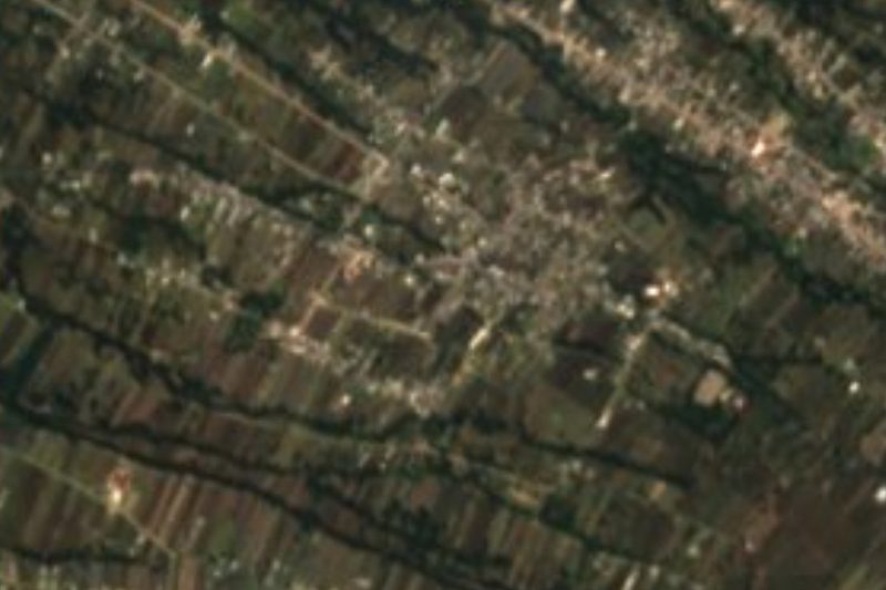
Map of San Pedro Tlalcuapan
Neighbourhoods and villages of San Pedro Tlalcuapan
Part of San Pedro Tlalcuapan or just outside it, closest first.
-
San Bartolomé Cuahuixmatlac · Town · 2 km from the centre
Chiautempan's second-largest locality, with a church claimed as the first hermitage in the Americas and the Walnut Fair each August. -
Acxotla del Monte · Town · 3 km from the centre
Santa María Acxotla del Monte, a village of Teolocholco on La Malinche's slope, with a Virgen del Pilar church and an October fair. -
La Magdalena Tlaltelulco · Town · 3 km from the centre
A town on the lower slopes of La Malinche, 8 km from Tlaxcala on the Chiautempan-Puebla road, its own municipality since 1995, with a barrio carnival. -
San Francisco Tetlanohcan · Town · 3 km from the centre
Seat of a municipality at 2,420 m on the slopes of La Malinche: St Francis church with a clock, carnival camadas and woollen textiles. -
Chiautempan · Town · 4 km from the centre
Santa Ana Chiautempan, 6 km from Tlaxcala: the cradle of the sarape, with a July fair, a 16th-century Franciscan convent and mole prieto. -
San José Aztatla · Town · 4 km from the centre
Contla village at the foot of La Malinche, with a 19th-century church of bare-stone towers and cantera angels, a jagüey pond and a 19 March saint's day. -
San Pedro Xochiteotla · Town · 4 km from the centre
Village in Chiautempan with 2,868 people in 2020, once a blanket-weaving place, with its San Pedro fiesta on 29 June.
Day trips and tours from San Pedro Tlalcuapan
The closest Pueblos Mágicos and places to visit, with the drive from San Pedro Tlalcuapan and tours that leave from it.


Times marked ~ are estimated from the distance. Links open a partner site. We may earn a commission if you book, at no cost to you.
Before you go: getting to and around San Pedro Tlalcuapan
- The nearest airport is Puebla (PBC).
- The best months to go are February, March, November, and December.
- 3 of the places on this page are more than 3 km from the centre: take a taxi, a ride-hailing app or a local bus.
- For day trips a rental car gives the most freedom; the tours above leave from San Pedro Tlalcuapan.
Visiting San Pedro Tlalcuapan: what to see and do
The church of San Pedro Apóstol, the village's main temple.
The church of Nuestra Señora de la Defensa.
The auxiliary municipal presidency of Tlalcuapan.
The Xochipitzahuac dance, part of the village's weddings.
The slopes of La Malinche above the village.
Plan your trip
Places to stay in San Pedro Tlalcuapan
Compare hotels, posadas, and rentals in and around San Pedro Tlalcuapan.
Tours & activities
Day trips around Ixtenco sometimes stop in San Pedro Tlalcuapan; a tour is the easy way to see it without a car.
Rental cars
Pick up a car at PBC (Puebla): about 1 h 16 min by road to Ixtenco, then 24 km more to San Pedro Tlalcuapan, on your own schedule.
Flights
The nearest airport with scheduled flights is Puebla (PBC), about 1 h 16 min by road from Ixtenco, the base for San Pedro Tlalcuapan.
Mobile data
Signal can drop away from Ixtenco: download a map of the way to San Pedro Tlalcuapan before you set out, or carry an eSIM with data.
Links open a partner site. We may earn a commission if you book, at no cost to you.
When to go to San Pedro Tlalcuapan cool
San Pedro Tlalcuapan shares the climate of Ixtenco, 24 km away. The best months to visit are February, March, November, and December.
See the month-by-month climate of Ixtenco
Weather in San Pedro Tlalcuapan now and the next 7 days
Live forecast from Open-Meteo. Chance of rain is the day's highest.
The closest Pueblo Mágico: Ixtenco

Ixtenco is the Pueblo Mágico closest to San Pedro Tlalcuapan, with places to stay, food, and more to see.
Also close to
- Huamantla · Tlaxcala · 25 km away
- Huejotzingo · Puebla · 29 km away
- Cholula · Puebla · 29 km away
- Tlaxco · Tlaxcala · 37 km away
- Atlixco · Puebla · 50 km away
Near San Pedro Tlalcuapan


Drive times by road from OpenStreetMap, without traffic. Times marked ~ are estimated from the straight-line distance.
Location from OpenStreetMap. Written by Puebloteca.