Village Tzompantepec, Tlaxcala Municipality of Tzompantepec La Malinche
Small seat near Apizaco where Tlaxcalans fought Cortés in 1519, with the painted façade of the Divino Salvador church and clay-comal workshops.
From Chiautempan: 20 min by car (19 km by road) How to get there ↓
Near here
See everything nearby ↓


Plan your visit to Tzompantepec
Where to stay near Tzompantepec
Compare hotels, posadas and guest houses in Tzompantepec.
Tours to Tzompantepec
Day trips and guided outings from Huamantla often include Tzompantepec; with a local guide you can get there without a car.
 Tours from Puebla City
Africam Safari Zoo Admission with Transportation
★ 4.8 (87) · From US$35
How to get to Tzompantepec
- From Chiautempan: about 20 min by road (~19 km)
- Nearest airport: Puebla (PBC), 1 h 5 min by car to Huamantla
Links open a partner site. We may earn a commission if you book, at no cost to you.
Tours from Puebla City, near Tzompantepec


Tours, prices and ratings from Viator, checked weekly. We may earn a commission if you book.
About Tzompantepec
San Salvador Tzompantepec is the seat of the municipality of Tzompantepec in eastern Tlaxcala, about 2,460 metres up on the northern slopes of La Malinche and 9 km southeast of Apizaco. It is a small place: 2,102 people lived here at the 2020 census, while the whole municipality has more than 18,000. The name comes from tzompantli, the rack where the skulls of sacrificed people were displayed, plus the place ending tepec, and is translated as "place where skulls are kept".
The area holds some of the oldest traces of settlement in Tlaxcala, and archaeologists use the name Tzompantepec phase for the period, around 1700-1200 BC, when the first permanent villages appeared here, with communal kilns for firing pottery and cooking maguey leaves. Centuries later it was one of the lordships of pre-Hispanic Tlaxcala. In early September 1519 the country around it saw the battles between the Tlaxcalans under Xicohténcatl Axayacatzin and Hernán Cortés's Spaniards; local tradition holds that on Tzompantzingo hill the Spaniards lost their banner. After those fights the Tlaxcalans became Cortés's allies. The Franciscans built a visiting chapel that answered to Huamantla, and in colonial times Tzompantepec ruled over what are now Cuaxomulco, Tetlanohcan and Teacalco. The municipality was created in 1822. On 1 January 1873 the presidential train of Sebastián Lerdo de Tejada, opening the Mexican Railway between Mexico City and Veracruz, passed the village station to cheering crowds.
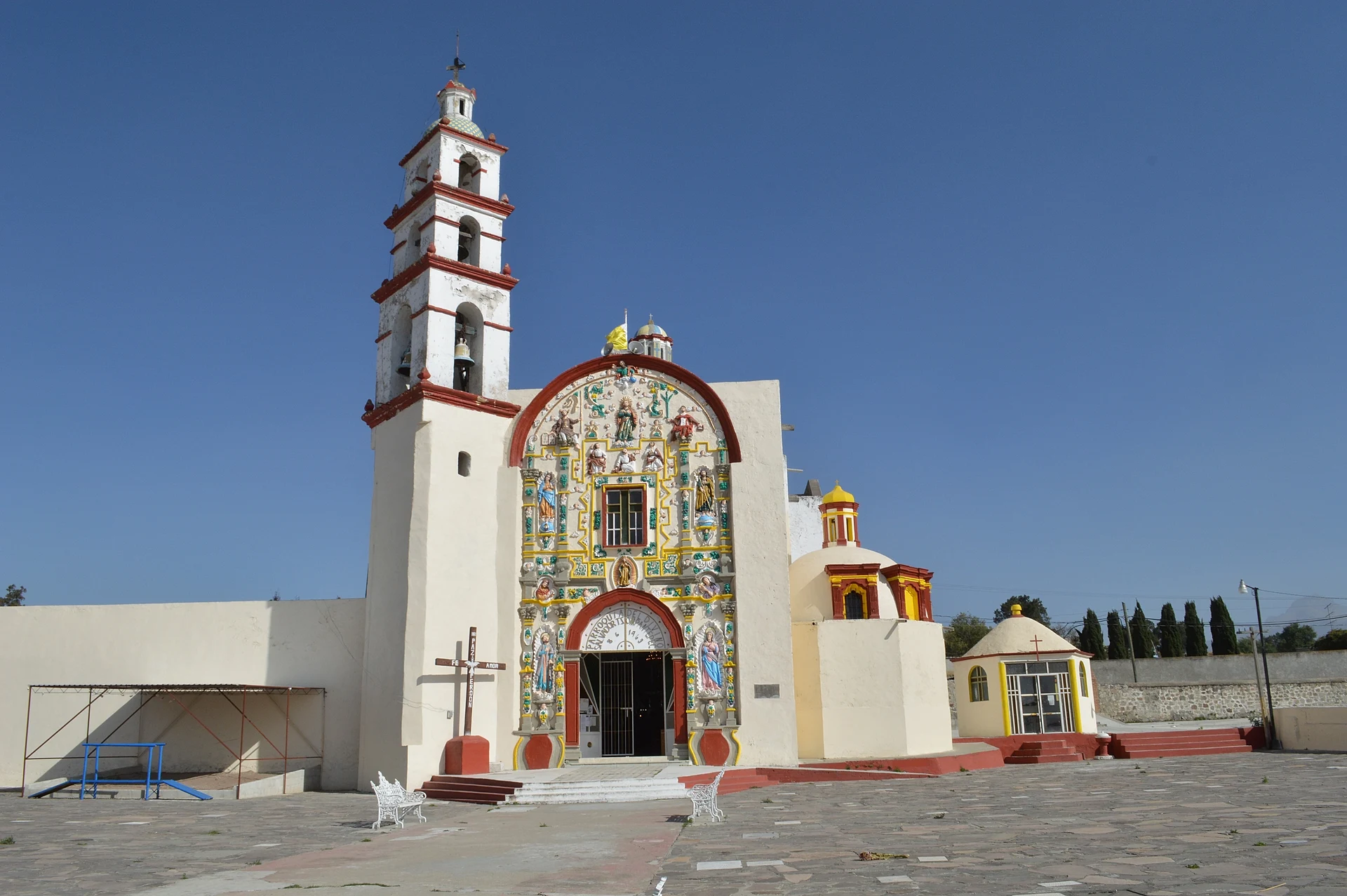
The Divino Salvador parish church stands out from afar for its painted stucco façade with estípite pilasters: at the top Christ appears in glory with Peter, James and John and with Moses and Elijah, the Transfiguration, flanked by Saint Anne and Saint Joachim. The interior was redecorated in the early 20th century but keeps a painting of the souls in purgatory by Antonio Caro, dated 1681. The atrium is still used as a cemetery and is enclosed by a wall of inverted arches. The Divino Salvador feast falls on 6 August, with mañanitas and mariachi at 5 am and a committee that goes out to meet the image at the edge of town; at carnival, camadas of huehues dance in velvet costumes and carved wooden masks. Clay is the local trade: Tzompantepec has workshops making comales, large incised pots and burnished pottery.
How to get to Tzompantepec
Drive from Chiautempan: 20 min, 19 km
From Apizaco it is about 8 km, roughly 10 minutes: head south on federal highway 119 (Apizaco-Apetatitlán) and follow Calle 16 de Septiembre into the centre of Tzompantepec. From Tlaxcala city it is about 25 km, roughly 25 minutes, on the 117D Tlaxcala-Apizaco toll road and the Apizaco bypass (highway 136), joining the 119 for the last stretch. From Huamantla it is about 23 km, roughly 20 minutes, on highway 136 toward Apizaco. From Puebla it is about 55 km, roughly 55 minutes, on federal highway 121 and the 117D.
By public transport: ATAH buses leave Mexico City's TAPO terminal for Apizaco every hour (about 2 hours); from Apizaco a taxi to Tzompantepec takes about 8 minutes.
Directions to Tzompantepec on Google Maps
Distances are in a straight line; the road is usually longer.
Links open a partner site. We may earn a commission if you book, at no cost to you.
From the nearest cities to Tzompantepec
- Chiautempan · 19 km by road, 20 min
- Huamantla · 23 km by road, 20 min
- San Martín Texmelucan · 47 km by road, 35 min
Drive times by road from OpenStreetMap, without traffic or stops. Times marked ~ are estimated from the straight-line distance.
Before you go to Tzompantepec: hours, prices and tips
- Best season
- Divino Salvador feast on 6 August (some sources give the 7th as the main day), with mañanitas at 5 am. Carnival with camadas of huehues before Lent. Wikipedia (Municipio de Tzompantepec) · checked Oct 2026
Hours and prices change, especially around holidays. Each fact links to where we checked it.
Visiting Tzompantepec: what to see and do
The painted façade of the Divino Salvador parish church, with the Transfiguration.
Antonio Caro's 1681 painting of the souls in purgatory inside the church.
The atrium cemetery with its wall of inverted arches.
The village workshops making clay comales and pots.
The Divino Salvador feast on 6 August.
Plan your trip
Places to stay in Tzompantepec
Compare hotels, posadas, and rentals in and around Tzompantepec.
Tours & activities
Day trips and guided outings from Huamantla often include Tzompantepec; with a local guide you can get there without a car.
Rental cars
Pick up a car at PBC (Puebla): about 1 h 5 min by road to Huamantla, then 19 km more to Tzompantepec, on your own schedule.
Flights
The nearest airport with scheduled flights is Puebla (PBC), about 1 h 5 min by road from Huamantla, the base for Tzompantepec.
Mobile data
Signal can drop away from Huamantla: download a map of the way to Tzompantepec before you set out, or carry an eSIM with data.
Links open a partner site. We may earn a commission if you book, at no cost to you.
When to go to Tzompantepec cool
Tzompantepec shares the climate of Huamantla, 19 km away. The best months to visit are January, February, November, and December.
See the month-by-month climate of Huamantla
Weather in Tzompantepec now and the next 7 days
Live forecast from Open-Meteo. Chance of rain is the day's highest.
The closest Pueblo Mágico: Huamantla

Huamantla is the Pueblo Mágico closest to Tzompantepec, with places to stay, food, and more to see.
Also close to
- Ixtenco · Tlaxcala · 22 km away
- Tlaxco · Tlaxcala · 27 km away
- Huejotzingo · Puebla · 41 km away
- Cholula · Puebla · 42 km away
- Chignahuapan · Puebla · 51 km away
Closest to Tzompantepec
-
San Andrés Ahuashuatepec · Town · 1 km away
-
San Juan Quetzalcoapan · Village · 2 km away
-
Cuaxomulco · Town · 3 km away
-
Cuatlapanga · Mountain · 4 km away
-
San José Teacalco · Town · 5 km away
-
San Miguel Contla · Town · 5 km away
-
Santa María Texcalac · Town · 5 km away
-
Xaloztoc · Town · 5 km away


Near Tzompantepec


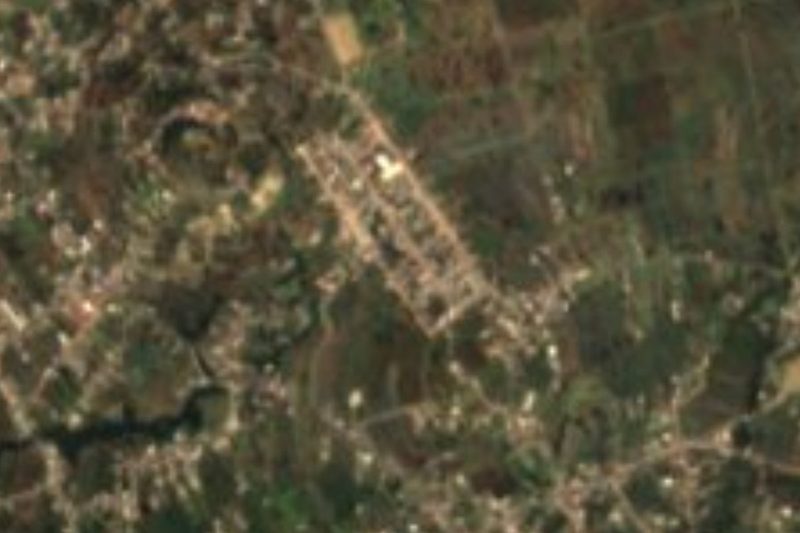


Drive times by road from OpenStreetMap, without traffic. Times marked ~ are estimated from the straight-line distance.
Location from OpenStreetMap. Written by Puebloteca.