

City Los Cabos, Baja California Sur Municipality of Los Cabos Los Cabos
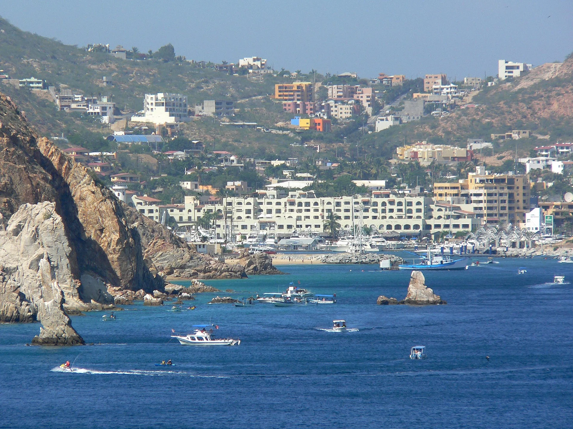
The resort city at the tip of Baja: a marina full of sportfishing boats, Médano Beach, loud nightlife and water taxis to El Arco.
From San José del Cabo: 30 min by car (33 km by road) How to get there ↓
Near here


Plan your visit to Cabo San Lucas
Where to stay near Cabo San Lucas
Compare hotels, posadas and guest houses in Cabo San Lucas.
Tours to Cabo San Lucas
Day trips and guided outings from Todos Santos often include Cabo San Lucas; with a local guide you can get there without a car.
 Cabo San Lucas Luxury Catamaran Whale Watching
★ 4.9 (2,294) · From US$129
How to get to Cabo San Lucas
- From San José del Cabo: about 30 min by road (~33 km)
- Nearest airport: Los Cabos (SJD), 1 h 17 min by car to Todos Santos
Links open a partner site. We may earn a commission if you book, at no cost to you.
Popular tours to Cabo San Lucas


Tours, prices and ratings from Viator, checked weekly. We may earn a commission if you book.
About Cabo San Lucas
Cabo San Lucas sits at the very southern tip of the Baja California peninsula, in the municipality of Los Cabos, Baja California Sur, where the Pacific Ocean meets the Sea of Cortez. San José del Cabo, the municipal seat, is about 33 km to the northeast along the coastal Tourist Corridor. The 2020 census counted 202,694 people, a jump from 68,463 in 2010 that partly reflects the merger of neighbouring settlements such as Colonia del Sol and Las Palmas into the city; it is now the second largest city in the state after La Paz.
The Pericú people lived on this coast long before Europeans arrived and called the place Yenecamú. Spanish navigators named the cape after Saint Luke in the 1540s, and its sheltered bay became a watering stop on the Pacific sea routes; permanent settlement in the cape region only began after the Jesuits founded the mission of San José del Cabo in 1730. For most of the twentieth century Cabo San Lucas was a fishing village built around tuna: a floating cannery ship arrived in 1925, an onshore plant followed by 1929, and canning remained the main employer until the company left in 1979. A few fishing lodges drew wealthy anglers from the 1950s, but the real change came with the completion of the Transpeninsular Highway in 1973 and the international airport in 1976, after which the federal government promoted Los Cabos as a planned resort destination.
Today the town wraps around a large marina lined with restaurants, the Puerto Paraíso mall and the docks where sportfishing boats, sailboats and water taxis leave. Just east of it, Médano Beach is the long, busy town beach, with calm water, beach clubs and kayak and paddleboard rentals, and views straight across to Land's End. From the marina, glass-bottom boats and pangas run out to El Arco, the granite arch at the end of the peninsula, to the sea lion colony and to Playa del Amor, all inside a flora and fauna protection area decreed in 1973. The streets just inland, such as Calle Miguel Hidalgo and Boulevard Lázaro Cárdenas, hold the bars and nightclubs Cabo is known for, among them Cabo Wabo Cantina and El Squid Roe, and the small old centre keeps the Plaza Amelia Wilkes, the Church of San Lucas and a natural history museum.
Fishing is still at the heart of the place: Bisbee's Los Cabos Offshore, held every October, is billed as the richest marlin tournament in the world, and charter pangas and yachts go out year round for marlin, tuna and dorado. Humpback whales pass offshore in winter, with the best months roughly January to March. The climate is hot desert, with mild, sunny winters, hot summers and a hurricane risk from late summer into autumn; Hurricane Odile made landfall here in September 2014. Cruise ships anchor in the bay and ferry passengers to shore, so the marina can be crowded on port days. Note that the Pacific-facing beaches west of the arch have heavy shore break and are not safe for swimming.
How to get to Cabo San Lucas
Drive from San José del Cabo: 30 min, 33 km
Los Cabos International Airport (SJD) is just north of San José del Cabo, about 45 km by road from Cabo San Lucas along the Tourist Corridor. The Ruta del Desierto airport bus leaves from outside Terminals 1 and 2 and takes 30 to 60 minutes depending on traffic; licensed taxis and pre-booked shuttles are the other options. Águila buses connect Cabo San Lucas with San José del Cabo and La Paz, from a terminal north of the centre on the road to Todos Santos. Cruise ships anchor in the bay and tender passengers to the marina.
Directions to Cabo San Lucas on Google Maps
Distances are in a straight line; the road is usually longer.
Links open a partner site. We may earn a commission if you book, at no cost to you.
From the nearest cities to Cabo San Lucas
- San José del Cabo · 33 km by road, 30 min
- La Paz · 159 km by road, 2 h 15 min
- Culiacán · about 435 km by road, ~6 h 25 min
Drive times by road from OpenStreetMap, without traffic or stops. Times marked ~ are estimated from the straight-line distance.
What to see in Cabo San Lucas 9
Sights with their own page, closest to the centre first.
Beaches
-
Playa El Médano · Beach · 3 km from the centre
Cabo San Lucas's main swimming beach: a long, sheltered bay beach with beach clubs, water sports and Land's End at one end. -
Playa del Amor · Beach · 3 km from the centre
Lover's Beach, the sheltered Sea of Cortez cove beside El Arco, reached only by water taxi; calm enough to swim and snorkel on most days. -
Playa del Divorcio · Beach · 3 km from the centre
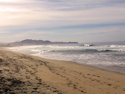
Divorce Beach, the Pacific side of the sand neck at Land's End: wide sand and heavy surf, reached through Playa del Amor. Not for swimming. -
Bahía Santa María · Beach · 11 km from the centre
A horseshoe cove on the Corridor with calm, clear water, a reef at both rocky ends and a free lot, restrooms and lifeguards. -
Bahía Chileno · Beach · 13 km from the centre
A sheltered cove on the Los Cabos Corridor with a public beach, lifeguards and a reef you can snorkel straight from the sand. -
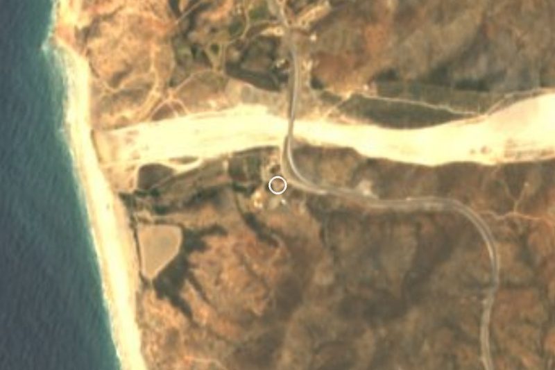
Playa Migriño · Beach · 25 km from the centre
A wide Pacific beach with dunes north of Cabo San Lucas, known for camel and ATV tours; the surf and currents make swimming unsafe.

Landmarks and museums
-
Marina Cabo San Lucas · Landmark · 2 km from the centre
The harbour at the heart of Cabo San Lucas: yachts and sportfishing boats, a boardwalk, restaurants, and the dock for El Arco water taxis and whale tours. -
El Arco de Cabo San Lucas · Landmark · 3 km from the centre
The granite sea arch at Land's End, the very tip of Baja, with a sea lion colony and Pelican Rock nearby; seen by boat from the Cabo marina. -
Centro Histórico de San José del Cabo · Landmark · 30 km from the centre
The old mission town at the heart of San José del Cabo: Plaza Mijares, the parish church, galleries on Álvaro Obregón and the Thursday Art Walk.

Map of Cabo San Lucas
Day trips and tours from Cabo San Lucas
The closest Pueblos Mágicos and places to visit, with the drive from Cabo San Lucas and tours that leave from it.



Times marked ~ are estimated from the distance. Links open a partner site. We may earn a commission if you book, at no cost to you.
Before you go: getting to and around Cabo San Lucas
- The nearest airport is Los Cabos (SJD).
- The best months to go are March, April, May, and December.
- 4 of the places on this page are more than 3 km from the centre: take a taxi, a ride-hailing app or a local bus.
- El Arco de Cabo San Lucas, Playa del Amor, and Playa del Divorcio: reached by boat or on foot, not by road (each page says from where).
- For day trips a rental car gives the most freedom; the tours above leave from Cabo San Lucas.
Before you go to Cabo San Lucas: hours, prices and tips
- Best season
- Humpback whales pass Cabo in winter, roughly January to March, with early March the peak. Bisbee's marlin tournament fills the town every October. Wikivoyage · checked Oct 2026
- Rules
- Do not swim or walk at the water's edge on the Pacific-facing beaches, including those near El Arco: big waves can arrive with little warning. Wikivoyage · checked Oct 2026
Hours and prices change, especially around holidays. Each fact links to where we checked it.
Visiting Cabo San Lucas: what to see and do
Take a water taxi or glass-bottom boat from the marina to El Arco, the sea lion colony and Playa del Amor.
Swim, kayak or paddleboard at Médano Beach, the calm town beach facing Land's End.
Charter a panga or yacht for marlin, tuna and dorado, or watch the boats weigh in at the marina.
Go whale watching in winter, when humpbacks pass the cape, roughly January to March.
Walk the marina boardwalk at sunset and eat fish tacos in the streets behind it.
Visit the Plaza Amelia Wilkes, the Church of San Lucas and the natural history museum in the old centre.
Spend a night on Calle Hidalgo and Boulevard Lázaro Cárdenas, home of Cabo Wabo and El Squid Roe.
Plan your trip
Places to stay in Cabo San Lucas
Compare hotels, posadas, and rentals in and around Cabo San Lucas.
Tours & activities
Day trips and guided outings from Todos Santos often include Cabo San Lucas; with a local guide you can get there without a car.
Rental cars
Pick up a car at SJD (Los Cabos): about 1 h 17 min by road to Todos Santos, then 70 km more to Cabo San Lucas, on your own schedule.
Flights
The nearest airport with scheduled flights is Los Cabos (SJD), about 1 h 17 min by road from Todos Santos, the base for Cabo San Lucas.
Mobile data
Signal can drop away from Todos Santos: download a map of the way to Cabo San Lucas before you set out, or carry an eSIM with data.
Links open a partner site. We may earn a commission if you book, at no cost to you.
Photos
When to go to Cabo San Lucas mild
Cabo San Lucas shares the climate of Todos Santos, 70 km away. The best months to visit are March, April, May, and December.
See the month-by-month climate of Todos Santos
Weather in Cabo San Lucas now and the next 7 days
Live forecast from Open-Meteo. Chance of rain is the day's highest.
The closest Pueblo Mágico: Todos Santos

Todos Santos is the Pueblo Mágico closest to Cabo San Lucas, with places to stay, food, and more to see.
Near Cabo San Lucas

Drive times by road from OpenStreetMap, without traffic. Times marked ~ are estimated from the straight-line distance.
Location from OpenStreetMap. Written by Puebloteca.