Nature reserve Xalatlaco, Estado de México Toluca Valley
The forest corridor between Mexico City, Toluca and Cuernavaca that feeds all three cities' aquifers; visit it at Zempoala, La Marquesa or Ajusco.
From Toluca: 50 min by car (48 km by road) How to get there ↓
Near here
See everything nearby ↓


Plan your visit to Bosque de Agua
Where to stay near Bosque de Agua
Compare hotels, posadas and guest houses in Bosque de Agua.
Tours to Bosque de Agua
Day trips and guided outings from Tepoztlán often include Bosque de Agua; with a local guide you can get there without a car.
 Tours from Cuernavaca
3hr Cooking Class in Cuernavaca 8 Recipes and Bottomless Drinks
From US$59
How to get to Bosque de Agua
- From Toluca: about 50 min by road (~48 km)
- Nearest airport: Mexico City (MEX), 1 h 25 min by car to Tepoztlán
Links open a partner site. We may earn a commission if you book, at no cost to you.
Tours from Cuernavaca, near Bosque de Agua


Tours, prices and ratings from Viator, checked weekly. We may earn a commission if you book.
About Bosque de Agua
The Bosque de Agua, or Great Water Forest, is not a single park with a ticket booth but a band of forested mountains, about 250,000 hectares in all, that separates Mexico City from Toluca and Cuernavaca. It takes in the Chichinautzin, Zempoala, Ajusco and Las Cruces ranges of the Trans-Mexican Volcanic Belt and is shared by 37 municipalities and boroughs: 22 in the State of Mexico (Xalatlaco, Ocuilan, Tianguistenco, Ocoyoacac, Lerma and Huixquilucan among them), eight in Morelos and seven in the capital. Some 21 protected areas lie wholly or partly inside it, and around 80% of the land is communally owned.
The name was coined by researchers at UAM Xochimilco, backed by Greenpeace Mexico, to make a point about what the forest does. Its high ground is the headwaters of four basins, the Valley of Mexico, the Balsas, the Lerma and the Pánuco, and rain soaking into it recharges ten aquifers. Those supply at least 70% of the water used in Mexico City and practically all of Toluca's and Cuernavaca's. The idea is old: in Nahuatl the Ajusco was Axochco, "where the water blooms".
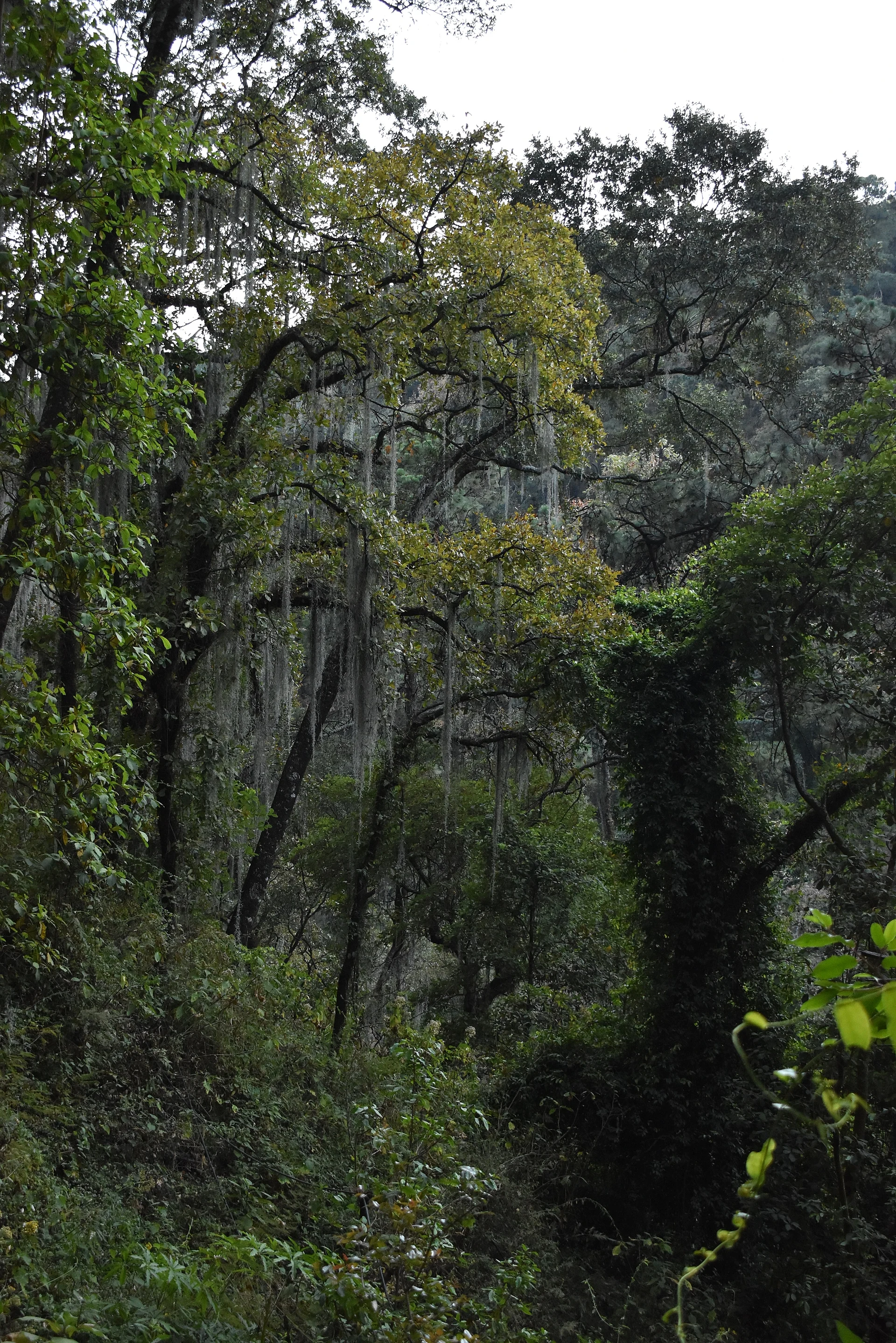
The upper slopes are dominated by sacred fir (oyamel), mountain pine and oak, with coyotes, bobcats, opossums, squirrels and snakes in the woods and finches, hummingbirds and swallows overhead; the Xochimilco wetlands, also part of the corridor, are home to the axolotl. The corridor is under pressure from urban sprawl, illegal logging, fires and new roads, and in January 2025 the federal environment ministry and its enforcement agency signed an agreement to protect it with the governments of Mexico City, the State of Mexico and Morelos.
Travellers get to know the Bosque de Agua through its doorways: the Lagunas de Zempoala between Huitzilac and Ocuilan, La Marquesa on the Toluca highway, and the Ajusco and Desierto de los Leones on the Mexico City side.
How to get to Bosque de Agua
Drive from Toluca: 50 min, 48 km
Because it is a corridor rather than one site, you reach it by several roads. For La Marquesa (Insurgente Miguel Hidalgo National Park), take the Mexico City–Toluca highway (15/15D) and exit at La Marquesa; it is about 30 to 40 minutes from Metepec. For the Lagunas de Zempoala, take the Mexico City–Cuernavaca toll road (95D) to Huitzilac; in the centre of Huitzilac pick up the federal highway towards Toluca, and the public-use area starts at about km 14.5. From Toluca, take the Santiago–Chalma road. The Ajusco and the Desierto de los Leones are reached from Tlalpan and Cuajimalpa, inside Mexico City.
CONANP lists Pullman de Morelos buses from Mexico City's Taxqueña terminal and Flecha Roja buses from Cuernavaca for Zempoala, and buses between Toluca and the capital pass La Marquesa, but to move between the forests a car is the practical choice. Cuernavaca is about 30 km in a straight line from the State of Mexico side of the corridor, and Tepoztlán, the nearest Pueblo Mágico, about the same; by road it is further.
Directions to Bosque de Agua on Google Maps
Distances are in a straight line; the road is usually longer.
Links open a partner site. We may earn a commission if you book, at no cost to you.
From the nearest cities to Bosque de Agua
- Toluca · 48 km by road, 50 min
- Mexico City · 48 km by road, 55 min
- Cuernavaca · 47 km by road, 1 h 5 min
Drive times by road from OpenStreetMap, without traffic or stops. Times marked ~ are estimated from the straight-line distance.
Before you go to Bosque de Agua: hours, prices and tips
- Hours
- At the Lagunas de Zempoala, the corridor's best-known doorway, the national park opens Saturdays, Sundays and public holidays, 9 am to 6 pm. CONANP · checked Oct 2026
- Entry
- At Zempoala the national park fee is 95 pesos per person per day; Mexicans and foreign residents with ID pay half, students and teachers get 75% off, and seniors, people with disabilities and children under 12 enter free. CONANP · checked Oct 2026
Hours and prices change, especially around holidays. Each fact links to where we checked it.
Visiting Bosque de Agua: what to see and do
Walk the shore of Laguna de Zempoala, in the national park on the Morelos–State of Mexico line.
Spend a day in the valleys of La Marquesa, with horses, trout ponds and trails through the pines.
Climb the Ajusco, the highest ground in Mexico City.
Visit the Carmelite convent of the Desierto de los Leones in its fir forest.
Walk among the fir, mountain pine and oak forests that water three cities.
Plan your trip
Places to stay in Bosque de Agua
Compare hotels, posadas, and rentals in and around Bosque de Agua.
Tours & activities
Day trips and guided outings from Tepoztlán often include Bosque de Agua; with a local guide you can get there without a car.
Rental cars
Pick up a car at MEX (Mexico City): about 1 h 25 min by road to Tepoztlán, then 29 km more to Bosque de Agua, on your own schedule.
Flights
The nearest airport with scheduled flights is Mexico City (MEX), about 1 h 25 min by road from Tepoztlán, the base for Bosque de Agua.
Travel insurance
If you plan on hiking at Bosque de Agua, check that your policy covers it: some plans leave adventure activities out.
Mobile data
Signal can drop away from Tepoztlán: download a map of the way to Bosque de Agua before you set out, or carry an eSIM with data.
Links open a partner site. We may earn a commission if you book, at no cost to you.
When to go to Bosque de Agua mild
Bosque de Agua shares the climate of Tepoztlán, 29 km away. The best months to visit are January, February, March, and December.
See the month-by-month climate of Tepoztlán
Weather in Bosque de Agua now and the next 7 days
Live forecast from Open-Meteo. Chance of rain is the day's highest.
The closest Pueblo Mágico: Tepoztlán

Tepoztlán is the Pueblo Mágico closest to Bosque de Agua, with places to stay, food, and more to see.
Also close to
- Malinalco · Estado de México · 32 km away
- Metepec · Estado de México · 33 km away
- Xochitepec · Morelos · 41 km away
- Tlayacapan · Morelos · 41 km away
- Ixtapan de la Sal · Estado de México · 54 km away
Closest to Bosque de Agua
-
Ajusco · Mountain · 7 km away
-
Fierro del Toro · Village · 10 km away
-
Santo Tomás Ajusco · Village · 10 km away
-
Cerro San Miguel · Mountain · 11 km away
-
San Miguel Ajusco · Town · 11 km away
-
Lagunas de Zempoala · Lake · 13 km away
-
Parres El Guarda · Village · 13 km away
-
Tres Marías · Village · 14 km away


Near Bosque de Agua


Drive times by road from OpenStreetMap, without traffic. Times marked ~ are estimated from the straight-line distance.
Lists with Bosque de Agua
Nature Parks in Estado de México · 13 Nature Parks near Cuernavaca · 18 Nature Parks near Tepoztlán · 19 Nature Parks near Malinalco · 17 Nature Parks near Metepec · 16 Nature Parks near Mexico City · 16 Nature Parks near Toluca · 15 Nature Parks near Xochitepec · 15Location from OpenStreetMap. Written by Puebloteca.