Village Tlalpan, Ciudad de México Municipality of Tlalpan Valley of Mexico
A Tlalpan founding village at 3,000 m with a 16th-century church and a pre-Hispanic stone in its atrium, on the way to Cumbres del Ajusco park.
From Mexico City: 35 min by car (31 km by road) How to get there ↓
Near here
See everything nearby ↓


Plan your visit to Santo Tomás Ajusco
Where to stay near Santo Tomás Ajusco
Compare hotels, posadas and guest houses in Santo Tomás Ajusco.
Tours to Santo Tomás Ajusco
Day trips and guided outings from Tepoztlán often include Santo Tomás Ajusco; with a local guide you can get there without a car.
 Tours from Mexico City
Teotihuacan pyramids morning or afternoon without tourist traps
★ 4.9 (10,269) · From US$59
How to get to Santo Tomás Ajusco
- From Mexico City: about 35 min by road (~31 km)
- Nearest airport: Mexico City (MEX), 1 h 25 min by car to Tepoztlán
Links open a partner site. We may earn a commission if you book, at no cost to you.
Tours from Mexico City, near Santo Tomás Ajusco


Tours, prices and ratings from Viator, checked weekly. We may earn a commission if you book.
About Santo Tomás Ajusco
Santo Tomás Ajusco is one of the original villages of Tlalpan, in the south of Mexico City, at about 3,000 metres, where the air is noticeably cooler than in the rest of the city. Its Nahuatl name, Axochco, is read as "where water springs forth" and gave Spanish the word Ajusco. It was founded in 1531, early in the colonial period, to gather Nahua and Otomí people on land once dominated by the Tepanecs of Azcapotzalco, and it was granted the rank of pueblo in 1609. The Archivo General de la Nación keeps a record of its foundation written in Nahuatl.
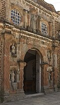
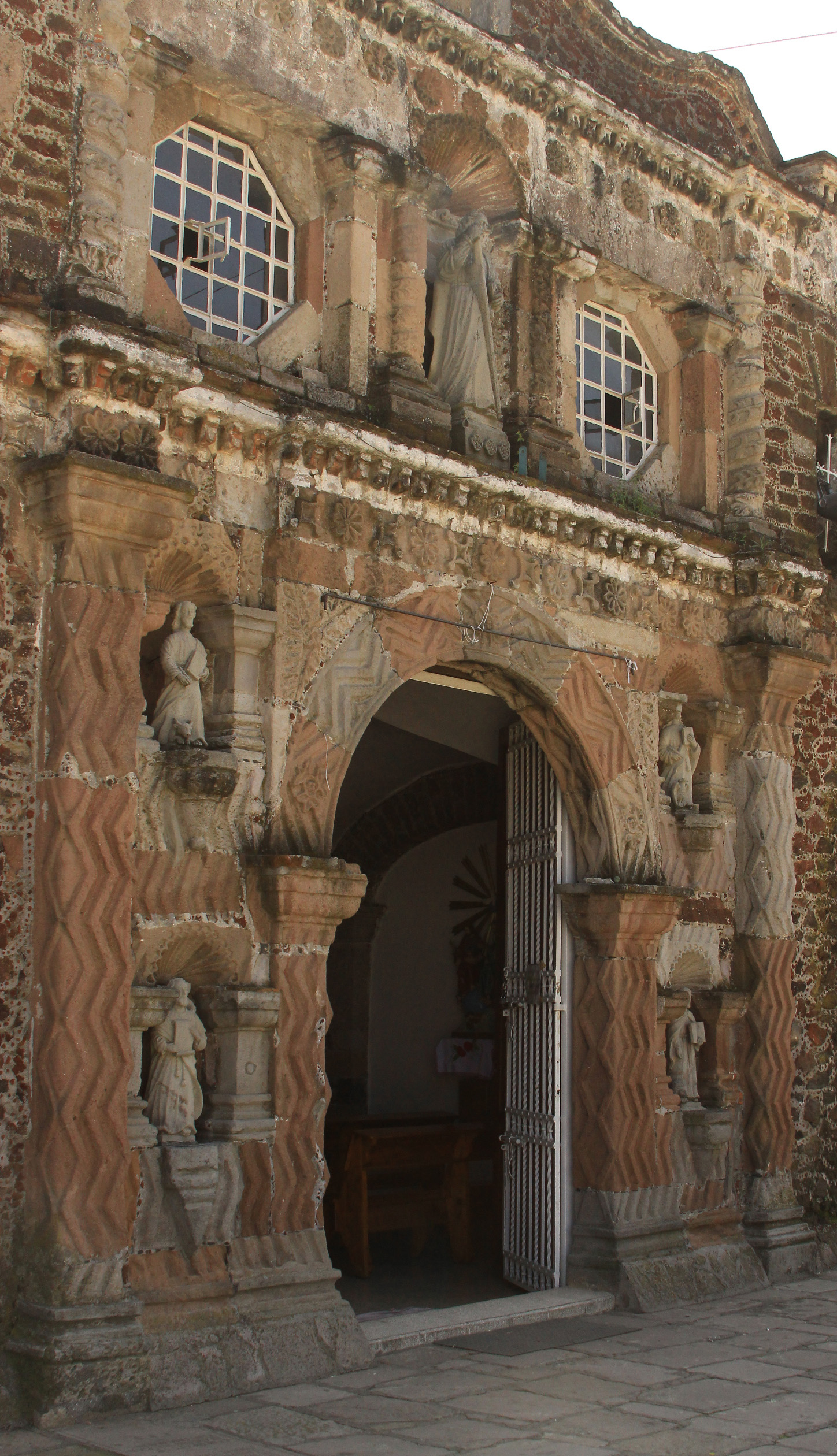
The village centres on the parish of Santo Tomás Apóstol, from the 16th century: a single nave, a bell tower and a stone façade with niches for the four Evangelists and, above the door, the patron saint. The atrium holds "el cuartillo", a pre-Hispanic cube-shaped carved block brought from the Tequipa pyramid, and a tepetlacalli, a ceremonial stone chest, with Mexica-style reliefs. The parish also serves the chapels of San Miguel Xicalco, San Miguel Ajusco and Santa María Magdalena Petlacalco. A stone cross stands in front of the church and a bandstand kiosk on the plaza.
The main feast is 21 December, Saint Thomas's day; 3 July and 2 February (Candlemas) are also celebrated. Santo Tomás is a regular stop for people heading up to Cumbres del Ajusco National Park, about 3.4 km away, and on to the trails of the Pico del Águila (the volcano has its own page on this site). Food vendors line the highway for the road, and the market in San Miguel Topilejo is a good place to eat.
How to get to Santo Tomás Ajusco
Drive from Mexico City: 35 min, 31 km
By car: from Calzada de Tlalpan take the free exit toward Cuernavaca and, at kilometre 25, the turn-off for San Miguel Xicalco leads straight to the village. The other route is the Picacho-Ajusco highway, which starts at the junction of Periférico Sur and Bulevar de la Luz; it is the main road up the Ajusco.
By public transport: there is no Metro or Metrobús to the village. From Metro Universidad (Line 3) a bus runs to San Miguel Ajusco, about 90 minutes, and from there you continue by local taxi. Another option is Metro Line 2 to Tasqueña, the Tren Ligero to Estadio Azteca and then the green pesero marked "Ajusco" at the stop beside the stadium; a bus to Santo Tomás Ajusco also leaves from near Six Flags. Ask the driver for the village by name and check the last return. A local taxi from San Miguel Ajusco to most points in the park costs about 50 to 100 pesos and takes 15 to 20 minutes; an app taxi from other parts of the city can take up to 90 minutes depending on traffic.
Directions to Santo Tomás Ajusco on Google Maps
Distances are in a straight line; the road is usually longer.
Links open a partner site. We may earn a commission if you book, at no cost to you.
From the nearest cities to Santo Tomás Ajusco
- Mexico City · 31 km by road, 35 min
- Cuernavaca · 48 km by road, 1 h 10 min
- Toluca · 66 km by road, 1 h 15 min
Drive times by road from OpenStreetMap, without traffic or stops. Times marked ~ are estimated from the straight-line distance.
Before you go to Santo Tomás Ajusco: hours, prices and tips
- Best time of day
- The main feast is 21 December (Saint Thomas the Apostle); 3 July and 2 February are also celebrated. Wikipedia es: Santo Tomás Ajusco · checked Oct 2026
- What to bring
- Bring a jacket: at about 3,000 m the village is cooler than the rest of the city. Ciudad de México: Santo Tomás Ajusco · checked Oct 2026
Hours and prices change, especially around holidays. Each fact links to where we checked it.
Visiting Santo Tomás Ajusco: what to see and do
Step into the 16th-century parish of Santo Tomás Apóstol and look at its stone façade with the four Evangelists.
Find "el cuartillo" in the atrium, the pre-Hispanic block brought from the Tequipa pyramid.
Look at the tepetlacalli, the ceremonial stone chest with Mexica-style reliefs.
Sit by the bandstand kiosk on the plaza and the stone cross in front of the church.
Come in December: 21 December is the feast of Saint Thomas.
Continue to Cumbres del Ajusco National Park, about 3.4 km away, to walk among forest and high grassland.
Plan your trip
Places to stay in Santo Tomás Ajusco
Compare hotels, posadas, and rentals in and around Santo Tomás Ajusco.
Tours & activities
Day trips and guided outings from Tepoztlán often include Santo Tomás Ajusco; with a local guide you can get there without a car.
Rental cars
Pick up a car at MEX (Mexico City): about 1 h 25 min by road to Tepoztlán, then 28 km more to Santo Tomás Ajusco, on your own schedule.
Flights
The nearest airport with scheduled flights is Mexico City (MEX), about 1 h 25 min by road from Tepoztlán, the base for Santo Tomás Ajusco.
Mobile data
Signal can drop away from Tepoztlán: download a map of the way to Santo Tomás Ajusco before you set out, or carry an eSIM with data.
Links open a partner site. We may earn a commission if you book, at no cost to you.
When to go to Santo Tomás Ajusco mild
Santo Tomás Ajusco shares the climate of Tepoztlán, 28 km away. The best months to visit are January, February, March, and December.
See the month-by-month climate of Tepoztlán
Weather in Santo Tomás Ajusco now and the next 7 days
Live forecast from Open-Meteo. Chance of rain is the day's highest.
The closest Pueblo Mágico: Tepoztlán

Tepoztlán is the Pueblo Mágico closest to Santo Tomás Ajusco, with places to stay, food, and more to see.
Also close to
- Tlayacapan · Morelos · 38 km away
- Metepec · Estado de México · 40 km away
- Malinalco · Estado de México · 41 km away
- Xochitepec · Morelos · 47 km away
- Tepotzotlán · Estado de México · 56 km away
Closest to Santo Tomás Ajusco
-
San Miguel Ajusco · Town · 2 km away
-
Ajusco · Mountain · 4 km away
-
San Andrés Totoltepec · Village · 6 km away
-
Bosque de Tlalpan · Nature reserve · 9 km away
-
Parque nacional Fuentes Brotantes de Tlalpan · Nature reserve · 9 km away
-
Bosque de Agua · Nature reserve · 10 km away
-
La Magdalena Contreras · Village · 10 km away
-
Los Dinamos · Nature reserve · 10 km away


Near Santo Tomás Ajusco




Drive times by road from OpenStreetMap, without traffic. Times marked ~ are estimated from the straight-line distance.
Location from OpenStreetMap. Written by Puebloteca.