Nature reserve La Magdalena Contreras, Ciudad de México Municipality of La Magdalena Contreras Valley of Mexico
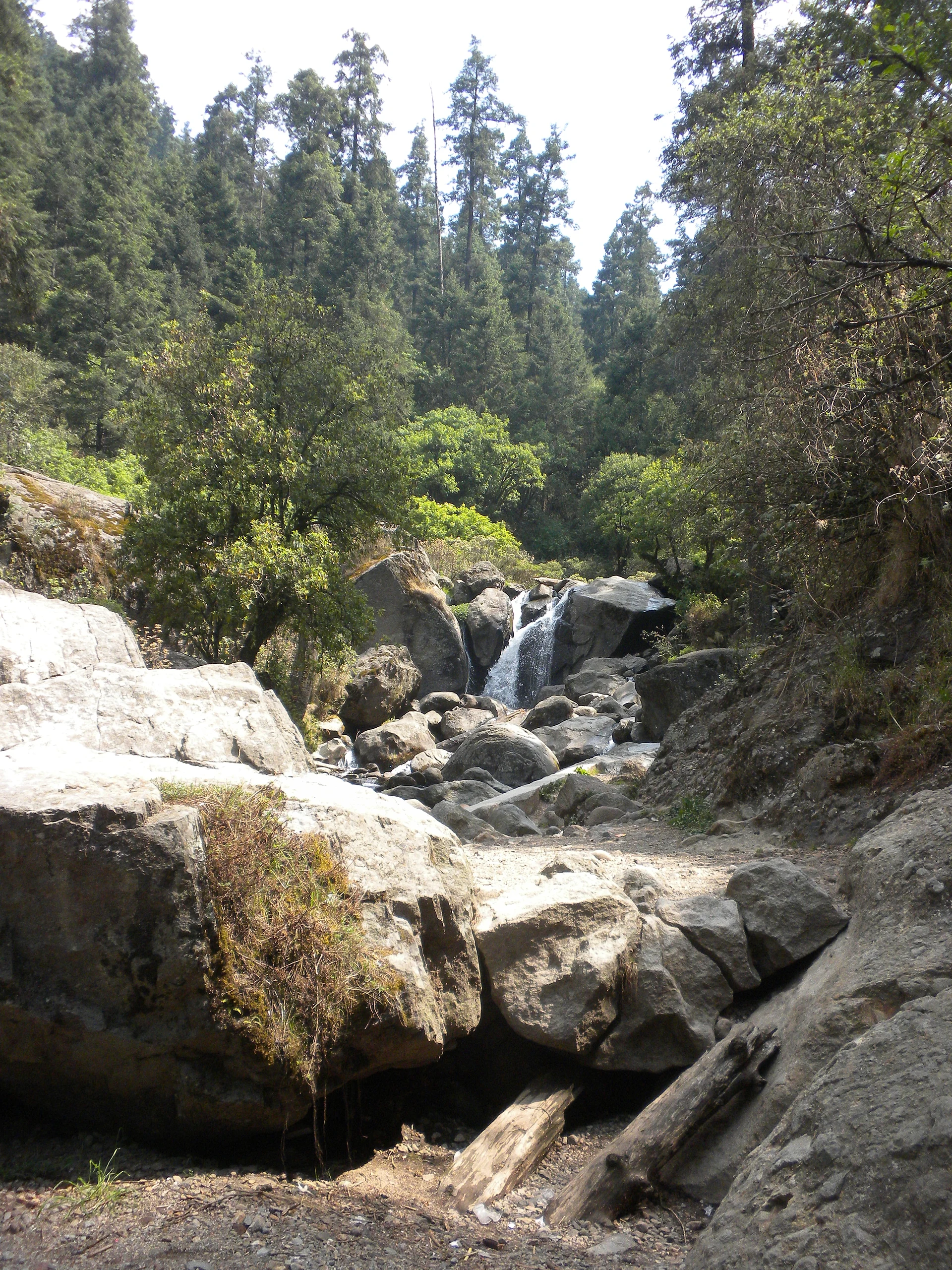
Forested canyon of the Río Magdalena, the city's last living river: waterfalls, climbing walls, trout and old Porfirian power plants.
From Mexico City: 25 min by car (23 km by road) How to get there ↓
Near here
See everything nearby ↓


Plan your visit to Los Dinamos
Where to stay near Los Dinamos
Compare hotels, posadas and guest houses in Los Dinamos.
Tours to Los Dinamos
Day trips and guided outings from Metepec often include Los Dinamos; with a local guide you can get there without a car.
 Private Hiking to Puerta del Cielo in Los Dinamos Park
★ 4.6 (20) · From US$80
How to get to Los Dinamos
- From Mexico City: about 25 min by road (~23 km)
- Nearest airport: Toluca (TLC), 17 min by car to Metepec
Links open a partner site. We may earn a commission if you book, at no cost to you.
Popular tours to Los Dinamos

Tours, prices and ratings from Viator, checked weekly. We may earn a commission if you book.
About Los Dinamos
Los Dinamos is the forested canyon of the Río Magdalena in the borough of La Magdalena Contreras, on the south-western edge of Mexico City. It is part of a protected natural area of about 2,429 hectares of pine, oak and fir, and the river that runs through it, cold and fast between rocks and small falls up to about 3.5 m high, is often called the last living river in the capital. Some 26 km of trails climb from the valley floor to viewpoints on the surrounding hills.
The name comes from the four dynamos, small hydroelectric plants, that were built along the river during the Porfiriato. In 1897 Ángel Sánchez and a group of French investors began harnessing the river's flow to supply electricity to around six textile mills in what are now the boroughs of Magdalena Contreras and Álvaro Obregón. The machines are long out of use, but at the second dynamo you can still peer through barred windows at cast-iron valves and pipes inside the old stone and brick powerhouse.
The canyon is one of the city's favourite weekend escapes. Climbers come for the rock walls, including a face of nearly 300 m on Cerro Coconetla, where a lookout also keeps an ancient carving of the rain god Tláloc; hikers head up to viewpoints such as the Puerta del Cielo on Cerro Tarumba. There is mountain biking, rappelling, zip lines, horse riding, trout fishing and camping, and cabins for an overnight stay. Food stands serve quesadillas, mushroom soup and trout. Weekdays are far quieter than weekends, and many visitors stop for lunch in Magdalena Atlitic, the last village before the park entrance.
How to get to Los Dinamos
Drive from Mexico City: 25 min, 23 km
From Metro Miguel Ángel de Quevedo (Line 3) or Metro Copilco (Line 3), buses leave about every 40 minutes for the corner of Avenida San Jerónimo and Calle Guadalupe; from there it is a 15-minute walk up Calle Guadalupe to the park entrance, and taxis usually wait to take visitors further up the canyon. Buses also run from Metro Taxqueña (Line 2); the trip takes about an hour. By car from the Centro, take San Antonio Abad, Viaducto Miguel Alemán and Periférico Sur, then Camino a Santa Teresa, Fuente de los Molinos and Camino a Los Dinamos, about 30 to 45 minutes depending on traffic.
Directions to Los Dinamos on Google Maps
Distances are in a straight line; the road is usually longer.
Links open a partner site. We may earn a commission if you book, at no cost to you.
From the nearest cities to Los Dinamos
- Mexico City · 23 km by road, 25 min
- Toluca · 60 km by road, 1 h 5 min
- Cuernavaca · 69 km by road, 1 h 15 min
Drive times by road from OpenStreetMap, without traffic or stops. Times marked ~ are estimated from the straight-line distance.
Before you go to Los Dinamos: hours, prices and tips
- Entry
- Entry to the park is free. Time Out México · checked Oct 2026
- Best time of day
- Arrive around 6 or 7 am and avoid weekends if you can; weekdays are much quieter. Excélsior · checked Oct 2026
- Guide or tour
- Trails range from easy walks to serious hikes and can be done alone; local guides are available for the main viewpoints. Tours: Viator GetYourGuide Mexico City Tourism (CDMX) · checked Oct 2026
- What to bring
- Comfortable shoes, clothes for cool weather and water. Excélsior · checked Oct 2026
Hours and prices change, especially around holidays. Each fact links to where we checked it.
Visiting Los Dinamos: what to see and do
Follow the Río Magdalena past its small waterfalls and pools.
Look through the windows of the second dynamo at its old cast-iron machinery.
Climb or rappel on the rock walls, among them the big face of Cerro Coconetla.
Hike up to the Puerta del Cielo viewpoint on Cerro Tarumba.
Try trout fishing, a zip line or a horse ride along the canyon.
Eat trout, mushroom soup and quesadillas at the food stands.
Camp or rent a cabin to wake up in the forest.
Plan your trip
Places to stay in Los Dinamos
Compare hotels, posadas, and rentals in and around Los Dinamos.
Tours & activities
Day trips and guided outings from Metepec often include Los Dinamos; with a local guide you can get there without a car.
Rental cars
Pick up a car at TLC (Toluca): about 17 min by road to Metepec, then 37 km more to Los Dinamos, on your own schedule.
Flights
The nearest airport with scheduled flights is Toluca (TLC), about 17 min by road from Metepec, the base for Los Dinamos.
Travel insurance
If you plan on hiking at Los Dinamos, check that your policy covers it: some plans leave adventure activities out.
Mobile data
Signal can drop away from Metepec: download a map of the way to Los Dinamos before you set out, or carry an eSIM with data.
Links open a partner site. We may earn a commission if you book, at no cost to you.
When to go to Los Dinamos cool
Los Dinamos shares the climate of Metepec, 37 km away. The best months to visit are January, February, March, and December.
See the month-by-month climate of Metepec
Weather in Los Dinamos now and the next 7 days
Live forecast from Open-Meteo. Chance of rain is the day's highest.
The closest Pueblo Mágico: Metepec

Metepec is the Pueblo Mágico closest to Los Dinamos, with places to stay, food, and more to see.
Also close to
- Tepoztlán · Morelos · 38 km away
- Tepotzotlán · Estado de México · 46 km away
- Malinalco · Estado de México · 47 km away
- Tlayacapan · Morelos · 48 km away
- Villa del Carbón · Estado de México · 53 km away
Closest to Los Dinamos
-
La Magdalena Contreras · Village · 1 km away
-
Cerro Judío · Mountain · 2 km away
-
San Jerónimo Lídice · Village · 5 km away
-
Santa Rosa Xochiac · Village · 5 km away
-
Bosque de Tlalpan · Nature reserve · 6 km away
-
Ciudad Universitaria · Landmark · 7 km away
-
Cuicuilco · Archaeological site · 7 km away
-
Desierto de los Leones · Nature reserve · 7 km away


Near Los Dinamos
-
Parque nacional Fuentes Brotantes de Tlalpan · Nature reserve · Ciudad de México
20 min drive · 11 km


Drive times by road from OpenStreetMap, without traffic. Times marked ~ are estimated from the straight-line distance.
Lists with Los Dinamos
Nature Parks in Ciudad de México · 7 Nature Parks near Mexico City · 16 Nature Parks near Metepec · 16 Nature Parks near Tepoztlán · 19 Nature Parks near Cuernavaca · 18 Nature Parks near Toluca · 15 Nature Parks near Tepotzotlán · 11 Nature Parks near Malinalco · 17Location from OpenStreetMap. Written by Puebloteca.