Town Almoloya del Río, Estado de México Toluca Valley
A clothing-and-mariachi town beside the Lerma marshes, with the Señor de Burgos parish church and a French clock from 1926.
From Toluca: 25 min by car (26 km by road) How to get there ↓
Near here


Plan your visit to Almoloya del Río
Where to stay near Almoloya del Río
Compare hotels, posadas and guest houses in Almoloya del Río.
Tours to Almoloya del Río
Day trips around Metepec sometimes stop in Almoloya del Río; a tour is the easy way to see it without a car.
 Tours from Cuernavaca
3hr Cooking Class in Cuernavaca 8 Recipes and Bottomless Drinks
From US$59
How to get to Almoloya del Río
- From Toluca: about 25 min by road (~26 km)
- Nearest airport: Toluca (TLC), 17 min by car to Metepec
Links open a partner site. We may earn a commission if you book, at no cost to you.
Tours from Cuernavaca, near Almoloya del Río


Tours, prices and ratings from Viator, checked weekly. We may earn a commission if you book.
About Almoloya del Río
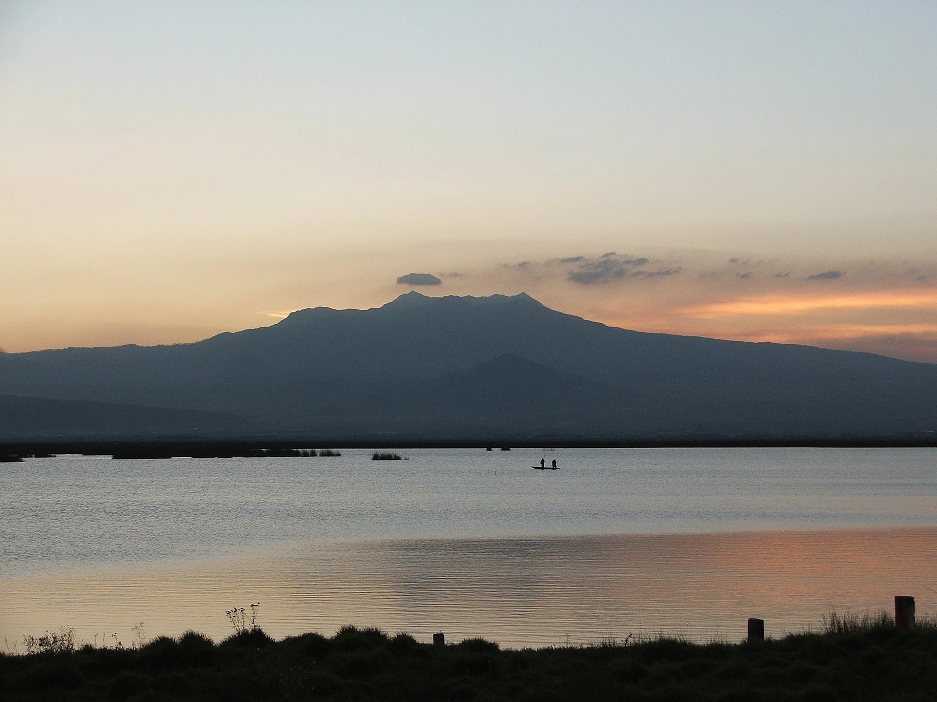
At the foot of the Nevado de Toluca, around 2,600 m up, Almoloya del Río holds most of its small municipality: 10,792 of its 12,694 inhabitants in 2020 lived in the seat. In Nahuatl the name means "place where water is born". Otomí and Matlatzinca settlers lived here on the edge of the Chignahuapan lake marshes; the Mexica took it in 1476, and Gonzalo de Sandoval arrived in 1521. The municipality was created on 26 March 1847. Between the 1930s and 1950s, the works that carried Lerma river water to Mexico City dried up much of the lake, yet marshes remain where migratory birds winter.
Its best-known building is the 16th-17th-century church of San Miguel Arcángel and dedicated to the Señor de Burgos; it faces west, towards where the lake used to be, with the Nevado de Toluca behind, and its bells were cast in 1947. In town stands the Esmeralda clock, made in France in 1926: it first stood in Mexico City and was given to the town in thanks for the water it sold, and since 1940 it has stood where it does today, its chimes carrying to neighbouring communities. Towards the marsh, an ecotourism park opened in 2007 lets you watch birds.
Clothes are the local trade: denim, rebozos, stoles and embroidered skirts, sold at the Sunday tianguis, with a clothing-and-sewing fair every September. There is also paper and cardboard craft and textiles. Many residents play mariachi at Plaza Garibaldi in Mexico City. At carnival, held in honour of the Virgen de los Dolores, the Paseo de Locos, vaqueros, pastoras and señor Santiago dancers come out.
How to get to Almoloya del Río
Drive from Toluca: 25 min, 26 km
Almoloya del Río is about 26 km from Toluca by road (approx.; allow 35 to 45 minutes) and about 15 km in a straight line from Metepec. From Toluca, the usual way is the Toluca-Tenango trunk road through Metepec, then south on state road EM 44 (Mexicaltzingo-Atizapán-Xalatlaco), which runs through the town; state road EM 6, Tenango-La Marqueza, and federal highway 200, Tianguistenco-Chalma, circle the area. Santiago Tianguistenco borders the municipality to the south and east.
Coming from the capital, Toluca is the gateway. We found no published bus or combi timetable for the town itself: ask at the Toluca terminal or in central Tianguistenco about combis to Almoloya del Río.
Directions to Almoloya del Río on Google Maps
Distances are in a straight line; the road is usually longer.
Links open a partner site. We may earn a commission if you book, at no cost to you.
From the nearest cities to Almoloya del Río
- Toluca · 26 km by road, 25 min
- Mexico City · 63 km by road, 1 h 5 min
- Cuernavaca · 59 km by road, 1 h 15 min
Drive times by road from OpenStreetMap, without traffic or stops. Times marked ~ are estimated from the straight-line distance.
Map of Almoloya del Río
Neighbourhoods and villages of Almoloya del Río
Part of Almoloya del Río or just outside it, closest first.
-
Santa Cruz Atizapán · Town · 2 km from the centre
Seat of Atizapán municipality at the source of the Lerma river: the 3 May Santa Cruz feast, a neoclassical church and the Tepozoco archaeological site. -
Santiago Tianguistenco · Town · 3 km from the centre
A market town whose huge Tuesday tianguis dates back to pre-Hispanic times, with some trading still done by barter. -
Capulhuac · Town · 4 km from the centre
The barbacoa capital of central Mexico, with a barbacoa fair at Carnival and a 16th-century Augustinian parish church. -
Guadalupe Yancuictlalpan · Village · 4 km from the centre
Gualupita, the "land of the sarape": wooden looms, wool sweaters and coats, and a textile tianguis near Tianguistenco.
Day trips and tours from Almoloya del Río
The closest Pueblos Mágicos and places to visit, with the drive from Almoloya del Río and tours that leave from it.


Times marked ~ are estimated from the distance. Links open a partner site. We may earn a commission if you book, at no cost to you.
Before you go: getting to and around Almoloya del Río
- The nearest airport is Toluca (TLC).
- The best months to go are January, February, March, and December.
- 2 of the places on this page are more than 3 km from the centre: take a taxi, a ride-hailing app or a local bus.
- For day trips a rental car gives the most freedom; the tours above leave from Almoloya del Río.
Before you go to Almoloya del Río: hours, prices and tips
- Best time of day
- Come on a Sunday for the tianguis, where regional clothing is sold; the clothing-and-sewing fair is in September. Wikipedia (en) · checked Oct 2026
Hours and prices change, especially around holidays. Each fact links to where we checked it.
Visiting Almoloya del Río: what to see and do
The parish church of San Miguel Arcángel (16th-17th century), dedicated to the Señor de Burgos, with a view of the Nevado de Toluca.
The Esmeralda clock, from 1926.
The ecotourism park, opened in 2007, beside the Chignahuapan marsh and lagoon.
The Sunday tianguis, with clothing and rebozos.
The clothing-and-sewing fair, in September.
The carnival for the Virgen de los Dolores, with locos, vaqueros and pastoras dances.
Plan your trip
Places to stay in Almoloya del Río
Compare hotels, posadas, and rentals in and around Almoloya del Río.
Tours & activities
Day trips around Metepec sometimes stop in Almoloya del Río; a tour is the easy way to see it without a car.
Rental cars
Pick up a car at TLC (Toluca): about 17 min by road to Metepec, then 15 km more to Almoloya del Río, on your own schedule.
Flights
The nearest airport with scheduled flights is Toluca (TLC), about 17 min by road from Metepec, the base for Almoloya del Río.
Mobile data
Signal can drop away from Metepec: download a map of the way to Almoloya del Río before you set out, or carry an eSIM with data.
Links open a partner site. We may earn a commission if you book, at no cost to you.
When to go to Almoloya del Río cool
Almoloya del Río shares the climate of Metepec, 15 km away. The best months to visit are January, February, March, and December.
See the month-by-month climate of Metepec
Weather in Almoloya del Río now and the next 7 days
Live forecast from Open-Meteo. Chance of rain is the day's highest.
The closest Pueblo Mágico: Metepec

Metepec is the Pueblo Mágico closest to Almoloya del Río, with places to stay, food, and more to see.
Also close to
- Malinalco · Estado de México · 23 km away
- Ixtapan de la Sal · Estado de México · 40 km away
- Tonatico · Estado de México · 44 km away
- Tepoztlán · Morelos · 45 km away
- Xochitepec · Morelos · 45 km away
Near Almoloya del Río


Drive times by road from OpenStreetMap, without traffic. Times marked ~ are estimated from the straight-line distance.
Location from OpenStreetMap. Written by Puebloteca.