

City Huixquilucan, Estado de México Municipality of Huixquilucan Valley of Mexico
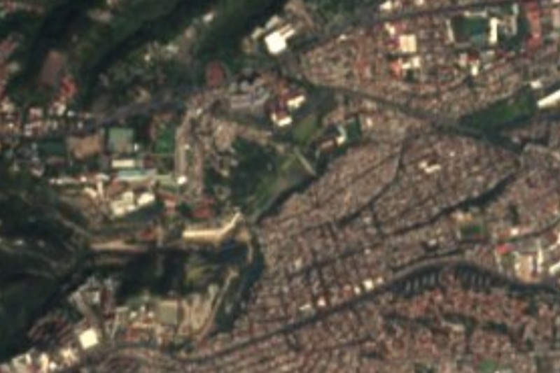
Not Naucalpan de Juárez: the built-up part of Huixquilucan that holds Interlomas, with 100 m+ towers and the Paseo Interlomas mall.
From Mexico City: 30 min by car (25 km by road) How to get there ↓
Near here




Plan your visit to Naucalpan
Where to stay near Naucalpan
Compare hotels, posadas and guest houses in Naucalpan.
Tours to Naucalpan
Day trips and guided outings from Tepotzotlán often include Naucalpan; with a local guide you can get there without a car.
 Tours from Mexico City
Teotihuacan pyramids morning or afternoon without tourist traps
★ 4.9 (10,269) · From US$59
How to get to Naucalpan
- From Mexico City: about 30 min by road (~25 km)
- Nearest airport: Mexico City (Felipe Ángeles) (NLU), 48 min by car to Tepotzotlán
Links open a partner site. We may earn a commission if you book, at no cost to you.
Tours from Mexico City, near Naucalpan


Tours, prices and ratings from Viator, checked weekly. We may earn a commission if you book.
About Naucalpan
This Naucalpan is not the city of Naucalpan de Juárez, though the two touch. It is a locality in the municipality of Huixquilucan, on the Mexico City border, that grew as an extension of its neighbour's urban sprawl; hence the name, from Nahuatl, meaning "above the four neighbourhoods". INEGI counted 134,948 people in 2020 (figure from Wikidata), about half the municipality. Hardly anyone calls it that: people say Huixquilucan, or use the names of its developments, above all Interlomas.
Interlomas was built on what was the Jesús del Monte ranch, which Joaquín de Dios Pradel bought in 1852 and which was divided into 239 plots in 1905. The boom came from 1995, after Santa Fe was created, when ravines and woods filled up with offices, schools and apartments; there are now several towers over 100 m and the area became one of the country's most exclusive places to live. The first shopping centre started construction in 1991 and opened in 1994.
What visitors see is mostly architecture and shopping. Paseo Interlomas, opened in January 2012, is UFO-shaped and anchored by a Liverpool; with department stores, cinemas and food courts, it is one of the most extravagantly designed malls on the west side. Restaurants are mostly corporate chains. There is no historic centre: for the old village, with an 18th-century parish and plaza, go to Huixquilucan de Degollado, which has its own page.
How to get to Naucalpan
Drive from Mexico City: 30 min, 25 km
The usual way in is by bus from a Mexico City Metro station. According to Wikipedia, routes from Huixquilucan and the State of Mexico link with Tacubaya, Tacuba, Cuatro Caminos and Observatorio, and the ATROLSA 132 corridor runs from Metro Chapultepec to Bosques de las Lomas, Tecamachalco and Palmas; check the exact route in a transit app before you go. By car, the Chamapa-Lechería toll road crosses the municipality and connects with Naucalpan, Atizapán and the Toluca highway. It is about 16 km in a straight line from central Mexico City, and traffic decides the real time. Tepotzotlán is about 36 km away in a straight line.
Directions to Naucalpan on Google Maps
Distances are in a straight line; the road is usually longer.
Links open a partner site. We may earn a commission if you book, at no cost to you.
From the nearest cities to Naucalpan
- Mexico City · 25 km by road, 30 min
- Toluca · 50 km by road, 50 min
- Cuernavaca · 83 km by road, 1 h 30 min
Drive times by road from OpenStreetMap, without traffic or stops. Times marked ~ are estimated from the straight-line distance.
Map of Naucalpan
Neighbourhoods and villages of Naucalpan
Part of Naucalpan or just outside it, closest first.
-
Jesús del Monte · Town · 3 km from the centre
Hill community of 30,396 people in Huixquilucan, near Interlomas; it grew from 161 residents in 1960 to over 30,000 today. -
Magdalena Chichicaspa · Town · 6 km from the centre
Otomí community in Huixquilucan above Naucalpan and Bosque Real: a parish from 1978, barbacoa and the Magdalena feast on 22 July. -
El Hielo · Village · 9 km from the centre
High Huixquilucan community among Sierra de las Cruces pines at nearly 3,000 m, on the Naucalpan–Toluca road, with real cold in winter. -
Huixquilucan de Degollado · Town · 9 km from the centre
A hill town of 10,735 at 2,712 m, with an 18th-century parish where Santos Degollado was buried and a long calendar of patron-saint fiestas.


Day trips and tours from Naucalpan
The closest Pueblos Mágicos and places to visit, with the drive from Naucalpan and tours that leave from it.


Times marked ~ are estimated from the distance. Links open a partner site. We may earn a commission if you book, at no cost to you.
Before you go: getting to and around Naucalpan
- The nearest airport is Mexico City (Felipe Ángeles) (NLU).
- The best months to go are January, February, March, and December.
- 3 of the places on this page are more than 3 km from the centre: take a taxi, a ride-hailing app or a local bus.
- For day trips a rental car gives the most freedom; the tours above leave from Naucalpan.
Before you go to Naucalpan: hours, prices and tips
- Hours
- Paseo Interlomas is open daily from 11 am to 9 pm. Wikivoyage · checked Oct 2026
Hours and prices change, especially around holidays. Each fact links to where we checked it.
Visiting Naucalpan: what to see and do
Paseo Interlomas, the UFO-shaped shopping centre, with Liverpool, a cinema and food courts.
Centro Comercial Interlomas, the area's first mall, opened in 1994.
The Interlomas apartment towers, several over 100 metres tall.
For contrast, the old village: the parish of San Antonio de Padua in Huixquilucan de Degollado.
Plan your trip
Places to stay in Naucalpan
Compare hotels, posadas, and rentals in and around Naucalpan.
Tours & activities
Day trips and guided outings from Tepotzotlán often include Naucalpan; with a local guide you can get there without a car.
Rental cars
Pick up a car at NLU (Mexico City (Felipe Ángeles)): about 48 min by road to Tepotzotlán, then 36 km more to Naucalpan, on your own schedule.
Flights
The nearest airport with scheduled flights is Mexico City (Felipe Ángeles) (NLU), about 48 min by road from Tepotzotlán, the base for Naucalpan.
Mobile data
Signal can drop away from Tepotzotlán: download a map of the way to Naucalpan before you set out, or carry an eSIM with data.
Links open a partner site. We may earn a commission if you book, at no cost to you.
When to go to Naucalpan cool
Naucalpan shares the climate of Tepotzotlán, 36 km away. The best months to visit are January, February, March, and December.
See the month-by-month climate of Tepotzotlán
Weather in Naucalpan now and the next 7 days
Live forecast from Open-Meteo. Chance of rain is the day's highest.
The closest Pueblo Mágico: Tepotzotlán

Tepotzotlán is the Pueblo Mágico closest to Naucalpan, with places to stay, food, and more to see.
Also close to
- Metepec · Estado de México · 38 km away
- Villa del Carbón · Estado de México · 42 km away
- Tepoztlán · Morelos · 49 km away
- Malinalco · Estado de México · 55 km away
- Teotihuacán · Estado de México · 56 km away
Near Naucalpan


Drive times by road from OpenStreetMap, without traffic. Times marked ~ are estimated from the straight-line distance.
Location from OpenStreetMap. Written by Puebloteca.