
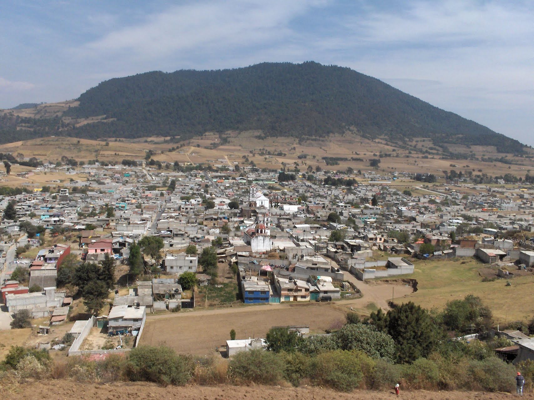
Village Tenango del Valle, Estado de México Municipality of Tenango del Valle Toluca Valley Southern Estado de México
Tenango del Valle's bread village: the 24 August feast of San Bartolomé brings thousands of pilgrims and floats decked with pan de feria.
From Toluca: 30 min by car (31 km by road) How to get there ↓
Near here
See everything nearby ↓


Plan your visit to San Bartolomé Atlatlahuca
Where to stay near San Bartolomé Atlatlahuca
Compare hotels, posadas and guest houses in San Bartolomé Atlatlahuca.
Tours to San Bartolomé Atlatlahuca
Day trips and guided outings from Malinalco often include San Bartolomé Atlatlahuca; with a local guide you can get there without a car.
 Tours from Cuernavaca
3hr Cooking Class in Cuernavaca 8 Recipes and Bottomless Drinks
From US$59
How to get to San Bartolomé Atlatlahuca
- From Toluca: about 30 min by road (~31 km)
- Nearest airport: Toluca (TLC), 1 h 14 min by car to Malinalco
Links open a partner site. We may earn a commission if you book, at no cost to you.
Tours from Cuernavaca, near San Bartolomé Atlatlahuca


Tours, prices and ratings from Viator, checked weekly. We may earn a commission if you book.
About San Bartolomé Atlatlahuca
San Bartolomé Atlatlahuca is a delegación of Tenango del Valle municipality, in the south of the Toluca Valley, with about 7,200 people in 2020. It calls itself the Land of Pan de Feria. Atlatlahuca means "place of reddish water", as shown in the Codex Mendoza, and it is the oldest locality in the municipality: it was an encomienda of Hernando de Jerez, a corregimiento in 1537, then fell under the alcaldía mayor of Malinalco and, from 1580, that of Teotenanco.
What the village is known for is the pan de feria its bakers make, treated as a craft in the State of Mexico. It shows best at the fiestas. A week before the patron feast and the one on 1 January, floats decorated with this bread parade through town, handing it out on the way and ending in the churchyard with a shower of bread. The big day is 24 August, honouring San Bartolomé Apóstol; it is regarded as the largest fair in the region and draws thousands of pilgrims, many from Guanajuato, plus the village's own dances. On 1 January people venerate Nuestro Padre Jesús, 15 May is San Isidro Labrador, and on Corpus Thursday the streets are dressed up.
The church is the oldest monument in the municipality, though its facade and vault have been altered and the 2017 earthquake damaged the high-altar ciborium. The Palacio de Piedra, now the delegation office, is also worth a look. Metal and inflatable balloons are made here too.
How to get to San Bartolomé Atlatlahuca
Drive from Toluca: 30 min, 31 km
From Toluca take the Vialidad Toluca-Tenango (federal 55): about 25 km and 25 minutes to Tenango de Arista. Continue on federal 55 toward Tenancingo; Atlatlahuca is about 5 minutes past Tenango, with the municipal seat, Tenango de Arista, to the north. Mexico City is about 92 km from Tenango de Arista. From Toluca it is about 25 km straight-line and roughly 30 minutes by car; Malinalco, the nearest pueblo, is about 18 km straight-line. There is no published published colectivo timetables; ask for the ones leaving from Tenango de Arista.
Directions to San Bartolomé Atlatlahuca on Google Maps
Distances are in a straight line; the road is usually longer.
Links open a partner site. We may earn a commission if you book, at no cost to you.
From the nearest cities to San Bartolomé Atlatlahuca
- Toluca · 31 km by road, 30 min
- Cuernavaca · 66 km by road, 1 h 30 min
- Mexico City · 83 km by road, 1 h 30 min
Drive times by road from OpenStreetMap, without traffic or stops. Times marked ~ are estimated from the straight-line distance.
Before you go to San Bartolomé Atlatlahuca: hours, prices and tips
- Best time of day
- The week before 24 August or 1 January, when the pan de feria floats run and bread is showered in the churchyard. Wikipedia (es) · checked Oct 2026
- Best season
- The patron feast is 24 August; other dates are 1 January (Nuestro Padre Jesús), 15 May (San Isidro) and Corpus Thursday. Wikipedia (es) · checked Oct 2026
Hours and prices change, especially around holidays. Each fact links to where we checked it.
Visiting San Bartolomé Atlatlahuca: what to see and do
Come on 24 August for the feast of San Bartolomé and its parade of floats with pan de feria.
Taste and buy pan de feria at the village bakeries.
Step into the church, the oldest in the municipality.
Look at the Palacio de Piedra, the delegation office.
Come on 1 January for the feast of Nuestro Padre Jesús and a second float parade.
Plan your trip
Places to stay in San Bartolomé Atlatlahuca
Compare hotels, posadas, and rentals in and around San Bartolomé Atlatlahuca.
Tours & activities
Day trips and guided outings from Malinalco often include San Bartolomé Atlatlahuca; with a local guide you can get there without a car.
Rental cars
Pick up a car at TLC (Toluca): about 1 h 14 min by road to Malinalco, then 18 km more to San Bartolomé Atlatlahuca, on your own schedule.
Flights
The nearest airport with scheduled flights is Toluca (TLC), about 1 h 14 min by road from Malinalco, the base for San Bartolomé Atlatlahuca.
Mobile data
Signal can drop away from Malinalco: download a map of the way to San Bartolomé Atlatlahuca before you set out, or carry an eSIM with data.
Links open a partner site. We may earn a commission if you book, at no cost to you.
When to go to San Bartolomé Atlatlahuca mild
San Bartolomé Atlatlahuca shares the climate of Malinalco, 18 km away. The best months to visit are January, February, March, and December.
See the month-by-month climate of Malinalco
Weather in San Bartolomé Atlatlahuca now and the next 7 days
Live forecast from Open-Meteo. Chance of rain is the day's highest.
The closest Pueblo Mágico: Malinalco

Malinalco is the Pueblo Mágico closest to San Bartolomé Atlatlahuca, with places to stay, food, and more to see.
Also close to
- Metepec · Estado de México · 20 km away
- Ixtapan de la Sal · Estado de México · 26 km away
- Tonatico · Estado de México · 30 km away
- Xochitepec · Morelos · 44 km away
- Tepoztlán · Morelos · 55 km away
Closest to San Bartolomé Atlatlahuca
-
Tenango de Arista · Town · 4 km away
-
Teotenango · Archaeological site · 5 km away
-
San Francisco Putla · Village · 7 km away
-
San José · Village · 8 km away
-
Joquicingo · Town · 9 km away
-
Santa María Jajalpa · Village · 9 km away
-
Calimaya · Town · 11 km away
-
San Antonio la Isla · Town · 11 km away


Near San Bartolomé Atlatlahuca


Drive times by road from OpenStreetMap, without traffic. Times marked ~ are estimated from the straight-line distance.
Location from OpenStreetMap. Written by Puebloteca.