

Town Soyaniquilpan de Juárez, Estado de México Northern Estado de México
A seat on the México–Querétaro highway where Benito Juárez slept in 1867; San Francisco parish, the Carmen chapel and the old La Goleta hacienda.
From San Juan del Río: 1 h by car (69 km by road) How to get there ↓
Near here
See everything nearby ↓


Plan your visit to San Francisco Soyaniquilpan
Where to stay near San Francisco Soyaniquilpan
Compare hotels, posadas and guest houses in San Francisco Soyaniquilpan.
Tours to San Francisco Soyaniquilpan
Day trips around Jilotepec sometimes stop in San Francisco Soyaniquilpan; a tour is the easy way to see it without a car.
 Tours from Zacatlan
Zacatlán Guided Tour walking through the Center
★ 5.0 (2) · From US$8
How to get to San Francisco Soyaniquilpan
- From San Juan del Río: about 1 h by road (~69 km)
- Nearest airport: Mexico City (Felipe Ángeles) (NLU), 1 h 20 min by car to Jilotepec
Links open a partner site. We may earn a commission if you book, at no cost to you.
Tours from Zacatlan, near San Francisco Soyaniquilpan
Tours, prices and ratings from Viator, checked weekly. We may earn a commission if you book.
About San Francisco Soyaniquilpan
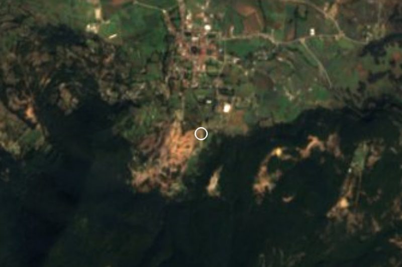
San Francisco Soyaniquilpan is the seat of Soyaniquilpan de Juárez, a municipality in the north of the State of Mexico that Jilotepec wraps around on three sides and Hidalgo borders to the north and east. It had 5,706 residents in 2020, at about 2,400 m, just off the México–Querétaro highway. The name is usually rendered as "watery place where the grass breaks".
It began as an Otomí town in the old kingdom of Jilotepec. In colonial times the land went to the La Goleta hacienda, which grew to 43,654 hectares and from 1693 to 1743 belonged to the Marquises of Villa del Villar del Águila. Lying on the road north, the town saw the armies of the Reform War march through, and on 22 December 1860 the battle of Calpulalpan was fought on La Goleta's land. Maximilian passed through on his last journey to Querétaro, and on the night of 10 July 1867 Benito Juárez slept at number 20 on the main street, which is where "de Juárez" comes from. The municipality split from Jilotepec on 9 September 1872.
In town are the 19th-century parish church of San Francisco de Asís, with its carved doorway and atrium wall, and the Neoclassical chapel of the Virgen del Carmen. Out in the country stand the former La Goleta hacienda of 1693, with a porch of twelve round arches and traces of the 5 km aqueduct that brought water from the Mexicaltongo spring; the high-walled former hacienda of Tandejé; and the Casa Arcada from the late 18th century. The Ojo de Agua, El Capulín and Quilote springs are the local weekend outings. The feast of Saint Francis on 4 October brings a maize fair, and on the Saturday before, the estampas parade winds through the streets with a brass band and rockets.
How to get to San Francisco Soyaniquilpan
Drive from San Juan del Río: 1 h, 69 km
From Mexico City head north on the Viaducto Bicentenario or the México–Querétaro highway (57) and stay on the 57 for about 60 km to the Soyaniquilpan exit, which leaves you close to the centre. From the Terminal Norte it is about 84 km, roughly 1 hour 10 minutes without traffic. The Arco Norte also crosses the municipality. Jilotepec, the nearest of our pueblos, is just 8 km away on the Jilotepec–San Agustín road, about 10 minutes. From San Juan del Río it is about 69 km on the 57D towards Mexico City, roughly an hour.
By bus, take one of the lines from the Terminal Central del Norte (Metro Autobuses del Norte) that serve Jilotepec and Querétaro.
Directions to San Francisco Soyaniquilpan on Google Maps
Distances are in a straight line; the road is usually longer.
Links open a partner site. We may earn a commission if you book, at no cost to you.
From the nearest cities to San Francisco Soyaniquilpan
- San Juan del Río · 69 km by road, 1 h
- Mexico City · 90 km by road, 1 h 20 min
- Pachuca · 107 km by road, 1 h 20 min
Drive times by road from OpenStreetMap, without traffic or stops. Times marked ~ are estimated from the straight-line distance.
Before you go to San Francisco Soyaniquilpan: hours, prices and tips
- Best season
- Feast of Saint Francis on 4 October with a maize fair; the Saturday before brings the estampas parade with a band and rockets. San Agustín marks Candlemas on 2 February and its patron on 28 August. Enciclopedia de los Municipios de México (INAFED) · checked Oct 2026
Hours and prices change, especially around holidays. Each fact links to where we checked it.
Visiting San Francisco Soyaniquilpan: what to see and do
The 19th-century parish church of San Francisco de Asís.
The Neoclassical chapel of the Virgen del Carmen.
Number 20 on the main street, where Benito Juárez spent the night in 1867.
The former La Goleta hacienda and its twelve-arch porch.
The former Tandejé hacienda and the Casa Arcada.
The 18th-century church of San Agustín Buenavista.
The Ojo de Agua, El Capulín and Quilote springs.
Plan your trip
Places to stay in San Francisco Soyaniquilpan
Compare hotels, posadas, and rentals in and around San Francisco Soyaniquilpan.
Tours & activities
Day trips around Jilotepec sometimes stop in San Francisco Soyaniquilpan; a tour is the easy way to see it without a car.
Rental cars
Pick up a car at NLU (Mexico City (Felipe Ángeles)): about 1 h 20 min by road to Jilotepec, then 7 km more to San Francisco Soyaniquilpan, on your own schedule.
Flights
The nearest airport with scheduled flights is Mexico City (Felipe Ángeles) (NLU), about 1 h 20 min by road from Jilotepec, the base for San Francisco Soyaniquilpan.
Mobile data
Signal can drop away from Jilotepec: download a map of the way to San Francisco Soyaniquilpan before you set out, or carry an eSIM with data.
Links open a partner site. We may earn a commission if you book, at no cost to you.
When to go to San Francisco Soyaniquilpan cool
San Francisco Soyaniquilpan shares the climate of Jilotepec, 7 km away. The best months to visit are January, February, March, and December.
See the month-by-month climate of Jilotepec
Weather in San Francisco Soyaniquilpan now and the next 7 days
Live forecast from Open-Meteo. Chance of rain is the day's highest.
The closest Pueblo Mágico: Jilotepec

Jilotepec is the Pueblo Mágico closest to San Francisco Soyaniquilpan, with places to stay, food, and more to see.
Also close to
- Villa del Carbón · Estado de México · 33 km away
- Aculco · Estado de México · 34 km away
- Huichapan · Hidalgo · 42 km away
- Tepotzotlán · Estado de México · 46 km away
- Tecozautla · Hidalgo · 59 km away
Closest to San Francisco Soyaniquilpan
-
Santuario de la Virgen de la Piedrita · Landmark · 8 km away
-
Peñas de Dexcaní Alto · Mountain · 11 km away
-
Presa Danxhó · Lake · 16 km away
-
San Juan Michimaloya · Village · 17 km away
-
San Sebastián de Juárez · Village · 17 km away
-
Santiago Tlautla · Village · 17 km away
-
San Juan Tuxtepec · Village · 20 km away
-
Tula de Allende · City · 20 km away

Near San Francisco Soyaniquilpan





Drive times by road from OpenStreetMap, without traffic. Times marked ~ are estimated from the straight-line distance.
Location from OpenStreetMap. Written by Puebloteca.