

Village Nopala de Villagrán, Hidalgo
A Nopala de Villagrán locality at 2,339 m, in the municipality's south-east corner beside the Estado de México line; 509 residents in 2020.
From San Juan del Río: 1 h 15 min by car (78 km by road) How to get there ↓
Near here
See everything nearby ↓



Plan your visit to San Sebastián de Juárez
Where to stay near San Sebastián de Juárez
Compare hotels, posadas and guest houses in San Sebastián de Juárez.
Tours to San Sebastián de Juárez
Day trips and guided outings from Jilotepec often include San Sebastián de Juárez; with a local guide you can get there without a car.
 Tours from Zacatlan
Zacatlán Guided Tour walking through the Center
★ 5.0 (2) · From US$8
How to get to San Sebastián de Juárez
- From San Juan del Río: about 1 h 15 min by road (~78 km)
- Nearest airport: Mexico City (Felipe Ángeles) (NLU), 1 h 20 min by car to Jilotepec
Links open a partner site. We may earn a commission if you book, at no cost to you.
Tours from Zacatlan, near San Sebastián de Juárez
Tours, prices and ratings from Viator, checked weekly. We may earn a commission if you book.
About San Sebastián de Juárez
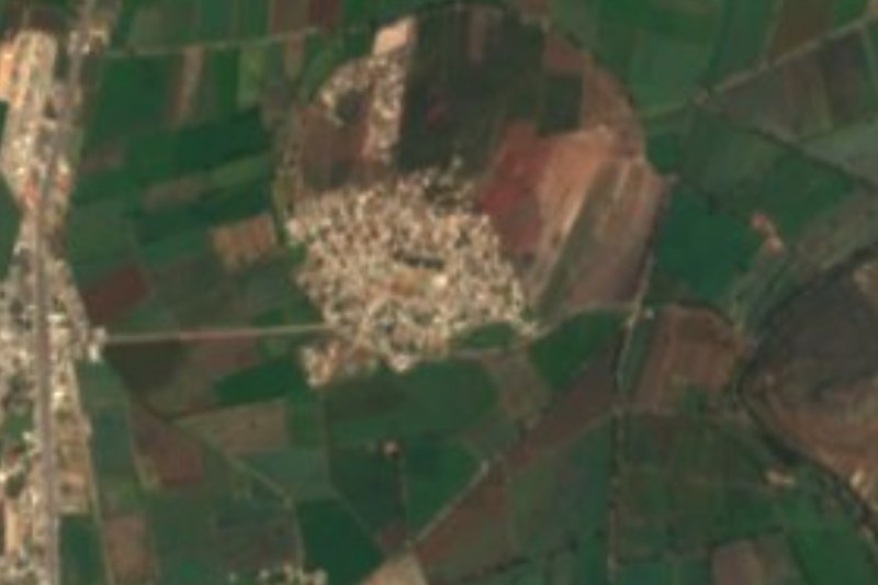
San Sebastián de Juárez sits at 2,339 metres among the rolling hills of the Neovolcanic Axis, with a temperate subhumid climate and summer rains. Its coordinates put it in the far south-east of Nopala de Villagrán, a municipality INEGI places between parallels 20°8′ and 20°20′ and meridians 99°30′ and 99°51′, which leaves the village a short way from the Estado de México boundary. Its waters belong to the Tecozautla River subbasin.
The 2020 census counted 509 people, 253 men and 256 women, 3.00% of the municipality. The trend had been downward: 805 in 1990, 555 five years later, a low of 463 in 2005, then a rebound to 536 in 2010. Wikimedia Commons holds a December 2009 photograph of the railway line that runs near the village, with a freight train, and its title notes that the photographer was still on the Estado de México side of the border.
The countryside is that of the whole municipality. According to Wikipedia the vegetation is mesquite, huizache, prickly pear and maguey; in 2015 Nopala planted 6,944 hectares of maize and 720 of beans, plus barley, oats, tuna fruit and pulque maguey. INEGI's compendium records that the municipality's craftspeople make metates, molcajetes and pieces in quarry stone and marble, and embroider napkins, tablecloths and handkerchiefs; local cooking is known for cheeses and creams, tamales and pumpkin-seed sweets.
How to get to San Sebastián de Juárez
Drive from San Juan del Río: 1 h 15 min, 78 km
San Sebastián de Juárez lies in the south-east of Nopala de Villagrán, close to the Estado de México border. Using Wikipedia's coordinates, in a straight line it is about 24 km from Jilotepec and from Tula de Allende, about 26 km from Huichapan, about 48 km from Ixmiquilpan and about 83 km from Pachuca (approximate; by road they will be longer). Nopala, the municipal seat, is the reference point for asking about the way: INEGI's compendium notes that Hacienda del Destello stands on the road before you reach Nopala. Before leaving, plot the route on a current map and check the state of the final stretch with people in the area.
Directions to San Sebastián de Juárez on Google Maps
Distances are in a straight line; the road is usually longer.
Links open a partner site. We may earn a commission if you book, at no cost to you.
From the nearest cities to San Sebastián de Juárez
- San Juan del Río · 78 km by road, 1 h 15 min
- Pachuca · 112 km by road, 1 h 35 min
- Mexico City · 114 km by road, 1 h 50 min
Drive times by road from OpenStreetMap, without traffic or stops. Times marked ~ are estimated from the straight-line distance.
Visiting San Sebastián de Juárez: what to see and do
The freight railway line crossing the hilly landscape.
The maize, maguey and prickly pear of the highland at 2,339 m.
The church of Santa María Magdalena in Nopala, finished in 1620.
The municipality's hacienda buildings, such as those at Jagüey and Dañu.
The metates, molcajetes and embroidery made in the municipality.
Plan your trip
Places to stay in San Sebastián de Juárez
Compare hotels, posadas, and rentals in and around San Sebastián de Juárez.
Tours & activities
Day trips and guided outings from Jilotepec often include San Sebastián de Juárez; with a local guide you can get there without a car.
Rental cars
Pick up a car at NLU (Mexico City (Felipe Ángeles)): about 1 h 20 min by road to Jilotepec, then 24 km more to San Sebastián de Juárez, on your own schedule.
Flights
The nearest airport with scheduled flights is Mexico City (Felipe Ángeles) (NLU), about 1 h 20 min by road from Jilotepec, the base for San Sebastián de Juárez.
Mobile data
Signal can drop away from Jilotepec: download a map of the way to San Sebastián de Juárez before you set out, or carry an eSIM with data.
Links open a partner site. We may earn a commission if you book, at no cost to you.
When to go to San Sebastián de Juárez cool
San Sebastián de Juárez shares the climate of Jilotepec, 24 km away. The best months to visit are January, February, March, and December.
See the month-by-month climate of Jilotepec
Weather in San Sebastián de Juárez now and the next 7 days
Live forecast from Open-Meteo. Chance of rain is the day's highest.
The closest Pueblo Mágico: Jilotepec

Jilotepec is the Pueblo Mágico closest to San Sebastián de Juárez, with places to stay, food, and more to see.
Also close to
- Huichapan · Hidalgo · 26 km away
- Aculco · Estado de México · 31 km away
- Tecozautla · Hidalgo · 42 km away
- Villa del Carbón · Estado de México · 50 km away
- Tequisquiapan · Querétaro · 54 km away
Closest to San Sebastián de Juárez
-
Nopala de Villagrán · Town · 15 km away
-
San Juan Michimaloya · Village · 16 km away
-
Tepetitlán · Village · 16 km away
-
Presa Endhó · Lake · 17 km away
-
San Francisco Soyaniquilpan · Town · 17 km away
-
Chapantongo · Village · 18 km away
-
Arroyo Zarco Pueblo · Village · 21 km away
-
Santuario de la Virgen de la Piedrita · Landmark · 22 km away


Near San Sebastián de Juárez





Drive times by road from OpenStreetMap, without traffic. Times marked ~ are estimated from the straight-line distance.
Location from OpenStreetMap. Written by Puebloteca.