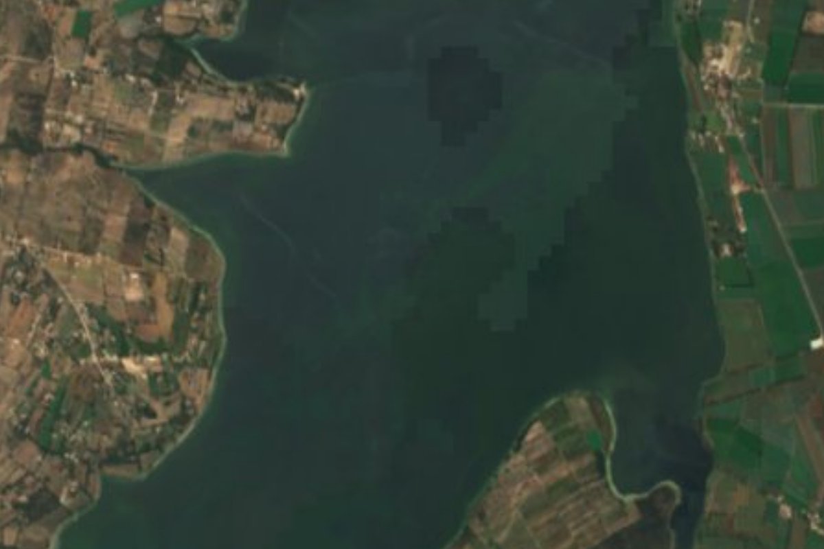
Lake Tepetitlán, Hidalgo
Large reservoir in the Mezquital Valley between Tepetitlán and Tula, built 1947-1951 and now fed by Mexico City wastewater.
From Pachuca: 1 h 25 min by car (99 km by road) How to get there ↓
Near here
See everything nearby ↓


Plan your visit to Presa Endhó
Where to stay near Presa Endhó
Compare hotels, posadas and guest houses in Presa Endhó.
Tours to Presa Endhó
Day trips and guided outings from Jilotepec often include Presa Endhó; with a local guide you can get there without a car.
How to get to Presa Endhó
- From Pachuca: about 1 h 25 min by road (~99 km)
- Nearest airport: Mexico City (Felipe Ángeles) (NLU), 1 h 20 min by car to Jilotepec
Links open a partner site. We may earn a commission if you book, at no cost to you.
About Presa Endhó
Presa Endhó fills part of the Tula plains in the Mezquital Valley, between the municipalities of Tepetitlán and Tula de Allende, at about 2,000 metres above sea level and some 100 kilometres north of Mexico City. It was built between 1947 and 1951 to hold the water entering the local irrigation district and to store it in dry spells. The dam wall is masonry and compacted earth with basalt rock, 60 metres high, and it holds a reservoir of 1,260 hectares.
This is not a leisure lake. Since 1975, when the Túnel Emisor Central was finished, the dam has received sewage from the Valle de México metropolitan drainage system, and the Endhó canal carries that water to the Tula and Alfajayucan irrigation districts. The Michimaloya river also flows into the reservoir. According to Wikipedia, wastewater irrigation grew from about 14,000 hectares in 1926 to some 85,000 today, and studies report heavy-metal contamination in the dam and in wells of neighbouring communities.
Local news in recent years centres on water hyacinth and the Culex mosquito. According to Conagua, the area covered by hyacinth fell from 900 hectares in October 2025 to 443 in June 2026 after 105 thousand cubic metres of weed were removed with machinery; spraying against the mosquito has run since 1 May 2026 across 27 riverside communities, and in August Conagua and Tepetitlán agreed to reinforce the Plan Maestro de Recuperación. Native vegetation along the shore is thorn scrub, mesquite, agave and cacti.
How to get to Presa Endhó
Drive from Pachuca: 1 h 25 min, 99 km
The dam lies between the municipalities of Tepetitlán and Tula de Allende, in the Mezquital Valley, about 100 km north of Mexico City according to Wikipedia. In a straight line it is about 10 km north of the city of Tula de Allende, some 27 km from Jilotepec and some 66 km from Pachuca (approx.). The surrounding communities are Santa Ana Ahuehuepan, Pedro María Anaya, La Loma, La Ermita, San Pedro Nextlalpan, Santa María Daxthó and Xijay de Cuauhtémoc; they are the reference points for getting near the shore. It is not a park with developed access.
Directions to Presa Endhó on Google Maps
Distances are in a straight line; the road is usually longer.
Links open a partner site. We may earn a commission if you book, at no cost to you.
From the nearest cities to Presa Endhó
- Pachuca · 99 km by road, 1 h 25 min
- San Juan del Río · 100 km by road, 1 h 35 min
- Mexico City · 100 km by road, 1 h 45 min
Drive times by road from OpenStreetMap, without traffic or stops. Times marked ~ are estimated from the straight-line distance.
Before you go to Presa Endhó: hours, prices and tips
- Rules
- The water is wastewater from the Valle de México; Conagua has been fumigating riverside communities against the Culex mosquito since 1 May 2026. Excélsior · checked Oct 2026
Hours and prices change, especially around holidays. Each fact links to where we checked it.
Visiting Presa Endhó: what to see and do
The 60 m dam wall of masonry and basalt rock.
The 1,260-hectare reservoir between Tepetitlán and Tula.
The Endhó canal, which carries water to the Tula and Alfajayucan irrigation districts.
Shores of thorn scrub, mesquite, agave and cacti.
Patches of water hyacinth on the reservoir.
Plan your trip
Places to stay in Presa Endhó
Compare hotels, posadas, and rentals in and around Presa Endhó.
Tours & activities
Day trips and guided outings from Jilotepec often include Presa Endhó; with a local guide you can get there without a car.
Rental cars
Pick up a car at NLU (Mexico City (Felipe Ángeles)): about 1 h 20 min by road to Jilotepec, then 27 km more to Presa Endhó, on your own schedule.
Flights
The nearest airport with scheduled flights is Mexico City (Felipe Ángeles) (NLU), about 1 h 20 min by road from Jilotepec, the base for Presa Endhó.
Travel insurance
If you plan on swimming or kayaking at Presa Endhó, check that your policy covers it: some plans leave adventure activities out.
Mobile data
Signal can drop away from Jilotepec: download a map of the way to Presa Endhó before you set out, or carry an eSIM with data.
Links open a partner site. We may earn a commission if you book, at no cost to you.
When to go to Presa Endhó cool
Presa Endhó shares the climate of Jilotepec, 27 km away. The best months to visit are January, February, March, and December.
Presa Endhó is best for swimming and time on the water in the warmest months (March, April, and May); in the rainiest ones (July, August, and September) expect storms in the afternoon.
See the month-by-month climate of Jilotepec
Weather in Presa Endhó now and the next 7 days
Live forecast from Open-Meteo. Chance of rain is the day's highest.
The closest Pueblo Mágico: Jilotepec

Jilotepec is the Pueblo Mágico closest to Presa Endhó, with places to stay, food, and more to see.
Also close to
- Huichapan · Hidalgo · 39 km away
- Villa del Carbón · Estado de México · 46 km away
- Aculco · Estado de México · 48 km away
- Tepotzotlán · Estado de México · 49 km away
- Tecozautla · Hidalgo · 52 km away
Closest to Presa Endhó
-
San Juan Michimaloya · Village · 5 km away
-
Tepetitlán · Village · 6 km away
-
Zona Arqueológica de Tula · Archaeological site · 9 km away
-
Tula de Allende · City · 10 km away
-
Tezontepec de Aldama · Town · 12 km away
-
Cerro de la Cruz · Village · 15 km away
-
Tlahuelilpan · Town · 15 km away
-
Tlaxcoapan · Town · 16 km away

Near Presa Endhó





Drive times by road from OpenStreetMap, without traffic. Times marked ~ are estimated from the straight-line distance.
Lists with Presa Endhó
Lakes and Lagoons in Hidalgo · 11 Lakes and Lagoons near Huichapan · 5 Lakes and Lagoons near Villa del Carbón · 8 Lakes and Lagoons near Aculco · 6 Lakes and Lagoons near Tepotzotlán · 9Location from OpenStreetMap. Written by Puebloteca.