Lake Tepeji del Río de Ocampo, Hidalgo Municipality of Tepeji del Río de Ocampo
A 1922 reservoir on the Tepeji river below Tepeji del Río: carp and tilapia fishing, migrating birds and fishing tournaments.
From Mexico City: 1 h 15 min by car (75 km by road) How to get there ↓
Near here
See everything nearby ↓


Plan your visit to Presa Requena
Where to stay near Presa Requena
Compare hotels, posadas and guest houses in Presa Requena.
Tours to Presa Requena
Day trips and guided outings from Jilotepec often include Presa Requena; with a local guide you can get there without a car.
 Tours from Zacatlan
Zacatlán Guided Tour walking through the Center
★ 5.0 (2) · From US$8
How to get to Presa Requena
- From Mexico City: about 1 h 15 min by road (~75 km)
- Nearest airport: Mexico City (Felipe Ángeles) (NLU), 1 h 20 min by car to Jilotepec
Links open a partner site. We may earn a commission if you book, at no cost to you.
Tours from Zacatlan, near Presa Requena
Tours, prices and ratings from Viator, checked weekly. We may earn a commission if you book.
About Presa Requena
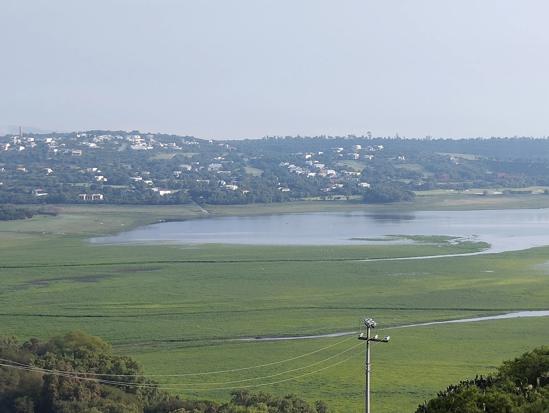
The Requena dam went up between 1919 and 1922 on the Tepeji river, about 6 km downstream from Tepeji del Río and roughly 60 km northwest of Mexico City. The reservoir sits between the municipalities of Tepeji del Río de Ocampo and Tula de Allende, at about 2,110 metres, on the semi-arid plains at the southern end of the Mezquital Valley. Its gravity wall is 37.4 metres high and 230 long, and it holds up to 52.5 million cubic metres. Water from the Taxhimay reservoir comes in from the south; below the dam the stream joins the El Salto river and from there on is called the Tula.
This is a working reservoir more than a resort. A cooperative of about 40 fishermen, 'Pescadores Unidos de la Presa Requena 20 Arcos', nets carp, tilapia and charal, and the lake hosts sport-fishing and powerboat events. White and grey herons, pelicans and ducks gather along the banks, especially during migration. Clean-up drives have worked along its 10 km of shoreline to clear water hyacinth and rubbish.
Its level swings a lot from year to year. Conagua released water during the 2020 floods, and in July 2023, after months of heat and little rain, it was nearly empty and huge numbers of fish died; the June and July 2024 rains brought it back to about 89% of capacity. It's worth asking about the water before you go.
How to get to Presa Requena
Drive from Mexico City: 1 h 15 min, 75 km
Your base is Tepeji del Río, on the México-Querétaro toll road about 60 km from Mexico City. The reservoir lies about 6 km downstream of town, toward Tula; it's a few minutes from central Tepeji by car or taxi, and asking for the fishermen's access or '20 Arcos' helps. From Mexico City allow about 70 minutes by car, depending on traffic getting out of the city. By bus, Ovnibus links Tepeji with Mexico City's Terminal Norte in around an hour; from Tepeji, take a taxi for the last stretch. Jilotepec, the nearest Pueblo Mágico (State of Mexico), is about 22 km away in a straight line, roughly 25 to 30 minutes along the same highway.
Directions to Presa Requena on Google Maps
Distances are in a straight line; the road is usually longer.
Links open a partner site. We may earn a commission if you book, at no cost to you.
From the nearest cities to Presa Requena
- Mexico City · 75 km by road, 1 h 15 min
- Pachuca · 100 km by road, 1 h 25 min
- San Juan del Río · 97 km by road, 1 h 30 min
Drive times by road from OpenStreetMap, without traffic or stops. Times marked ~ are estimated from the straight-line distance.
Before you go to Presa Requena: hours, prices and tips
- Best time of day
- Depends on the rains: the reservoir nearly dried out in mid-2023 and refilled to about 89% after the June-July 2024 rains, so it is fullest after the rainy season. Wikipedia (es) · checked Oct 2026
Hours and prices change, especially around holidays. Each fact links to where we checked it.
Visiting Presa Requena: what to see and do
The 1922 dam wall, 37 metres high and 230 long
Herons, pelicans and ducks along the banks, especially during migration
The boats of the 20 Arcos fishing cooperative
Sport-fishing and powerboat events when the water is high enough
Tepeji del Río, about 6 km upstream
Plan your trip
Places to stay in Presa Requena
Compare hotels, posadas, and rentals in and around Presa Requena.
Tours & activities
Day trips and guided outings from Jilotepec often include Presa Requena; with a local guide you can get there without a car.
Rental cars
Pick up a car at NLU (Mexico City (Felipe Ángeles)): about 1 h 20 min by road to Jilotepec, then 22 km more to Presa Requena, on your own schedule.
Flights
The nearest airport with scheduled flights is Mexico City (Felipe Ángeles) (NLU), about 1 h 20 min by road from Jilotepec, the base for Presa Requena.
Travel insurance
If you plan on swimming or kayaking at Presa Requena, check that your policy covers it: some plans leave adventure activities out.
Mobile data
Signal can drop away from Jilotepec: download a map of the way to Presa Requena before you set out, or carry an eSIM with data.
Links open a partner site. We may earn a commission if you book, at no cost to you.
When to go to Presa Requena cool
Presa Requena shares the climate of Jilotepec, 22 km away. The best months to visit are January, February, March, and December.
Presa Requena is best for swimming and time on the water in the warmest months (March, April, and May); in the rainiest ones (July, August, and September) expect storms in the afternoon.
See the month-by-month climate of Jilotepec
Weather in Presa Requena now and the next 7 days
Live forecast from Open-Meteo. Chance of rain is the day's highest.
The closest Pueblo Mágico: Jilotepec

Jilotepec is the Pueblo Mágico closest to Presa Requena, with places to stay, food, and more to see.
Also close to
- Tepotzotlán · Estado de México · 27 km away
- Villa del Carbón · Estado de México · 28 km away
- Aculco · Estado de México · 57 km away
- Teotihuacán · Estado de México · 57 km away
- Huichapan · Hidalgo · 59 km away
Closest to Presa Requena
-
Tepeji del Río · Town · 5 km away
-
Santiago Tlautla · Village · 6 km away
-
Real Castilla · Village · 9 km away
-
Santiago Tlapanaloya · Village · 9 km away
-
Tula de Allende · City · 12 km away
-
Atotonilco de Tula · Town · 13 km away
-
Zona Arqueológica de Tula · Archaeological site · 13 km away
-
El Dorado Huehuetoca · Town · 14 km away


Near Presa Requena


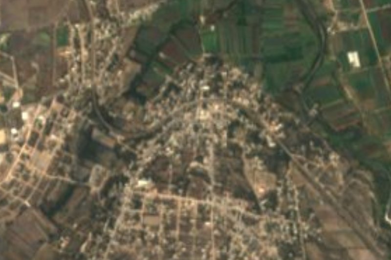



Drive times by road from OpenStreetMap, without traffic. Times marked ~ are estimated from the straight-line distance.
Lists with Presa Requena
Lakes and Lagoons in Hidalgo · 11 Lakes and Lagoons near Tepotzotlán · 9 Lakes and Lagoons near Villa del Carbón · 8 Lakes and Lagoons near Teotihuacán · 11 Lakes and Lagoons near Aculco · 6 Lakes and Lagoons near Huichapan · 5 Lakes and Lagoons near Mexico City · 9Location from OpenStreetMap. Written by Puebloteca.