
Town Tonanitla, Estado de México Valley of Mexico
Seat of Tonanitla, a municipality created only in 2003 after a century-long fight for autonomy; its fair for Nuestra Señora de los Remedios is on 1 September.
From Mexico City: 35 min by car (35 km by road) How to get there ↓
Near here
See everything nearby ↓


Plan your visit to Santa María Tonanitla
Where to stay near Santa María Tonanitla
Compare hotels, posadas and guest houses in Santa María Tonanitla.
Tours to Santa María Tonanitla
Day trips around Tepotzotlán sometimes stop in Santa María Tonanitla; a tour is the easy way to see it without a car.
How to get to Santa María Tonanitla
- From Mexico City: about 35 min by road (~35 km)
- Nearest airport: Mexico City (Felipe Ángeles) (NLU), 48 min by car to Tepotzotlán
Links open a partner site. We may earn a commission if you book, at no cost to you.
About Santa María Tonanitla
Santa María Tonanitla is the seat of the municipality of Tonanitla, in the northern Valley of Mexico, and counted 6,915 residents in the 2020 census. The name is Nahuatl and reads as "in the place of our mother": the municipal glyph shows an old woman's head on a hill, a reference to Tonan, the goddess people once venerated here. The land sits at roughly 2,240 m, among Jaltenco, Tecámac, Ecatepec, Tultitlán and Nextlalpan, and farming is still the main occupation.
The recent history here is about land and about independence. In 1931 the village was granted 524 hectares of ejido carved out of the grazing land of the Ojo de Agua hacienda, and in 1935 another 259 were added. In 1949 a plot in the centre was expropriated to build the primary school. For more than a century the village belonged to the municipality of Jaltenco and pressed to break away; the State of México legislature finally agreed on 29 July 2003 with decrees 152, 153 and 154, and the town council took office on 3 December that year, which is now the municipal anniversary.
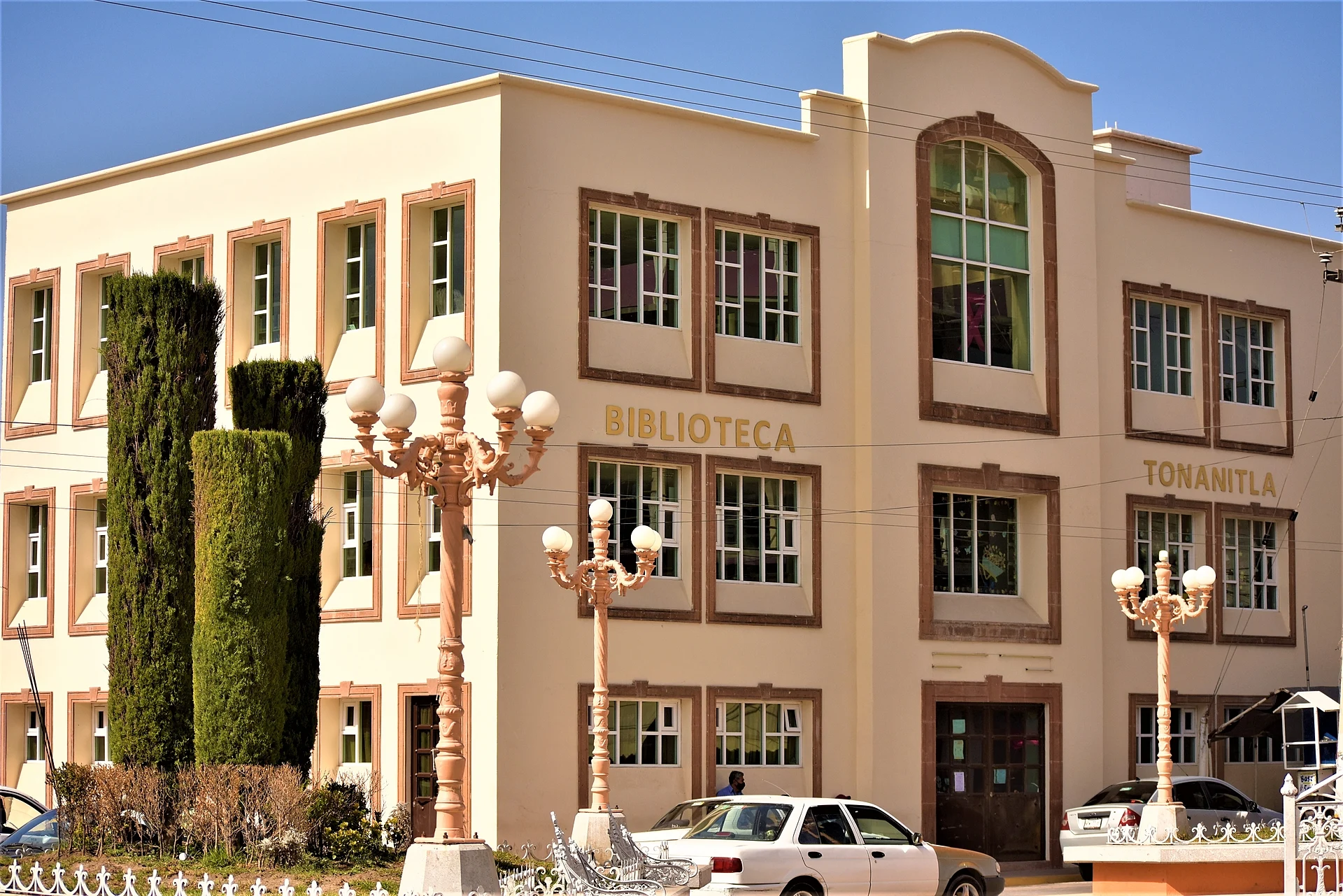
What a visitor finds is village life: a small centre with its public library, and the fairs. The big one honours the patron, Nuestra Señora de los Remedios, on 1 September (moved to the nearest weekend and followed by eight more days, the tornafiesta). In August there is the Feria del Elote y del Maíz, running since 2003 in colonia Concepción.
How to get to Santa María Tonanitla
Drive from Mexico City: 35 min, 35 km
Tonanitla lies in the north of the Valley of Mexico between Jaltenco and Tecámac, about 30 km in a straight line from Mexico City's Zócalo and about 18 km from Tepotzotlán; by road allow roughly 45 minutes to over an hour from the city depending on traffic (our estimate, not an official figure). The toll road of the area is the Circuito Exterior Mexiquense, whose Zumpango–Tultepec section crosses the México–Querétaro highway (57D); from there, or from the México–Pachuca highway, you reach Jaltenco, which borders Tonanitla. There is no reliable published information on public-transport routes to the village: the safest plan is to get to Jaltenco or Tecámac and take a colectivo or taxi for the last stretch, and check a maps app.
Directions to Santa María Tonanitla on Google Maps
Distances are in a straight line; the road is usually longer.
Links open a partner site. We may earn a commission if you book, at no cost to you.
From the nearest cities to Santa María Tonanitla
- Mexico City · 35 km by road, 35 min
- Pachuca · 67 km by road, 55 min
- Toluca · 97 km by road, 1 h 25 min
Drive times by road from OpenStreetMap, without traffic or stops. Times marked ~ are estimated from the straight-line distance.
Before you go to Santa María Tonanitla: hours, prices and tips
- Best season
- The patron-saint fair for Nuestra Señora de los Remedios is on 1 September (moved to the nearest weekend, plus an eight-day tornafiesta); the Feria del Elote y del Maíz is in August in colonia Concepción. Wikipedia (es): Municipio de Tonanitla · checked Oct 2026
Hours and prices change, especially around holidays. Each fact links to where we checked it.
Visiting Santa María Tonanitla: what to see and do
The village centre and the Biblioteca Pública Municipal de Tonanitla.
The patron-saint fair for Nuestra Señora de los Remedios on 1 September, with its eight-day tornafiesta.
The Feria del Elote y del Maíz in August, in colonia Concepción.
The colonia fairs: Asunción (15 August) and Concepción (8 December).
The farmland of the 1931 ejido around the village.
Plan your trip
Places to stay in Santa María Tonanitla
Compare hotels, posadas, and rentals in and around Santa María Tonanitla.
Tours & activities
Day trips around Tepotzotlán sometimes stop in Santa María Tonanitla; a tour is the easy way to see it without a car.
Rental cars
Pick up a car at NLU (Mexico City (Felipe Ángeles)): about 48 min by road to Tepotzotlán, then 18 km more to Santa María Tonanitla, on your own schedule.
Flights
The nearest airport with scheduled flights is Mexico City (Felipe Ángeles) (NLU), about 48 min by road from Tepotzotlán, the base for Santa María Tonanitla.
Mobile data
Signal can drop away from Tepotzotlán: download a map of the way to Santa María Tonanitla before you set out, or carry an eSIM with data.
Links open a partner site. We may earn a commission if you book, at no cost to you.
When to go to Santa María Tonanitla cool
Santa María Tonanitla shares the climate of Tepotzotlán, 18 km away. The best months to visit are January, February, March, and December.
See the month-by-month climate of Tepotzotlán
Weather in Santa María Tonanitla now and the next 7 days
Live forecast from Open-Meteo. Chance of rain is the day's highest.
The closest Pueblo Mágico: Tepotzotlán

Tepotzotlán is the Pueblo Mágico closest to Santa María Tonanitla, with places to stay, food, and more to see.
Also close to
- Teotihuacán · Estado de México · 22 km away
- Otumba · Estado de México · 31 km away
- Villa del Carbón · Estado de México · 43 km away
- Zempoala · Hidalgo · 47 km away
- Jilotepec · Estado de México · 58 km away
Closest to Santa María Tonanitla
-
San Pablo de las Salinas · City · 4 km away
-
Santa Ana Nextlalpan · Town · 6 km away
-
San Francisco Coacalco · City · 8 km away
-
Santiago Teyahualco · Town · 8 km away
-
Tultepec · Town · 8 km away
-
Museo Paleontológico de Santa Lucía Quinametzin · Landmark · 9 km away
-
Tecámac de Felipe Villanueva · Town · 9 km away
-
Santa María Cuautepec · Village · 10 km away


Near Santa María Tonanitla


Drive times by road from OpenStreetMap, without traffic. Times marked ~ are estimated from the straight-line distance.
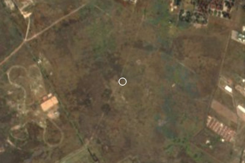
Location from OpenStreetMap. Written by Puebloteca.