
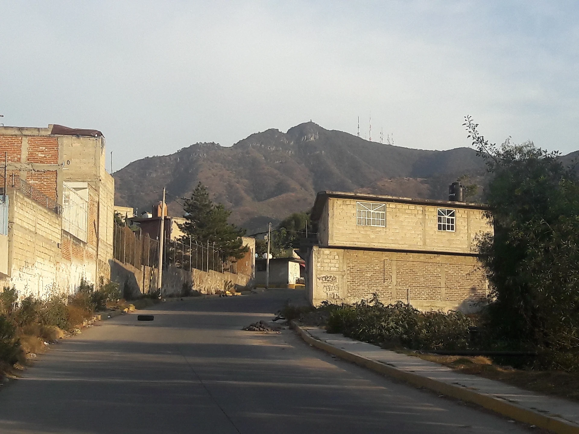
Village Tultitlán, Estado de México Municipality of Tultitlán Valley of Mexico
Smallest pueblo of Tultitlán at the foot of the Sierra de Guadalupe, with a 1737 Baroque chapel and feasts on 2 February and 15 August.
From Mexico City: 35 min by car (33 km by road) How to get there ↓
Near here
See everything nearby ↓


Plan your visit to Santa María Cuautepec
Where to stay near Santa María Cuautepec
Compare hotels, posadas and guest houses in Santa María Cuautepec.
Tours to Santa María Cuautepec
Day trips and guided outings from Tepotzotlán often include Santa María Cuautepec; with a local guide you can get there without a car.
How to get to Santa María Cuautepec
- From Mexico City: about 35 min by road (~33 km)
- Nearest airport: Mexico City (Felipe Ángeles) (NLU), 48 min by car to Tepotzotlán
Links open a partner site. We may earn a commission if you book, at no cost to you.
About Santa María Cuautepec
Santa María Cuautepec is the smallest of Tultitlán's seven pueblos, tucked into the south of the municipality between the housing developments of Fuentes del Valle, Villas de San José and Real del Bosque and its bigger namesake, San Mateo Cuautepec. The Nahuatl name means "on the eagle's hill", and the hill is right there: the Sierra de Guadalupe rises just above the village.
Local history puts the first settlers, from the Teotihuacan world, between about AD 200 and 750, with Toltec groups settling nearby later. The first chapel went up in the 1600s and is now the sacristy; the main chapel, dedicated to Our Lady of Candelaria, was finished in 1737, a date cut into a stone in the choir. It is the smallest chapel in the municipality yet has the most elaborate Baroque façade of any church in Tultitlán. People have guessed the owners of the nearby La Mariscala hacienda paid for it, but nothing documents that.
The year is marked by pilgrimages and feasts: cyclists ride to San Juan de los Lagos in January, walkers go to the Basilica of Guadalupe in February, and on 12 December the Virgin is honoured at the hermitage in the upper part of the village. The patron-saint fairs fall on 2 February (Candelaria) and 15 August (Assumption), with a procession, mariachi serenades, fireworks and fairground rides. The village also has two temazcal steam baths and a kiosk, and the Sierra de Guadalupe State Park is next door.
How to get to Santa María Cuautepec
Drive from Mexico City: 35 min, 33 km
Santa María Cuautepec is in the south of Tultitlán, roughly 22 km in a straight line from Mexico City (about; driving time varies a lot with traffic on the Mexico-Querétaro corridor). We found no published bus route that reaches the village itself, so the clearest option is Mexibús Line 2 (La Quebrada to Las Américas, 22.3 km): its stations Fuentes del Valle, Mariscala Real del Bosque, Villas de San José and Santa María are named after the developments that surround the village. From there, walk or take local transport to the chapel. By car, enter Tultitlán and look for the Candelaria chapel; Tepotzotlán, the nearest pueblo on our map, is about 14 km away in a straight line. Check the last stretch on a map before you set out.
Directions to Santa María Cuautepec on Google Maps
Distances are in a straight line; the road is usually longer.
Links open a partner site. We may earn a commission if you book, at no cost to you.
From the nearest cities to Santa María Cuautepec
- Mexico City · 33 km by road, 35 min
- Pachuca · 79 km by road, 1 h 5 min
- Toluca · 87 km by road, 1 h 15 min
Drive times by road from OpenStreetMap, without traffic or stops. Times marked ~ are estimated from the straight-line distance.
Before you go to Santa María Cuautepec: hours, prices and tips
- Best time of day
- The main fairs are 2 February (Candelaria) and 15 August (Assumption); the Señor de la Misericordia feast falls on the second Sunday of Easter. Wikipedia (es) · checked Oct 2026
Hours and prices change, especially around holidays. Each fact links to where we checked it.
Visiting Santa María Cuautepec: what to see and do
The Chapel of Our Lady of Candelaria (1737), with the most elaborate Baroque façade of any church in Tultitlán.
The Chapel of the Señor de la Misericordia, the old hermitage in the upper village, where the Virgin of Guadalupe is honoured on 12 December.
Sierra de Guadalupe State Park, which starts above the village; the Cerro Picacho viewpoint at its highest point is reached from the El Fraile entrance.
The Candelaria feast (2 February) and the Assumption feast (15 August), with procession and fireworks.
The village kiosk and the two temazcal steam baths that Wikipedia lists.
Plan your trip
Places to stay in Santa María Cuautepec
Compare hotels, posadas, and rentals in and around Santa María Cuautepec.
Tours & activities
Day trips and guided outings from Tepotzotlán often include Santa María Cuautepec; with a local guide you can get there without a car.
Rental cars
Pick up a car at NLU (Mexico City (Felipe Ángeles)): about 48 min by road to Tepotzotlán, then 14 km more to Santa María Cuautepec, on your own schedule.
Flights
The nearest airport with scheduled flights is Mexico City (Felipe Ángeles) (NLU), about 48 min by road from Tepotzotlán, the base for Santa María Cuautepec.
Mobile data
Signal can drop away from Tepotzotlán: download a map of the way to Santa María Cuautepec before you set out, or carry an eSIM with data.
Links open a partner site. We may earn a commission if you book, at no cost to you.
When to go to Santa María Cuautepec cool
Santa María Cuautepec shares the climate of Tepotzotlán, 14 km away. The best months to visit are January, February, March, and December.
See the month-by-month climate of Tepotzotlán
Weather in Santa María Cuautepec now and the next 7 days
Live forecast from Open-Meteo. Chance of rain is the day's highest.
The closest Pueblo Mágico: Tepotzotlán

Tepotzotlán is the Pueblo Mágico closest to Santa María Cuautepec, with places to stay, food, and more to see.
Also close to
- Teotihuacán · Estado de México · 31 km away
- Villa del Carbón · Estado de México · 37 km away
- Otumba · Estado de México · 40 km away
- Jilotepec · Estado de México · 56 km away
- Zempoala · Hidalgo · 58 km away
Closest to Santa María Cuautepec
-
Fuentes del Valle · Town · 1 km away
-
San Francisco Coacalco · City · 3 km away
-
Santiago Teyahualco · Town · 3 km away
-
Buenavista · City · 5 km away
-
Tultitlán de Mariano Escobedo · Town · 5 km away
-
Tultepec · Town · 6 km away
-
Catedral de Cuautitlán · Landmark · 7 km away
-
Cuautitlán · City · 7 km away


Near Santa María Cuautepec


Drive times by road from OpenStreetMap, without traffic. Times marked ~ are estimated from the straight-line distance.
Location from OpenStreetMap. Written by Puebloteca.