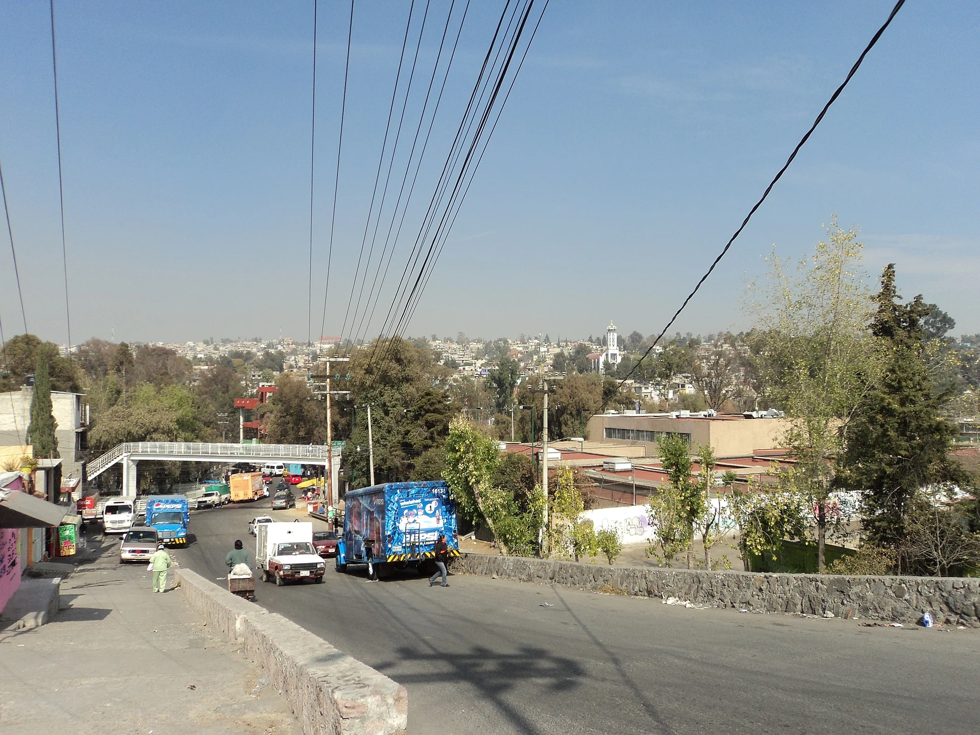
City Nicolás Romero, Estado de México Valley of Mexico
A mill city on the northern edge of greater Mexico City, born of 19th-century textile factories; San Pedro parish, Teatro Centenario, Cahuacán woods.
From Mexico City: 40 min by car (39 km by road) How to get there ↓
Near here
See everything nearby ↓


Plan your visit to Nicolás Romero
Where to stay near Nicolás Romero
Compare hotels, posadas and guest houses in Nicolás Romero.
Tours to Nicolás Romero
Day trips and guided outings from Tepotzotlán often include Nicolás Romero; with a local guide you can get there without a car.
 Tours from Mexico City
Teotihuacan pyramids morning or afternoon without tourist traps
★ 4.9 (10,269) · From US$59
How to get to Nicolás Romero
- From Mexico City: about 40 min by road (~39 km)
- Nearest airport: Mexico City (Felipe Ángeles) (NLU), 48 min by car to Tepotzotlán
Links open a partner site. We may earn a commission if you book, at no cost to you.
Tours from Mexico City, near Nicolás Romero


Tours, prices and ratings from Viator, checked weekly. We may earn a commission if you book.
About Nicolás Romero
For most of the colonial era this place was San Pedro Azcapotzaltongo, Nahuatl for "among the little anthills", and from 1821 to 1898 it was called Monte Bajo. In 1898 the state legislature made it a villa and renamed it after Colonel Nicolás Romero, who walked out of the Molino Viejo mill in 1859 to fight for the Liberals and was shot by the French in Mexico City's Plazuela de Mixcalco in 1865. The seat became a city in 1998. Today it is part of the Mexico City metropolitan area: INEGI counted 323,545 people in the city and 430,601 in the municipality in 2020, spread over hills at about 2,390 m.
This was Otomí country. Cahuacán, Magú, San Miguel Hila and Tlillan predate the Spanish, and the Aztecs made Cahuacán a tribute centre around 1430. Industry is what reshaped it. The San Ildefonso spinning and weaving mill started in 1847, La Abeja and La Colmena ran at Molino Viejo, Barrón began making thread in 1852, and in 1900 the El Progreso Industrial paper mill opened along with the Monte Alto railway. Each mill grew its own village, which still carries its name, and the mill hands formed brass bands that became known across the region. San Ildefonso, the oldest of the textile works, still turns out woollen cloth.
For visitors the city is more a gateway to the hills than a weekend destination, but there are things to see. The centre, now styled the historic centre of San Pedro Azcapotzaltongo, has the parish church of San Pedro Apóstol, the Jardín Hidalgo with an old Monte Alto railway station, and the Teatro Centenario, opened on 15 September 1910; it served as a barracks, cinema and boxing hall before it was rebuilt in 1993. The street market in the centre is worth a wander. To the west the Sierra de Monte Alto climbs to nearly 3,500 m, with fir and pine forest around Cahuacán, San Juan de las Tablas and Transfiguración; Cahuacán's church of Santa María Magdalena is considered the oldest in the area. In the rainy season wild mushrooms such as queximones and semas are sold locally, and local artisans do the beadwork used on stage costumes.
How to get to Nicolás Romero
Drive from Mexico City: 40 min, 39 km
From Mexico City take the northern Periférico to Atizapán de Zaragoza, then the Atizapán–Nicolás Romero road, which runs into town as the main avenue. From the Metro El Rosario area it is about 22 km, roughly 30 minutes without traffic; at rush hour the main road jams and the town runs a movable-barrier extra lane to ease it.
By public transport, buses and minibuses leave from Metro El Rosario, Metro Cuatro Caminos (El Toreo), Metro Politécnico and Metro Chapultepec, and other routes link to the Tlalnepantla and San Rafael stations of the Tren Suburbano; operators include Autobuses Rápidos de Monte Alto (ARMASA) and Autobuses del Noroeste. Tepotzotlán, the nearest of our pueblos, is about 15 km northeast via the road to Villa Nicolás Romero, roughly 20 minutes. Toluca is about 58 km away.
Directions to Nicolás Romero on Google Maps
Distances are in a straight line; the road is usually longer.
Links open a partner site. We may earn a commission if you book, at no cost to you.
From the nearest cities to Nicolás Romero
- Mexico City · 39 km by road, 40 min
- Toluca · 66 km by road, 1 h 5 min
- Pachuca · 100 km by road, 1 h 30 min
Drive times by road from OpenStreetMap, without traffic or stops. Times marked ~ are estimated from the straight-line distance.
Before you go to Nicolás Romero: hours, prices and tips
- Best season
- The feast of San Pedro Apóstol, the biggest in the municipality, is on 29 June; almost every month one of the villages celebrates its patron saint. Enciclopedia de los Municipios de México (INAFED) · checked Oct 2026
Hours and prices change, especially around holidays. Each fact links to where we checked it.
Visiting Nicolás Romero: what to see and do
The parish church of San Pedro Apóstol, whose 29 June feast is the biggest in the municipality.
The 1910 Teatro Centenario, rebuilt in 1993.
Jardín Hidalgo, with an old Monte Alto railway station.
The mill villages of San Ildefonso, La Colmena, Barrón and Progreso Industrial, with their 19th-century buildings.
The San Ildefonso textile museum and the Fernando Castro Vázquez local history museum, open on special days.
The church of Santa María Magdalena in Cahuacán and the forests of the Sierra de Monte Alto.
The street market in the centre.
Plan your trip
Places to stay in Nicolás Romero
Compare hotels, posadas, and rentals in and around Nicolás Romero.
Tours & activities
Day trips and guided outings from Tepotzotlán often include Nicolás Romero; with a local guide you can get there without a car.
Rental cars
Pick up a car at NLU (Mexico City (Felipe Ángeles)): about 48 min by road to Tepotzotlán, then 12 km more to Nicolás Romero, on your own schedule.
Flights
The nearest airport with scheduled flights is Mexico City (Felipe Ángeles) (NLU), about 48 min by road from Tepotzotlán, the base for Nicolás Romero.
Mobile data
Signal can drop away from Tepotzotlán: download a map of the way to Nicolás Romero before you set out, or carry an eSIM with data.
Links open a partner site. We may earn a commission if you book, at no cost to you.
When to go to Nicolás Romero cool
Nicolás Romero shares the climate of Tepotzotlán, 12 km away. The best months to visit are January, February, March, and December.
See the month-by-month climate of Tepotzotlán
Weather in Nicolás Romero now and the next 7 days
Live forecast from Open-Meteo. Chance of rain is the day's highest.
The closest Pueblo Mágico: Tepotzotlán

Tepotzotlán is the Pueblo Mágico closest to Nicolás Romero, with places to stay, food, and more to see.
Also close to
- Villa del Carbón · Estado de México · 19 km away
- Jilotepec · Estado de México · 42 km away
- Teotihuacán · Estado de México · 49 km away
- Metepec · Estado de México · 53 km away
- Otumba · Estado de México · 58 km away
Closest to Nicolás Romero
-
Lago de Guadalupe · Lake · 5 km away
-
Ciudad López Mateos · City · 10 km away
-
Cuautitlán Izcalli · City · 10 km away
-
Catedral de Cuautitlán · Landmark · 14 km away
-
Tultitlán de Mariano Escobedo · Town · 14 km away
-
Xochitla Parque Ecológico · Nature reserve · 14 km away
-
Arcos del Sitio · Landmark · 15 km away
-
Buenavista · City · 15 km away


Near Nicolás Romero


Drive times by road from OpenStreetMap, without traffic. Times marked ~ are estimated from the straight-line distance.
Location from OpenStreetMap. Written by Puebloteca.