Village Jilotzingo, Estado de México Valley of Mexico
The biggest locality in Jilotzingo municipality, at 2,714 m in the Monte Alto range, spread over barrios among peaks above 3,000 m.
From Mexico City: 35 min by car (33 km by road) How to get there ↓
Near here
See everything nearby ↓


Plan your visit to San Luis Ayucan
Where to stay near San Luis Ayucan
Compare hotels, posadas and guest houses in San Luis Ayucan.
Tours to San Luis Ayucan
Day trips and guided outings from Tepotzotlán often include San Luis Ayucan; with a local guide you can get there without a car.
 Tours from Mexico City
Teotihuacan pyramids morning or afternoon without tourist traps
★ 4.9 (10,269) · From US$59
How to get to San Luis Ayucan
- From Mexico City: about 35 min by road (~33 km)
- Nearest airport: Mexico City (Felipe Ángeles) (NLU), 48 min by car to Tepotzotlán
Links open a partner site. We may earn a commission if you book, at no cost to you.
Tours from Mexico City, near San Luis Ayucan


Tours, prices and ratings from Viator, checked weekly. We may earn a commission if you book.
About San Luis Ayucan
San Luis Ayucan is the most populous locality in the municipality of Jilotzingo: 4,275 residents in 2020 out of the municipality's 19,877. It sits at 2,714 m in the Monte Alto range, north of the Monte de las Cruces, and its land is spread over scattered barrios: Barrio Grande, Ensido, Endonica, Monfi, La Cuesta, Las Manzanas and others, so there is no single compact centre. Around it rise Cerro Ñango (3,171 m, 1.4 km away), Gachupín (3,001 m), Texcane (3,204 m) and Geishto (3,240 m).
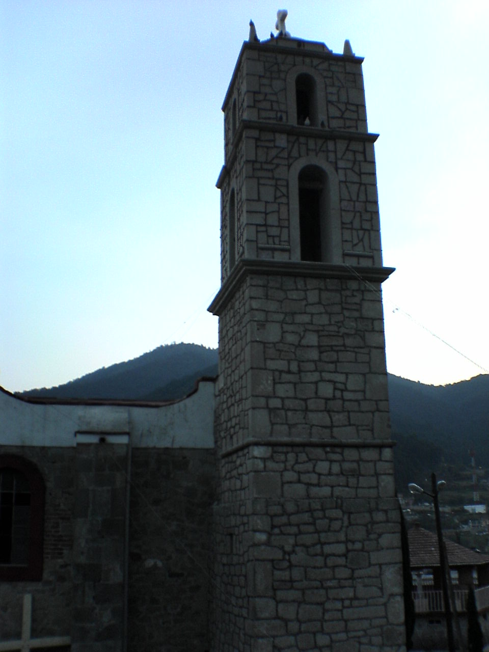
The name is Nahuatl and probably comes from ayotl (turtle) or ayotli (squash) plus can, "place"; Wikipedia leaves it as a possibility. The first settlers of the area were Otomí, and a decree of 1868 placed Ayucan within Santa Ana Jilotzingo. Its patron saint is San Luis Gonzaga, and the photo of the village shows a chapel.
The most distinctive thing is Holy Week: according to Wikipedia, in Ayucan participants dress in red, as the devil, with a mask and a whip called a chicote, and on Holy Saturday they splash water on people. The climate is cold mountain: 12.5 °C on average, recorded lows around -5 °C, about 1,070 mm of rain a year and very occasional snowfalls, such as that of 1983.
How to get to San Luis Ayucan
Drive from Mexico City: 35 min, 33 km
San Luis Ayucan sits high in Monte Alto, northeast of Toluca and west of Mexico City, about 25 km in a straight line from the centre of the capital; by road it takes roughly 30 minutes to over an hour depending on traffic and the route. It borders Huixquilucan to the south and Santiago Tepatlaxco to the east. The exact route and public transport lines are not published, so check the way on a map before setting out.
There are no hotels in the village. The closest are 15-19 km away: Hotel Loma Linda and Hotel Naucalli (about 17 km east) and Posada Familiar del Río (19 km north). The nearest pueblo is Tepotzotlán, about 43 km away, roughly 42 minutes by car.
Directions to San Luis Ayucan on Google Maps
Distances are in a straight line; the road is usually longer.
Links open a partner site. We may earn a commission if you book, at no cost to you.
From the nearest cities to San Luis Ayucan
- Mexico City · 33 km by road, 35 min
- Toluca · 63 km by road, 55 min
- Pachuca · 115 km by road, 1 h 30 min
Drive times by road from OpenStreetMap, without traffic or stops. Times marked ~ are estimated from the straight-line distance.
Before you go to San Luis Ayucan: hours, prices and tips
- Best time of day
- Holy Week is the most distinctive date: participants dress in red with masks and whips, and on Holy Saturday they splash water on people. The climate is cold mountain all year; July is the wettest month. Wikipedia (es): Municipio de Jilotzingo · checked Oct 2026
- What to bring
- A warm jacket: the annual mean is 12.5 °C and January averages 9.8 °C. Pueblos América: San Luis Ayucan · checked Oct 2026
Hours and prices change, especially around holidays. Each fact links to where we checked it.
Visiting San Luis Ayucan: what to see and do
The chapel of San Luis Ayucan, dedicated to San Luis Gonzaga.
Holy Week, with participants in red costumes, masks and whips.
The scattered barrios of Ensido, Endonica, Monfi and Las Manzanas.
The peaks of Ñango, Gachupín, Texcane and Geishto, all above 3,000 m, around the village.
The forests, springs and streams of the Monte Alto range.
Plan your trip
Places to stay in San Luis Ayucan
Compare hotels, posadas, and rentals in and around San Luis Ayucan.
Tours & activities
Day trips and guided outings from Tepotzotlán often include San Luis Ayucan; with a local guide you can get there without a car.
Rental cars
Pick up a car at NLU (Mexico City (Felipe Ángeles)): about 48 min by road to Tepotzotlán, then 28 km more to San Luis Ayucan, on your own schedule.
Flights
The nearest airport with scheduled flights is Mexico City (Felipe Ángeles) (NLU), about 48 min by road from Tepotzotlán, the base for San Luis Ayucan.
Mobile data
Signal can drop away from Tepotzotlán: download a map of the way to San Luis Ayucan before you set out, or carry an eSIM with data.
Links open a partner site. We may earn a commission if you book, at no cost to you.
When to go to San Luis Ayucan cool
San Luis Ayucan shares the climate of Tepotzotlán, 28 km away. The best months to visit are January, February, March, and December.
See the month-by-month climate of Tepotzotlán
Weather in San Luis Ayucan now and the next 7 days
Live forecast from Open-Meteo. Chance of rain is the day's highest.
The closest Pueblo Mágico: Tepotzotlán

Tepotzotlán is the Pueblo Mágico closest to San Luis Ayucan, with places to stay, food, and more to see.
Also close to
- Villa del Carbón · Estado de México · 28 km away
- Metepec · Estado de México · 37 km away
- Jilotepec · Estado de México · 54 km away
- Teotihuacán · Estado de México · 59 km away
- Malinalco · Estado de México · 62 km away
Closest to San Luis Ayucan
-
El Hielo · Village · 8 km away
-
Magdalena Chichicaspa · Town · 10 km away
-
Ciudad López Mateos · City · 14 km away
-
Naucalpan · City · 14 km away
-
Naucalpan de Juárez · City · 14 km away
-
Tlatilco · Archaeological site · 14 km away
-
Huixquilucan de Degollado · Town · 15 km away
-
Jesús del Monte · Town · 15 km away


Near San Luis Ayucan


Drive times by road from OpenStreetMap, without traffic. Times marked ~ are estimated from the straight-line distance.
Location from OpenStreetMap. Written by Puebloteca.