Lake Cuautitlán Izcalli, Estado de México Municipality of Cuautitlán Izcalli Valley of Mexico
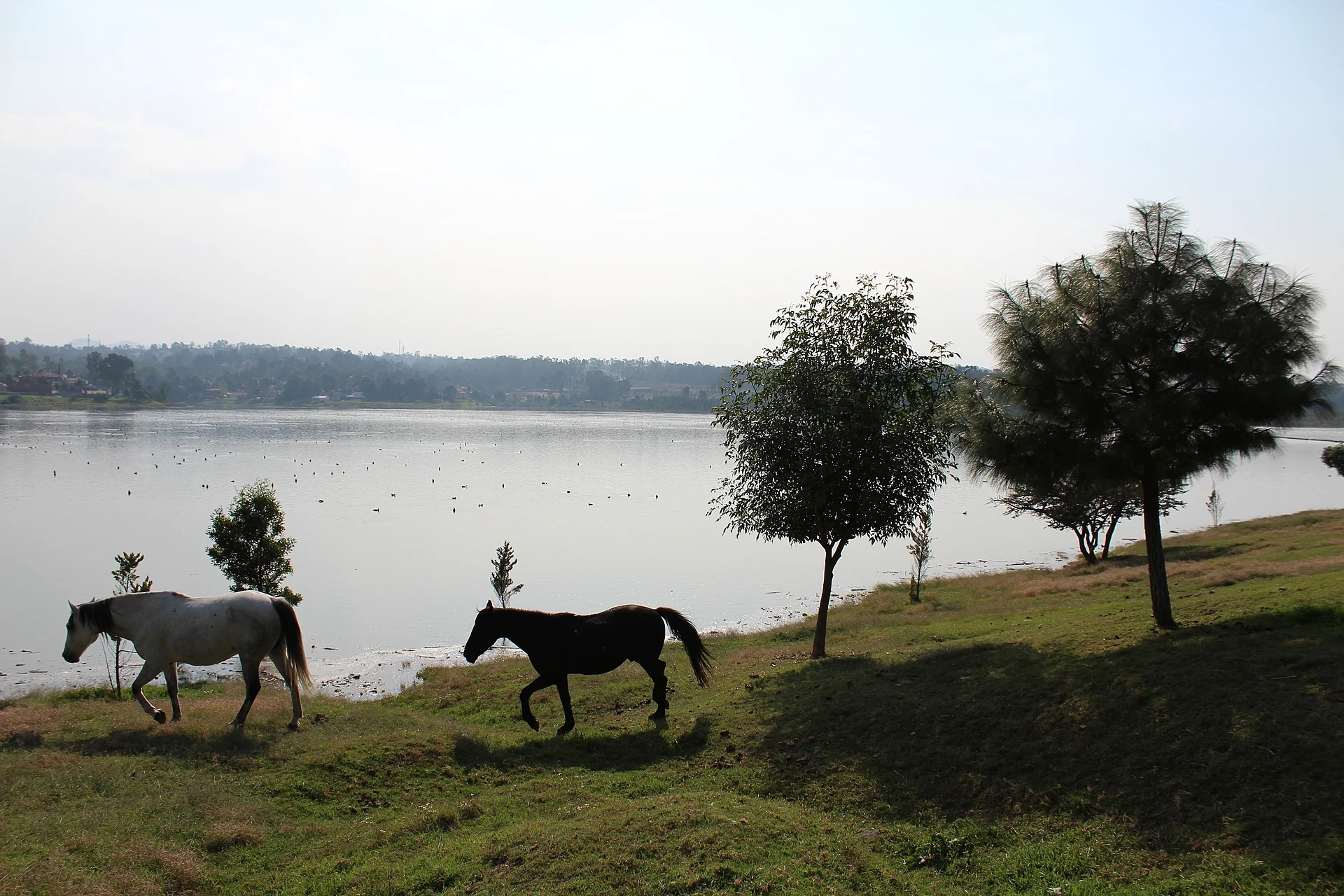
A 1930s reservoir on the west side of Cuautitlán Izcalli, a state protected area and a refuge for waterbirds within reach of Mexico City.
From Mexico City: 55 min by car (38 km by road) How to get there ↓
Near here
See everything nearby ↓


Plan your visit to Lago de Guadalupe
Where to stay near Lago de Guadalupe
Compare hotels, posadas and guest houses in Lago de Guadalupe.
Tours to Lago de Guadalupe
Day trips and guided outings from Tepotzotlán often include Lago de Guadalupe; with a local guide you can get there without a car.
 Tours from Mexico City
Teotihuacan pyramids morning or afternoon without tourist traps
★ 4.9 (10,269) · From US$59
How to get to Lago de Guadalupe
- From Mexico City: about 55 min by road (~38 km)
- Nearest airport: Mexico City (Felipe Ángeles) (NLU), 48 min by car to Tepotzotlán
Links open a partner site. We may earn a commission if you book, at no cost to you.
Tours from Mexico City, near Lago de Guadalupe


Tours, prices and ratings from Viator, checked weekly. We may earn a commission if you book.
About Lago de Guadalupe
Everyone calls it a lake, but Lago de Guadalupe is a reservoir. It was built between 1936 and 1943 to stop the floods that kept hitting the villages around it, and it holds back several rivers coming down from the hills: the Cuautitlán, San Pedro, Chiquito, Grande, Xinté and El Muerto. Part of the Moctezuma river basin, it is regarded as the second most important body of water in the Valley of Mexico. With about 348 hectares of open water and a capacity of roughly 60 million cubic metres, it fills much of the western side of Cuautitlán Izcalli, along the borders with Atizapán de Zaragoza and Nicolás Romero. The name goes back to the colonial encomendero Gil González Dávila, who dedicated it to the Virgin of Guadalupe.
On 13 October 2004 the State of Mexico declared it a state park, the Santuario del Agua y Forestal Presa Guadalupe, covering land in five municipalities: Cuautitlán Izcalli, Atizapán, Nicolás Romero, Isidro Fabela and Jilotzingo. It is also a Key Biodiversity Area, confirmed in 2015 for the bird congregations it supports. Izcalli's government counts around 150 bird species, including the Mexican duck, mallards, herons and, in winter, American white pelicans.
The downside is pollution. El Universal reported in June 2026 that untreated sewage still reaches the reservoir, mostly from Nicolás Romero, and that the municipality removes about 60 cubic metres of rubbish from the shore every week; in 2005 there was a mass fish die-off. Conagua is building a plant to treat its water for drinking and pipe it to the La Caldera tank in the east of the valley, due to finish in 2027. For visitors this is a place to walk the shore, watch birds and grazing horses, and look across the water to the wooded hills, not somewhere to swim.
How to get to Lago de Guadalupe
Drive from Mexico City: 55 min, 38 km
The lake lies on the west side of Cuautitlán Izcalli, about 25 km north-west of Mexico City in a straight line. By car, take the Periférico Norte onto the Mexico–Querétaro highway (57D) as far as Cuautitlán Izcalli, then head west through the city to the shore, which is lined by neighbourhoods such as Lago de Guadalupe and Bosques del Lago. With normal traffic allow 45 minutes to an hour or more.
By public transport, the Tren Suburbano covers the 27 km from Buenavista to its Cuautitlán terminus, and buses and combis to Cuautitlán leave from the Terminal Norte; inside Izcalli you continue by colectivo or taxi to the shore. Tepotzotlán, the nearest pueblo, is about 10 km away (roughly 15 to 20 minutes by car).
Directions to Lago de Guadalupe on Google Maps
Distances are in a straight line; the road is usually longer.
Links open a partner site. We may earn a commission if you book, at no cost to you.
From the nearest cities to Lago de Guadalupe
- Mexico City · 38 km by road, 55 min
- Toluca · 83 km by road, 1 h 25 min
- Pachuca · 98 km by road, 1 h 35 min
Drive times by road from OpenStreetMap, without traffic or stops. Times marked ~ are estimated from the straight-line distance.
Before you go to Lago de Guadalupe: hours, prices and tips
- Entry
- There is no charge to visit the lake. Chilango · checked Oct 2026
- Best season
- American white pelicans are winter visitors, seen in the Valley of Mexico mainly from October to March. Posta · checked Oct 2026
- What to bring
- Bring bags to carry your rubbish out: the shore already gets far too much. Chilango · checked Oct 2026
Hours and prices change, especially around holidays. Each fact links to where we checked it.
Visiting Lago de Guadalupe: what to see and do
Walk the shoreline and look across the reservoir to the wooded hills.
Watch waterbirds: ducks, herons and, from October to March, American white pelicans.
Look out for the horses that graze on the banks, a familiar sight here.
Combine it with the Espejo de los Lirios wetland park and the Sculpture Park in the same city.
Carry on to Tepotzotlán, about 10 km away, for its colonial museum and baroque church.
Plan your trip
Places to stay in Lago de Guadalupe
Compare hotels, posadas, and rentals in and around Lago de Guadalupe.
Tours & activities
Day trips and guided outings from Tepotzotlán often include Lago de Guadalupe; with a local guide you can get there without a car.
Rental cars
Pick up a car at NLU (Mexico City (Felipe Ángeles)): about 48 min by road to Tepotzotlán, then 10 km more to Lago de Guadalupe, on your own schedule.
Flights
The nearest airport with scheduled flights is Mexico City (Felipe Ángeles) (NLU), about 48 min by road from Tepotzotlán, the base for Lago de Guadalupe.
Travel insurance
If you plan on swimming or kayaking at Lago de Guadalupe, check that your policy covers it: some plans leave adventure activities out.
Mobile data
Signal can drop away from Tepotzotlán: download a map of the way to Lago de Guadalupe before you set out, or carry an eSIM with data.
Links open a partner site. We may earn a commission if you book, at no cost to you.
When to go to Lago de Guadalupe cool
Lago de Guadalupe shares the climate of Tepotzotlán, 10 km away. The best months to visit are January, February, March, and December.
Lago de Guadalupe is best for swimming and time on the water in the warmest months (March, April, and May); in the rainiest ones (July, August, and September) expect storms in the afternoon.
See the month-by-month climate of Tepotzotlán
Weather in Lago de Guadalupe now and the next 7 days
Live forecast from Open-Meteo. Chance of rain is the day's highest.
The closest Pueblo Mágico: Tepotzotlán

Tepotzotlán is the Pueblo Mágico closest to Lago de Guadalupe, with places to stay, food, and more to see.
Also close to
- Villa del Carbón · Estado de México · 24 km away
- Teotihuacán · Estado de México · 44 km away
- Jilotepec · Estado de México · 46 km away
- Otumba · Estado de México · 53 km away
- Metepec · Estado de México · 56 km away
Closest to Lago de Guadalupe
-
Cuautitlán Izcalli · City · 5 km away
-
Nicolás Romero · City · 5 km away
-
Ciudad López Mateos · City · 8 km away
-
Catedral de Cuautitlán · Landmark · 9 km away
-
Tultitlán de Mariano Escobedo · Town · 9 km away
-
Buenavista · City · 10 km away
-
Cuautitlán · City · 10 km away
-
Xochitla Parque Ecológico · Nature reserve · 11 km away


Near Lago de Guadalupe


Drive times by road from OpenStreetMap, without traffic. Times marked ~ are estimated from the straight-line distance.
Lists with Lago de Guadalupe
Lakes and Lagoons in Estado de México · 7 Lakes and Lagoons near Tepotzotlán · 9 Lakes and Lagoons near Villa del Carbón · 8 Lakes and Lagoons near Mexico City · 9 Lakes and Lagoons near Teotihuacán · 11 Lakes and Lagoons near Otumba · 9 Lakes and Lagoons near Toluca · 3Location from OpenStreetMap. Written by Puebloteca.