
Village Acámbaro, Guanajuato
Relocated village by the Solís dam; the original site that named the Chupícuaro culture lies underwater.
From Acámbaro: 10 min by car (7 km by road) How to get there ↓
Near here
See everything nearby ↓



Plan your visit to Chupícuaro
Where to stay near Chupícuaro
Compare hotels, posadas and guest houses in Chupícuaro.
Tours to Chupícuaro
Day trips and guided outings from Salvatierra often include Chupícuaro; with a local guide you can get there without a car.
 Tours from Morelia
Morelia City Tour
★ 4.9 (115) · From US$33
How to get to Chupícuaro
- From Acámbaro: about 10 min by road (~7 km)
- Nearest airport: Morelia (MLM), 1 h 9 min by car to Salvatierra
Links open a partner site. We may earn a commission if you book, at no cost to you.
Tours from Morelia, near Chupícuaro


Tours, prices and ratings from Viator, checked weekly. We may earn a commission if you book.
About Chupícuaro
Chupícuaro, in the municipality of Acámbaro, has about 2,600 residents and sits at 1,937 metres, according to the 2020 census. The name, though, is older than the village you can visit. The original settlement stood on the Lerma River where the Coroneo (or Tigre) joins it, and the burial grounds found there gave their name to the Chupícuaro culture, a Late Preclassic pottery tradition of west and central Mexico. Its figurines, with angular female forms and geometric decoration, now sit in museums such as the Museo Amparo in Puebla and the Louvre.
The Solís dam, built in the 1940s, covered most of that ground. The exact year is given as 1946 or 1949, but the order of events is clear: INAH managed to excavate some tombs before the flooding, and the villagers had to move. The new village, Nuevo Chupícuaro, was founded in 1946. The name comes from Purépecha chupicua, a morning-glory (Ipomoea) used for blue dye, plus ro, place: roughly "place of little bells" or "blue place".
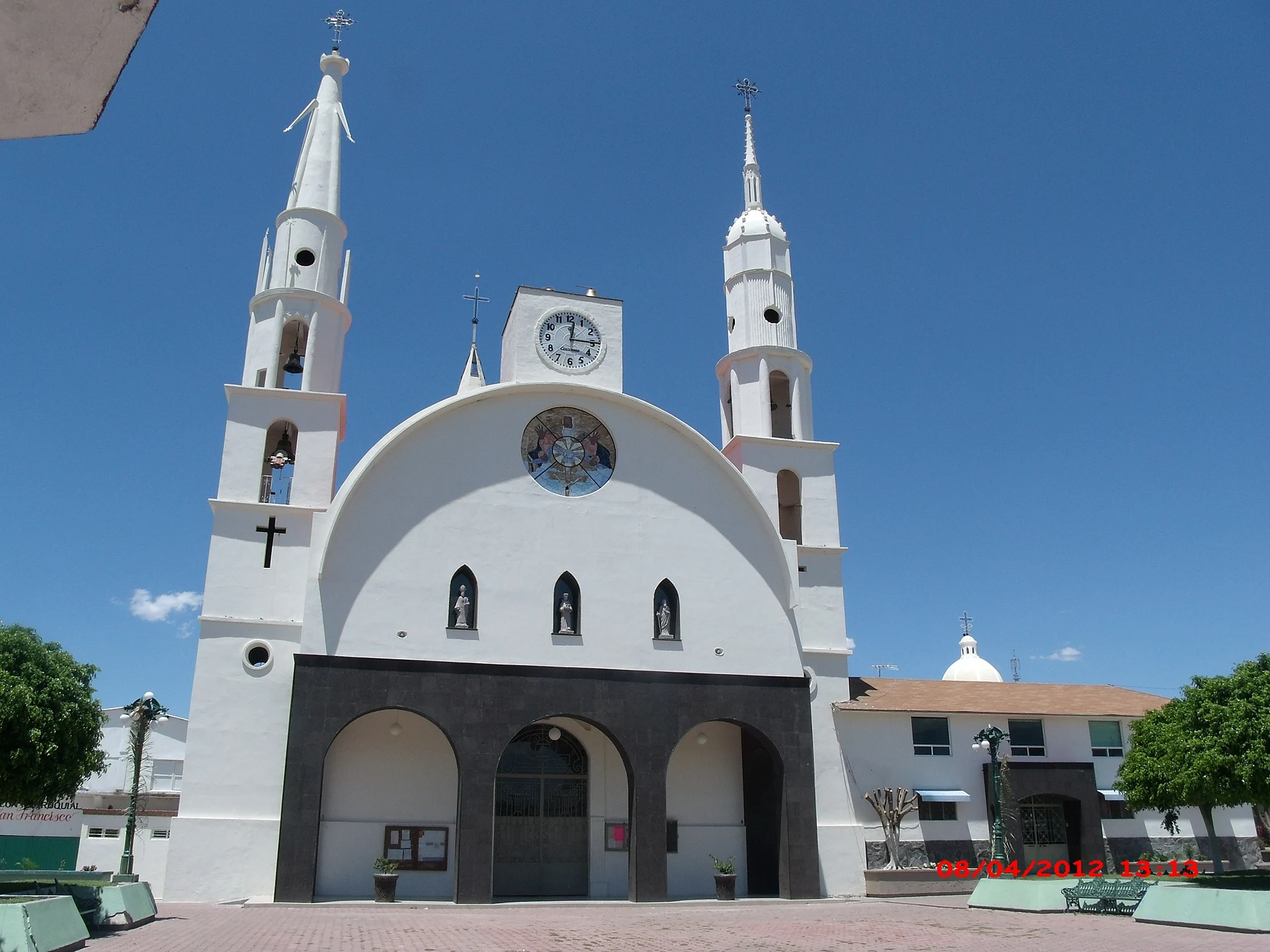
What is left of that past is small and mostly in the village itself. In 2013 the reservoir dropped low enough for the towers of the old church to be recovered and brought to Nuevo Chupícuaro. To see the archaeology, go to the local museum in Acámbaro, the municipal seat; the original site is still under the reservoir.
How to get to Chupícuaro
Drive from Acámbaro: 10 min, 7 km
Chupícuaro is reached from Acámbaro, the municipal seat: the original archaeological site was about 7 km from that city, and the new village lies in the same direction, beside the Solís reservoir, on federal highway 120 between Acámbaro and Jerécuaro. Allow roughly 30 minutes from Salvatierra and an hour from Celaya by road. There is no published public-transport timetable or dedicated service to Chupícuaro: the usual approach is a bus to Acámbaro and then local transport or a taxi. If you drive, find the village on a map by its full name (Chupícuaro, Acámbaro) and check the condition of the final stretch before leaving.
Directions to Chupícuaro on Google Maps
Distances are in a straight line; the road is usually longer.
Links open a partner site. We may earn a commission if you book, at no cost to you.
From the nearest cities to Chupícuaro
- Acámbaro · 7 km by road, 10 min
- Uriangato · 75 km by road, 1 h 10 min
- Celaya · 77 km by road, 1 h 10 min
Drive times by road from OpenStreetMap, without traffic or stops. Times marked ~ are estimated from the straight-line distance.
Visiting Chupícuaro: what to see and do
The church in Chupícuaro, with the old church's towers recovered from the dam in 2013
The Solís reservoir, under which the original village lies
The local museum in Acámbaro, with pieces of the Chupícuaro culture
Chupícuaro-style ceramic figurines at the Museo Amparo in Puebla
Plan your trip
Places to stay in Chupícuaro
Compare hotels, posadas, and rentals in and around Chupícuaro.
Tours & activities
Day trips and guided outings from Salvatierra often include Chupícuaro; with a local guide you can get there without a car.
Rental cars
Pick up a car at MLM (Morelia): about 1 h 9 min by road to Salvatierra, then 25 km more to Chupícuaro, on your own schedule.
Flights
The nearest airport with scheduled flights is Morelia (MLM), about 1 h 9 min by road from Salvatierra, the base for Chupícuaro.
Mobile data
Signal can drop away from Salvatierra: download a map of the way to Chupícuaro before you set out, or carry an eSIM with data.
Links open a partner site. We may earn a commission if you book, at no cost to you.
When to go to Chupícuaro mild
Chupícuaro shares the climate of Salvatierra, 25 km away. The best months to visit are January, February, March, and April.
See the month-by-month climate of Salvatierra
Weather in Chupícuaro now and the next 7 days
Live forecast from Open-Meteo. Chance of rain is the day's highest.
The closest Pueblo Mágico: Salvatierra

Salvatierra is the Pueblo Mágico closest to Chupícuaro, with places to stay, food, and more to see.
Also close to
- Yuriria · Guanajuato · 48 km away
- Cuitzeo · Michoacán · 48 km away
- Amealco · Querétaro · 59 km away
- Tlalpujahua · Michoacán · 62 km away
- El Oro · Estado de México · 66 km away
Closest to Chupícuaro
-
Acámbaro · Town · 5 km away
-
Tarandacuao · Town · 20 km away
-
Jerécuaro · Town · 21 km away
-
Araró · Hot springs · 22 km away
-
Tarimoro · Town · 25 km away
-
La Moncada · Village · 27 km away
-
Los Azufres · Hot springs · 32 km away
-
Santiago Maravatío · Village · 34 km away


Near Chupícuaro


Drive times by road from OpenStreetMap, without traffic. Times marked ~ are estimated from the straight-line distance.
Location from OpenStreetMap. Written by Puebloteca.