
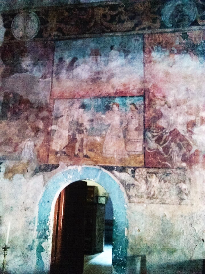
Village San Agustín Metzquititlán, Hidalgo Municipality of San Agustín Metzquititlán
Sierra Baja village at 1,379 m, 1.5 km from Metzquititlán, with 677 residents; its Nahuatl name reads as "green place" or "place of blue stone".
From Pachuca: 1 h 15 min by car (75 km by road) How to get there ↓
Near here
See everything nearby ↓



Plan your visit to Santa María Xoxoteco
Where to stay near Santa María Xoxoteco
Compare hotels, posadas and guest houses in Santa María Xoxoteco.
Tours to Santa María Xoxoteco
Day trips and guided outings from Metztitlán often include Santa María Xoxoteco; with a local guide you can get there without a car.
 Tours from Zacatlan
Zacatlán Guided Tour walking through the Center
★ 5.0 (2) · From US$8
How to get to Santa María Xoxoteco
- From Pachuca: about 1 h 15 min by road (~75 km)
- Nearest airport: Mexico City (Felipe Ángeles) (NLU), 2 h 18 min by car to Metztitlán
Links open a partner site. We may earn a commission if you book, at no cost to you.
Tours from Zacatlan, near Santa María Xoxoteco
Tours, prices and ratings from Viator, checked weekly. We may earn a commission if you book.
About Santa María Xoxoteco
Xoxoteco comes from Nahuatl, and Wikipedia gives two readings: xoxo, "green", plus the locative -teco, "green place" or "beside the greenery"; or xoxouhqui (blue), tetl (stone) and co, "place of blue stone". The village stands at 1,379 metres in the Sierra Baja, within the Sierra Madre Oriental and its Huasteca Karst subprovince. Its climate is semi-dry temperate, and its runoff belongs to the Metztitlán River subbasin.
The same source puts it 1.5 km from Metzquititlán, the municipal seat, and 90 km from Pachuca. Another entry, on the church, places it 2.5 km east of Metzquititlán; treat both numbers as rough guides. People live mainly from farming and livestock. The censuses show a very steady community: 617 residents in 1900, between 543 and 649 at every count of the 20th century, and 677 in 2020 (334 men, 343 women), 7.16% of the municipality.
Most visitors come for the 16th-century chapel, found in 1976 under a coat of paint and famous for its murals; that chapel has its own page under Metztitlán, so it is enough here to note that it stands inside the village, a plain nave topped by a bell gable. Beyond the church, the neighbouring seat is proud of its Clock Tower, about 25 metres tall, begun in 1975 with a clock donated by then-governor Matías Rodríguez and a bronze eagle on top, and of a Plaza Constitución decreed in 1850.
How to get to Santa María Xoxoteco
Drive from Pachuca: 1 h 15 min, 75 km
Wikipedia puts Xoxoteco 1.5 km from Metzquititlán (another entry says 2.5 km to the east) and 90 km from Pachuca. According to the list for Federal Highway 105, that road runs from Pachuca to Huejutla through Mineral del Monte, Atotonilco el Grande, San Agustín Metzquititlán, Zacualtipán and Molango, so the neighbouring seat sits on the axis that climbs from Pachuca toward the Huasteca. In a straight line the village is about 17 km from Metztitlán, about 26 km from Atotonilco el Grande and about 45 km from Pachuca (approximate figures from Wikipedia's coordinates). Reach Metzquititlán first on Highway 105, then ask there about the short last stretch.
Directions to Santa María Xoxoteco on Google Maps
Distances are in a straight line; the road is usually longer.
Links open a partner site. We may earn a commission if you book, at no cost to you.
From the nearest cities to Santa María Xoxoteco
- Pachuca · 75 km by road, 1 h 15 min
- Tulancingo · 105 km by road, 1 h 50 min
- Huauchinango · 130 km by road, 2 h 15 min
Drive times by road from OpenStreetMap, without traffic or stops. Times marked ~ are estimated from the straight-line distance.
Visiting Santa María Xoxoteco: what to see and do
The painted 16th-century chapel (see its page under Metztitlán).
The plain nave and bell gable of the chapel, from the first century of evangelisation.
The Metzquititlán Clock Tower, about 25 m tall, 1.5 km away.
Metzquititlán's Plaza Constitución, decreed in 1850.
The farm plots and hill landscape at 1,379 m.
Plan your trip
Places to stay in Santa María Xoxoteco
Compare hotels, posadas, and rentals in and around Santa María Xoxoteco.
Tours & activities
Day trips and guided outings from Metztitlán often include Santa María Xoxoteco; with a local guide you can get there without a car.
Rental cars
Pick up a car at NLU (Mexico City (Felipe Ángeles)): about 2 h 18 min by road to Metztitlán, then 16 km more to Santa María Xoxoteco, on your own schedule.
Flights
The nearest airport with scheduled flights is Mexico City (Felipe Ángeles) (NLU), about 2 h 18 min by road from Metztitlán, the base for Santa María Xoxoteco.
Mobile data
Signal can drop away from Metztitlán: download a map of the way to Santa María Xoxoteco before you set out, or carry an eSIM with data.
Links open a partner site. We may earn a commission if you book, at no cost to you.
When to go to Santa María Xoxoteco mild
Santa María Xoxoteco shares the climate of Metztitlán, 16 km away. The best months to visit are January, February, March, and December.
See the month-by-month climate of Metztitlán
Weather in Santa María Xoxoteco now and the next 7 days
Live forecast from Open-Meteo. Chance of rain is the day's highest.
The closest Pueblo Mágico: Metztitlán

Metztitlán is the Pueblo Mágico closest to Santa María Xoxoteco, with places to stay, food, and more to see.
Also close to
- Huasca de Ocampo · Hidalgo · 35 km away
- Mineral del Chico · Hidalgo · 37 km away
- Real del Monte · Hidalgo · 42 km away
- Pahuatlán · Puebla · 56 km away
- Acaxochitlán · Hidalgo · 59 km away
- Metztitlán · Hidalgo · 16 km away
Closest to Santa María Xoxoteco
-
Reserva de la Biosfera Barranca de Metztitlán · Nature reserve · 7 km away
-
San Pedro Tlatemalco · Landmark · 8 km away
-
Carpinteros · Village · 12 km away
-
Huayacocotla · Town · 15 km away
-
Zacualtipán · Town · 15 km away
-
Alumbres · Village · 18 km away
-
Tlamaya · Village · 23 km away
-
Balneario Amajac · Hot springs · 25 km away


Near Santa María Xoxoteco



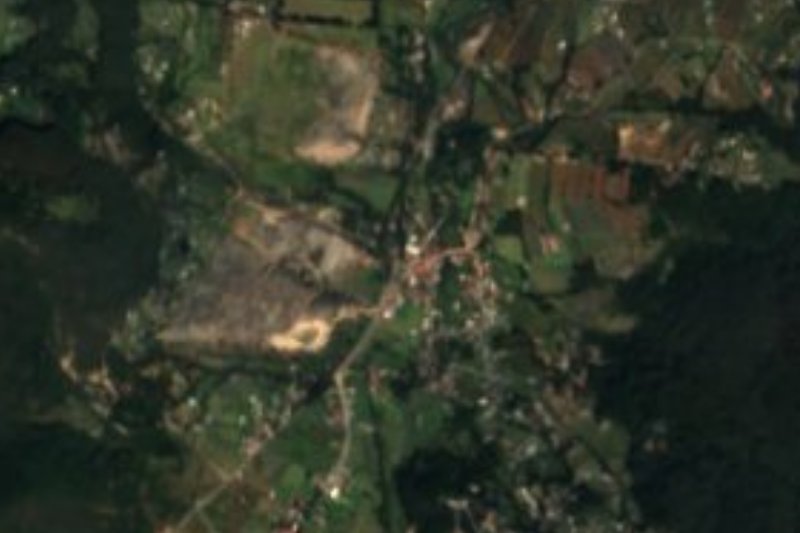


Drive times by road from OpenStreetMap, without traffic. Times marked ~ are estimated from the straight-line distance.
Location from OpenStreetMap. Written by Puebloteca.