Landmark Barrio Mágico Bars and nightlife Art and murals Mining history Pachuca de Soto, Hidalgo Municipality of Pachuca de Soto Hidalgo Mountain Corridor Comarca Minera Geopark
A hillside mining barrio of alleys and stairways above central Pachuca, with murals and old pulque bars. A Barrio Mágico since 2023.
From Tulancingo: about 45 min by road (~50 km) How to get there ↓
Near here
See everything nearby ↓


Plan your visit to El Arbolito
Where to stay near El Arbolito
Compare hotels, posadas and guest houses in El Arbolito.
Tours to El Arbolito
Look for tours of the area around Real del Monte that stop at El Arbolito.
 Tours from Zacatlan
Zacatlán Guided Tour walking through the Center
★ 5.0 (2) · From US$8
How to get to El Arbolito
- From Tulancingo: about 45 min by road (~50 km)
- Nearest airport: Mexico City (Felipe Ángeles) (NLU), 1 h 6 min by car to Real del Monte
Links open a partner site. We may earn a commission if you book, at no cost to you.
Tours from Zacatlan, near El Arbolito
Tours, prices and ratings from Viator, checked weekly. We may earn a commission if you book.
About El Arbolito
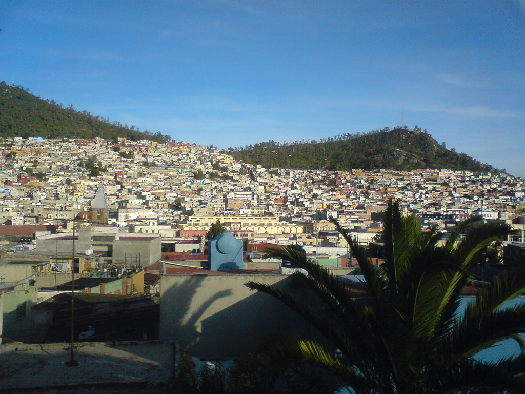
El Arbolito is a mining barrio climbing the hill just north of Pachuca's historic centre, about 800 metres from the Reloj Monumental clock tower. On 28 February 2023 Mexico's federal tourism ministry named it a Barrio Mágico: the fourth in the country, after Chetumal's historic centre, the Barrio de Tlaxcala in San Luis Potosí and Villa de Seris in Hermosillo, and the first in Hidalgo.
It was one of the first neighbourhoods of mine workers in the 19th century, when British companies drove Pachuca's silver boom, although most of the hillside filled with houses in the early 1900s. Part of the roughly 8,000 km of mine tunnels between Pachuca and Real del Monte runs beneath it. Residents say a huge pepper tree once stood in the middle of the barrio, ringed with benches where miners gathered, and that this little tree gave the place its name; where it stood there is now a mine wagon donated by the Real del Monte mining company. When mining declined, many houses and tenements emptied out and the barrio carried a rough reputation for years.
Today you explore it on foot along alleys and long flights of steps that tire the legs but open onto views of the city. The designation brought the federal Rutas Mágicas de Color programme, which began repainting facades along Galeana and Reforma streets in October 2023, using a palette proposed by INAH, the national heritage institute, and chosen with a local collective; the Cancha del Pueblo sports court is covered in murals by residents and artists. Old bars such as El Gran Golpe and La Nueva Veta, where miners went for pulque, are still open, and neighbourhood groups like Unidos por El Arbolito and Arbolito Cultura run walking tours, street parties, bazaars, workshops and music.
How to get to El Arbolito
The barrio begins about 800 metres north of the Reloj Monumental on Plaza de la Independencia; from there it is a 15 to 20-minute walk uphill with plenty of steps, so wear comfortable shoes. A taxi can drop you at the top. Pachuca is about 90 km north of Mexico City on the México–Pachuca highway (federal 85); first-class buses leave the Terminal del Norte very often, and Futura and ADO also run from Felipe Ángeles airport (AIFA), a trip of around an hour and a half. From Pachuca's bus station, take a taxi, a combi or the Tuzobús rapid bus into the centre; the Tuzobús costs 10 pesos with a Tuzocard.
Directions to El Arbolito on Google Maps
Distances are in a straight line; the road is usually longer.
Links open a partner site. We may earn a commission if you book, at no cost to you.
From the nearest cities to El Arbolito
- Tulancingo · about 50 km by road, ~45 min
- Huauchinango · about 90 km by road, ~1 h 20 min
- Mexico City · about 115 km by road, ~1 h 40 min
Drive times by road from OpenStreetMap, without traffic or stops. Times marked ~ are estimated from the straight-line distance.
Visiting El Arbolito: what to see and do
Views over Pachuca from the alleys and stairways of the upper barrio.
The mine wagon on the spot where the pepper tree that named the barrio once stood.
The murals around the Cancha del Pueblo.
The repainted facades along Galeana and Reforma streets.
El Gran Golpe and La Nueva Veta, old miners' pulque bars.
A callejoneada or guided walk run by the barrio's community groups.
Plan your trip
Places to stay in El Arbolito
Compare hotels, posadas, and rentals in and around El Arbolito.
Tours & activities
Look for tours of the area around Real del Monte that stop at El Arbolito.
Rental cars
Pick up a car at NLU (Mexico City (Felipe Ángeles)): about 1 h 6 min by road to Real del Monte, then 6 km more to El Arbolito, on your own schedule.
Flights
The nearest airport with scheduled flights is Mexico City (Felipe Ángeles) (NLU), about 1 h 6 min by road from Real del Monte, the base for El Arbolito.
Mobile data
Signal can drop away from Real del Monte: download a map of the way to El Arbolito before you set out, or carry an eSIM with data.
Links open a partner site. We may earn a commission if you book, at no cost to you.
When to go to El Arbolito cool
El Arbolito shares the climate of Real del Monte, 6 km away. The best months to visit are February, March, April, and May.
See the month-by-month climate of Real del Monte
Weather in El Arbolito now and the next 7 days
Live forecast from Open-Meteo. Chance of rain is the day's highest.
The closest Pueblo Mágico: Real del Monte

Real del Monte is the Pueblo Mágico closest to El Arbolito, with places to stay, food, and more to see.
Also close to
- Mineral del Chico · Hidalgo · 8 km away
- Huasca de Ocampo · Hidalgo · 16 km away
- Zempoala · Hidalgo · 25 km away
- Otumba · Estado de México · 49 km away
- Metztitlán · Hidalgo · 50 km away
Closest to El Arbolito
-
Cristo Rey · Viewpoint · 1 km away
-
Jardín de los Niños Héroes · Nature reserve · 1 km away
-
Plaza Juárez · Landmark · 1 km away
-
Jardín del Maestro · Nature reserve · 2 km away
-
Pachuca · City · 2 km away
-
Parque Hidalgo · Nature reserve · 2 km away
-
Parque de la Familia · Nature reserve · 2 km away
-
Parque Ecológico Cubitos · Nature reserve · 4 km away


Near El Arbolito


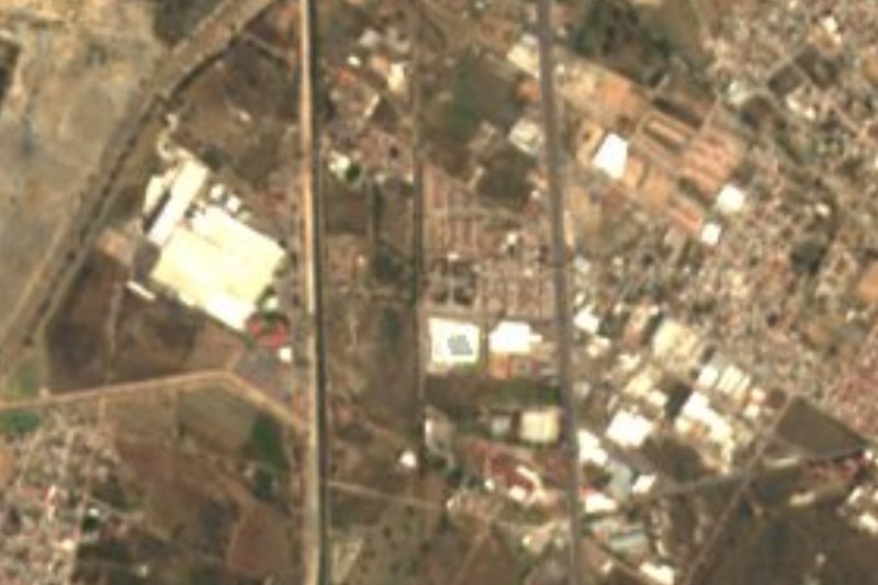


Drive times by road from OpenStreetMap, without traffic. Times marked ~ are estimated from the straight-line distance.
Location from OpenStreetMap. Written by Puebloteca.