Town Zacualtipán de Ángeles, Hidalgo
Cool, rainy Sierra Alta town with a 1572 Augustinian chapel, the rock-carved Casa de Piedra and museums of the sierra and of Felipe Ángeles.
From Pachuca: 1 h 30 min by car (94 km by road) How to get there ↓
Near here
See everything nearby ↓


Plan your visit to Zacualtipán
Where to stay near Zacualtipán
Compare hotels, posadas and guest houses in Zacualtipán.
Tours to Zacualtipán
Day trips around Metztitlán sometimes stop in Zacualtipán; a tour is the easy way to see it without a car.
How to get to Zacualtipán
- From Pachuca: about 1 h 30 min by road (~94 km)
- Nearest airport: Mexico City (Felipe Ángeles) (NLU), 2 h 18 min by car to Metztitlán
Links open a partner site. We may earn a commission if you book, at no cost to you.
About Zacualtipán
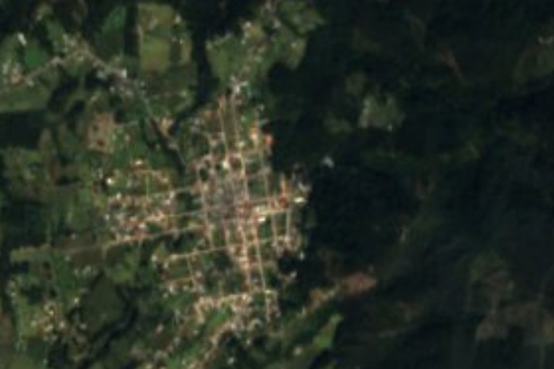
Zacualtipán comes from Tzacualtipan, translated as "place of hiding places" or "place of mounds or pyramids"; its glyph is a five-step pyramid with a hand above it. The town sits at 1,979 metres in Hidalgo's Sierra Alta, on the Carso Huasteco plateau, where more than 2,000 millimetres of rain fall each year and the average temperature is around 14 °C: mist country, with pine, oak and fir forest, and a few coffee plots. It became a municipality on 26 April 1861 and was granted city status on 8 March 1943. It had 29,472 residents in 2020; more than half of the municipality's working population is employed in industry, including small garment workshops.
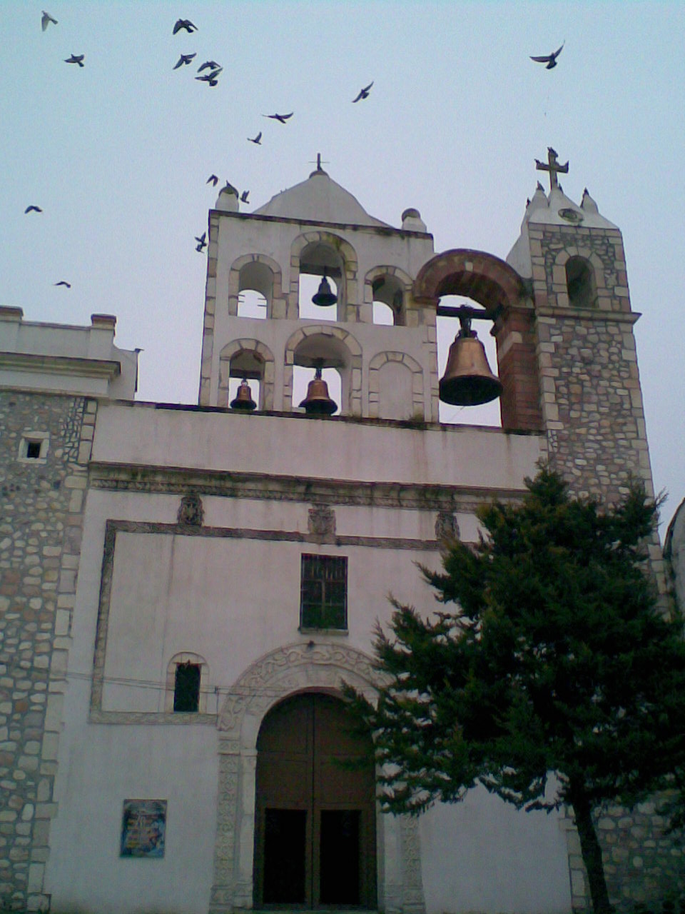
The oldest building is the chapel of Jesús Nazareno, built by the Augustinians and dated 1572, with a stone façade and a bell gable. The parish church of Santa María de la Encarnación dates from 1734, and there is also the parish of Dolores. The local curiosity is the Casa de Piedra, a house hollowed out of a huge boulder, according to the municipal encyclopedia by a fugitive from justice in the early 18th century. In Barrio Cosapa, the Museo Regional de la Sierra Alta, opened in 2009, covers the region's architecture, traditional medicine, farming, legends and festivals across eight rooms. In Barrio Arados, the house where the revolutionary general Felipe Ángeles lived has been a museum since 2016, with three rooms on his role between 1908 and 1916.
Festivals blend religion and farming. On 2 February maize and bean seed is blessed for planting; at carnival the men dress up and dance through the streets to huapango trios and brass bands; on Holy Cross day decorated wooden crosses are set on wells, houses and fields; and on San Juan's day people used to wash their hair at the wells so it would grow. The most deeply rooted celebration is Todos Santos, from 30 October to 3 November, as across the Sierra Alta.
How to get to Zacualtipán
Drive from Pachuca: 1 h 30 min, 94 km
From Pachuca it is about 89 km on mountain roads, roughly 1 h 30 min by car. From Mexico City it is about 181 km, around 2 h 45 min.
By bus, Autobuses Conexión and Futura leave Mexico City's Central de Autobuses del Norte roughly every four hours and take 3 h 30 min to 4 hours; Conexión also departs from Indios Verdes (about 2 h 45 min). Metztitlán, the nearest Pueblo Mágico, is about 13 km away in a straight line, though the road through the sierra is considerably longer.
Directions to Zacualtipán on Google Maps
Distances are in a straight line; the road is usually longer.
Links open a partner site. We may earn a commission if you book, at no cost to you.
From the nearest cities to Zacualtipán
- Pachuca · 94 km by road, 1 h 30 min
- Tulancingo · 101 km by road, 1 h 45 min
- Huauchinango · 126 km by road, 2 h 10 min
Drive times by road from OpenStreetMap, without traffic or stops. Times marked ~ are estimated from the straight-line distance.
Before you go to Zacualtipán: hours, prices and tips
- Hours
- Museo Regional de la Sierra Alta: Monday to Saturday, 9 am to 6 pm. Museo Felipe Ángeles: Tuesday to Saturday, 10 am to 5 pm. Wikipedia: Museo Regional de la Sierra Alta; Museo Felipe Ángeles · checked Oct 2026
- Entry
- Both museums are free. Wikipedia: Museo Regional de la Sierra Alta; Museo Felipe Ángeles · checked Oct 2026
- Best season
- Candelaria on 2 February; carnival; Holy Cross on 3 May; San Juan on 24 June; Todos Santos from 30 October to 3 November; 12 December. INAFED Enciclopedia de los Municipios · checked Oct 2026
- What to bring
- Warm and waterproof clothes: the climate is cool and very rainy, especially from June to September. Wikipedia: Zacualtipán · checked Oct 2026
Hours and prices change, especially around holidays. Each fact links to where we checked it.
Visiting Zacualtipán: what to see and do
The Augustinian chapel of Jesús Nazareno, from 1572
The parish church of Santa María de la Encarnación, from 1734
The Casa de Piedra, carved into a boulder
The Museo Regional de la Sierra Alta in Barrio Cosapa
The Museo Felipe Ángeles, in the general's former home
Todos Santos, 30 October to 3 November
Plan your trip
Places to stay in Zacualtipán
Compare hotels, posadas, and rentals in and around Zacualtipán.
Tours & activities
Day trips around Metztitlán sometimes stop in Zacualtipán; a tour is the easy way to see it without a car.
Rental cars
Pick up a car at NLU (Mexico City (Felipe Ángeles)): about 2 h 18 min by road to Metztitlán, then 13 km more to Zacualtipán, on your own schedule.
Flights
The nearest airport with scheduled flights is Mexico City (Felipe Ángeles) (NLU), about 2 h 18 min by road from Metztitlán, the base for Zacualtipán.
Mobile data
Signal can drop away from Metztitlán: download a map of the way to Zacualtipán before you set out, or carry an eSIM with data.
Links open a partner site. We may earn a commission if you book, at no cost to you.
When to go to Zacualtipán mild
Zacualtipán shares the climate of Metztitlán, 13 km away. The best months to visit are January, February, March, and December.
See the month-by-month climate of Metztitlán
Weather in Zacualtipán now and the next 7 days
Live forecast from Open-Meteo. Chance of rain is the day's highest.
The closest Pueblo Mágico: Metztitlán

Metztitlán is the Pueblo Mágico closest to Zacualtipán, with places to stay, food, and more to see.
Also close to
- Huasca de Ocampo · Hidalgo · 50 km away
- Mineral del Chico · Hidalgo · 50 km away
- Real del Monte · Hidalgo · 57 km away
- Pahuatlán · Puebla · 67 km away
- Acaxochitlán · Hidalgo · 72 km away
Closest to Zacualtipán
-
Alumbres · Village · 4 km away
-
Carpinteros · Village · 14 km away
-
Capilla de Santa María Xoxoteco · Landmark · 15 km away
-
Santa María Xoxoteco · Village · 15 km away
-
Molango · Town · 17 km away
-
San Pedro Tlatemalco · Landmark · 17 km away
-
Hualula · Village · 20 km away
-
Laguna de Atezca · Lake · 20 km away


Near Zacualtipán





Drive times by road from OpenStreetMap, without traffic. Times marked ~ are estimated from the straight-line distance.
Location from OpenStreetMap. Written by Puebloteca.