

Town Huayacocotla, Veracruz Totonacapan
A cool pine-forest town at about 2,150 m on Veracruz's western tip, with a 17th-century Augustinian church and a famous community radio.
From Tulancingo: 1 h 20 min by car (70 km by road) How to get there ↓
Near here
See everything nearby ↓


Plan your visit to Huayacocotla
Where to stay near Huayacocotla
Compare hotels, posadas and guest houses in Huayacocotla.
Tours to Huayacocotla
Day trips around Metztitlán sometimes stop in Huayacocotla; a tour is the easy way to see it without a car.
 Tours from Zacatlan
Zacatlán Guided Tour walking through the Center
★ 5.0 (2) · From US$8
How to get to Huayacocotla
- From Tulancingo: about 1 h 20 min by road (~70 km)
- Nearest airport: Mexico City (Felipe Ángeles) (NLU), 2 h 18 min by car to Metztitlán
Links open a partner site. We may earn a commission if you book, at no cost to you.
Tours from Zacatlan, near Huayacocotla
Tours, prices and ratings from Viator, checked weekly. We may earn a commission if you book.
About Huayacocotla
Huayacocotla is a mountain town and municipal seat in the far northwest of Veracruz, on a wedge of the state that pushes in between Hidalgo and Puebla. It sits at about 2,150 m in the Sierra de Huayacocotla, a branch of the Sierra Madre Oriental, far above the hot coastal plain that most visitors associate with Veracruz. The town had 6,113 people at the 2020 census and the municipality 21,796. Its name comes from Nahuatl and is usually read as "place of large trees", a nod to the pines that cover these ridges; in Otomí the town is called Mbati.
The first inhabitants of the area were Huastecs. Spanish evangelisation began around 1550, when Augustinian friars came from the convent of Atotonilco; work on the church started in 1565, was halted by epidemics, and the building was only finished in 1673. In colonial times Huayacocotla stood on a mule-train route towards central New Spain, collected the alcabala tax on passing goods and attracted wealthy Spanish families; later it lived from pine resin. In 1877 the head of the canton of Chicontepec moved here, and in 1881 the town became a villa. Apples and pears spread around Huayacocotla from 1946, and after decades of uncontrolled logging, the La Selva ejido received the first regulated timber permit in Veracruz in 1978 and won a national forestry merit award for 1990.
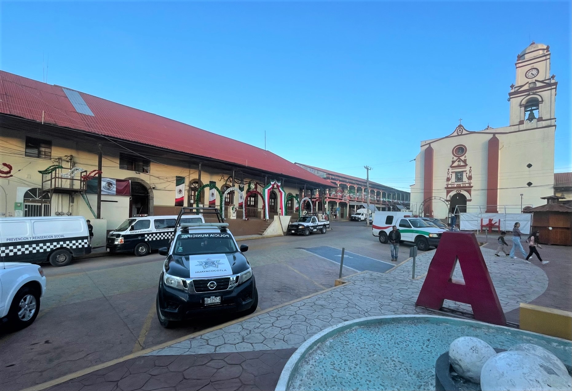
The stone parish church on the main square, beside the arcaded municipal palace, is the town's historic monument. Huayacocotla is also known across Mexico for its community radio, Radio Huayacocotla, which broadcast to the Indigenous villages of the sierra on short wave as XEJN-OC for about 30 years before moving to FM as XHFCE. The local crafts are woodwork, woollens and embroidery, the typical dishes are zacahuil and regional mole, and the music is the son huasteco.
How to get to Huayacocotla
Drive from Tulancingo: 1 h 20 min, 70 km
Huayacocotla is about 195 km by road from Xalapa, but it is far easier to reach from Hidalgo. Autobuses Conexión buses link it with the bus terminal in Tulancingo, Hidalgo, in about 2 hours 15 minutes; there is no direct bus from Mexico City, so travellers usually change at Tulancingo after leaving from the Terminal Norte.
Directions to Huayacocotla on Google Maps
Distances are in a straight line; the road is usually longer.
Links open a partner site. We may earn a commission if you book, at no cost to you.
From the nearest cities to Huayacocotla
- Tulancingo · 70 km by road, 1 h 20 min
- Huauchinango · 95 km by road, 1 h 40 min
- Pachuca · 106 km by road, 1 h 45 min
Drive times by road from OpenStreetMap, without traffic or stops. Times marked ~ are estimated from the straight-line distance.
Before you go to Huayacocotla: hours, prices and tips
- Best season
- Festival of Nuestro Señor Jesús in February; Holy Week with a live Way of the Cross; Day of the Miraculous Cross 3 May; Corpus Christi in June; Day of the Dead 1–2 November; Virgin of Guadalupe 12 December. Enciclopedia de los Municipios de México (INAFED) · checked Oct 2026
- What to bring
- Warm clothes: the town sits at about 2,150 m in the pine forests of the sierra and is much colder than the Veracruz lowlands. Wikidata / PueblosAmerica (altitude) · checked Oct 2026
Hours and prices change, especially around holidays. Each fact links to where we checked it.
Visiting Huayacocotla: what to see and do
See the stone parish church on the main square, begun in 1565 and finished in 1673.
Walk the plaza and the arcades of the municipal palace.
Breathe the cool air of the pine and oak forests that give the town its name.
Look for local woodwork, woollens and embroidery.
Try zacahuil, the giant Huastec tamale, and the regional mole.
Plan your trip
Places to stay in Huayacocotla
Compare hotels, posadas, and rentals in and around Huayacocotla.
Tours & activities
Day trips around Metztitlán sometimes stop in Huayacocotla; a tour is the easy way to see it without a car.
Rental cars
Pick up a car at NLU (Mexico City (Felipe Ángeles)): about 2 h 18 min by road to Metztitlán, then 30 km more to Huayacocotla, on your own schedule.
Flights
The nearest airport with scheduled flights is Mexico City (Felipe Ángeles) (NLU), about 2 h 18 min by road from Metztitlán, the base for Huayacocotla.
Mobile data
Signal can drop away from Metztitlán: download a map of the way to Huayacocotla before you set out, or carry an eSIM with data.
Links open a partner site. We may earn a commission if you book, at no cost to you.
Photos
When to go to Huayacocotla mild
Huayacocotla shares the climate of Metztitlán, 30 km away. The best months to visit are January, February, March, and December.
See the month-by-month climate of Metztitlán
Weather in Huayacocotla now and the next 7 days
Live forecast from Open-Meteo. Chance of rain is the day's highest.
The closest Pueblo Mágico: Metztitlán

Metztitlán is the Pueblo Mágico closest to Huayacocotla, with places to stay, food, and more to see.
Also close to
- Huasca de Ocampo · Hidalgo · 39 km away
- Pahuatlán · Puebla · 44 km away
- Mineral del Chico · Hidalgo · 47 km away
- Real del Monte · Hidalgo · 49 km away
- Acaxochitlán · Hidalgo · 51 km away
Closest to Huayacocotla
-
Carpinteros · Village · 8 km away
-
Capilla de Santa María Xoxoteco · Landmark · 15 km away
-
Santa María Xoxoteco · Village · 15 km away
-
Reserva de la Biosfera Barranca de Metztitlán · Nature reserve · 21 km away
-
Ayotuxtla · Village · 22 km away
-
Zacualtipán · Town · 22 km away
-
Agua Blanca de Iturbide · Town · 24 km away
-
San Pedro Tlatemalco · Landmark · 24 km away

Near Huayacocotla


Drive times by road from OpenStreetMap, without traffic. Times marked ~ are estimated from the straight-line distance.
Location from OpenStreetMap. Written by Puebloteca.