


Nature reserve Cabo Corrientes, Jalisco Municipality of Cabo Corrientes Banderas Bay
The rocky cape that closes Banderas Bay to the south, crowned by a lighthouse from 1903, reached on foot from the remote fishing village of Corrales.
Reached on foot from Corrales: 50 min each way. How to get there ↓
Near here
See everything nearby ↓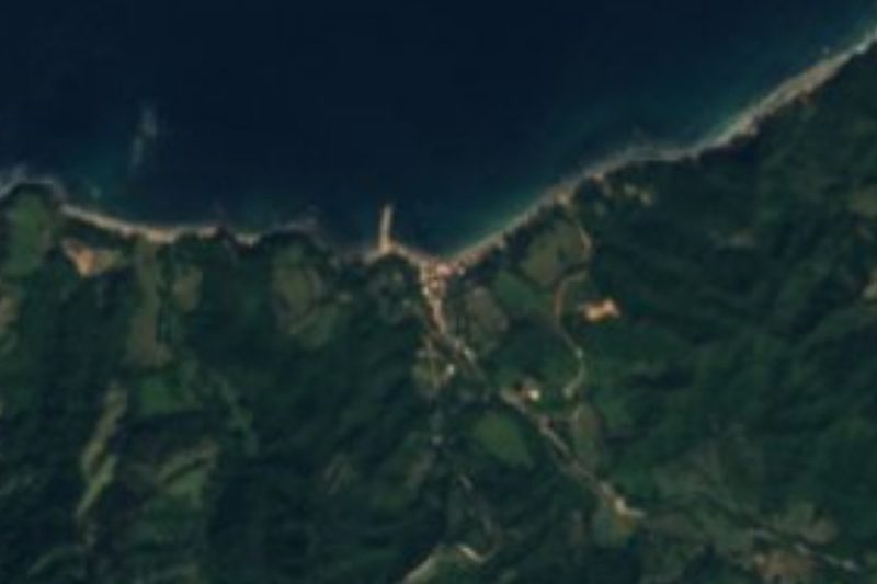

Plan your visit to Cabo Corrientes
Where to stay near Cabo Corrientes
Compare hotels, posadas and guest houses in Cabo Corrientes.
Tours to Cabo Corrientes
Day trips and guided outings from Sayulita often include Cabo Corrientes; with a local guide you can get there without a car.
 Tours from Puerto Vallarta
Winner 2026 Downtown Vallarta Food Tour with Vallarta Food Tours
★ 5.0 (3,971) · From US$59
How to get to Cabo Corrientes
- Reached on foot from Corrales: 50 min each way.
- From Puerto Vallarta: about 2 h 15 min by road (~106 km)
- Nearest airport: Puerto Vallarta (PVR), 41 min by car to Sayulita
Links open a partner site. We may earn a commission if you book, at no cost to you.
Tours from Puerto Vallarta, near Cabo Corrientes


Tours, prices and ratings from Viator, checked weekly. We may earn a commission if you book.
About Cabo Corrientes
Cabo Corrientes is the headland that marks the southern end of Banderas Bay, the counterpart of Punta de Mita on the far side of the bay's mouth. It lies at the western tip of the Jalisco municipality that takes its name, a wild, thinly populated stretch of jungle-covered mountains that drop straight into the Pacific, about 65 km west of Puerto Vallarta. The cape has been a key mark for navigators since the first Spanish charts of the coast, which already show it in the 17th century, and the sea off it is known for strong currents and rough water: sailors call it Mexico's Point Conception, after the notoriously windy cape in California.
On the point stands the Faro de Cabo Corrientes, one of the oldest buildings in the region. It was built in the early 1900s, in the time of Porfirio Díaz, with its structure and fittings brought from Europe, and has been lit since 1903. It is an octagonal masonry tower about 18 m tall rising from a single-storey keeper's house, painted white with a red lantern; because it sits high on the cliffs its light shines 93 m above the sea, a white flash every six seconds. It is still an active aid to navigation run by the Mexican Navy, although a visitor in 2012 found it in need of restoration, and it has run on emergency lighting at times since.
The nearest village is Corrales, a small fishing community on a cove about 2 km east of the cape, whose beach is known to surfers for its powerful waves. No road goes to the lighthouse: you walk from Corrales along a path over the headland, and the grounds are open but the tower itself is closed. From the top there is a sweeping view north across the whole of Banderas Bay. Getting to Corrales is an adventure in itself, either on a long dirt road through the sierra from El Tuito or by boat from Boca de Tomatlán on a guided trip.
How to get to Cabo Corrientes
Drive from Puerto Vallarta to Corrales: 2 h 15 min, 106 km
By land: take Highway 200 south from Puerto Vallarta to El Tuito, then unpaved roads west through the sierra to Corrales; routing on OpenStreetMap data gives about 57 km from El Tuito, roughly an hour and a half on dirt, so a high-clearance vehicle and dry weather help. By sea: guided day trips leave Puerto Vallarta for Boca de Tomatlán, cross by boat to Corrales and return the same way. From Corrales a footpath leads over the headland to the lighthouse, about 4 km on foot (around 50 minutes each way).
Reached on foot from Corrales: 50 min each way.
Directions to Cabo Corrientes on Google Maps
Distances are in a straight line; the road is usually longer.
Links open a partner site. We may earn a commission if you book, at no cost to you.
From the nearest cities to Cabo Corrientes
- Puerto Vallarta · 106 km by road, 2 h 15 min to Corrales, then 50 min on foot
- Autlán · about 200 km by road, ~2 h 55 min to Corrales, then 50 min on foot
- Manzanillo · 293 km by road, 4 h 25 min to Corrales, then 50 min on foot
Drive times by road from OpenStreetMap, without traffic or stops. Times marked ~ are estimated from the straight-line distance.
Before you go to Cabo Corrientes: hours, prices and tips
- Guide or tour
- Guided day trips go by boat from Boca de Tomatlán to Corrales, walk the trail to the lighthouse with an official guide, and include beach time and a meal in the village. Tours: Viator GetYourGuide PV Angels (Navegante Urbano) · checked Oct 2026
- Rules
- The lighthouse is an active Navy aid to navigation: the grounds are open to walkers, but the tower is closed. Lighthouse Directory (University of North Carolina) · checked Oct 2026
Hours and prices change, especially around holidays. Each fact links to where we checked it.
Visiting Cabo Corrientes: what to see and do
Walk from Corrales over the headland to the 1903 lighthouse.
Look north from the point across the whole of Banderas Bay.
Watch the surf break on Corrales beach.
Eat fresh fish at Corrales after the walk.
Come by boat from Boca de Tomatlán on a guided day trip along the south shore.
Plan your trip
Places to stay in Cabo Corrientes
Compare hotels, posadas, and rentals in and around Cabo Corrientes.
Tours & activities
Day trips and guided outings from Sayulita often include Cabo Corrientes; with a local guide you can get there without a car.
Rental cars
Pick up a car at PVR (Puerto Vallarta): about 41 min by road to Sayulita, then 58 km more to Cabo Corrientes, on your own schedule.
Flights
The nearest airport with scheduled flights is Puerto Vallarta (PVR), about 41 min by road from Sayulita, the base for Cabo Corrientes.
Travel insurance
If you plan on hiking at Cabo Corrientes, check that your policy covers it: some plans leave adventure activities out.
Mobile data
Signal can drop away from Sayulita: download a map of the way to Cabo Corrientes before you set out, or carry an eSIM with data.
Links open a partner site. We may earn a commission if you book, at no cost to you.
Photos
When to go to Cabo Corrientes warm
Cabo Corrientes shares the climate of Sayulita, 58 km away. The best months to visit are March, April, May, and November.
See the month-by-month climate of Sayulita
Weather in Cabo Corrientes now and the next 7 days
Live forecast from Open-Meteo. Chance of rain is the day's highest.
The closest Pueblo Mágico: Sayulita

Sayulita is the Pueblo Mágico closest to Cabo Corrientes, with places to stay, food, and more to see.
Closest to Cabo Corrientes
-
Chimo · Village · 13 km away
-
Aquiles Serdán · Village · 14 km away
-
La Sauceda · Village · 14 km away
-
El Refugio Suchitlán · Village · 16 km away
-
Ixtlahuahuey · Village · 18 km away
-
Mayto · Beach · 21 km away
-
Pizota · Village · 23 km away
-
Tehuamixtle · Village · 23 km away


Near Cabo Corrientes


Drive times by road from OpenStreetMap, without traffic. Times marked ~ are estimated from the straight-line distance.
Lists with Cabo Corrientes
Nature Parks in Jalisco · 17 Nature Parks near Puerto Vallarta · 7Location from OpenStreetMap. Written by Puebloteca.