One of the largest bays in Mexico, open to the Pacific between Cabo Corrientes in Jalisco and Punta de Mita in Nayarit, with the Ameca River marking the state line at its head. Puerto Vallarta fills the Jalisco shore; Nuevo Vallarta, Bucerías and La Cruz de Huanacaxtle line the Nayarit side. South of Puerto Vallarta the mountains drop straight into the sea, so Yelapa, Quimixto and the beaches around them are reached by water taxi, and from December to March humpback whales come into the bay to calve. This guide also covers the coast just outside it: Sayulita and the Riviera Nayarit to the north, El Tuito and the Pacific shore of Cabo Corrientes to the south.
1 Pueblo Mágico · 164 places to visit
Pueblos Mágicos in Banderas Bay

Map
Places to visit in Banderas Bay 164
164 places with their own page, grouped by kind.
Villages · 63 Beaches · 43 Landmarks and museums · 27 Towns · 16 Nature reserves · 6 Islands · 4 Waterfalls · 2 Cities · 1 Mountains · 1 Viewpoints · 1
Villages
-
Altavista · Village · Nayarit
Hillside farming village in the Sierra de Vallejo, set among mango groves, and the gateway to the Altavista petroglyphs and La Pila del Rey. -
Aquiles Serdán · Village · Jalisco
Tiny farming and fishing ranchería on the open Pacific coast of Cabo Corrientes, a few kilometers north of Mayto beach. -
Aután · Village · Nayarit
A farming village of about 1,650 people on the flat coastal plain north of San Blas, two kilometers from Guadalupe Victoria. -
Boca de Tomatlán · Village · Jalisco
Fishing village at the mouth of the Horcones River where the coastal road ends and water taxis leave for Las Ánimas, Quimixto and Yelapa. -
Boca del Asadero · Village · Nayarit
A small fishing village by the mouth of the Río Grande de Santiago, north-west of San Blas, at the end of a road through farmland and shrimp ponds. -
Chacala · Village · Jalisco
Hill village of Cabo Corrientes about 600 m up, on the dirt road from El Tuito to Yelapa; not the Nayarit beach town of the same name. -
Chacalilla · Village · Nayarit
Ejido village of about 540 people north of San Blas, built over a Postclassic Aztatlán town where archaeologists found ten sacrificed skulls. -
Chimo · Village · Jalisco
Remote fishing village on the south shore of Banderas Bay, west of Yelapa, where a dirt road from the sierra finally meets the sea. -
Chula Vista · Village · Nayarit
A small, growing village on Highway 200 next to Villa Morelos, at the junction with the toll road from Puerto Vallarta, below the Sierra de Vallejo. -
El Capomo · Village · Nayarit
A farm village between La Peñita and Las Varas whose name also covers Costa Capomo, wide empty beaches backed by wetlands with crocodiles. -
El Capomo · Village · Nayarit
A farming hamlet of about 160 people on the bean fields of the northern San Blas plain, at the end of a dirt road off the Guadalupe Victoria highway. -
El Carleño · Village · Nayarit
A farming village of about 350 people just north of Guadalupe Victoria, on the bean-growing plain of the Río Grande de Santiago delta. -
El Coatante · Village · Nayarit
A rural village of about 320 people on the old road to Puerto Vallarta, in the quiet northeast corner of Bahía de Banderas far from the beaches. -
El Colomo · Village · Nayarit
A farming village on the Ameca River, once the heart of the Maisterrena hacienda and in 1935 the first ejido of the Banderas Bay region. -
El Colorado · Village · Jalisco
Farming village of about 1,150 people on Highway 544 in the Ameca valley, just south of Las Palmas, on the Las Palmas bus route. -
El Espino · Village · Nayarit
A hamlet of 75 people in the wooded hills of southern San Blas, about 3 km south of Jolotemba and 2 km off the road to Ixtapa de la Concepción. -
El Guamúchil · Village · Nayarit
A fast-growing roadside village in the hills on Highway 200 between Bucerías and Sayulita, about 280 m up, with schools and everyday life. -
El Limón · Village · Nayarit
Village of about 460 people near the mouth of the Río Grande de Santiago, the westernmost of the Laureles y Góngora ejido, about 4 km from the sea. -
El Llano · Village · Nayarit
A crossroads village on the Tepic road, two and a half kilometers before Santa Cruz de Miramar, with cenadurías, taquerías and a gas station. -
El Madrigaleño · Village · Nayarit
Growing farm village of about 830 people right next to Guadalupe Victoria, on the bean-growing delta plain north of San Blas. -
El Monteón · Village · Nayarit
A highway village south of Los Ayala where a 2 km jungle path leads to Punta Raza, an untouched beach with a turtle sanctuary. -
El Ranchito · Village · Jalisco
Valley village of about 1,400 people on the Mascota River beyond Ixtapa, at the end of the El Ranchito city-bus line from Puerto Vallarta. -
El Refugio Suchitlán · Village · Jalisco
A ranchería of under 200 people at about 620 m in the Cabo Corrientes sierra, in raicilla country, reached by a long dirt road from El Tuito. -
Guadalupe Victoria · Village · Nayarit
Farming town of about 3,000 on the coastal plain north of San Blas, known locally as La Virocha, among bean fields, estuaries and shrimp farms. -
Huaristemba · Village · Nayarit
Farming ejido of about 700 people inland from San Blas, on a branch road off the Tepic highway; in 1857 it marked the road from Tepic to the north. -
Ipala · Village · Jalisco
Fishing and farming hamlet by a small estuary on the open Pacific coast of Cabo Corrientes, next to Villa del Mar and 3 km from Tehuamixtle. -
Isla del Conde · Village · Nayarit
Farming village of about 400 people on the south bank of the lower Río Grande de Santiago, among bean fields and shrimp ponds north of San Blas. -
Ixtapa de la Concepción · Village · Nayarit
A farming village at the end of the road north of Zacualpan, named for a salty river and its patron, the Immaculate Conception. -
Ixtlahuahuey · Village · Jalisco
A mountain ranchería of about 250 people at 640 m in the Cabo Corrientes sierra, where a family still distils raicilla the old way. -
Jolotemba · Village · Nayarit
A roadside village of about 300 people south of Santa Cruz de Miramar, on the way to Playa El Limoncito, whose public access the ejido has fought for. -
La Bajada · Village · Nayarit
A hill village of about 450 people above La Palma, inland from Matanchén Bay; its forest and plantations are a stop on the San Blas Christmas Bird Count. -
La Chiripa · Village · Nayarit
A village of about 370 people on the San Blas to Guadalupe Victoria road, among shrimp ponds and farmland 20 minutes north of the port. -
La Libertad · Village · Nayarit
A foothill village of about 1,650 people off the San Blas road, some 13 km inland from the port and a short drive from Singayta. -
La Palma · Village · Nayarit
An inland village of about 1,200 people two kilometers behind Aticama, on the bus route to Playa Los Cocos south of San Blas. -
La Puerta de la Lima · Village · Nayarit
Roadside farming village on Highway 200 between La Peñita and Las Varas, the nearest village to the Altavista petroglyphs. -
La Punta Negra · Village · Jalisco
Tiny roadside settlement and beach on Vallarta's south shore, where the road up to El Nogalito leaves Highway 200; a stop on the Mismaloya bus. -
La Sauceda · Village · Jalisco
A hamlet of about 140 people at 560 m in the hills of Cabo Corrientes, on the dirt roads linking the sierra ranchos behind Yelapa's coast. -
Las Juntas y los Veranos · Village · Jalisco
Ejido village in the Horcones River valley on Highway 200 south of Vallarta, home of the Los Veranos zip lines and the botanical garden. -
Las Palmas · Village · Nayarit
A farming village of about 180 people on highway 74 between Tepic and San Blas, an old ejido of the Navarrete hacienda lands. -
Laureles y Góngora · Village · Nayarit
Ejido village of about 550 people, also called El Ciruelo, half a kilometer from the lower Río Grande de Santiago north of San Blas. -
Lima de Abajo · Village · Nayarit
A farming village of about 930 people just off Highway 200 north of La Peñita, with a road west to the beach at Boca del Naranjo. -
Los Ayala · Village · Nayarit
The smallest, quietest village on Jaltemba Bay: a calm, almost waveless beach, a jungle path to Playa del Beso and boats to Isla del Coral. -
Los Llanitos · Village · Jalisco
Mountain hamlet at about 750 m in the sierra behind Puerto Vallarta, at the end of the road past the Jorullo suspension bridge. -
Los Sauces · Village · Nayarit
A hamlet of about 270 people in the remote northeast of Bahía de Banderas, three kilometers beyond El Coatante, with schools and little else. -
Mezcalitos · Village · Nayarit
A small community on Boulevard Nuevo Vallarta, between Valle Dorado and Mezcales, a couple of kilometers from the resorts of Nuevo Vallarta. -
Mismaloya · Village · Jalisco
Village and calm cove beach where The Night of the Iguana was filmed in 1963, with Los Arcos offshore and the El Edén river jungle up the valley. -
Otates y Cantarranas · Village · Nayarit
A farming village of about 800 people on the coastal plain north of Ixtapa de la Concepción, near the turtle beaches of Las Tortugas and Platanitos. -
Pimientillo · Village · Nayarit
A small village on the south bank of the Río Grande de Santiago in the north of San Blas, near Guadalupe Victoria (La Virocha). -
Pizota · Village · Jalisco
Tiny boat-only fishing village past Yelapa on the south shore of Banderas Bay, with Playa Manzanilla, a jungle waterfall and no resorts. -
Playa de Ramírez · Village · Nayarit
Despite the name, an inland hamlet of about 100 people on the farm plain of northern San Blas, 1.5 km from the Río Grande de Santiago. -
Quimixto · Village · Jalisco
A small fishing village with no roads between Las Ánimas and Majahuitas, known for the waterfall half an hour's walk up the La Puerta River. -
Reforma Agraria · Village · Nayarit
A village of about 580 people, also called La Colorada, among irrigation canals on the low plain about 16 km northeast of San Blas. -
San Ignacio · Village · Nayarit
A fast-growing village on Highway 200 beside the Sayulita River, about 5 km by road from Sayulita, with fondas and taquerías. -
San Isidro · Village · Nayarit
A small farming village on the road from Zacualpan to Ixtapa de la Concepción, on the way to the turtle beaches of Platanitos and Las Tortugas. -
San Quintín · Village · Nayarit
A small hamlet on Highway 200 a few kilometers inland from Sayulita, which more than tripled in size between 2005 and 2020. -
Santa Rosa Tapachula · Village · Nayarit
Small farming village of the Bahía de Banderas valley, just south-east of the municipal seat, Valle de Banderas, far from the resort coast. -
Tebelchia · Village · Jalisco
A growing village of about 660 people, also called El Roble, in the low country of northern Puerto Vallarta municipality near El Colomo. -
Tehuamixtle · Village · Jalisco
A fishing hamlet of about 120 people on a calm little bay south of Mayto, known for its huge oysters and an old wreck on the seabed. -
Tondoroque · Village · Nayarit
A small roadside community on Highway 200 between Mezcales and Bucerías, next to the Flamingos golf course and a few minutes from the beach. -
Villa Morelos · Village · Nayarit
A growing village between Highway 200 and the Puerto Vallarta toll road, at the foot of the Sierra de Vallejo, 2 km inland from Lo de Marcos. -
Villa del Mar · Village · Jalisco
Seaside hamlet south of Tehuamixtle with rustic cabins on a low bluff, sunsets over the open Pacific and sea-turtle conservation stays. -
Yelapa · Village · Jalisco
A car-free fishing village on a horseshoe cove at the south end of Banderas Bay, reached by water taxi, with a waterfall a short walk up the hill. -
Úrsulo Galván · Village · Nayarit
A village on Highway 200 right next to Lo de Marcos, on the Compostela side of the municipal line, a short walk from Lo de Marcos beach.



















Beaches
-
Boca de Tomates · Beach · Jalisco
A beach of seafood ramadas behind Puerto Vallarta's airport, by the Ameca river mouth: come for pescado sarandeado, not a swim, as crocodiles live here. -
Las Caletas · Beach · Jalisco
John Huston's former jungle hideaway between Quimixto and Yelapa, now a boat-only beach visited on Vallarta Adventures day trips and evening shows. -
Litibú · Beach · Nayarit
A long sandy bay on the north side of the Punta de Mita peninsula, next to Higuera Blanca, with a Greg Norman golf course and beach resorts. -
Mayto · Beach · Jalisco
A long, empty golden beach on the open Pacific south of El Tuito, with a university sea-turtle camp, a few small hotels and strong surf. -
Playa Amapas · Beach · Jalisco
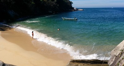
Small rocky cove just past the south end of Los Muertos, reached over the El Púlpito rock; amber sand, green water, no lifeguards. -
Playa Boca de Chila · Beach · Nayarit
A long, empty beach of pale sand at the mouth of the Chila river, with mangroves, water birds and a sea-turtle camp, west of Zacualpan. -
Playa Caballo · Beach · Jalisco
A quiet beach right next to Las Ánimas on the jungle coast trail from Boca de Tomatlán, home to a small hotel and beach club. -
Playa Camarones · Beach · Jalisco
Downtown beach of the 5 de Diciembre neighborhood, just north of the Malecón: named for shrimp fishermen, now loved by local families. -
Playa Careyeros · Beach · Nayarit
A quiet, almost undeveloped beach between Punta de Mita and Higuera Blanca, with clear turquoise water and a rough, poorly signed dirt road in. -
Playa Colomitos · Beach · Jalisco
A tiny emerald cove in the jungle west of Boca de Tomatlán, reached on a 30 to 45 minute coastal trail or a short water-taxi ride. -
Playa Conchas Chinas · Beach · Jalisco
A string of small rocky coves just south of the Zona Romántica, with shell sand, clear water, tide pools and snorkelling around the rocks. -
Playa Destiladeras · Beach · Nayarit
A long, wide sweep of fine pale sand on the road to Punta de Mita, with seafood palapas, shallow water and waves for surfing and boogie boarding. -
Playa El Anclote · Beach · Nayarit
Punta de Mita's town beach: long, gentle waves for beginner surfers, a row of seafood palapas and the pangas that run to the Marietas. -
Playa El Borrego · Beach · Nayarit
San Blas's town beach: almost 3 km of soft sand at the end of Calle Azueta, with seafood palapas, beginner surf and sunsets. -
Playa El Naranjo · Beach · Nayarit
Long, empty beach north of La Peñita at the far end of Jaltemba Bay, with a sea-turtle camp where you can camp and help release hatchlings. -
Playa Garza Blanca · Beach · Jalisco
Calm south-shore cove below the Garza Blanca resort, sheltered by boulder breakwaters; clear water for swimming, snorkeling and paddleboarding. -
Playa Isabel · Beach · Jalisco
Small, calm, shady cove a short walk from Yelapa's pier, with clear water for snorkeling and far fewer people than the main beach. -
Playa La Lancha · Beach · Nayarit
A wild sand beach and point break east of Punta de Mita, reached on foot: lefts and rights for longboarders, best on winter swells. -
Playa La Manzanilla · Beach · Nayarit
La Cruz de Huanacaxtle's family beach: a mile-long crescent of grey sand with calm, shallow water and palapa restaurants on the sand. -
Playa Las Cuevas · Beach · Nayarit
A little-visited surf beach about 2.5 km south of Chacala, under the volcanic hill of Cerro de las Cuevas; strong waves and almost no one around. -
Playa Las Cuevas · Beach · Nayarit
A small cove of white sand and weathered boulders north of Sayulita, reached by a jungle path, with a rock arch to Playa Malpaso at low tide. -
Playa Las Estacas · Beach · Jalisco
A sheltered cove just south of Conchas Chinas, fronted by the Hyatt Ziva resort; the sand is public, the land behind it is not. -
Playa Las Glorias · Beach · Jalisco
Hotel-zone beach of nearly a kilometer between Los Tules and Playa Tranquila, lined with resorts and condos, about 3 km north of the Malecón. -
Playa Las Minitas · Beach · Nayarit
A small, secluded beach southwest of Lo de Marcos at the end of the Camino a Las Minitas, between the main beach and Playa Los Venados. -
Playa Las Ánimas · Beach · Jalisco
A 600-meter beach of palapa restaurants on the south shore, the first water-taxi stop from Boca de Tomatlán and the end of the coastal hike. -
Playa Los Muertos · Beach · Jalisco
The busy town beach of the Zona Romántica: palapa restaurants, beach clubs, the sail-shaped pier for south-shore water taxis and the original seahorse statue. -
Playa Los Tules · Beach · Jalisco
Hotel-zone beach of soft amber sand and gentle waves next to Playa de Oro, busy with parasailing, jet skis and banana boats. -
Playa Los Venados · Beach · Nayarit
A small, quiet bay just south of Lo de Marcos where big waves break into curtains of spray and the south end is calm, with a lookout on the hill. -
Playa Majahuitas · Beach · Jalisco
A sheltered, boat-only cove of white sand and reef between Quimixto and Yelapa, the snorkel-and-lunch stop on many bay tours. -
Playa Malpaso · Beach · Nayarit
A wild, mile-long beach between Sayulita and San Pancho, reached on foot by a jungle trail; strong rip currents make swimming dangerous. -
Playa Olas Altas · Beach · Jalisco
Zona Romántica beach from the Cuale River mouth south to the Los Muertos pier: calmer than Los Muertos and a favorite with Mexican families. -
Playa Palmares · Beach · Jalisco
Puerto Vallarta's south-shore public beach: the first Blue Flag beach in Jalisco, with lifeguards, ramps, showers and a city beach club. -
Playa Patzcuarito · Beach · Nayarit
A tiny wild beach of dark sand southwest of Sayulita, reached by scrambling over the rocks from Carricitos; few people and big sunsets. -
Playa Punta Raza · Beach · Nayarit
A wild beach of about 3 km below the Punta Raza headland, reached on foot from El Monteón; strong surf, a turtle camp and no services. -
Playa Pátzcuaro · Beach · Nayarit
A quiet, unsigned local favorite on the open coast just southwest of Sayulita, reached by a dirt track and a creek off the Punta de Mita road. -
Playa Rosita · Beach · Jalisco
The narrow, stony beach below the Malecón, named after the 1948 Hotel Rosita; for sunsets and watching fishermen, not for swimming. -
Playa de Barro · Beach · Nayarit
A remote jungle-backed beach north of San Pancho with a small natural mud bath and rock pools, reached by a long hike or a rough 4x4 road. -
Playa de Oro · Beach · Jalisco
Kilometer-long golden beach of Vallarta's northern hotel zone, between the cruise port and the Pitillal River, with three public accesses. -
Playa de las Tortugas · Beach · Nayarit
A long, nearly empty turtle-nesting beach just south of Platanitos, with coconut palms, surf, a mangrove estuary and a Conanp turtle camp. -
Playa del Amor · Beach · Nayarit
The Hidden Beach of the Marietas: a patch of sand inside an open hollow in the rock, reached by swimming through a short sea tunnel. -
Playa del Beso · Beach · Nayarit
A small cove among rocks just past Los Ayala, also called Playa Frideras, reached by a 15-minute jungle path or along the shore at low tide. -
Playa del Toro · Beach · Nayarit
A tiny cove of golden sand under a cliff-top lookout on the Punta Raza headland, about an hour's jungle walk from Los Ayala. -
Punta Monterrey · Beach · Nayarit
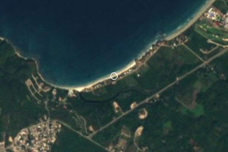
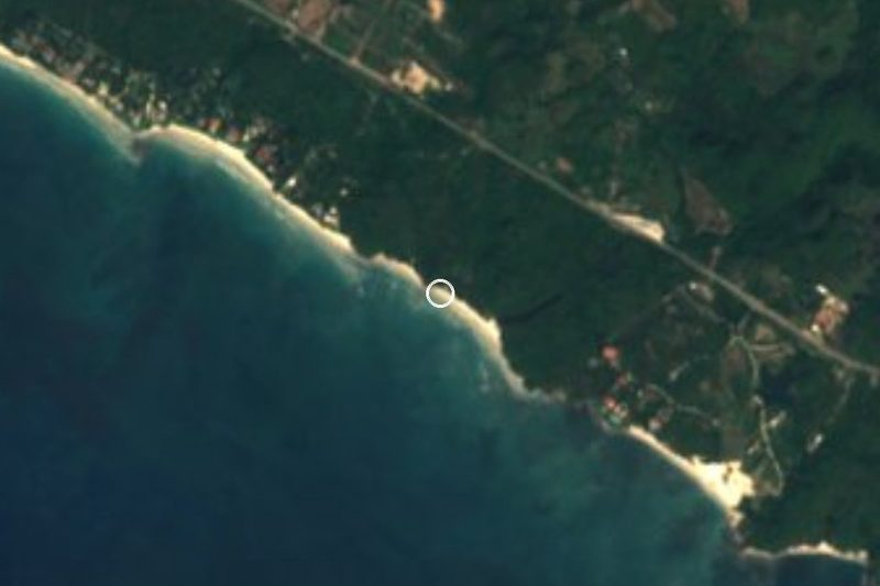
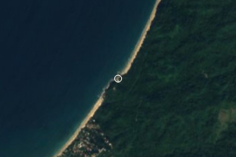
A secluded, jungle-backed point and beach between San Pancho and Lo de Marcos, reached by a dirt road; camping is not allowed.














Landmarks and museums
-
Aquaventuras Park · Landmark · Nayarit
Water park on Highway 200 at the entrance to Nuevo Vallarta, ten minutes from the airport: slides, a lazy river, zip line and a dolphin and sea lion habitat. -
Cerro de la Contaduría · Landmark · Nayarit
The hill above San Blas with the ruined 18th-century fort and counting house, old cannons, and the roofless church of La Marinera. -
Chico's Paradise · Landmark · Jalisco
Open-air riverside restaurant at km 20 on the road to El Tuito, on the Horcones River boulders, with cliff divers, river pools and zip lines. -
ChocoMuseo · Landmark · Jalisco
Free little chocolate museum and tasting bar a block above the Malecón, with hands-on bean-to-bar, truffle and mole workshops. -
Ecoparque El Nogalito · Landmark · Jalisco
Jungle ecopark above the village of El Nogalito, 20 minutes south of Vallarta: zip lines and a riverbed walk to a waterfall and swimming pool. -
El Edén de Mismaloya · Landmark · Jalisco
Jungle ecopark on the Mismaloya River where Predator was filmed in 1987: swimming holes, rock slides, a riverside restaurant and zip lines. -
El Pitillal · Landmark · Jalisco
The old farming town swallowed by Puerto Vallarta, with a twin-towered church, a bandstand plaza and the evening taco stands that food tours come for. -
Faro de Matamoros · Landmark · Jalisco
Retired 1932 lighthouse on the hill above downtown Vallarta, now a free lookout with a spiral staircase and an Elizabeth Taylor mural. -
Gringo Gulch · Landmark · Jalisco
Hillside lanes above the Cuale River where Hollywood names settled in the 1950s and 60s; Burton and Taylor's houses and their bridge are here. -
Malecón de Puerto Vallarta · Landmark · Jalisco
Puerto Vallarta's car-free seafront promenade, lined with bronze sculptures and pebble mosaics, and the city's favourite place to watch the sunset. -
Marina Vallarta · Landmark · Jalisco
The yacht harbour and planned district between the airport and the cruise port: a waterside boardwalk, a lighthouse, and the docks where many bay tours start. -
Mariposario Jardín Mágico · Landmark · Jalisco
Banderas Bay's only butterfly sanctuary, a shaded garden in Campo Verde where guides explain the life cycle and visitors release a butterfly. -
Mercado Municipal Río Cuale · Landmark · Jalisco
Downtown Vallarta's riverside craft and food market, in a 1970s building by Alejandro Zohn; open daily for souvenirs and market lunches. -
Muelle de Playa Los Muertos · Landmark · Jalisco
The sail-topped pier of the Zona Romántica, opened in 2013 and rebuilt in 2023, where water taxis leave for Yelapa and the south shore. -
Museo Histórico Naval de Puerto Vallarta · Landmark · Jalisco
The Mexican Navy's museum on the Malecón: ship models, cannons, uniforms and the story of the Manila galleons, in 14 rooms since 2006. -
Museo del Arte en Piel · Landmark · Jalisco
A small private museum on Calle Juárez in the Centro showing historical dress recreated in leather by artisan Alfonso Nuño Romero. -
Museo del Cuale · Landmark · Jalisco
Small INAH archaeology museum on Isla del Río Cuale with pre-Hispanic pottery and shaft-tomb finds from West Mexico; temporarily closed in 2026. -
Paradise Village Marina · Landmark · Nayarit
A 200-berth marina in a sheltered estuary inside the Paradise Village resort in Nuevo Vallarta, base of the Vallarta Yacht Club. -
Parque Lázaro Cárdenas · Landmark · Jalisco
Seafront park at the south end of the Malecón, being covered in tile-and-mirror mosaics by Vallarta artist Natasha Moraga since 2017. -
Parroquia de Nuestra Señora de Guadalupe · Landmark · Jalisco
Puerto Vallarta's brick parish church with the crown-topped bell tower that defines the city skyline; the goal of the December 1-12 pilgrimages. -
Plaza de Armas de Puerto Vallarta · Landmark · Jalisco
The town's main square by the Malecón, with its bandstand, Ignacio Vallarta statue and danzón on Thursday and Sunday evenings. -
Puente Jorullo · Landmark · Jalisco
A 470 m suspension bridge hung 150 m over the Cuale River canyon in the hills behind Vallarta, crossed on foot or by ATV in the ejido's River Park. -
Puente del Amor · Landmark · Jalisco
The little covered bridge over Calle Zaragoza that joined Elizabeth Taylor's and Richard Burton's houses, now part of the Casa Kimberly hotel. -
Terminal Marítima de Puerto Vallarta · Landmark · Jalisco
Puerto Vallarta's cruise port, three berths on the harbour beside Marina Vallarta where about 170 cruise ships a year tie up for the day. -
VidantaWorld · Landmark · Nayarit
Vast resort complex at the south end of Nuevo Vallarta: golf, the PGA Tour Mexico Open, Cirque du Soleil's LUDŌ and the new BON theme park. -
Zona Romántica · Landmark · Jalisco
Puerto Vallarta's old town south of the Río Cuale: cobbled streets, Los Muertos beach and pier, cafés, galleries and the heart of the city's gay scene. -
Zoológico de Vallarta · Landmark · Jalisco
Family-run jungle zoo up the river road behind Mismaloya, where visitors hand-feed many of the animals; open every day of the year.






Towns
-
El Porvenir · Town · Nayarit
A working town of about 6,000 people in the farming valley of Bahía de Banderas, between San Vicente and San José del Valle. -
El Tuito · Town · Jalisco
The quiet, ochre-walled seat of Cabo Corrientes, up in the pine-and-agave hills an hour south of Vallarta: plaza, Sunday market, local cheese and raicilla. -
Ixtapa · Town · Jalisco
Puerto Vallarta's second town, 11 km inland in the valley: home of the University of Guadalajara's coast campus and once a banana hacienda. -
La Peñita de Jaltemba · Town · Nayarit
The working town of Jaltemba Bay: a palm-lined main street to the beach, a big Thursday street market, and Guayabitos just across the river. -
Las Jarretaderas · Town · Nayarit
The first town in Nayarit after the Ameca River bridge, an old ejido beside Nuevo Vallarta known for seafood joints and its surf-fishing tournament. -
Las Juntas · Town · Jalisco
Fast-growing town on Highway 200 near Vallarta's airport and the Ameca bridges, where the mountain road to Mascota and San Sebastián begins. -
Las Palmas de Arriba · Town · Jalisco
Ejido town on the Ameca River in the far north of Puerto Vallarta municipality, on Highway 544 on the way up to San Sebastián del Oeste. -
Las Varas · Town · Nayarit
An inland farm town and road junction near Chacala, with a community museum of local archaeology and a carnival of masked mojigangas. -
Mezcales · Town · Nayarit
Busy working town on Highway 200 between Nuevo Vallarta and Bucerías, one of the largest in Bahía de Banderas; taquerías, cenadurías and local life. -
Nuevo Vallarta · Town · Nayarit
Planned resort town just across the Ameca River from Puerto Vallarta: long beach, big hotels, canals, marinas and golf. Officially Nuevo Nayarit since 2022. -
San Clemente de Lima · Town · Nayarit
Young valley town next to Mezcales that grew from a hamlet of under 200 people to nearly 10,000 in fifteen years; named for Saint Clement. -
San José del Valle · Town · Nayarit
One of the biggest towns of Bahía de Banderas, a fast-growing valley town near the Ameca River whose fiesta of Saint Joseph fills the streets each March. -
San Juan de Abajo · Town · Nayarit
Farming town in the Banderas valley, below the Sierra de Vallejo: a twin-towered parish, evening taco stands and a big May fiesta for Saint John. -
San Vicente · Town · Nayarit
The most populous town of Bahía de Banderas, a valley town named for Saint Vincent Ferrer, with a church, a kiosk plaza and lively food streets. -
Valle de Banderas · Town · Nayarit
The farming town that gave Banderas Bay its name, now seat of Bahía de Banderas: a quiet plaza, an old church and fields below the Sierra de Vallejo. -
Zacualpan · Town · Nayarit
A farming town north of Las Varas known for its devotion to the Divino Niño, a ten-day Santa Cruz fair and the turtle beach at Chila.






Nature reserves
-
Cabo Corrientes · Nature reserve · Jalisco
The rocky cape that closes Banderas Bay to the south, crowned by a lighthouse from 1903, reached on foot from the remote fishing village of Corrales. -
Estero El Salado · Nature reserve · Jalisco
Protected mangrove estuary in the middle of Puerto Vallarta's hotel strip, with biologist-led boat tours, a watchtower and wild crocodiles. -
Jardín Botánico de Vallarta · Nature reserve · Jalisco
A hillside botanical garden at km 24 south of Puerto Vallarta, famous for its orchids, jungle trails, birding and swims in the Horcones River. -
Los Arcos de Mismaloya · Nature reserve · Jalisco
Five granite islets with sea arches off Mismaloya, a marine refuge since 1975 and the bay's favourite snorkel stop, under ten minutes by boat from the beach. -
Rancho Primavera · Nature reserve · Jalisco
Restored 200-acre ranch 3 km from El Tuito that has become a birding hotspot, with feeders, ponds and trails; day birders welcome. -
Sierra de Vallejo · Nature reserve · Nayarit
The jungle-covered coastal range behind Sayulita and the Bahía de Banderas valley, home to jaguars, 261 bird species and shade-grown coffee.



Islands
-
Isla Cangrejito · Island · Nayarit
A grass-topped rock islet in Jaltemba Bay, also mapped as Isla Cerotero, between the beaches of Guayabitos and Los Ayala and Isla del Coral. -
Isla del Coral · Island · Nayarit
A small jungle-topped island off Rincón de Guayabitos, a 15-minute panga ride away, with a sheltered beach, easy snorkelling and an underwater Virgin. -
Isla del Río Cuale · Island · Jalisco
A shady river island between downtown and the Zona Romántica, with craft stalls, riverside restaurants, a small archaeology museum and iguanas. -
Piedra Blanca · Island · Nayarit
White sea rock off Isla del Rey, crowned by San Blas's sailors' Virgin and held by the Wixárika as Tatéi Haramara, where life emerged from the sea.


Waterfalls
-
Cascada Palo María · Waterfall · Jalisco
The waterfall closest to Puerto Vallarta: a 30 to 45 minute river walk from the Palo María bridge on Highway 200 to a jungle pool, free to visit. -
Cascadas de Mismaloya · Waterfall · Jalisco
A chain of three jungle waterfalls high in the hills behind Mismaloya, up to about 75 m tall, reached only on a long, hard hike.


Cities
-
Puerto Vallarta · City · Jalisco
Jalisco's big beach city on Banderas Bay: a cobbled old town, a sculpture-lined Malecón and the boats to every beach of the south shore.
Mountains
-
Cerro del Mono · Mountain · Nayarit
Monkey Mountain: a rocky 320 m summit above Higuera Blanca, between Punta de Mita and Sayulita, with a 360-degree view of the Pacific coast.

Viewpoints
-
Mirador Cerro de la Cruz · Viewpoint · Jalisco
Lookout around the cross on the hill above downtown, reached by steep lanes and stairs from the Malecón, with a 360° view from Los Arcos to Punta Mita.

Top tours in Banderas Bay


Tours, prices and ratings from Viator, checked weekly. We may earn a commission if you book.
Getting around Banderas Bay
Fly into Puerto Vallarta (PVR).
Cities to start from: Puerto Vallarta
Most of the region is reached by road: a rental car is the easiest way to see several places in a day, and buses link the larger towns.
By boat or on foot from Boca de Tomatlán: Playa Caballo, Playa Colomitos, Playa Isabel, Playa Las Ánimas, Quimixto, Yelapa.
By boat or on foot from Punta de Mita: Playa La Lancha, Playa del Amor.
Also by boat or on foot (each page says from where): Cabo Corrientes, Cascada Palo María, Cascadas de Mismaloya, Cerro del Mono, Isla del Coral, Las Caletas, Los Arcos de Mismaloya, Piedra Blanca, Pizota, Playa Majahuitas, Playa del Toro.
When to visit Banderas Bay
Most of Banderas Bay is at its best in March, April, May, and November.
Month-by-month climate on each Pueblo Mágico's page: Sayulita