


City Puerto Vallarta, Jalisco Municipality of Puerto Vallarta Banderas Bay
Jalisco's big beach city on Banderas Bay: a cobbled old town, a sculpture-lined Malecón and the boats to every beach of the south shore.
From Tepic: 2 h 20 min by car (175 km by road) How to get there ↓
Near here


Plan your visit to Puerto Vallarta
Where to stay near Puerto Vallarta
Compare hotels, posadas and guest houses in Puerto Vallarta.
Tours to Puerto Vallarta
Day trips and guided outings from Sayulita often include Puerto Vallarta; with a local guide you can get there without a car.
 Puerto Vallarta Zipline, Rappel, Water Slide & Speedboat tour
★ 4.9 (2,144) · From US$69
How to get to Puerto Vallarta
- From Tepic: about 2 h 20 min by road (~175 km)
- Nearest airport: Puerto Vallarta (PVR), 41 min by car to Sayulita
Links open a partner site. We may earn a commission if you book, at no cost to you.
Popular tours to Puerto Vallarta


Tours, prices and ratings from Viator, checked weekly. We may earn a commission if you book.
About Puerto Vallarta
Puerto Vallarta is a resort city on the shore of Banderas Bay, on the Pacific coast of Jalisco, squeezed onto a narrow coastal plain at the foot of the forested Sierra Madre. It is the second-largest urban area in the state after Guadalajara: the city itself had about 224,000 people in 2020, and together with the neighboring municipality of Bahía de Banderas, across the Ameca River in Nayarit, the metropolitan area passes 479,000. Tourism employs close to 80 percent of the workforce. Locals usually just call it Vallarta, after Ignacio Vallarta, a 19th-century governor of Jalisco.
The town began as Las Peñas de Santa María de Guadalupe, traditionally said to have been founded on December 12, 1851, by Guadalupe Sánchez Torres and his family at the mouth of the Cuale River. It grew in the 1860s as a landing for the mining company upriver, and by 1885 had some 800 residents. Its fame came a century later: in 1963 John Huston filmed The Night of the Iguana at nearby Mismaloya, and the tabloid romance of Richard Burton and Elizabeth Taylor, who bought a house in town, put Vallarta on the map. The government followed with an international airport, highways and, in 1970, the El Salado wharf where cruise ships now dock.
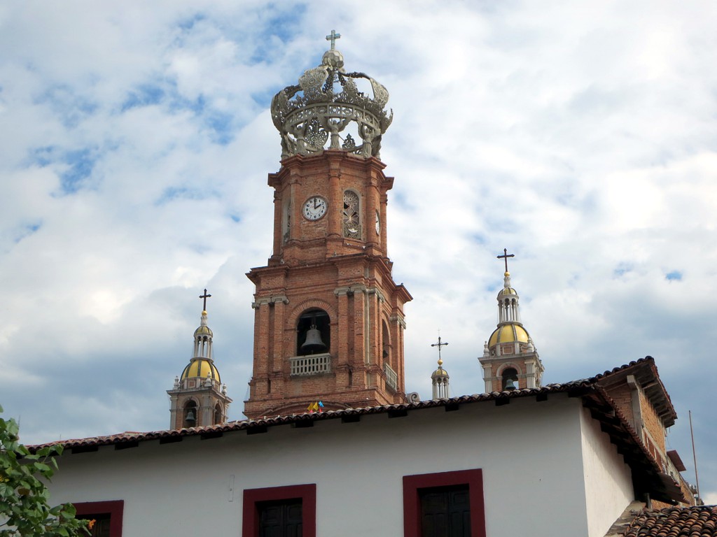
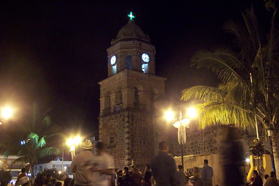
The heart of the city is still the old center, with cobbled streets, white houses with tile roofs and the Church of Our Lady of Guadalupe, whose crowned tower is the city's emblem. Along the sea runs the Malecón, a seafront promenade lined with bronze sculptures by artists such as Sergio Bustamante and Alejandro Colunga and busiest on Sunday evenings. South of the Cuale River, Isla Cuale holds craft markets and a small archaeological museum, and beyond it the Zona Romántica (Colonia Emiliano Zapata) is the lively old quarter of restaurants and bars around Playa de los Muertos, the city's largest public beach; it is also the center of a gay scene that has made Vallarta one of the best-known LGBT destinations in Latin America. To the north stretch the Hotel Zone and Marina Vallarta, next to the airport and cruise port.
Vallarta is also the gateway to the whole bay. Water taxis leave from the Los Muertos pier and from Boca de Tomatlán, at the southern edge of the municipality, for the beaches and villages of the south shore that no road reaches, such as Colomitos, Las Ánimas, Quimixto and Yelapa; tour boats run to Los Arcos marine park, protected since 1984, and to the Marietas Islands. The climate is tropical, with a dry, sunny winter that is the high season from late November to March, when humpback whales visit the bay, and a hot, rainy summer from mid-June to mid-October.
How to get to Puerto Vallarta
Drive from Tepic: 2 h 20 min, 175 km
Licenciado Gustavo Díaz Ordaz International Airport (PVR) is about 8 km north of the Zona Romántica, with year-round flights from the United States, Canada and Mexican cities and extra seasonal routes from November to March. Buy taxis at the official kiosk inside the terminal, or cross the pedestrian bridge outside: city buses marked Centro stop on the airport side (22 pesos in January 2026, about every 5 minutes, 20 to 30 minutes to the Zona Romántica), and Uber picks up on the far side under the bridge. Long-distance buses use the Central de Autobuses, about 9 km northeast of downtown behind the Corona building at km 9 of the Tepic highway; they reach Tepic in about 3 hours, Guadalajara in 4 to 5 and Mexico City in 12 to 13. Highway 200 links the city with Nayarit to the north and with Boca de Tomatlán, El Tuito and the Costalegre to the south.
Directions to Puerto Vallarta on Google Maps
Distances are in a straight line; the road is usually longer.
Links open a partner site. We may earn a commission if you book, at no cost to you.
From the nearest cities to Puerto Vallarta
- Tepic · 175 km by road, 2 h 20 min
- Autlán · about 170 km by road, ~2 h 30 min
- Manzanillo · 285 km by road, 3 h 45 min
Drive times by road from OpenStreetMap, without traffic or stops. Times marked ~ are estimated from the straight-line distance.
What to see in Puerto Vallarta 41
Sights with their own page, closest to the centre first.
Landmarks and museums
-
El Pitillal · Landmark · 1 km from the centre
The old farming town swallowed by Puerto Vallarta, with a twin-towered church, a bandstand plaza and the evening taco stands that food tours come for. -
ChocoMuseo · Landmark · 3 km from the centre
Free little chocolate museum and tasting bar a block above the Malecón, with hands-on bean-to-bar, truffle and mole workshops. -
Malecón de Puerto Vallarta · Landmark · 3 km from the centre
Puerto Vallarta's car-free seafront promenade, lined with bronze sculptures and pebble mosaics, and the city's favourite place to watch the sunset. -
Terminal Marítima de Puerto Vallarta · Landmark · 3 km from the centre
Puerto Vallarta's cruise port, three berths on the harbour beside Marina Vallarta where about 170 cruise ships a year tie up for the day. -
Faro de Matamoros · Landmark · 4 km from the centre
Retired 1932 lighthouse on the hill above downtown Vallarta, now a free lookout with a spiral staircase and an Elizabeth Taylor mural. -
Gringo Gulch · Landmark · 4 km from the centre
Hillside lanes above the Cuale River where Hollywood names settled in the 1950s and 60s; Burton and Taylor's houses and their bridge are here. -
Marina Vallarta · Landmark · 4 km from the centre
The yacht harbour and planned district between the airport and the cruise port: a waterside boardwalk, a lighthouse, and the docks where many bay tours start. -
Mercado Municipal Río Cuale · Landmark · 4 km from the centre
Downtown Vallarta's riverside craft and food market, in a 1970s building by Alejandro Zohn; open daily for souvenirs and market lunches. -
Museo Histórico Naval de Puerto Vallarta · Landmark · 4 km from the centre
The Mexican Navy's museum on the Malecón: ship models, cannons, uniforms and the story of the Manila galleons, in 14 rooms since 2006. -
Museo del Arte en Piel · Landmark · 4 km from the centre
A small private museum on Calle Juárez in the Centro showing historical dress recreated in leather by artisan Alfonso Nuño Romero. -
Museo del Cuale · Landmark · 4 km from the centre
Small INAH archaeology museum on Isla del Río Cuale with pre-Hispanic pottery and shaft-tomb finds from West Mexico; temporarily closed in 2026. -
Parroquia de Nuestra Señora de Guadalupe · Landmark · 4 km from the centre
Puerto Vallarta's brick parish church with the crown-topped bell tower that defines the city skyline; the goal of the December 1-12 pilgrimages. -
Plaza de Armas de Puerto Vallarta · Landmark · 4 km from the centre
The town's main square by the Malecón, with its bandstand, Ignacio Vallarta statue and danzón on Thursday and Sunday evenings. -
Puente del Amor · Landmark · 4 km from the centre
The little covered bridge over Calle Zaragoza that joined Elizabeth Taylor's and Richard Burton's houses, now part of the Casa Kimberly hotel. -
Mariposario Jardín Mágico · Landmark · 5 km from the centre
Banderas Bay's only butterfly sanctuary, a shaded garden in Campo Verde where guides explain the life cycle and visitors release a butterfly. -
Muelle de Playa Los Muertos · Landmark · 5 km from the centre
The sail-topped pier of the Zona Romántica, opened in 2013 and rebuilt in 2023, where water taxis leave for Yelapa and the south shore. -
Parque Lázaro Cárdenas · Landmark · 5 km from the centre
Seafront park at the south end of the Malecón, being covered in tile-and-mirror mosaics by Vallarta artist Natasha Moraga since 2017. -
Zona Romántica · Landmark · 5 km from the centre
Puerto Vallarta's old town south of the Río Cuale: cobbled streets, Los Muertos beach and pier, cafés, galleries and the heart of the city's gay scene. -
Puente Jorullo · Landmark · 8 km from the centre
A 470 m suspension bridge hung 150 m over the Cuale River canyon in the hills behind Vallarta, crossed on foot or by ATV in the ejido's River Park. -
Ecoparque El Nogalito · Landmark · 9 km from the centre
Jungle ecopark above the village of El Nogalito, 20 minutes south of Vallarta: zip lines and a riverbed walk to a waterfall and swimming pool. -
El Edén de Mismaloya · Landmark · 14 km from the centre
Jungle ecopark on the Mismaloya River where Predator was filmed in 1987: swimming holes, rock slides, a riverside restaurant and zip lines. -
Zoológico de Vallarta · Landmark · 14 km from the centre
Family-run jungle zoo up the river road behind Mismaloya, where visitors hand-feed many of the animals; open every day of the year.




Beaches
-
Playa Las Glorias · Beach · 2 km from the centre
Hotel-zone beach of nearly a kilometer between Los Tules and Playa Tranquila, lined with resorts and condos, about 3 km north of the Malecón. -
Playa Los Tules · Beach · 2 km from the centre
Hotel-zone beach of soft amber sand and gentle waves next to Playa de Oro, busy with parasailing, jet skis and banana boats. -
Playa de Oro · Beach · 2 km from the centre
Kilometer-long golden beach of Vallarta's northern hotel zone, between the cruise port and the Pitillal River, with three public accesses. -
Playa Camarones · Beach · 3 km from the centre
Downtown beach of the 5 de Diciembre neighborhood, just north of the Malecón: named for shrimp fishermen, now loved by local families. -
Playa Rosita · Beach · 3 km from the centre
The narrow, stony beach below the Malecón, named after the 1948 Hotel Rosita; for sunsets and watching fishermen, not for swimming. -
Playa Olas Altas · Beach · 4 km from the centre
Zona Romántica beach from the Cuale River mouth south to the Los Muertos pier: calmer than Los Muertos and a favorite with Mexican families. -
Playa Los Muertos · Beach · 5 km from the centre
The busy town beach of the Zona Romántica: palapa restaurants, beach clubs, the sail-shaped pier for south-shore water taxis and the original seahorse statue. -
Playa Amapas · Beach · 6 km from the centre
Small rocky cove just past the south end of Los Muertos, reached over the El Púlpito rock; amber sand, green water, no lifeguards. -
Playa Conchas Chinas · Beach · 6 km from the centre
A string of small rocky coves just south of the Zona Romántica, with shell sand, clear water, tide pools and snorkelling around the rocks. -
Boca de Tomates · Beach · 7 km from the centre
A beach of seafood ramadas behind Puerto Vallarta's airport, by the Ameca river mouth: come for pescado sarandeado, not a swim, as crocodiles live here. -
Playa Las Estacas · Beach · 7 km from the centre
A sheltered cove just south of Conchas Chinas, fronted by the Hyatt Ziva resort; the sand is public, the land behind it is not. -
Playa Palmares · Beach · 10 km from the centre
Puerto Vallarta's south-shore public beach: the first Blue Flag beach in Jalisco, with lifeguards, ramps, showers and a city beach club. -
Playa Garza Blanca · Beach · 11 km from the centre
Calm south-shore cove below the Garza Blanca resort, sheltered by boulder breakwaters; clear water for swimming, snorkeling and paddleboarding.



Nature reserves
-
Estero El Salado · Nature reserve · 4 km from the centre
Protected mangrove estuary in the middle of Puerto Vallarta's hotel strip, with biologist-led boat tours, a watchtower and wild crocodiles. -
Los Arcos de Mismaloya · Nature reserve · 13 km from the centre
Five granite islets with sea arches off Mismaloya, a marine refuge since 1975 and the bay's favourite snorkel stop, under ten minutes by boat from the beach.


Waterfalls
-
Cascada Palo María · Waterfall · 11 km from the centre
The waterfall closest to Puerto Vallarta: a 30 to 45 minute river walk from the Palo María bridge on Highway 200 to a jungle pool, free to visit. -
Cascadas de Mismaloya · Waterfall · 15 km from the centre
A chain of three jungle waterfalls high in the hills behind Mismaloya, up to about 75 m tall, reached only on a long, hard hike.


Islands
-
Isla del Río Cuale · Island · 4 km from the centre
A shady river island between downtown and the Zona Romántica, with craft stalls, riverside restaurants, a small archaeology museum and iguanas.

Viewpoints
-
Mirador Cerro de la Cruz · Viewpoint · 4 km from the centre
Lookout around the cross on the hill above downtown, reached by steep lanes and stairs from the Malecón, with a 360° view from Los Arcos to Punta Mita.

Map of Puerto Vallarta
Neighbourhoods and villages of Puerto Vallarta
Part of Puerto Vallarta or just outside it, closest first.
-
Las Juntas · Town · 7 km from the centre
Fast-growing town on Highway 200 near Vallarta's airport and the Ameca bridges, where the mountain road to Mascota and San Sebastián begins. -
Ixtapa · Town · 8 km from the centre
Puerto Vallarta's second town, 11 km inland in the valley: home of the University of Guadalajara's coast campus and once a banana hacienda. -
La Punta Negra · Village · 9 km from the centre
Tiny roadside settlement and beach on Vallarta's south shore, where the road up to El Nogalito leaves Highway 200; a stop on the Mismaloya bus. -
El Ranchito · Village · 13 km from the centre
Valley village of about 1,400 people on the Mascota River beyond Ixtapa, at the end of the El Ranchito city-bus line from Puerto Vallarta. -
Los Llanitos · Village · 14 km from the centre
Mountain hamlet at about 750 m in the sierra behind Puerto Vallarta, at the end of the road past the Jorullo suspension bridge. -
Mismaloya · Village · 14 km from the centre
Village and calm cove beach where The Night of the Iguana was filmed in 1963, with Los Arcos offshore and the El Edén river jungle up the valley. -
El Colorado · Village · 16 km from the centre
Farming village of about 1,150 people on Highway 544 in the Ameca valley, just south of Las Palmas, on the Las Palmas bus route. -
Boca de Tomatlán · Village · 17 km from the centre
Fishing village at the mouth of the Horcones River where the coastal road ends and water taxis leave for Las Ánimas, Quimixto and Yelapa. -
Las Palmas de Arriba · Town · 24 km from the centre
Ejido town on the Ameca River in the far north of Puerto Vallarta municipality, on Highway 544 on the way up to San Sebastián del Oeste. -
Tebelchia · Village · 26 km from the centre
A growing village of about 660 people, also called El Roble, in the low country of northern Puerto Vallarta municipality near El Colomo.




Day trips and tours from Puerto Vallarta
The closest Pueblos Mágicos and places to visit, with the drive from Puerto Vallarta and tours that leave from it.



All 13 Pueblos Mágicos within a weekend of Puerto Vallarta →
Times marked ~ are estimated from the distance. Links open a partner site. We may earn a commission if you book, at no cost to you.
Before you go: getting to and around Puerto Vallarta
- The nearest airport is Puerto Vallarta (PVR).
- The best months to go are March, April, May, and November.
- 42 of the places on this page are more than 3 km from the centre: take a taxi, a ride-hailing app or a local bus.
- Cascada Palo María, Los Arcos de Mismaloya, and Cascadas de Mismaloya: reached by boat or on foot, not by road (each page says from where).
- For day trips a rental car gives the most freedom; the tours above leave from Puerto Vallarta.
Before you go to Puerto Vallarta: hours, prices and tips
- Best season
- The rainy season runs from June to October, usually with afternoon downpours and sunny mornings; August is the wettest month and September has the highest hurricane risk. December 12 brings the processions of the Virgin of Guadalupe. Mexico Travel & Leisure · checked Oct 2026
- Rules
- At the airport, ignore the timeshare sellers in the rooms after customs who offer rides and tours; buy taxis only at the official kiosk. Wikivoyage · checked Oct 2026
Hours and prices change, especially around holidays. Each fact links to where we checked it.
Visiting Puerto Vallarta: what to see and do
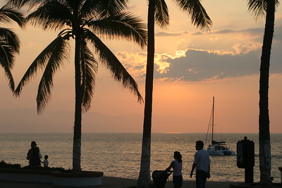
Walk the Malecón at sunset past its bronze sculptures, from the Boy on the Seahorse to the Friendship Fountain.
Visit the Church of Our Lady of Guadalupe and its crowned tower in the old center.
Browse the craft markets on Isla Cuale and see the pre-Hispanic collection of the Cuale Archaeological Museum.
Spend a day on Playa de los Muertos and eat in the restaurants of the Zona Romántica.
Take a water taxi from the Los Muertos pier or Boca de Tomatlán to Yelapa, Quimixto or Las Ánimas.
Snorkel at Los Arcos marine park, or go whale watching between December and March.
Plan your trip
Places to stay in Puerto Vallarta
Compare hotels, posadas, and rentals in and around Puerto Vallarta.
Tours & activities
Day trips and guided outings from Sayulita often include Puerto Vallarta; with a local guide you can get there without a car.
Rental cars
Pick up a car at PVR (Puerto Vallarta): about 41 min by road to Sayulita, then 34 km more to Puerto Vallarta, on your own schedule.
Flights
The nearest airport with scheduled flights is Puerto Vallarta (PVR), about 41 min by road from Sayulita, the base for Puerto Vallarta.
Mobile data
Signal can drop away from Sayulita: download a map of the way to Puerto Vallarta before you set out, or carry an eSIM with data.
Links open a partner site. We may earn a commission if you book, at no cost to you.
Photos
When to go to Puerto Vallarta warm
Puerto Vallarta shares the climate of Sayulita, 34 km away. The best months to visit are March, April, May, and November.
See the month-by-month climate of Sayulita
Weather in Puerto Vallarta now and the next 7 days
Live forecast from Open-Meteo. Chance of rain is the day's highest.
The closest Pueblo Mágico: Sayulita

Sayulita is the Pueblo Mágico closest to Puerto Vallarta, with places to stay, food, and more to see.
Also close to
- Mascota · Jalisco · 47 km away
- Talpa de Allende · Jalisco · 51 km away
- San Sebastián del Oeste · Jalisco · 66 km away
- Compostela · Nayarit · 74 km away
Near Puerto Vallarta






Drive times by road from OpenStreetMap, without traffic. Times marked ~ are estimated from the straight-line distance.
Location from OpenStreetMap. Written by Puebloteca.