

52 places with their own page in the municipality of Puerto Vallarta, in the state of Jalisco.
Map of Puerto Vallarta
Places to visit in Puerto Vallarta
Cities · 1 Towns · 3 Villages · 7 Beaches · 13 Islands · 1 Waterfalls · 2 Nature reserves · 2 Viewpoints · 1 Landmarks and museums · 22
Cities
-
Puerto Vallarta · City
Jalisco's big beach city on Banderas Bay: a cobbled old town, a sculpture-lined Malecón and the boats to every beach of the south shore.

Towns
-
Ixtapa · Town
Puerto Vallarta's second town, 11 km inland in the valley: home of the University of Guadalajara's coast campus and once a banana hacienda. -
Las Juntas · Town
Fast-growing town on Highway 200 near Vallarta's airport and the Ameca bridges, where the mountain road to Mascota and San Sebastián begins. -
Las Palmas de Arriba · Town
Ejido town on the Ameca River in the far north of Puerto Vallarta municipality, on Highway 544 on the way up to San Sebastián del Oeste.
Villages
-
Boca de Tomatlán · Village
Fishing village at the mouth of the Horcones River where the coastal road ends and water taxis leave for Las Ánimas, Quimixto and Yelapa. -
El Ranchito · Village
Valley village of about 1,400 people on the Mascota River beyond Ixtapa, at the end of the El Ranchito city-bus line from Puerto Vallarta. -
La Punta Negra · Village
Tiny roadside settlement and beach on Vallarta's south shore, where the road up to El Nogalito leaves Highway 200; a stop on the Mismaloya bus. -
Mismaloya · Village
Village and calm cove beach where The Night of the Iguana was filmed in 1963, with Los Arcos offshore and the El Edén river jungle up the valley. -
Los Llanitos · Village
Mountain hamlet at about 750 m in the sierra behind Puerto Vallarta, at the end of the road past the Jorullo suspension bridge. -
El Colorado · Village
Farming village of about 1,150 people on Highway 544 in the Ameca valley, just south of Las Palmas, on the Las Palmas bus route. -
Tebelchia · Village
A growing village of about 660 people, also called El Roble, in the low country of northern Puerto Vallarta municipality near El Colomo.


Beaches
-
Playa Los Muertos · Beach
The busy town beach of the Zona Romántica: palapa restaurants, beach clubs, the sail-shaped pier for south-shore water taxis and the original seahorse statue. -
Playa Palmares · Beach
Puerto Vallarta's south-shore public beach: the first Blue Flag beach in Jalisco, with lifeguards, ramps, showers and a city beach club. -
Playa Rosita · Beach
The narrow, stony beach below the Malecón, named after the 1948 Hotel Rosita; for sunsets and watching fishermen, not for swimming. -
Playa de Oro · Beach
Kilometer-long golden beach of Vallarta's northern hotel zone, between the cruise port and the Pitillal River, with three public accesses. -
Boca de Tomates · Beach
A beach of seafood ramadas behind Puerto Vallarta's airport, by the Ameca river mouth: come for pescado sarandeado, not a swim, as crocodiles live here. -
Playa Amapas · Beach
Small rocky cove just past the south end of Los Muertos, reached over the El Púlpito rock; amber sand, green water, no lifeguards. -
Playa Camarones · Beach
Downtown beach of the 5 de Diciembre neighborhood, just north of the Malecón: named for shrimp fishermen, now loved by local families. -
Playa Conchas Chinas · Beach
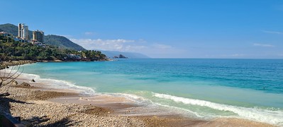
A string of small rocky coves just south of the Zona Romántica, with shell sand, clear water, tide pools and snorkelling around the rocks. -
Playa Garza Blanca · Beach
Calm south-shore cove below the Garza Blanca resort, sheltered by boulder breakwaters; clear water for swimming, snorkeling and paddleboarding. -
Playa Las Estacas · Beach
A sheltered cove just south of Conchas Chinas, fronted by the Hyatt Ziva resort; the sand is public, the land behind it is not. -
Playa Las Glorias · Beach
Hotel-zone beach of nearly a kilometer between Los Tules and Playa Tranquila, lined with resorts and condos, about 3 km north of the Malecón. -
Playa Los Tules · Beach
Hotel-zone beach of soft amber sand and gentle waves next to Playa de Oro, busy with parasailing, jet skis and banana boats. -
Playa Olas Altas · Beach
Zona Romántica beach from the Cuale River mouth south to the Los Muertos pier: calmer than Los Muertos and a favorite with Mexican families.



Islands
-
Isla del Río Cuale · Island
A shady river island between downtown and the Zona Romántica, with craft stalls, riverside restaurants, a small archaeology museum and iguanas.

Waterfalls
-
Cascada Palo María · Waterfall
The waterfall closest to Puerto Vallarta: a 30 to 45 minute river walk from the Palo María bridge on Highway 200 to a jungle pool, free to visit. -
Cascadas de Mismaloya · Waterfall
A chain of three jungle waterfalls high in the hills behind Mismaloya, up to about 75 m tall, reached only on a long, hard hike.


Nature reserves
-
Los Arcos de Mismaloya · Nature reserve
Five granite islets with sea arches off Mismaloya, a marine refuge since 1975 and the bay's favourite snorkel stop, under ten minutes by boat from the beach. -
Estero El Salado · Nature reserve
Protected mangrove estuary in the middle of Puerto Vallarta's hotel strip, with biologist-led boat tours, a watchtower and wild crocodiles.


Viewpoints
-
Mirador Cerro de la Cruz · Viewpoint
Lookout around the cross on the hill above downtown, reached by steep lanes and stairs from the Malecón, with a 360° view from Los Arcos to Punta Mita.

Landmarks and museums
-
Malecón de Puerto Vallarta · Landmark
Puerto Vallarta's car-free seafront promenade, lined with bronze sculptures and pebble mosaics, and the city's favourite place to watch the sunset. -
Museo del Cuale · Landmark
Small INAH archaeology museum on Isla del Río Cuale with pre-Hispanic pottery and shaft-tomb finds from West Mexico; temporarily closed in 2026. -
El Pitillal · Landmark
The old farming town swallowed by Puerto Vallarta, with a twin-towered church, a bandstand plaza and the evening taco stands that food tours come for. -
Faro de Matamoros · Landmark
Retired 1932 lighthouse on the hill above downtown Vallarta, now a free lookout with a spiral staircase and an Elizabeth Taylor mural. -
Marina Vallarta · Landmark
The yacht harbour and planned district between the airport and the cruise port: a waterside boardwalk, a lighthouse, and the docks where many bay tours start. -
Mercado Municipal Río Cuale · Landmark
Downtown Vallarta's riverside craft and food market, in a 1970s building by Alejandro Zohn; open daily for souvenirs and market lunches. -
Muelle de Playa Los Muertos · Landmark
The sail-topped pier of the Zona Romántica, opened in 2013 and rebuilt in 2023, where water taxis leave for Yelapa and the south shore. -
Museo Histórico Naval de Puerto Vallarta · Landmark
The Mexican Navy's museum on the Malecón: ship models, cannons, uniforms and the story of the Manila galleons, in 14 rooms since 2006. -
Parque Lázaro Cárdenas · Landmark
Seafront park at the south end of the Malecón, being covered in tile-and-mirror mosaics by Vallarta artist Natasha Moraga since 2017. -
Parroquia de Nuestra Señora de Guadalupe · Landmark
Puerto Vallarta's brick parish church with the crown-topped bell tower that defines the city skyline; the goal of the December 1-12 pilgrimages. -
Terminal Marítima de Puerto Vallarta · Landmark
Puerto Vallarta's cruise port, three berths on the harbour beside Marina Vallarta where about 170 cruise ships a year tie up for the day. -
Zona Romántica · Landmark
Puerto Vallarta's old town south of the Río Cuale: cobbled streets, Los Muertos beach and pier, cafés, galleries and the heart of the city's gay scene. -
Zoológico de Vallarta · Landmark
Family-run jungle zoo up the river road behind Mismaloya, where visitors hand-feed many of the animals; open every day of the year. -
ChocoMuseo · Landmark
Free little chocolate museum and tasting bar a block above the Malecón, with hands-on bean-to-bar, truffle and mole workshops. -
Ecoparque El Nogalito · Landmark
Jungle ecopark above the village of El Nogalito, 20 minutes south of Vallarta: zip lines and a riverbed walk to a waterfall and swimming pool. -
El Edén de Mismaloya · Landmark
Jungle ecopark on the Mismaloya River where Predator was filmed in 1987: swimming holes, rock slides, a riverside restaurant and zip lines. -
Gringo Gulch · Landmark
Hillside lanes above the Cuale River where Hollywood names settled in the 1950s and 60s; Burton and Taylor's houses and their bridge are here. -
Puente Jorullo · Landmark
A 470 m suspension bridge hung 150 m over the Cuale River canyon in the hills behind Vallarta, crossed on foot or by ATV in the ejido's River Park. -
Puente del Amor · Landmark
The little covered bridge over Calle Zaragoza that joined Elizabeth Taylor's and Richard Burton's houses, now part of the Casa Kimberly hotel. -
Museo del Arte en Piel · Landmark
A small private museum on Calle Juárez in the Centro showing historical dress recreated in leather by artisan Alfonso Nuño Romero. -
Plaza de Armas de Puerto Vallarta · Landmark
The town's main square by the Malecón, with its bandstand, Ignacio Vallarta statue and danzón on Thursday and Sunday evenings. -
Mariposario Jardín Mágico · Landmark
Banderas Bay's only butterfly sanctuary, a shaded garden in Campo Verde where guides explain the life cycle and visitors release a butterfly.


Neighbouring municipalities
Cabo Corrientes · 25 San Sebastián del Oeste · 5 Mascota · 8
More of Jalisco
Every place in Jalisco → Waterfalls in Jalisco · 7 Ruins in Jalisco · 3 Lakes and Lagoons in Jalisco · 7 Beaches in Jalisco · 20 Nature Parks in Jalisco · 17 Mountains in Jalisco · 6 Viewpoints in Jalisco · 4