


Landmark Puerto Vallarta, Jalisco Municipality of Puerto Vallarta Banderas Bay
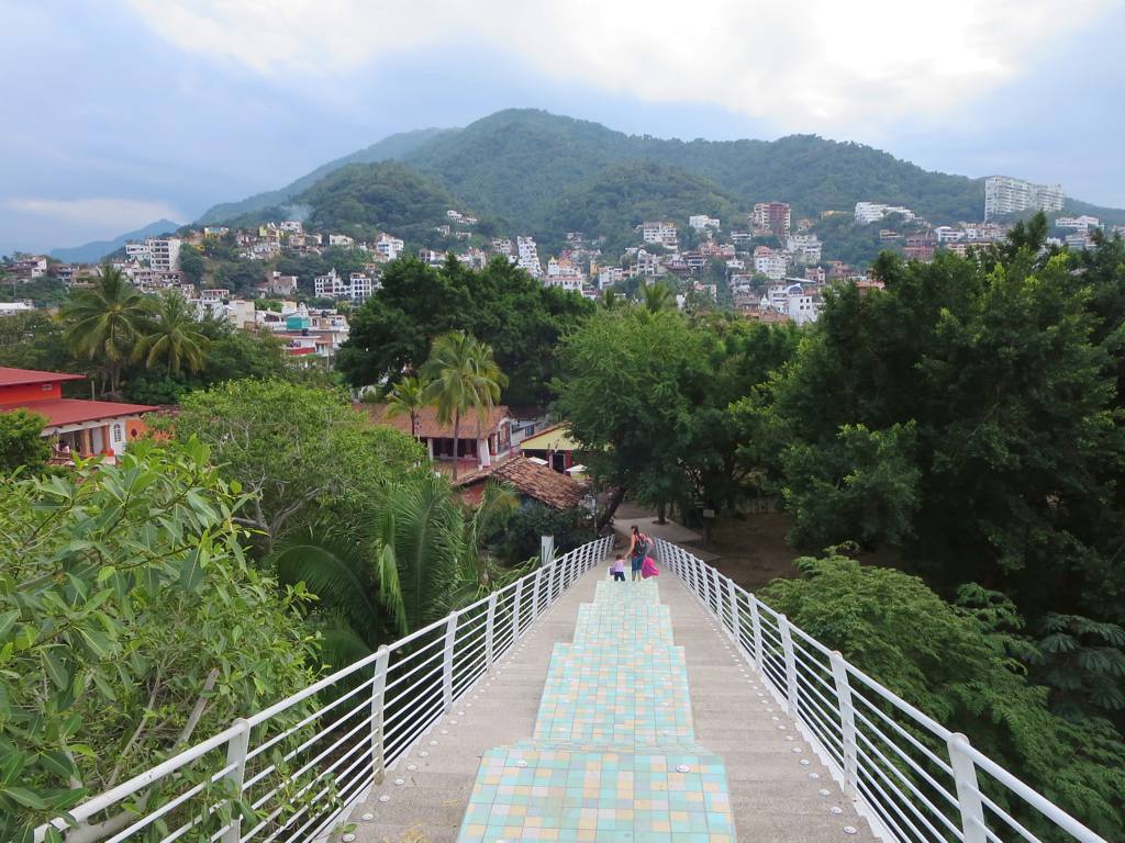
Hillside lanes above the Cuale River where Hollywood names settled in the 1950s and 60s; Burton and Taylor's houses and their bridge are here.
From Puerto Vallarta: 5 min by car (5 km by road) How to get there ↓
Near here
See everything nearby ↓


Plan your visit to Gringo Gulch
Where to stay near Gringo Gulch
Compare hotels, posadas and guest houses in Gringo Gulch.
Tours to Gringo Gulch
Look for tours of the area around Sayulita that stop at Gringo Gulch.
 Ebikes & Taco Tour
★ 4.8 (25) · From US$99
How to get to Gringo Gulch
- From Puerto Vallarta: about 5 min by road (~5 km)
- Nearest airport: Puerto Vallarta (PVR), 41 min by car to Sayulita
Links open a partner site. We may earn a commission if you book, at no cost to you.
Popular tours to Gringo Gulch

Tours, prices and ratings from Viator, checked weekly. We may earn a commission if you book.
About Gringo Gulch
Gringo Gulch is the small hillside neighbourhood just behind the Guadalupe church in downtown Puerto Vallarta, on the north bank of the Cuale River. Its steep cobbled lanes, whitewashed houses, red tile roofs and bougainvillea climb the slope of El Cerro, and it takes its name from the Americans who began building holiday homes here in the 1950s, after the town's centenary in 1951 started to draw outsiders.
Much of what you see was shaped by two builders. Fernando "Freddy" Romero wanted houses in the style of a traditional Mexican pueblo rather than modern villas, and his whitewashed adobe walls, pitched clay-tile roofs, stone and wrought iron became known as the Vallarta style; the engineer Guillermo Wulff added the brick cupolas seen all over town. Casa Tabachín, one of the first houses, from 1957, was rented by John Huston while he filmed The Night of the Iguana at Mismaloya in 1963.
That film is why the gulch is famous. Huston put Richard Burton and Elizabeth Taylor up in Casa Kimberley, on Calle Zaragoza; Burton bought it and gave it to Taylor for her 32nd birthday in 1964, and later they bought the house across the street and joined the two with a pink bridge over the lane, the puente del amor. The paparazzi coverage of their affair helped put Puerto Vallarta on the map. Taylor sold the property in the 1990s, and today the two houses are Casa Kimberly, an adults-only boutique hotel with nine suites and the Iguana restaurant. The rest of the gulch is still a quiet residential area to wander, with views over the rooftops to the bay.
How to get to Gringo Gulch
Drive from Puerto Vallarta: 5 min, 5 km
Gringo Gulch is on the hill directly behind the Parroquia de Nuestra Señora de Guadalupe, a few blocks up from the Malecón and the Plaza de Armas. From the church, walk uphill on Zaragoza; Casa Kimberly is at Calle Zaragoza 446. From the south side, climb the La Iguana footbridge from Isla Cuale, which lands on Calle Cuauhtémoc in the gulch. The lanes are steep and partly stepped, so it is a walk rather than a drive.
Directions to Gringo Gulch on Google Maps
Distances are in a straight line; the road is usually longer.
Links open a partner site. We may earn a commission if you book, at no cost to you.
From the nearest cities to Gringo Gulch
- Puerto Vallarta · 5 km by road, 5 min
- Tepic · 178 km by road, 2 h 25 min
- Autlán · about 170 km by road, ~2 h 30 min
Drive times by road from OpenStreetMap, without traffic or stops. Times marked ~ are estimated from the straight-line distance.
Before you go to Gringo Gulch: hours, prices and tips
- Rules
- Casa Kimberly is a private, adults-only hotel; non-guests can see it by reserving a table at its Iguana Restaurant & Tequila Bar. The rest of the gulch is a residential area. Casa Kimberly · checked Oct 2026
Hours and prices change, especially around holidays. Each fact links to where we checked it.
Visiting Gringo Gulch: what to see and do
Walk under the pink bridge that joins the two houses of Casa Kimberly over Calle Zaragoza.
Wander the steep cobbled lanes to see the whitewashed Vallarta-style houses and brick cupolas.
Book dinner at the Iguana restaurant in Casa Kimberly, the former Burton and Taylor homes.
Cross the La Iguana footbridge down to Isla Cuale.
Look out over the terracotta rooftops to Banderas Bay.
Plan your trip
Places to stay in Gringo Gulch
Compare hotels, posadas, and rentals in and around Gringo Gulch.
Tours & activities
Look for tours of the area around Sayulita that stop at Gringo Gulch.
Rental cars
Pick up a car at PVR (Puerto Vallarta): about 41 min by road to Sayulita, then 36 km more to Gringo Gulch, on your own schedule.
Flights
The nearest airport with scheduled flights is Puerto Vallarta (PVR), about 41 min by road from Sayulita, the base for Gringo Gulch.
Mobile data
Signal can drop away from Sayulita: download a map of the way to Gringo Gulch before you set out, or carry an eSIM with data.
Links open a partner site. We may earn a commission if you book, at no cost to you.
Photos
When to go to Gringo Gulch warm
Gringo Gulch shares the climate of Sayulita, 36 km away. The best months to visit are March, April, May, and November.
See the month-by-month climate of Sayulita
Weather in Gringo Gulch now and the next 7 days
Live forecast from Open-Meteo. Chance of rain is the day's highest.
The closest Pueblo Mágico: Sayulita

Sayulita is the Pueblo Mágico closest to Gringo Gulch, with places to stay, food, and more to see.
Also close to
- Mascota · Jalisco · 47 km away
- Talpa de Allende · Jalisco · 50 km away
- San Sebastián del Oeste · Jalisco · 68 km away
- Compostela · Nayarit · 78 km away
Closest to Gringo Gulch
-
Faro de Matamoros · Landmark · 0 km away
-
Isla del Río Cuale · Island · 0 km away
-
Mercado Municipal Río Cuale · Landmark · 0 km away
-
Museo Histórico Naval de Puerto Vallarta · Landmark · 0 km away
-
Museo del Arte en Piel · Landmark · 0 km away
-
Museo del Cuale · Landmark · 0 km away
-
Parroquia de Nuestra Señora de Guadalupe · Landmark · 0 km away
-
Plaza de Armas de Puerto Vallarta · Landmark · 0 km away


Near Gringo Gulch


Drive times by road from OpenStreetMap, without traffic. Times marked ~ are estimated from the straight-line distance.
Location from OpenStreetMap. Written by Puebloteca.